
NORTH COAST ROUTE
Olympic National Park, Washington State
Length: 32.8mi (52.8km) from Makah Trailhead to Rialto Beach. Option to extend another 18.3mi (29.3km) to Oil City
Days: 3 to 4 (5 to 6 with extension)
Difficulty: Hard (rocky scampering, steep passes requiring rope assist)
Gear: Standard gear + rain essentials, water shoes for fording, bear canister (required), tide chart (required), GPS or PLB (highly recommended)
Completed: September 2018
In summary: Gorgeous beach trek and a wonderful way to explore the most remote corner of the United States. Enjoy panoramic views of haystack rocks and fall asleep to the sound of the waves and gulls. Just be wary of the tides and come ready for sand / water. You are passing through a rainforest by the way.
Preparation / Know Before You Go
Getting there can be difficult. The trailhead is far from nearby cities (~2hrs from Port Angeles and ~3.5hrs from Aberdeen). Trekkers should also arrange for a dropoff / pickup or transit between the trailhead and destination. There are no roads along this part of the coast so the drive is over 1.5hrs. from one end of the trail to the other. Fortunately, affordable parking can be arranged with the local Makah if you need to leave a car. Just look for the lawn signs steps from the trailhead and pay cash.
Follow the rules! This trek place takes place along some of Washington’s most beautiful, but also most vulnerable natural coastlines. Thus, much of the land is protected and hikers are required to follow a number of guidelines put in place by the NPS as well as various native tribes who have graciously opened their land for public use. Rules to know include:
- The northern trailhead begins on the Makah Reservation and permits are required for access
- These can be purchased at a number of locations in Neah Bay for ~$10. Check out the local shops and native museums while you are there!
- Campsite reservations MUST be made with the National Park Service in advance (they book fast depending on season)
- Many campsites have quotas to reduce wear. Find more information here.
- Bring a bear canister and store all scented items in it at all times. You may not hang food.
- This is actually more for racoons than bears. They are aggressive and have been known to run off with daypacks in the area
- Canisters can be loaned from the NPS Wilderness Center though purchasing ahead of time will save you a detour
Get a tide chart and be wary of the tides. I cannot emphasize this enough. You can purchase tide charts at any local convenience store, gas station, Chamber of Commerce, etc. At the very least, having a tide chart and learning to read it will save you from trip delays. At most, it will save your life. If you are informed, this journey is very safe. As 90% of the trail is along the beach, it is nearly impossible to get lost! However, in some stretches the beaches are thin, rocky and bordered on one side by impassable cliffs. An official wilderness map will tell you how low the tide must be to pass at certain points along the trail and the tide chart will indicate at what times that is possible. Outside your window, the pass or entire beach will be swallowed up. Bring a GPS or PLB for emergencies, but do not chance it. The water is rough, the shores rocky, and I do not imagine the Coast Guard’s commute is short.
Purify your water. Though the route crosses a number of rivers, many of which are crystal clear, giardia is present in the area so never drink the water prior to cleansing it.
Day One: Shi Shi Trailhead to Seafield Creek Campground (7.3mi)
Day one got out to a slower start than anticipated after cell reception issues required a detour to the Quinault Ranger station in order to register and reserve campsites. By the time the drive was complete, Makah permits / tide charts were secured, and final gear checks made, it was around 1pm. Nevertheless, I happily embarked on a nice summer afternoon.
The trail started off with an unremarkable 2mi stretch through the coastal forest, but in no time I was spat out onto the beautiful Shi Shi Beach. My excitement was tempered relatively quickly however when I realized I had long missed the window for crossing the base of Point of the Arches. Fortunately, the 2hr tide delay offered a chance for some relaxing beach reading with the picturesque Point of the Arches haystack formation as my backdrop.
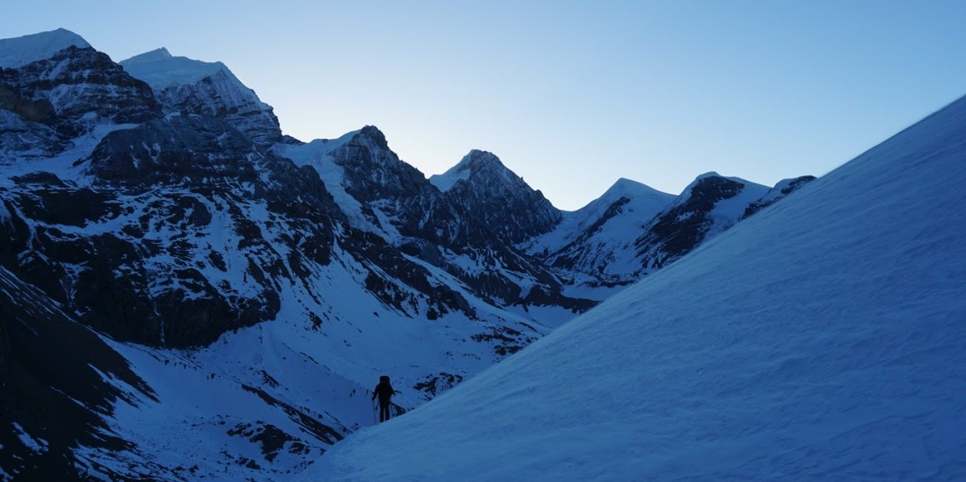
Around 4:30pm or so, the tide was low enough for me to get around the point, though not without getting soaked up to my knees. A short while later I reached the first overland pass, marked by a circular warning sign and a nearby rope and buoy. Like many of the other passes I would encounter, the steep path up the hill was slick with mud and I relied heavily on the rope assist. From the top of the cliffs, the view was incredible. Coastal forests in Washington tend to be sparse with wind-broken foliage, thus I was rewarded with panoramic views of the ocean and haystack rock formations. The sunset and dusk glow added to the effect (and picture quality), but also made it clear I needed to hustle.
As the sun went down and dusk turned to dark, it became pretty clear I was not going to make it to the Ozette campground as I had hoped. Instead I pulled out my headlamp and crawled over the rocky beaches at a snail’s pace. Amusingly, my lantern attracted insects and bats kept darting across my line of sight, some just feet from my face. Less amusingly, I found scampering across boulders and slick rocks to be very precarious in the dark and I didn’t make Seafield Creek until hours after dark. A set of colorful washed up buoys and retaining logs marked the site, and after a hasty dinner I was fast asleep.

Shi Shi Beach 
High tide near Point of the Arches 
Point of the Arches 
Dusk beyond Point of the Arches 
Rocky beach in Olympic National Park 
Marker indicating overland pass 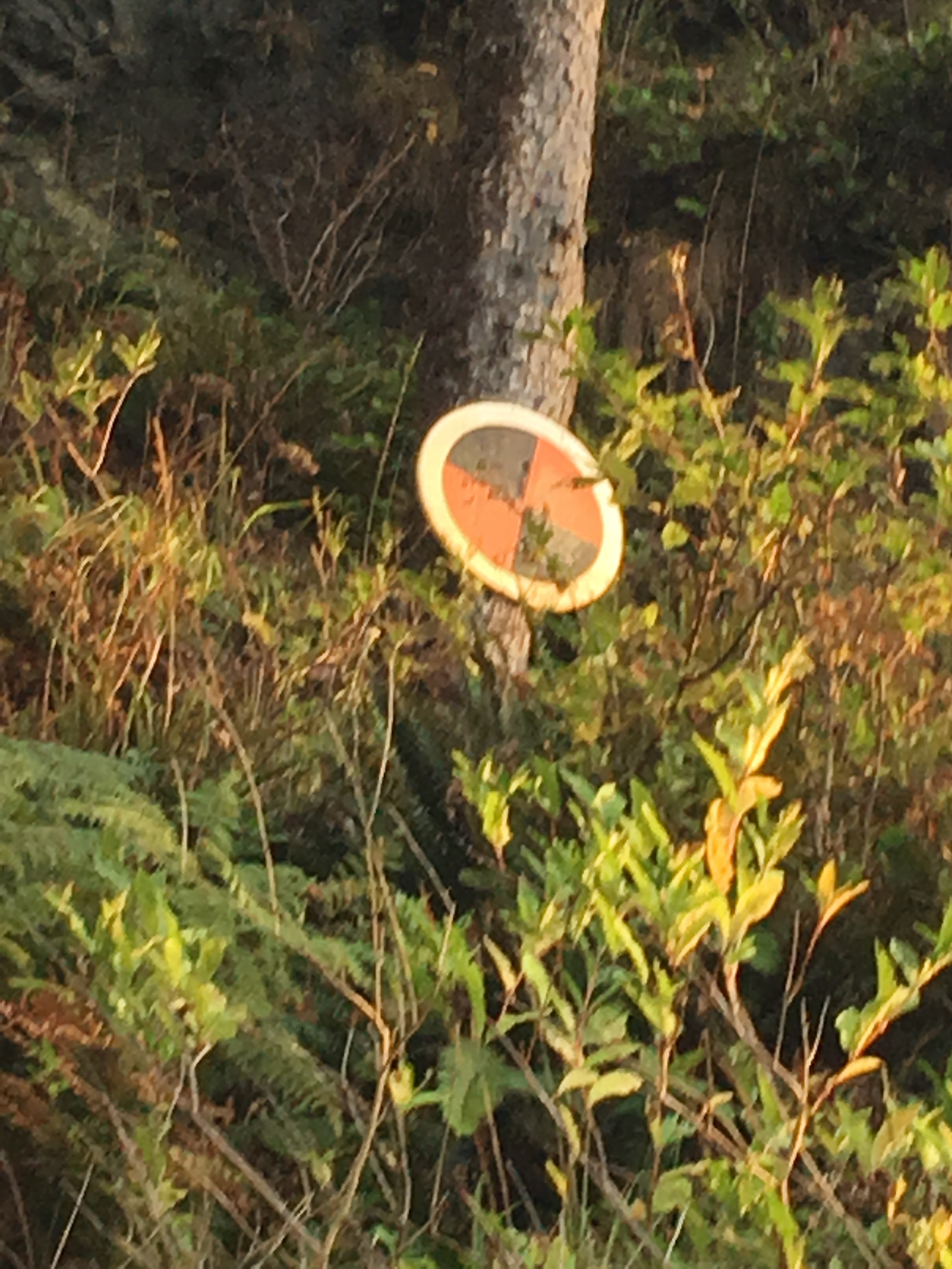
Keep an eye out for these markers, indicating impassible headlands 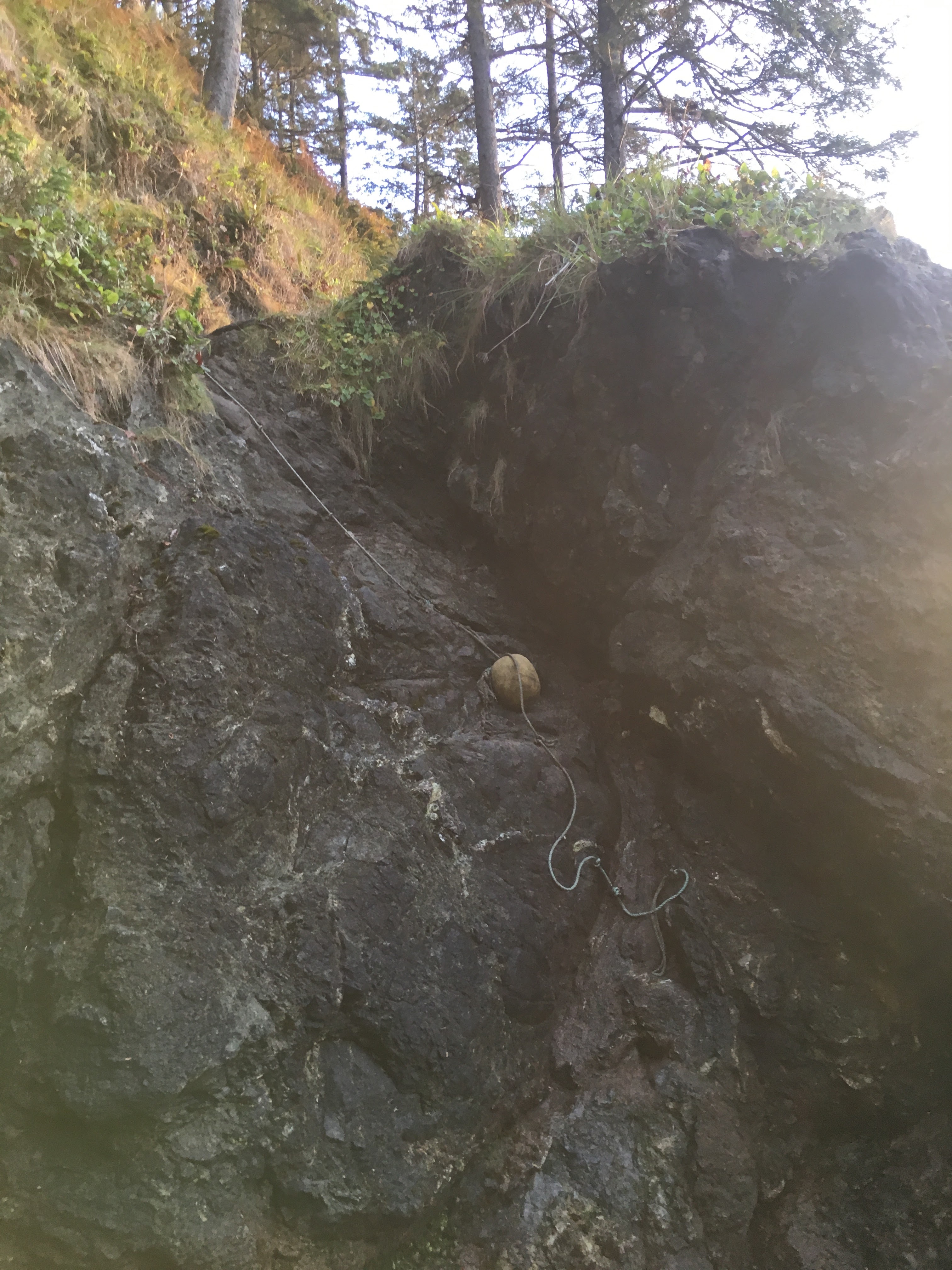
Ropes are used to scale / repel steep hills 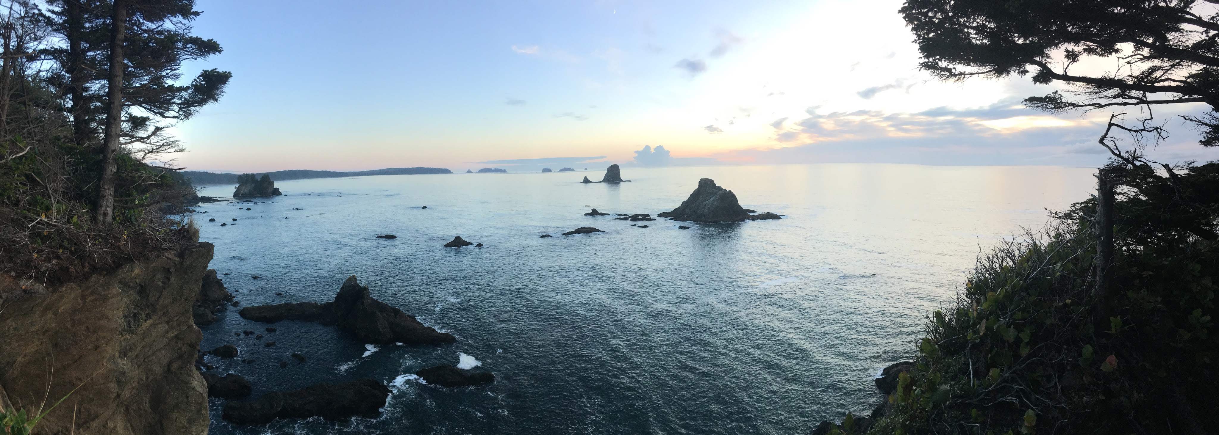
View of haystacks from overland pass 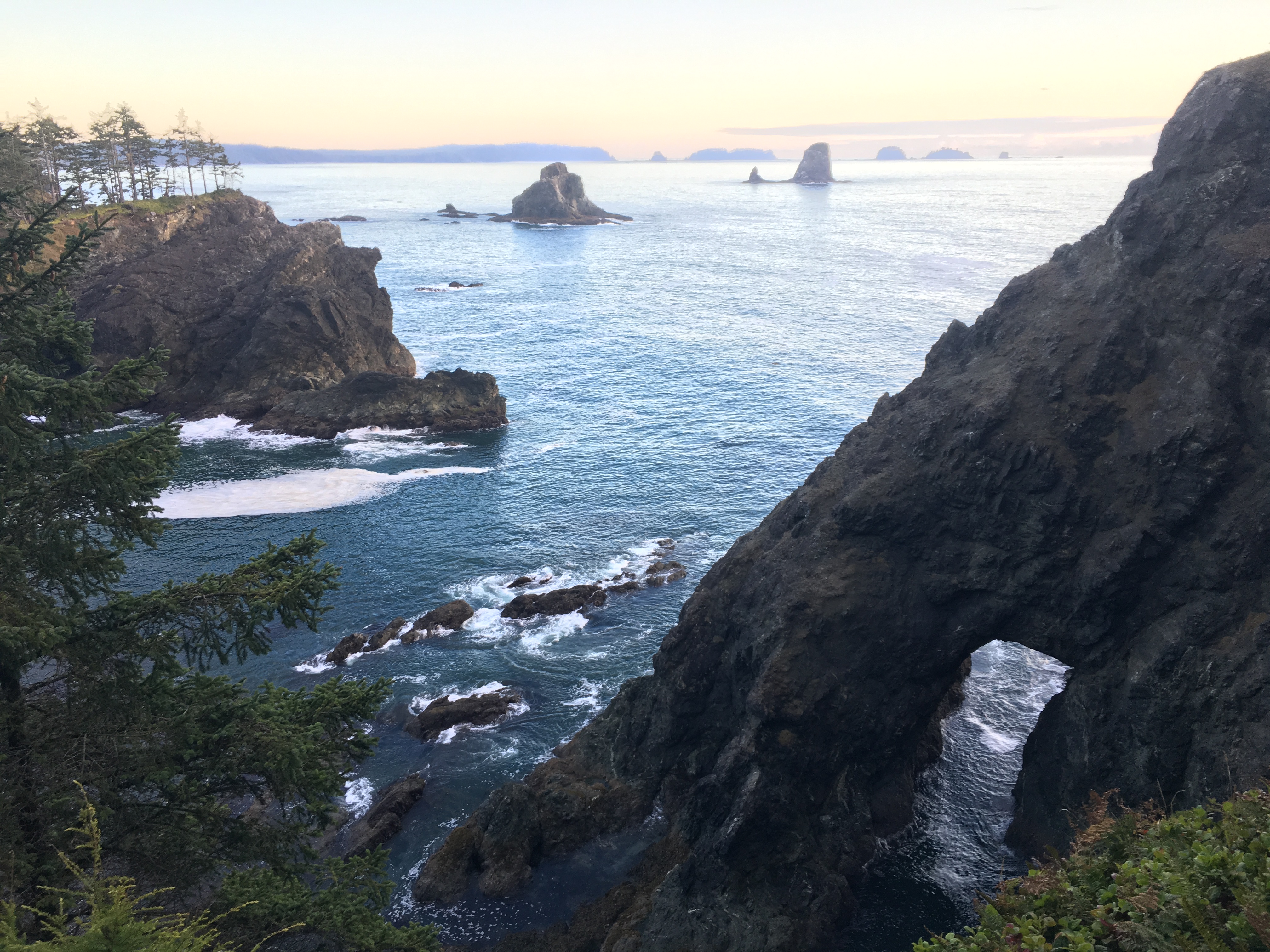
Sea arch, “Father and Son” haystacks from overland pass
Day Two: Seafield Creek to Cedar Creek Campground (16.4mi)
Day two got off to an early start, as was mandated by the tides. Keen on avoiding another round of night hiking, I packed up and headed out on a foggy morning. The day started with some calm, quiet beach walking. Before long, I came to the Ozette River where I was greeted by a pair of massive golden eagles that had just been fishing. The river was just too large to jump so I had to drop my boots and ford it barefoot. Though not an absolute necessity, I would recommend water shoes for this reason. Some of the river bottoms could be slick or rocky.
Beyond the river, I entered the Ozette Indian Reservation. One of the special things about this trek is that in addition to it’s obvious natural beauty, it also leads trekkers through historically significant lands. The beach at Ozette is the site of an 18th century mudslide that swallowed an entire Makah village. Hundreds of years later, the space was excavated as part of a major archeological dig. Some of the buildings from the dig still stand abandoned. At the southern tip of the reservation I made my way around Cape Alava, a beautiful beach area popular with day hikers and overnighters looking for a shorter trip. To my right, Ozette Island and the Wedding Rocks loomed large out on the water. Though I could not see any, the barking of seals echoed landward from the isolated haystacks.
Near Wedding Rocks I stumbled upon a set of petroglyphs, one of my favorite sites from the trip. My map noted they were in the area, but after about 20-30min. of searching I gave up and decided to move on. As I did so I paused for a drink of water, looked behind me, and there they were. Large and impressively well preserved I could easily make out the whales, faces, and fertility symbols etched into the large boulders centuries ago.
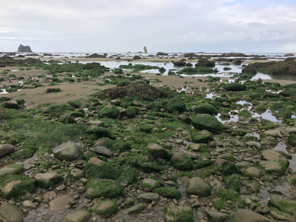
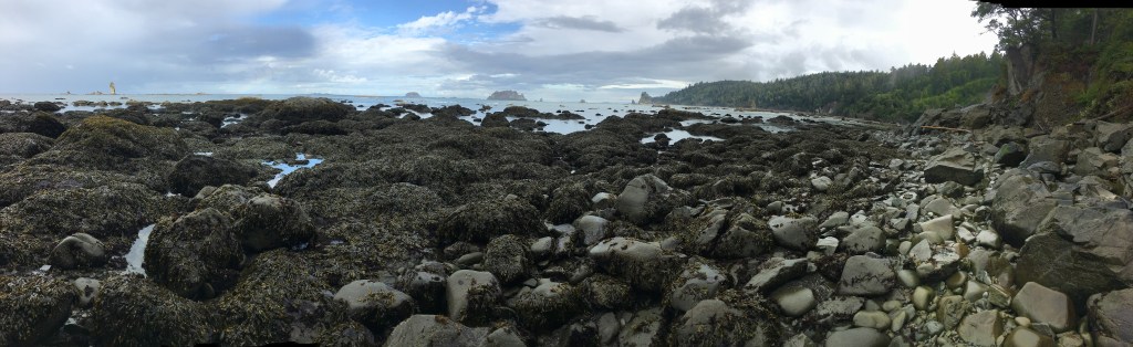
The rest of the journey was long and grueling, but worth the effort. Much of the route required some pretty tough scampering over rocks and boulders often slick from high tide being caked in algae, barnacles and anemones. I did my best to disturb as little of the sealife as possible, but it was difficult. I put my hiking poles to the test, shoving them between rocks and into holes in order to preserve my balance. I would not recommend hiking without poles. If I’d have been without, I likely would have spent a significant amount of time on all fours exposing my hands to the sharp barnacles and mussels. The scampering did offer a glimpse into some massive tide pools which I really enjoyed and spent a lot of time exploring. Fluorescent anemones and colorful starfish reminded me of aquarium touch tanks from when I was a kid.
After over 16 miles I finally arrived at Cedar Creek, which was in my opinion the perfect campsite. No matter how you set your itinerary, I would recommend one night here. The tent spots were insulated from the coastal winds, but still close enough to the surf that you could fall asleep to the sound of the crashing waves. In true Pacific Northwest fashion, the sunny weather of the day was steadily exchanged for a coastal haze, and I was blessed with a natural shower as I made camp.

Ozette River (water shoes recommended) 
One of many anemone tide pools along the route 
Old station for Makah village archeological site 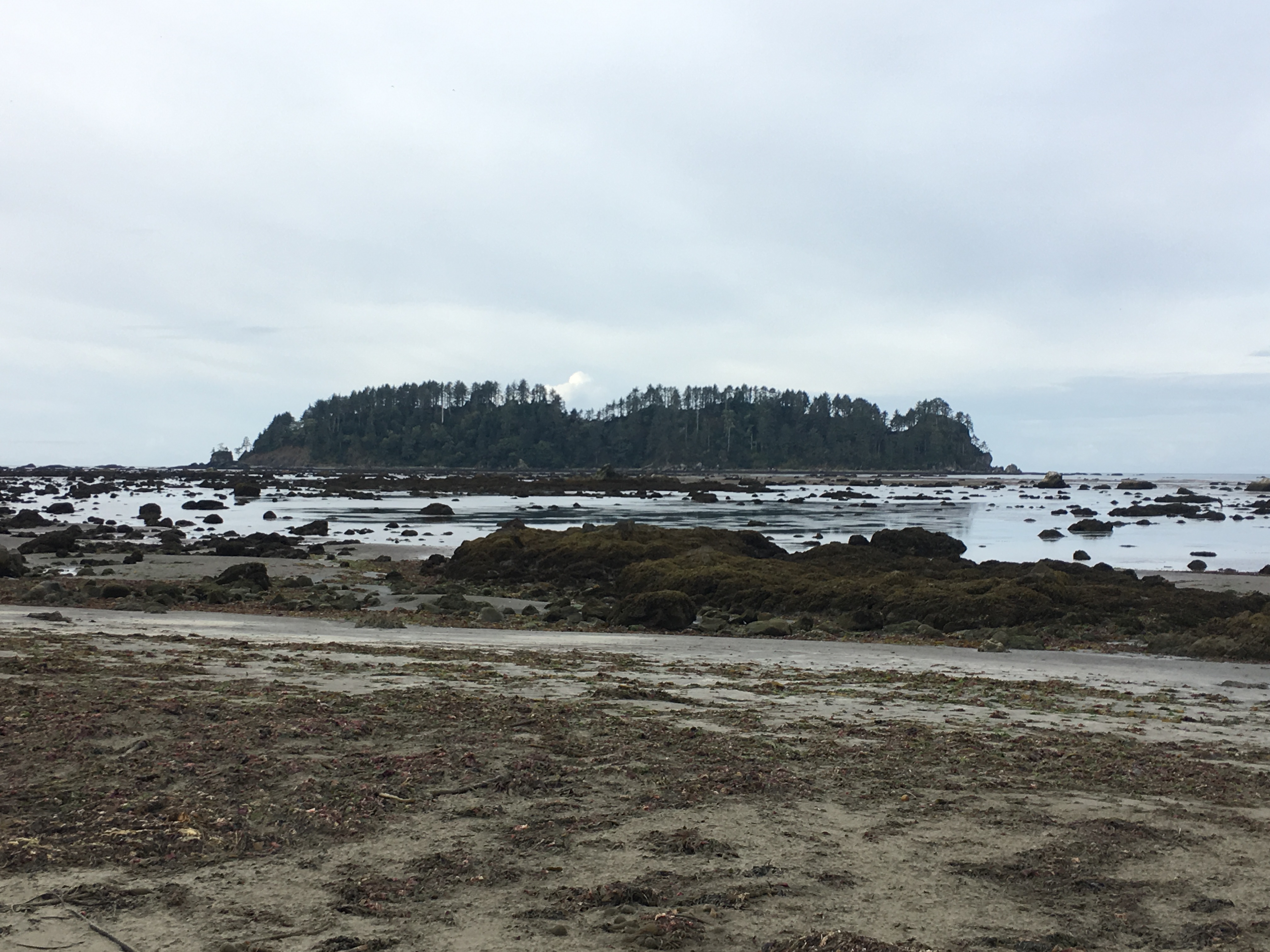
Ozette Island 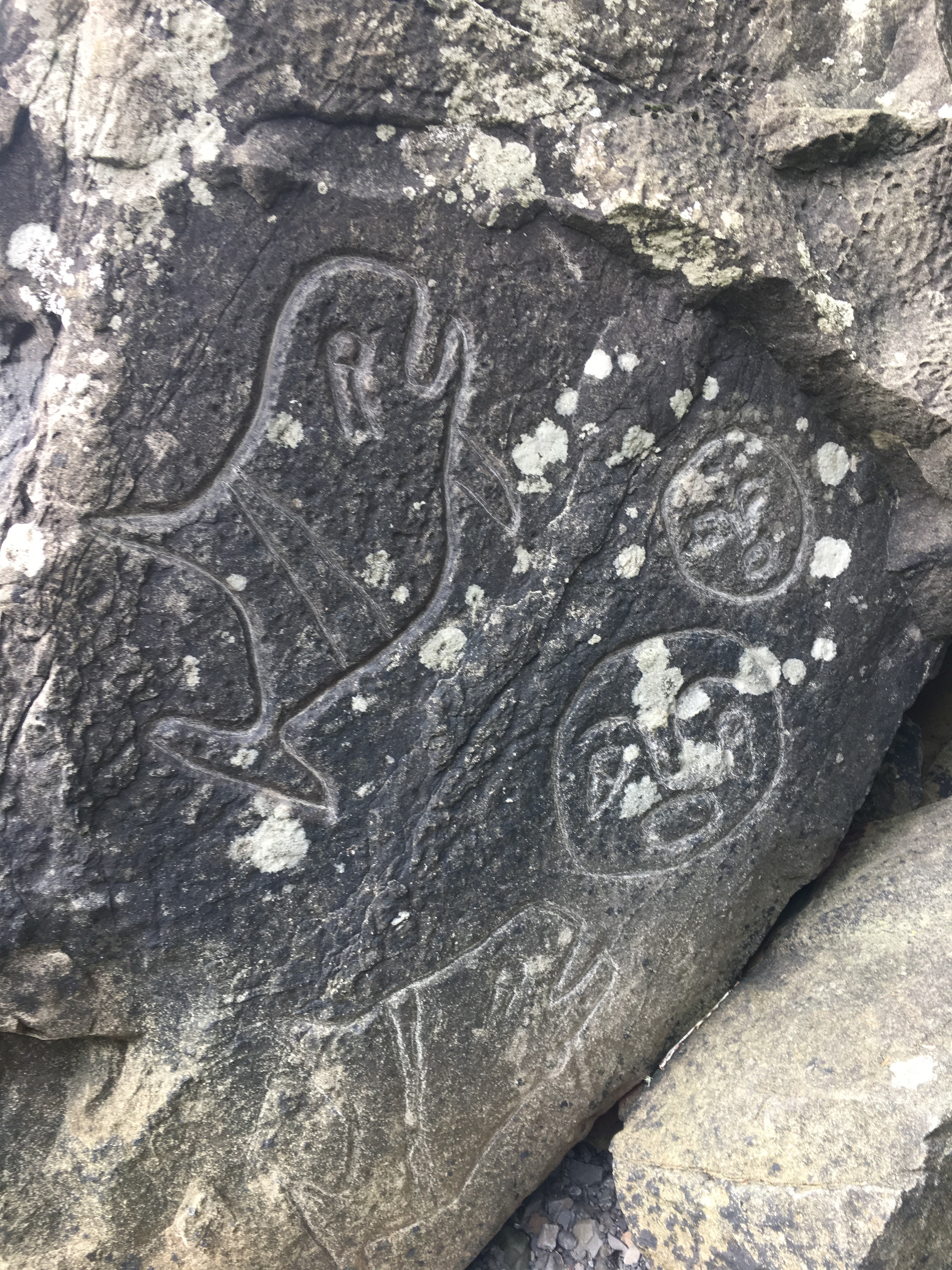
Native petroglyphs including: whales, masks, fertility symbols 
Tide formed grotto 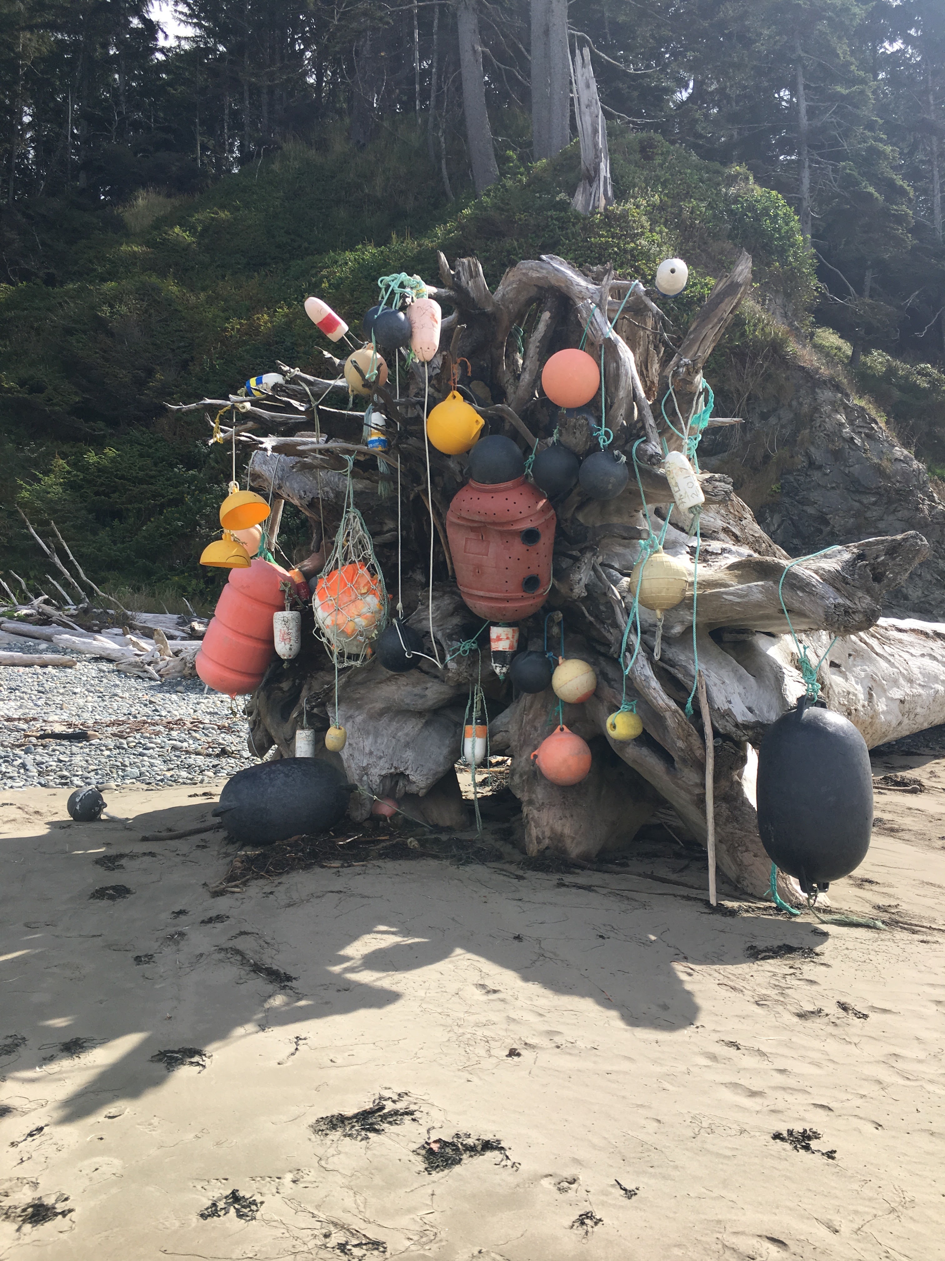
While the beaches are remarkably clean, washed up buoys dot the route 
Rocky coastline 
Beach overlook south of Yellow Banks 
Picturesque Cedar Creek campground
Day Three: Cedar Creek to Rialto Beach (9.1mi)
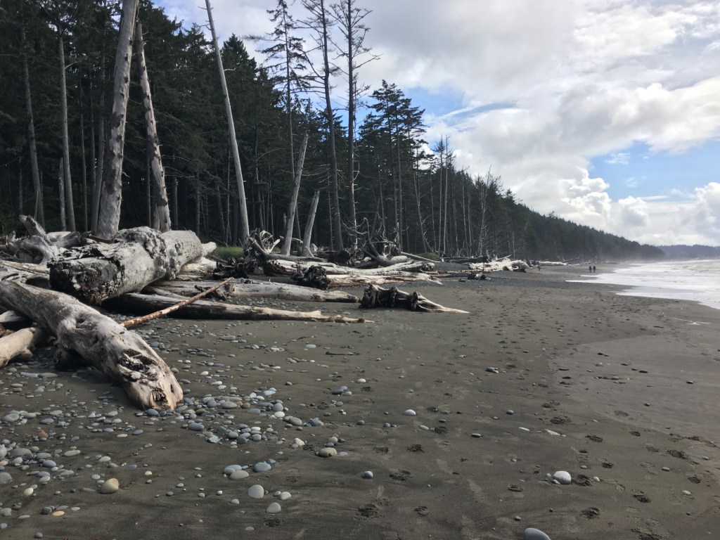
The day three start was just as early but a little slower as some soreness and fatigue had set in from the rock scampering the day prior. By sunrise the rain had retreated and been replaced by a blanket of ocean fog. The fog was thick enough that despite there being no actual rain, it soaked my fleece and I was forced to switch to the rain gear. The actual walking started with a leisurely couple of miles down a large beach. Things became a little more complicated when I came to the only overland pass of the day. The hill had become very slick with mud and even with the rope assist ascending was a challenge. I managed to avoid any spills by leaning back a near 45 degrees and trusting the integrity of the rope. On the way down I wasn’t so lucky and a misstep resulted in a 15ft slide down the side of the hill. Fortunately no injuries were sustained and I was back on another beach, this one littered with huge old growth logs.
Around late morning I turned the corner on Cape Johnson and was one step closer to the home stretch. The tide was just low enough, but even then the strip of dry beach and rock was thin. Before long I came upon the Chilean Memorial, a small headstone memorializing the sailors of a notable shipwreck just offshore. This is one of two such memorials on the North Coast Route, as the surrounding waters are known to be one of the most treacherous nautical areas in the world. As I continued to work my way south, the weather improved and before long I was enjoying a perfectly warm but windy afternoon.
The end of my journey came ceremoniously upon reaching Hole-in-the-Wall, a natural sea arch that is a favorite tourist attraction along the Pacific Coast. Over the course of my three days on the route, I mostly enjoyed solitude, only passing three other groups of hikers headed in the opposite direction. Once I cleared Hole-in-the-Wall, I was on the populated Rialto Beach. I moved past day trippers and beachgoers who seemed to be wondering where the muddy guy in the large backpack came from. In no time I was sitting in the parking lot, awaiting my pick up and looking forward to a hot shower.


Alternative Options
Though my journey ended after three days at Rialto Beach, many people on the North Coast Route will continue south through Oil City. There are two obstacles to this journey that prospective hikers should be aware of:
- The southern end of the North Coast Route requires very low tides to pass some of the headlands. Depending on when you go, tides may not dip below 2′ and thus the trip would not be feasible. This happened to be the case when I went and prevented me from completing the whole journey.
- The Quillayute River at Rialto Beach is impossible to ford. Hikers thus have two options for continuing to Oil City. One would be to hike / hitchhike 9.1miles along the road from Rialto to the Third Beach trailhead. The other would be to call the La Push Harbormaster and ask him to ferry you across. I was told this could be done for $20-40, but was also warned that it should be arranged ahead of time since calling day of is not always reliable.
Additional Sources
- National Park Service Wilderness Map
- Olympic National Park website – North Coast Route
- Washington Trails Association
- Clever Hiker blog
- Roamworthy blog
- Olympic Hiking Co. ($60 shuttle option between trailheads)
- Makah Tribe recreation permits
- Map of WA coast shipwrecks (NOAA website)
