
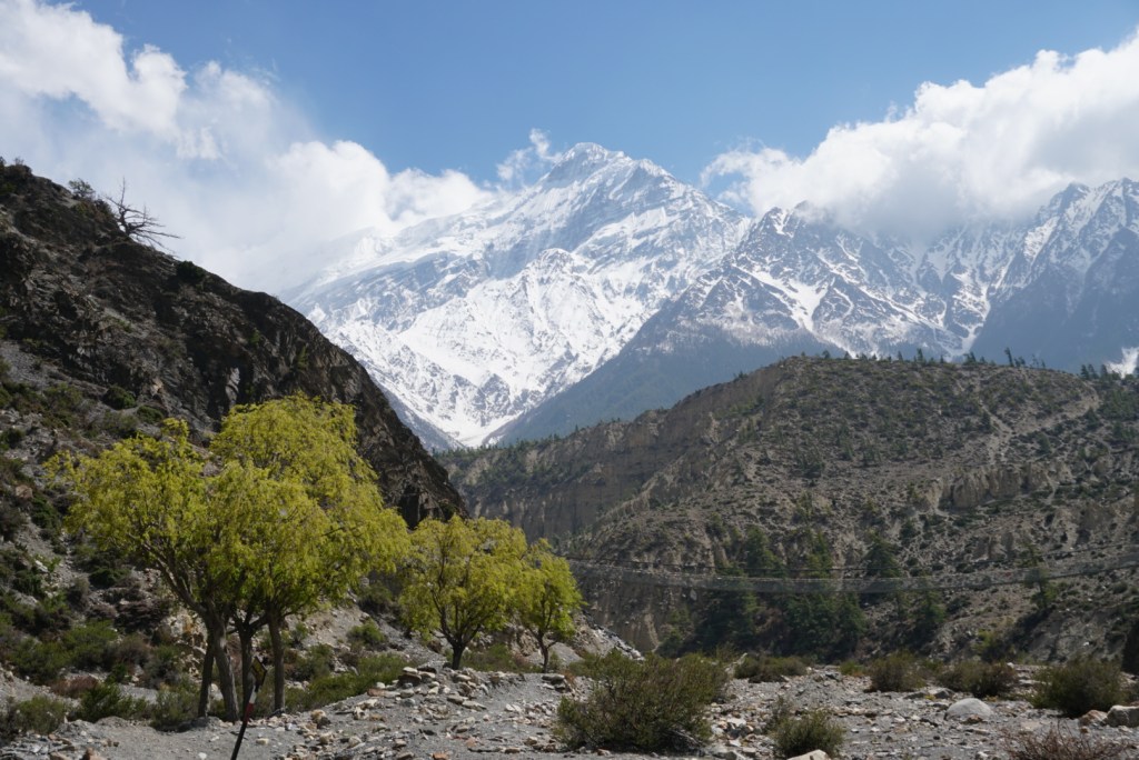
Annapurna Circuit
Annapurna Conservation Area, Nepal
Length: 156mi (251km)
Days: 16-20 to Birethanti (+1 day to Dhampus, -5 days if you finish in Jomsom)
Difficulty: Hard (extreme altitude and temperatures, seasonal exposure to ice and snow)
Gear: Limited backpacking gear required. You will need layers for both cold & warm temperatures
Completed: April 2019
In summary: One of the greatest alpine treks in the world, the Annapurna Circuit is one that all serious trekkers should have on their bucket list. This hike offers a spectacular opportunity to see some of the highest (and most dangerous) peaks in the Himalayas from all angles. Not only does the Annapurna provide some of the world’s best panoramas and mountain vistas, but it is also a culturally immersive journey. Staying in humble, family-run teahouses along the way, trekkers are sure to learn a lot about the Nepali / Tibetan culture and sacred sites along the way.
Preparation / Know Before You Go
Permits are required. All trekkers in the Annapurna region are expected to purchase a permit as well as a TIMS card in advance of hiking. These can be obtained for ~$40 USD at a Nepal Tourism Board (NTB) office in Kathmandu, or in cities closer to the trail such as Pokhara & Besisahar. You will encounter a couple of checkpoints along the trek, so ensure you are carrying these at all times.
Decide how you want to hike. There are a number of ways to hike the Annapurna Circuit, and groups of all types will be encountered on the trail. The easiest (and most expensive) way to trek is to go with an commercial tour group such as Intrepid Travel. The intermediate option is to hire a porter to carry your luggage, and the advanced option would be to hike unassisted. In my humble opinion, I would recommend one of the latter two options. While tour groups are fantastic for managing logistics and providing experts to point out interesting sights, you do sacrifice your autonomy and this could be critical if you need to take it slow or want to check out other things along the way. Although my hiking partner Ben and I decided to embrace the physical challenge of tackling the hike unsupported, hiring a porter is an admirable way to stimulate the local economy.
Dress for all possible weather. The Annapurna is notoriously difficult to pack for. Trekkers can expect to experience high temperatures while in the lowlands, and then extreme cold near the pass. Pack smart to avoid getting yourself into any trouble. Fortunately, you should have extra space in your bag since you will not need a tent or cooking supplies.
Educate yourself before you go. If there was one thing I regretted about my incredible journey to the Annapurna region, it was that I didn’t learn more about the local culture in advance. The Himalayas are one of the most sacred natural regions in the world, and though we picked up a ton of knowledge along the way, I wish I had more appreciation for the place and people prior to hiking. Read up on Buddhist culture, buy a guidebook, and stop in at the ancient monasteries along the way to ask questions of the friendly students and monks. If you treat them with respect and display ample curiosity, they may even invite you in for a private tour of spaces not usually open to tourists.
Treat teahouse proprietors with respect. It is well documented in other travel blogs that you can often receive free lodging in exchange for ordering your meals at a particular teahouse. If you are offered a discount, accept it! But don’t be an asshole tourist and harass the innkeepers for cheaper rates. Rarely is lodging more than $5-10 USD (500-1,000 NPR) per room, so you can pay it. Additionally, don’t stay in one lodge and purchase meals from another. That is a faux pax and disrespectful, as the food is generally where the money is for the locals.
Prepare for altitude and take it SLOW. I highly recommend a quick health check up in your home country before heading to extreme elevation. HAPE and HACE (high altitude pulmonary / cerebral edema) are serious concerns as you will reach altitudes of over 5,400m. (17,750ft.) on the journey. The itinerary below is designed to help your body acclimatize, but some people require more or less time than others. Make sure you spend at least one day on an acclimatization hike, and if you feel sick or drunk near the pass, head to lower elevation. As an extra precaution, I received an EKG and altitude medication prescription before departing.
Eat the Dal Bhat! One, because it is delicious. Two, because it usually comes with unlimited rice and lentil soup that will help remediate your caloric deficit. It used to be the case that dal bhat was the only dish that most teahouses carried, but almost all have since expanded their menus. Still, there is a reason the locals say: “Dal Bhat power, 24 hour!”
Day One: Kathmandu to Bhulbhule (5.5mi)
Despite being a short hiking day, our first on the Annapurna Circuit was a long and exhausting day of travel. We caught the 7:00am tourist bus from Kathmandu and took the bumpy 5+ hour ride up to the mountain town of Dumre, were we and a kind Austrian couple jumped off. We split a cab with them, and in no time were at the trailhead in Besisahar. We grabbed a bite at a local restaurant, got our TIMS cards stamped at the checkpoint, and embarked on the journey on a lifetime.
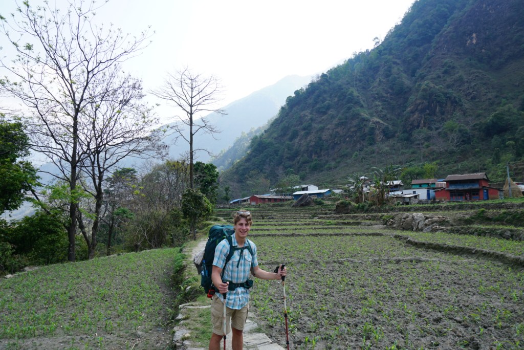
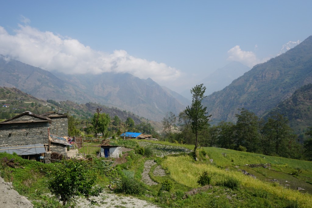
Being in the lowlands at ~800m. above sea level, the surroundings were lush and verdant. The couple miles we were able to get in before dark were along the edge of a narrow valley dotted with terrace farms. As we passed through some of the farms, following the familiar red & white trail markings, young children would run out of houses to come say ‘hello’ and ask us for treats. We had been instructed not to hand out anything, but we found the kids friendly and entertaining nonetheless. Though we had originally wanted to make more progress on our first day, nightfall came quickly on account of being tucked in the mountains, and we had to pull up in the town of Bhulbhule.
Our night in Bhulbhule was pleasant. We had a nice meal at the hands of the matriarch running the teahouse, and got our first look at the simple accommodations of a Nepali teahouse. Our room was clean, but a bare concrete room square two wooden beds and quilt blankets. As tired as we were, we had no problem falling asleep.

Day Two: Bhulbhule to Tal (17.5mi)
Our second day on the Annapurna was a beast. We made a decision to combine three lowland days into two, in hopes of earning ourselves an extra acclimatization day or tourist day in Pokhara, and ended up paying the price. We shoved off around 9:30am and enjoyed some fantastic hiking through terrace farms and small villages. The weather was superb, and every once in a while we could get a glimpse of the towering Himalayan peaks that would become our reality within a couple of days.
After around five hours of steady climbing, we reached the steepest and longest set of stairs I have ever seen in my life. Our map indicated that it would take 1hr. and 40min to move approximately 0.5km., and though we made good time, it was not too far off. Our troubles were rewarded by lunch in the hilltop village of Jagat, but the climbing took a toll on our legs. After a long break however, we soldiered on.
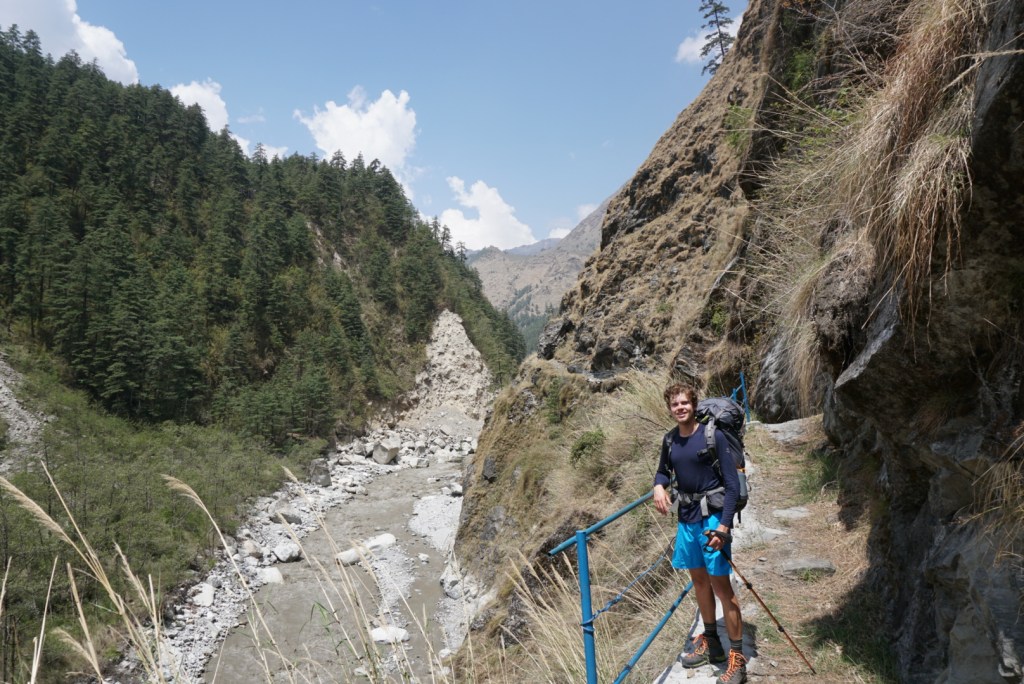
A mile or so into our second leg, our paths were blocked by an obstinate goat that just did not look friendly. When scrambling over some off-trail rocks to get around the path, we noticed a baby goat that had to have been birthed within the hour laying smack in the middle of the trail. It was quite a surprise and obviously the reason the goat was defending the path. Beyond that encounter, the rest of the journey was hell due to some unforeseen circumstances. Ben twisted his ankle pretty good on a loose rock,and I experienced a brutal episode of cramping in my quadriceps (likely tied to the earlier stairs). These ailments cost us a lot of time, and regrettably we were still on the trail well after dusk. When we finally limped into Tal, we crashed at the first guesthouse we saw, and forced ourselves to eat some dinner before bed.

Day Three: Tal to Chame (15.1mi)
Remarkably, we awoke on day three feeling pretty refreshed and were without too much soreness! We spent much of breakfast cursing the day prior, but when we hit the trail the sun was shining and the air was sweet. The Himalayan Range is potentially the most breathtaking and peaceful setting in the world, so it was impossible to feel down for long.
The day’s walking took us along the edge of the valley formed by the Marsyangdi River. Like every day prior to the pass, it would be a steady climb. Fortunately, there were no soul crushing sets of stairs like the day prior. I wish I had taken a photo of these stairs to show you all. I have also run countless Google searches on the “Jagat stairs” to no avail. My hypothesis is that trekkers are so devastated upon seeing the stairs, that they forget to capture a picture of them for future war stories.
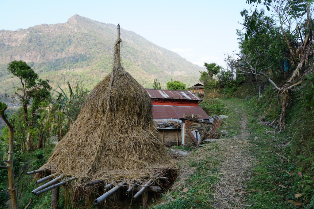
As we pushed through the roughly 15mi. day, we could start to see signs that our elevation was increasing. For one, the small villages that we passed through were changing. We were encountering fewer terrace farms, and it seemed that timber was taking over as the predominant industry. Toward the end of the day, we could hear the sound of axes and chainsaws echoing through the valley.
Our day ended in Chame, at one of my favorite guesthouses. We received a private little cottage for lodging, and the dining room was both cozy and packed with hardened trekkers from around the world. We spent some of our evening chatting with Germans over Tibetan tea and a warm fire, then ordered our first dinner of dal bhat. This teahouse was serving chicken with the dal bhat (first serving only) which provided some much needed protein. We ate like kings. I went to sleep having taken down two sizeable portions, while Ben impressively put down three.


Day Four: Chame to Upper Pisang (8.7mi)
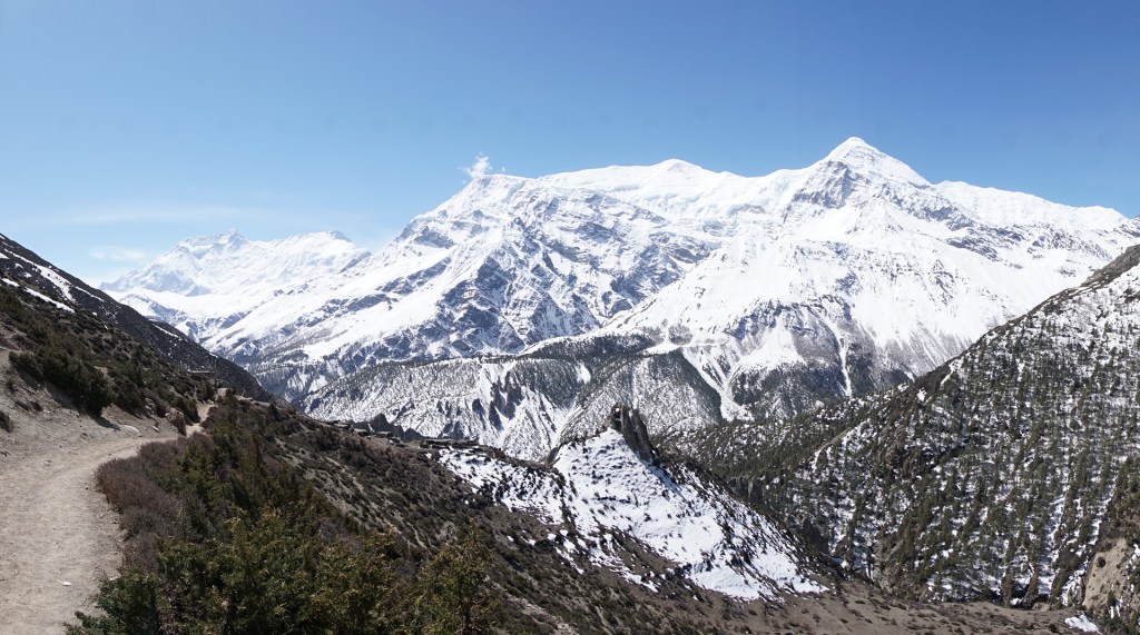
Day four was one of my favorites of the trek, and definitely the most enjoyable one in the “lowlands”. The sky was blue and the temperature perfect. By this point, we had reached ~3,000m. (~10,000ft.) of elevation and it really felt like we were in the mountains. The biggest challenge of the day was deciding when to stop for a photo, as I felt like every 5 minutes we were running into the “perfect shot” of Annapurna II.
The highlight of the day was around lunch. We had just scaled a sizeable incline, and at the top we noticed a couple of conspicuously modern buildings surrounded by apple orchards. We approached, and were thrilled to find that the building was a cafe selling fresh apple products. We loaded up on donuts, fresh apple juice, and dried apple chips. The food was phenomenal, and a much appreciated departure from a diet heavy in breads and rice. After stuffing our faces and grabbing a couple bags of apple chips for the road, we continued along the winding trail. Around early afternoon, we dropped to the level of the now raging river and crossed over and back a couple times. At this point the scenery was really starting to change, and by the time we made Upper Pisang, it was completely different.
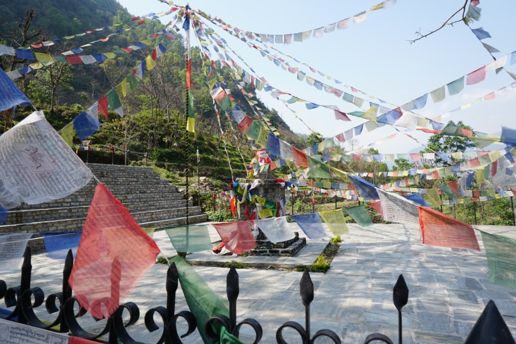
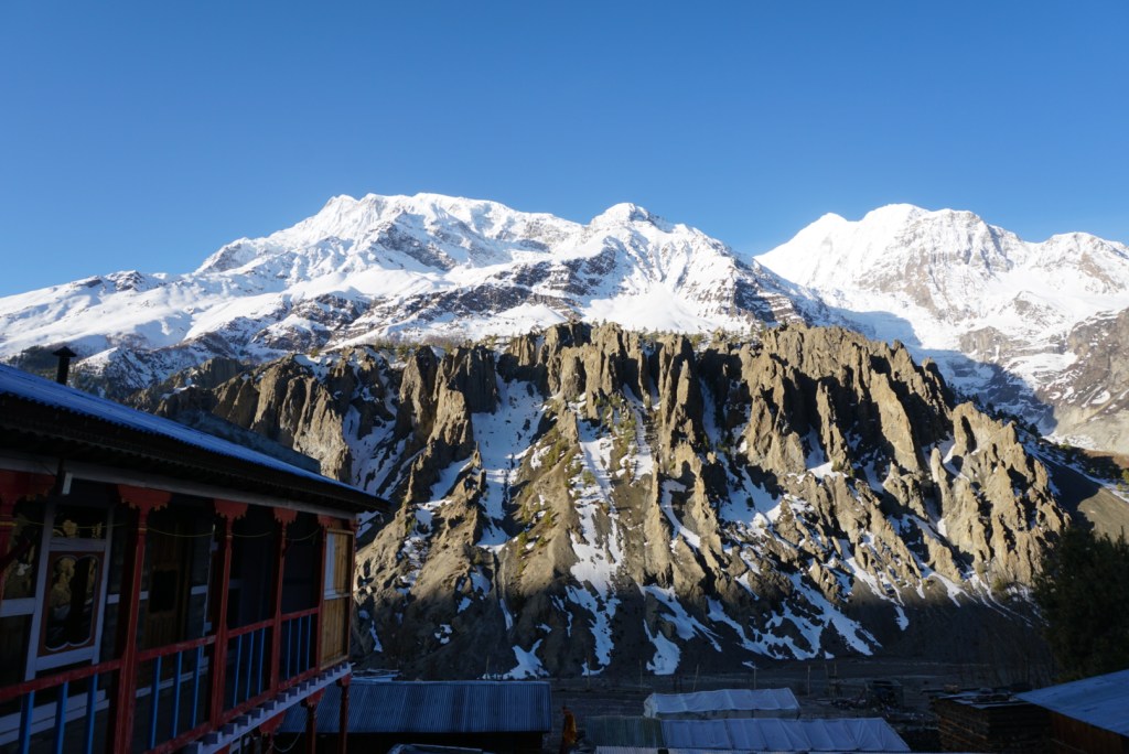
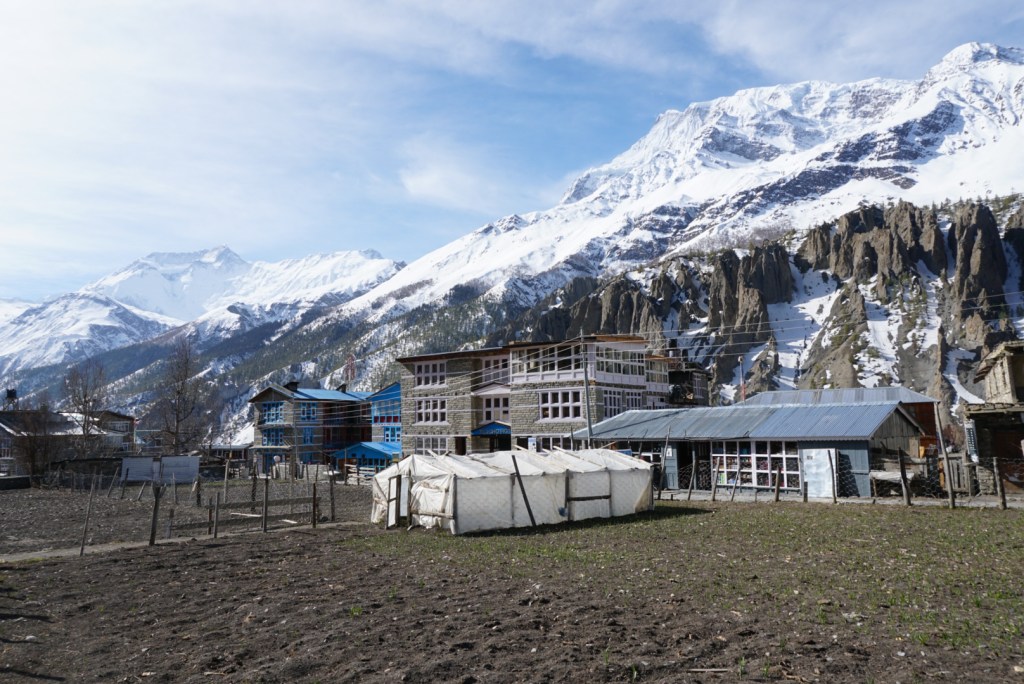
Upper Pisang resembled something out of a travel magazine. Perched on steep rocky slopes and towering above its counterpart Lower Pisang, every single teahouse had a magnificent view of the massif and the sharp peaks of Annapurna II & IV. Immediately, Ben and I elected to head to the highest of the guesthouses in search of the primo panorama. We were thrilled with what we found, and after a quick respite, we hiked a couple more stairs to the large monastery right above us. The site was brilliant, decorated with bright colors and ornate carvings. We sat for a while on wool pillows and listened to a monk, playing the drums and cymbals. Once finished, the night was capped off with a thermos of Nepali milk tea and a heaping portion of dal bhat while we read and watched the sunset from our dining room windows.


Day Five: Upper Pisang to Braga (9.3mi.)
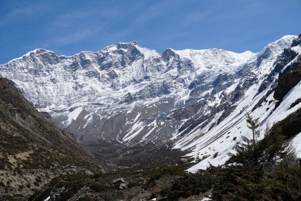
Day five was marked by a 6am wake up, as we hoped to catch the sunrise from the monastery. We were told that taking part in morning prayers can be a peaceful and auspicious way to begin any day of trekking, but unfortunately no monks were present. Nonetheless, we were able to watch as a friendly old woman tended to the grounds and started a weisang (incense) offering of pine branch and tsampa (a local grain often used in porridge). The morning view of Annapurna II was well worth rising for in itself. It was a clear blue day, and we spent a good amount of time watching in awe as clouds formed off the summit.
The rest of the day we kept climbing as we continued our rotation around the Annapurna range. Right off the bat, we were faced with a harrowing ascent that rivaled that of Jagat. Fortunately our path led us along switchbacks as opposed to stairs, but at 10,000 ft. of elevation we were huffing and puffing as we reached the top. When we immediately spotted a small wooden shack selling “apple pies” and yak cheese at the summit, we were overjoyed. We spent the equivalent of a whole meal’s worth of rupees on these incredible snacks, and then sat to enjoy the view.
As we continued on our way, we could really tell that we had entered a new environment over the last day or so. We were nearing the treeline and banks of snow could be seen dotting the hillsides around us. The villages themselves had changed as well. Stone replaced wood as the primary building material, and the cows from the lowland farms had been swapped for hardier yaks. The change of pace was welcomed though, and is part of what makes the Annapurna Circuit such an enjoyable trek.
The remainder of day five we found to be quite pleasant. The elevation gain was gradual, our lunch of yak macaroni was amazing, and towards the early evening we were given an impromptu tour of a local gompa (monastery) by young students. They told us about the stupas that blanketed the region and showed off a sacred handprint that was etched into a rock on the premises. Unfortunately, the language barrier made it very difficult to understand the significance of the revered handprint. The day finished in the town of Braga, just shy of Manang, in the Hotel Buddha. The culmination of a great day came when we were informed that for a couple rupees we could use the hotel’s electric water heaters for a HOT SHOWER!
Annapurna II from our teahouse deck 
Morning prayers in Upper Pisang 
The village of Pisang in the shadows of Annapurna II 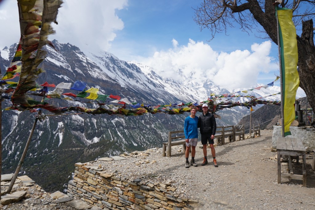
The stunning view post-switchbacks 
The stone village of Ghyaru 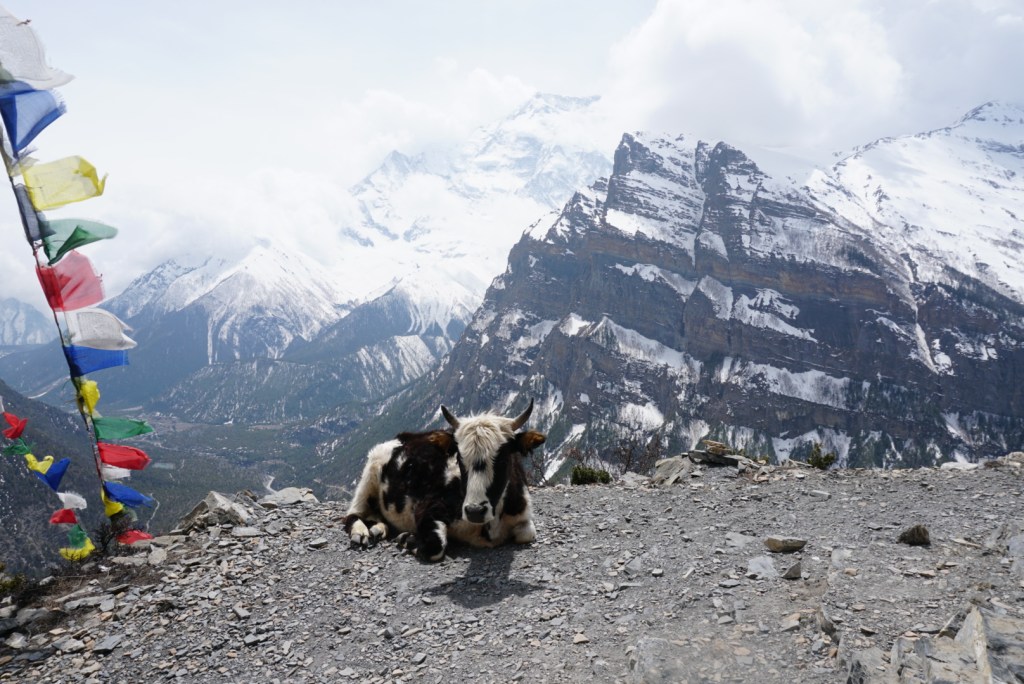
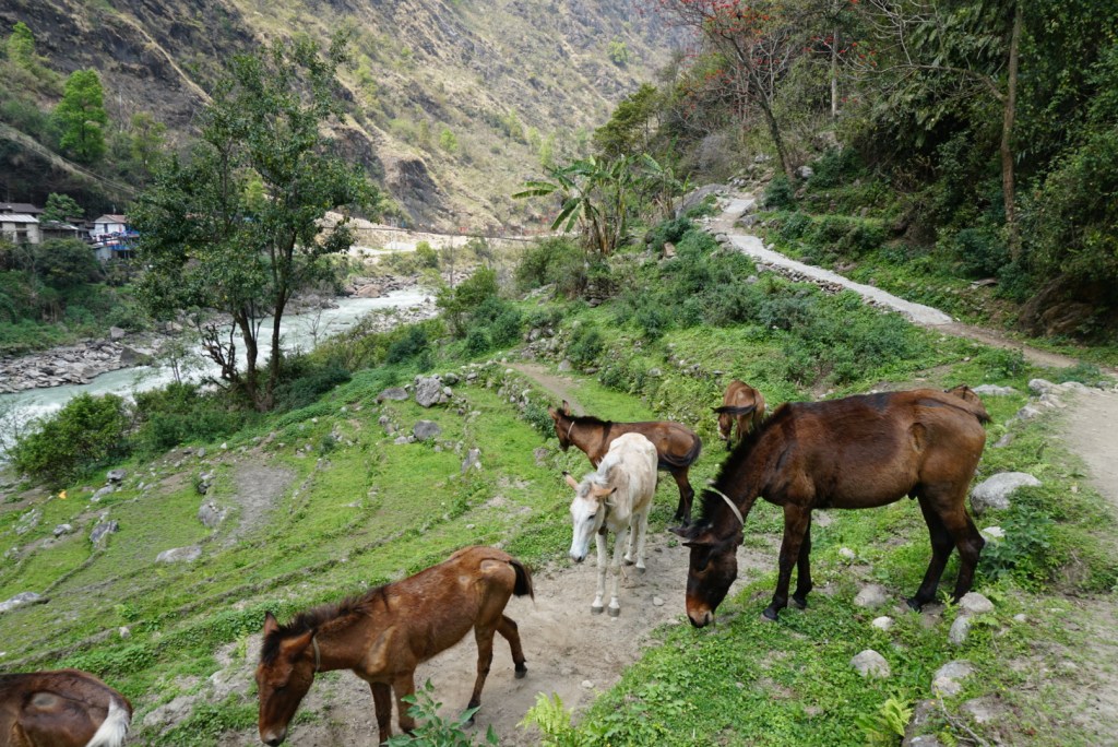
A peaceful yak enjoying the views 
A photo op with the trail dog that followed us for well over a mile 
The sacred handprint near Ngawal
Day Six: Rest Day – Kicho Tal (9.9mi.), then Braga to Manang (2.8mi.)
It is worth noting that for most trekkers on the Circuit, the “rest day” is not restful. The same should go for you if you elect to hike the circuit. Upon arrival in Braga, we were at over 11,000ft. (3,450m) and starting to stage for the pass. In order to assure that our bodies were ready for the extreme altitude, we elected to follow best practices and go for an acclimatization hike. This is when hikers day trip up to a high altitude to give your body a chance to adjust to the thinning air. Most trekkers do this and I would NOT recommend skipping it on the Annapurna. If you need a true rest day off your feet, then do this in addition to your acclimatization hike.
In Braga, there are two great options for your acclimatization hike: Kicho Tal (the Ice Lake) or Milarepa’s Cave. Kicho Tal is a sacred ice lake that is supposed to have reflective views of the Annapurnas when melted, and Milarepa’s Cave is a holy site where it is believed that a famous Tibetan philosopher meditated and lived off of stinging nettle. In the end, we elected to hike the Kicho Tal. After a slow and relaxing morning, we packed up a small day bag and set off.
The hike itself proved to be quite a challenge; the trail was steep and the weather harsh. Still, we had left our backpacks at the Hotel Buddha, and moving without them was liberating. After a couple hours of trudging our way through the snow, we made it to the lake. It being early April, Kicho Tal was still 95% frozen over, but there was a beautiful white stupa and the views at 15,000ft. were were worth it. With some good luck, we discovered an abandoned miners hut that we could crawl into for a lunch out of the wind.
The way down was quick and largely uneventful. We had made plans to swing by Sher Gompa, a 900 year-old women’s monastery, but got a little lost and overshot it. In the end, we skipped it, went back to the hotel to grab our bags, and completed the short, flat walk into Manang. We found Manang to be very enjoyable. It was one of the largest towns that we passed through, and as the last town before the pass that is inhabited year-round, it had more amenities. There was a cute one-room DVD movie theater, a small cultural center, and a local bakery at which we ordered some fantastic fresh apple crumble to cap off the day.


Day Seven: Manang to Yak Kharka (5.8mi.)
After a great night’s sleep we woke up ready to tackle a more relaxing day seven on the trail. Interestingly, Ben and I found out over breakfast that we both had been having wild, lucid dreams over the last couple evenings. I don’t know if it was related to the altitude or the spiritual fabric of Nepal, but it was certainly a twist neither of us expected on the trip.
We started the day by checking in at the ACAP checkpoint, and then filling up at a clean water station gifted by the New Zealand government and operated by local women. Once we were on the trail, we were able to enjoy sunny skies and a steady ascent. The trail was busier (though not crowded) and we made conversation with a number of the groups we encountered. Since around Chame or Pisang, most of the trekkers making the journey had fallen into the same cadence, so we started to recognize faces from prior teahouses and the trail. It was quite fun to watch as this little community of Czechs, Germans, Dutch, French, Japanese, and Americans developed.
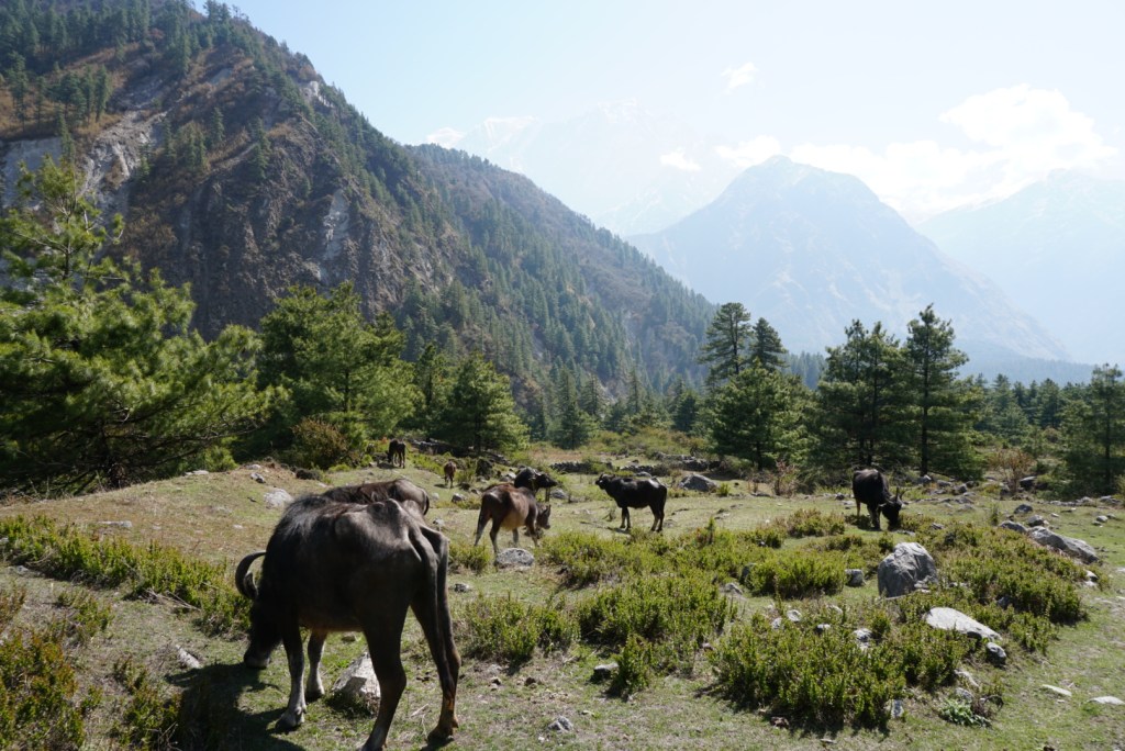
After a quick three hours or so, we arrived in Yak Kharka. We had the energy to go further, but it was not advised. Though the distances shortened considerably in the final days before the pass, it is vital to give your body time to acclimate prior to the big crossing. Instead, we spent the remaining hours of the day relaxing, reading outside, and making friends in the cozy teahouse dining room. Yak Kharka lived up to its name in that there were docile yaks roaming all around the small village, and every teahouse was serving up protein-packed yak-based meals. I opted for a yak burger, while Ben crushed a massive yak steak. The meal did a lot for our strength, and we fell asleep early, ready for the challenge of the next two days.


Day Eight: Yak Kharka to High Camp (5.0mi.)
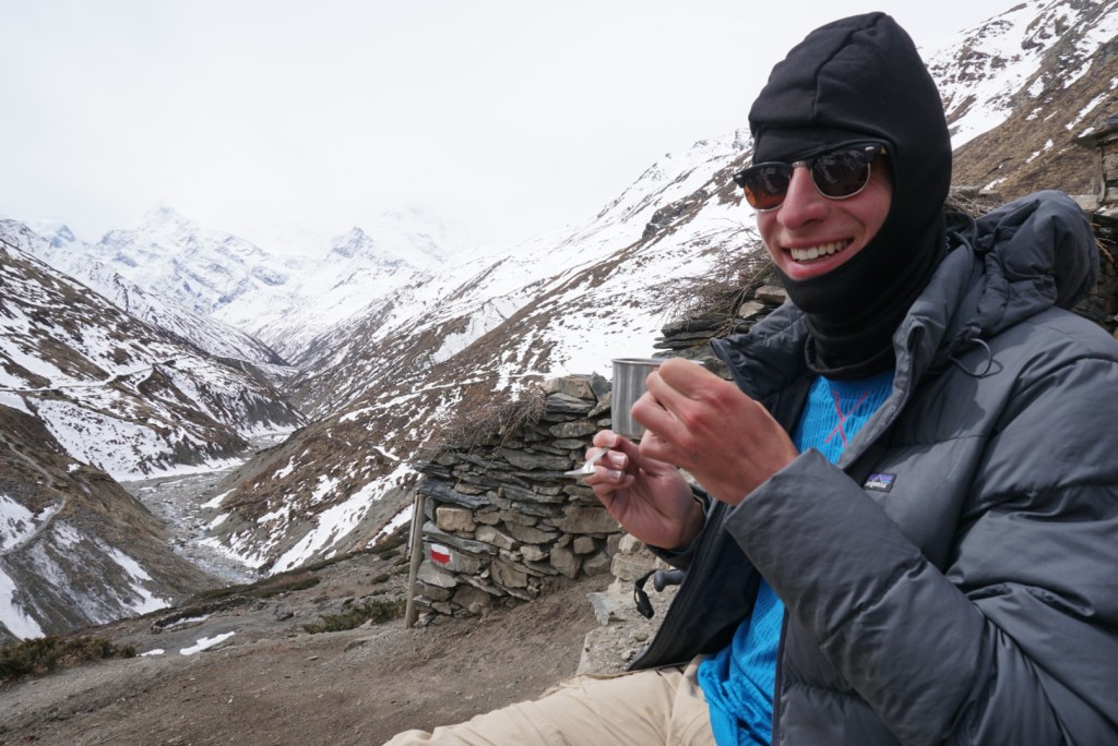
As we anticipated a little bit of a log jam at the staging sites for the pass, we decided to get an early start out of Yak Kharka. Despite some snow on the ground from the night before, the sun was out and it gradually warmed. The walk was tiring, but we were hardened from the rigorous days prior and made quick work of the early sections. Upon conquering a steep hill 2/3 of the way to Thorong Phedi, we stopped for a quick breather at a remote teahouse with a number of other trekkers. A cup of lemon ginger and a quick photoshoot later, we finished the journey to Thorong Phedi.
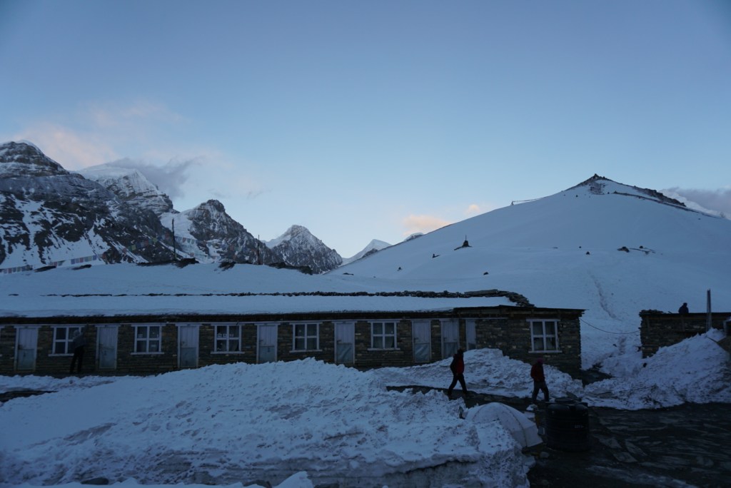
At Thorong Phedi, we were faced with a decision: spend the night at the lodge there, or push to High Camp. We had read that some hikers struggle with the altitude at High Camp, but the idea of staying at the highest lodge on the trail and shaving some mileage off the big day was just too tempting to pass up. The final push was a challenge. The trail pretty much went 400m straight up a hill, no stairs, no switchbacks. Additionally, ice coated much of the path. Still, we made it, and feeling accomplished we grabbed a room at 15,900ft. (4,850m).
The rest of the afternoon and evening was spent lounging in the High Camp dining room, eating dal bhat and trying to nap. Overall, we felt great considering the altitude. Some hikers were complaining of headaches, but my only symptom was being tired, yet unable to actually sleep. We were told this was actually quite common, and that at extreme altitude your body can be working too hard to fully fall asleep. Fortunately, when it was time to go to bed, I was able to get some shut eye. This was not however, before stepping out for a moment to stargaze. The night sky at High Camp was incredible. With no significant light pollution at such an altitude, you could see millions of stars and the bright band of the Milky Way.


Day Nine: High Camp to Muktinath, via Thorong Pass (8.7mi.)
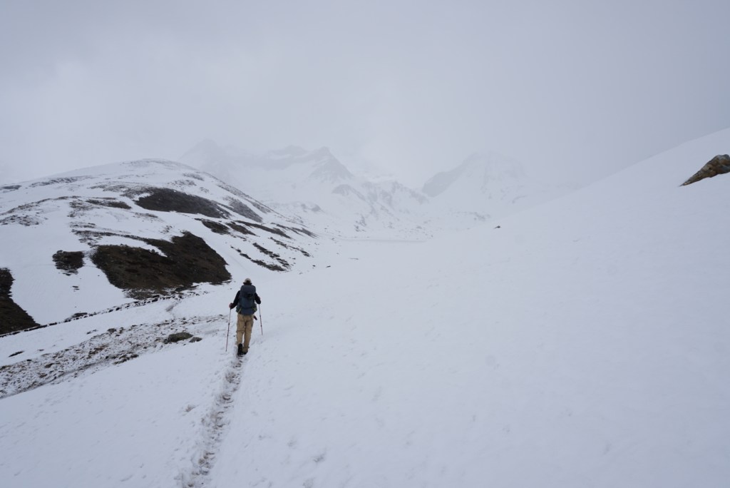
Our big day started at 4:30am. It might have been hard to roll out of bed that early, except our room was ice cold and we were anxious to get the blood flowing again. Still, we were shocked when we stepped outside and saw that a number of groups had left even earlier. Nevertheless, we strapped our headlamps on and took off across the snow.
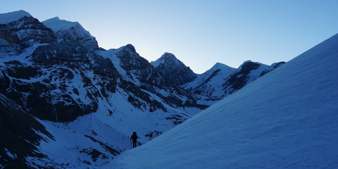
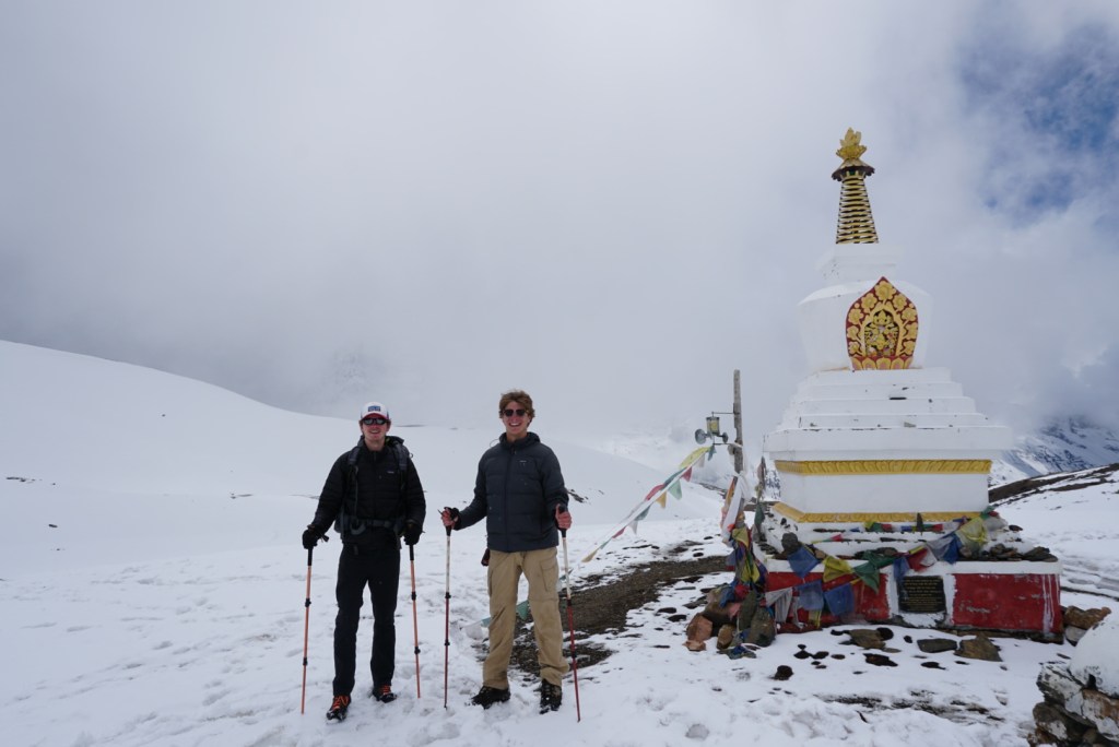
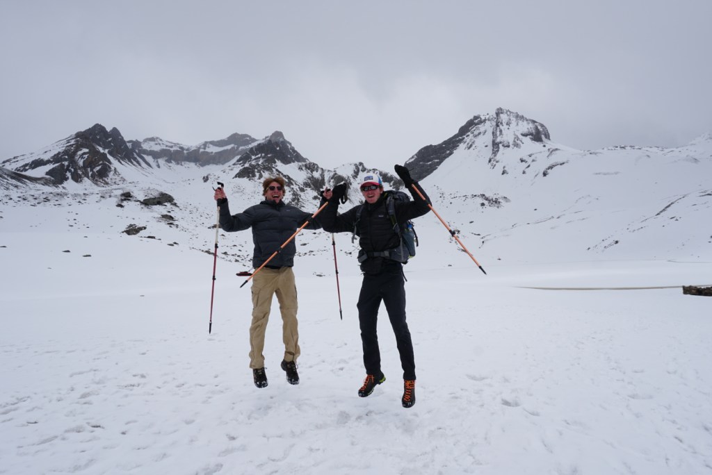
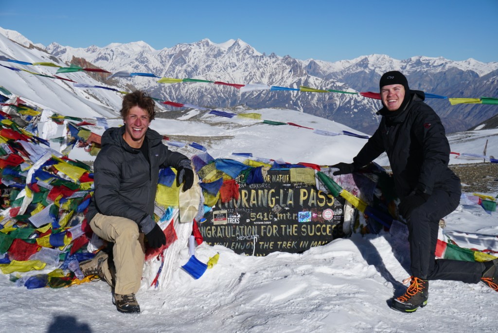
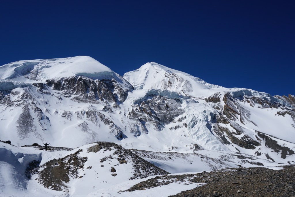
We could not have picked a better day to cross the pass. There was not a cloud as far as the eye could see, and as the sun rose we were treated to picture perfect views of the great Himalayan peaks. The wind was cutting through our gloves and balaclavas pretty good, but the ground was frozen enough that it did not impact visibility at all. We were huffing and puffing as we made made climb without crampons (I would recommend them), but our legs and lungs were strong and by 7:15am we were standing atop Thorong Pass, the highest passes in the world!!!
The energy at the top was electric. Trekkers were shouting out of joy as they reached 17,770ft. (5,416m.), and even the Nepali guides and porters who had done the trek countless times looked genuinely thrilled. We snapped photos, ate celebratory chocolate bars, grabbed tea at the family run shack, and just relished a spectacular moment. Though we still had some exciting days ahead, this was definitely the highlight of the trip, and a memory that we had worked incredibly hard to make. After about 2 hours of taking it all in, we began our descent.
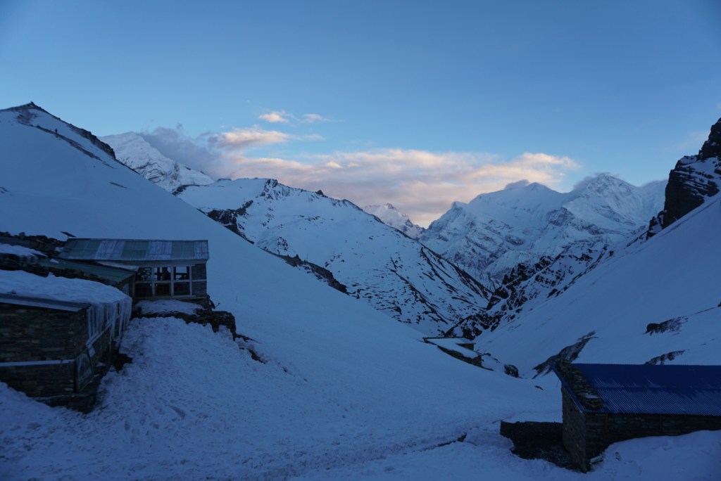
Very quickly, we learned the descent into Muktinath would not be something to take lightly. In a short time, we descended approximately 5,250ft. or 1,600m. on an icy and rocky path. This was very hard on the the knees, and each of us took a couple tumbles. On one of my missteps I ended up twisting my ankle pretty good and bending my hiking pole at a 90 degree angle. Later we would have to bend it back with the help of a large rock. Eventually however, we did arrive in Muktinath. It was a bustling town, and packed with Indian tourists who had come as part of a Hindu pilgrimage. We found a hotel and spent a little time walking the streets and shopping for family back home. Finally, we enjoyed a hot shower and then settled in for the night, still riding the high from our day on the pass.


Day Ten: Muktinath to Kagbeni (9.3mi.)
We had a relaxing day planned for day ten, so we took our time leaving in the morning and did not depart our hotel until around 9:45am. The slow pace was welcomed, as our bodies needed to recover from the strenuous day at Thorong La. Nonetheless, we still elected to take the longer scenic route to Kagbeni via a tiny village called Jhong. We had been told the main road to Kagbeni could be busy and very dusty, so we felt the extra mileage was worth it.
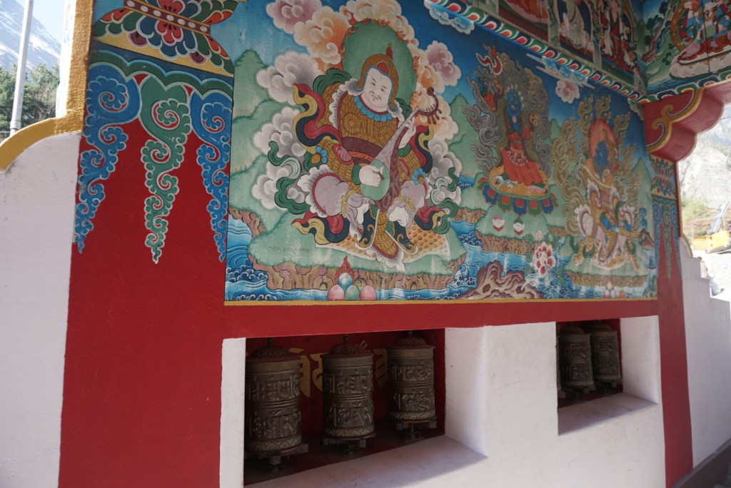
The scenery near Muktinath was completely different than what we had encountered on east side of the Annapurna range before the pass. The land was dry, dusty, and much flatter on account of a massive riverbed in between the Himalayan ranges. The region was clearly more inhabited, but still we felt a sense of isolation on the trail, and the new environment was appreciated. In Jhong, we came upon a fascinating 14th century monastery that was perched atop a sharp ridge and the ruins of an even older fort. The monastery had been severely damaged by the 2015 Nepal Earthquake and was undergoing restoration, but still we were able to go inside to peer at the intricate wall and ceiling paintings.
The remainder of the walking was uneventful. The path took us along remote farming roads and past herds of domesticated goats. The terrain resembled that of a desert until we came to Kagbeni, which was a scenic, dense, walled-in village at the edge of the massive riverbed. We descended into the town where we met a friendly German fellow who gave us teahouse recommendations and took as to a great German Bakery. After dinner, Ben and I walked over to another 14th century monastery belonging to the Sakyapa Buddhist sect (one of 4 major Tibetan schools). We paid for a tour, and were assigned a young boy with great English who lived and studied at the monastery. He was kind and patient as we peppered him with questions about Buddhism, the monastery, his life, and other sights / customs we had encountered in the region. It was a great ending to the day, and gave us both a lot more appreciation for the journey we had been on.


Day Eleven: Kagbeni to Chhairo (9.3mi.)
Day eleven on the Annapurna required us to run some errands, so we made quick work of the morning walk along the sandy, rocky riverbed. Our knees were feeling the residual effects of our recent climbs, but the flat ground felt good and really put into perspective the mountains on either side of us. By early afternoon we had reached Jomsom, where we got our permits stamped and went for a cash resupply at the only ATM on the route. There is a small airport and some bus stations at Jomsom, so this is a popular spot for many trekkers to end their journey. We could tell this was the case, as we encountered far fewer trekkers over next couple days and had lost touch with most of our little pre-Thorong La community.
After a great lunch of Thakali cuisine, the Thakalis are a prominent ethnic group in this region, we continued on. The rest of the trip was peaceful and uneventful, though we did make some last minute changes to our plans. Initially we intended to spend the night in Marpha, a sizeable riverside community similar to Kagbeni. However, just before dusk, as we neared Marpha, we came across a small village called Chhiaro that turned out to be a Tibetan refugee camp. As we ventured through, we were greeted be a couple of curious and happy children who wanted to play. We stopped for a bit, and ultimately decided we would rather spend our money in this community. We located the only inn in the village that we could find, and settled in.
It was a great evening. The children came back with some friends and a flat soccer ball, and we spent an hour or so before dinner kicking it around on the grassy patch outside our room. Our dinner did not disappoint either, the menu of traditional Tibetan food was a strong departure from the standard teahouse fare we had encountered elsewhere on the circuit. Most notably, Ben ordered this dish I could not venture to pronounce that tasted like sugared gnocchi. If passing through the area, I would strongly recommend all trekkers work Chhiaro into their itinerary.


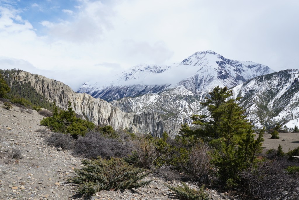
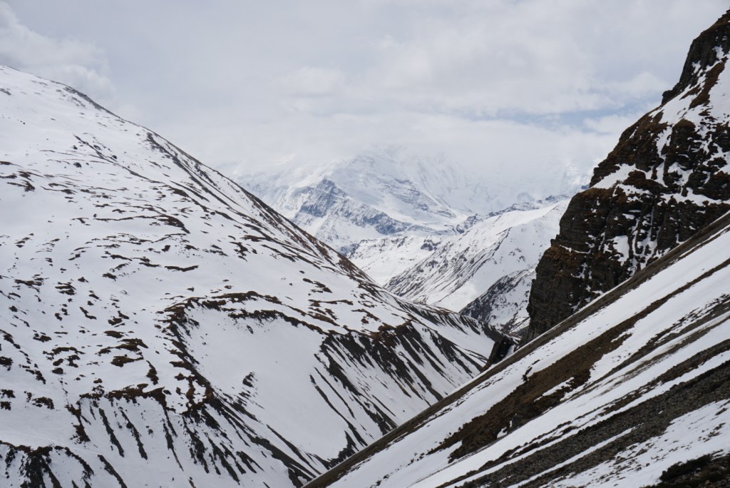
Day Twelve: Chhiaro to Kalopani (10.6mi.)
The day started with a hearty and unique Tibetan breakfast, then by 8:30am sharp we were back on the road. Our ACAP map indicated it would be a brisk 4hrs. walk, but similarly to the day prior, we learned that it would take much longer on the scenic side of the river. Still, we enjoyed the trip and were happy to not be moving along the side of a road. The scenery offered some great views of the Nilgiri and Nilgiri North peaks, and generally resembled some of our early days on the circuit, though it was not nearly as difficult. Just before lunch, we got a fleeting look at the prominent summit of Dhaulagiri, which was once thought to be the tallest mountain in the world (now it is the 7th).
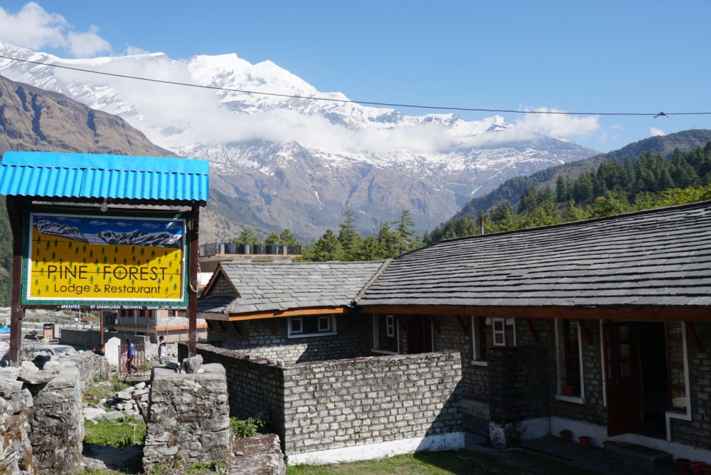
We found lunch spots to be harder to come by this day, as many of the small villages did not have a restaurant, but eventually we had a great meal in Kokethanti. Towards the end of our lunch, some clouds started to roll into the valley, so we hustled out and 20 minutes later found ourselves at our final destination in Kalopani. The lodge we found in Kalopani turned out to be a hospitality school offering on-the-job learning, so we treated ourselves to a great 4-course meal from the young chefs in training. Now that we were at lower elevation, we also decided to break our streak of sobriety and sample some of the Pine Forest’s local apple brandy and beer selection. Note: it is not recommended to drink alcohol prior to Thorong La, as it can exacerbate symptoms of altitude sickness.


Day Thirteen: Kalopani to Tatopani (13.5mi.)
Happy Nepali New Year! We had a long, but fast day of steep downhills ahead of us for day thirteen. As we wound our way down mountain roads, we couldn’t help but notice trucks and motorcycles of well dressed locals headed in the opposite direction with food and bottles of beer strapped to their vehicles. Eventually, we ran into a friendly Nepali man who explained to us that at midnight on April 14th, they would be ringing in the year 2076. The chance to witness these holiday celebrations gave us a little extra energy for the day.
As we made the rapid descent towards Tatopani, we could see the landscape around us changing. It was becoming greener as grass replaced rock on hillsides, and the trees were getting taller. It seemed this part of the valley received significantly more rain than the other regions, and we spotted a number of small waterfalls along the way.
When we reached Tatopani, we were told that there was a popular hot spring nearby, that we could experience for around 150 rupees. We were delighted to hear this. I had started to experience some mild pain in my left quad, and we both felt the spring could be therapeutic. We couldn’t have been more satisfied as we sat in the natural jacuzzi-like spring and watched happy trekkers and religious pilgrims enjoying the two large cement pools. For dinner, we feasted on dal bhat and had some celebratory Namaste beers to ring in the new year. For the first time on the circuit, I went to bed feeling like I had overeaten.
Day Fourteen: Tatopani to Ghorepani (12.3mi.)
Day fourteen on the Annapurna went down as our toughest on the trail for two reasons. One, it was a steep uphill day, that saw us gain 1,670m., or approximately 1 mile, in elevation. Two, my quad injury devolved to the point where my left leg was almost completely lame. I held up well during the daunting 500m. vertical climb that started our day, but after that things got worse and I relied heavily on my trekking poles for stability. I limped my way into lunch at Sikha, and we discussed pulling out, but there was no road access so the only option really was to continue. After around 2.5 hours of rest and massage, I felt stable enough to continue.
Aside from the injury, the day was strenuous, but offered some great scenery. Climbing back into the mountains, we were able to see the surrounding peaks from a new perspective. When we finally made it to Ghorepani and crashed at the first inn available, we caught some incredible views of both the Dhaulagiri and Annapurna ranges. Beyond the views, the night at the inn was very pleasant. It appeared we were the only one’s staying there that night, so we had the full attention of the friendly innkeeper. As he served us the best chicken dal bhat of the journey, he made it clear to us in broken English, “I am Nepali, I love God. When you stay at my house, you are my God. When you happy, I happy. When you not happy, I sad.” We went to sleep thankful for his kindness and praying for better health in the morning.


Day Fifteen: Ghorepani to Ghandruk (10.5mi.)
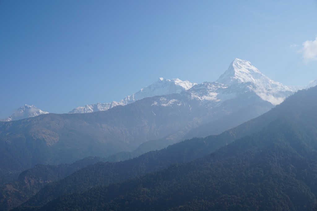
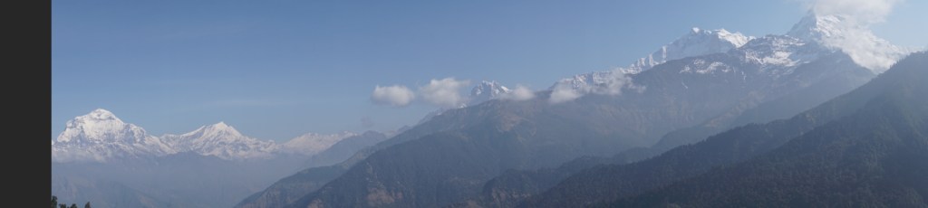
Thankfully, I awoke to find that the condition of my leg had significantly improved. Even better, it had improved to the point that I felt comfortable doing a pack-less 6:30am hike to the top of the popular Poonhill. The hike was through a forested ridgeline and took us up around 600m. of elevation. Surprisingly, we found the trail to be relatively crowded. It turned out the Poonhill was a popular hike for both day-trippers and backpackers on a short four day loop from Birethanti –> Ghorepani –> Ghandruk –> Birethanti. Still, despite the crowds, the view from the top of Poonhill was well worth the trouble. We marveled at the unobstructed, panoramic view from Daulagiri to Annapurna I and Muchapuchare, before eventually heading down. For a while, I had been growing worried that we would never get a clean look at Annapurna I on this journey.
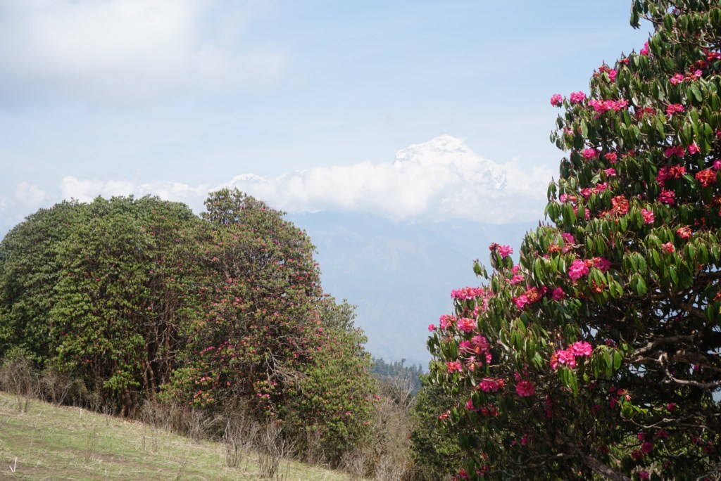
After grabbing our packs, we embarked on an up and down day through dense, green, moss-covered forests towards Ghandruk. Within the first hour, we reached and crossed Deurali Pass, which was peppered with bushy trees of vibrant pink flowers. These were some of the first bright natural colors that we saw on the circuit. Over the course of the afternoon, passed a countless number of tourists doing the shorter hike and the porters carrying their gear. I have tremendous respect for the industrious porters. They would often be carrying the bags for two to three foreigners, all by a single rope affixed to their foreheads. Many of them were quite old, and I always found it amusing to watch a 50+ year-old Nepali woman carrying three bags by her head dust a conventionally fit European couple up a steep hill. My amusement did turn to shame however, as my leg tightened up again, and by the end of the day I was the one getting beat up the hills.
Around early afternoon, Ben and I stopped for a satisfying lunch in Tadapani. Shortly after continuing, we passed a lone teahouse where the proprietor was standing outside and trying to convince us to come in before it rained. As there didn’t appear to be any ominous clouds in the sky, we wrote her off as a persuasive saleswoman and continued on. 45 minutes later, we realized we had made a huge mistake. Out of nowhere as the soothsayer predicted, massive clouds rolled in and we were caught in a downpour. Shortly thereafter, the downpour turned into what felt like a cyclone. We took off running through the intense thunder and lightning, and soon we came upon a teahouse where the owners welcomed us with open arms. As we changed out of our sopping wet clothes, I heard a large ‘crack‘, saw a flash and then smoke coming from a tree outside our window. It appeared lightning had struck no further than 20 meters away. The remainder of the evening was quite peaceful however. As the storm raged outside, we huddled around a fire with other trekkers and a few guides who regaled us with stories of climbing expeditions, Nepali tigers, and the 2014 avalanche.

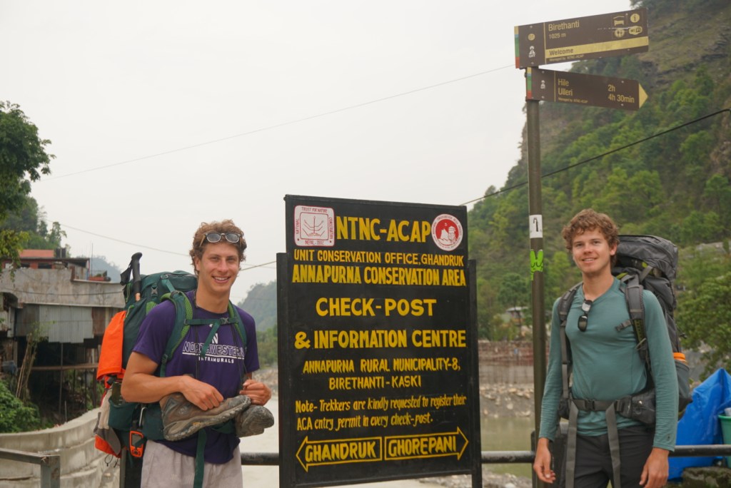
Day Sixteen: Ghandruk to Birethanti (12.5mi)
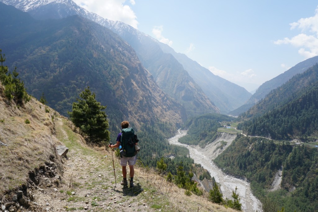
As was so commonly the case on this crazy adventure, our final day on the trail did not go as planned, but worked out for the best. We set off for Dhampus, the furthest of the two endpoints, after a quick 7:00am breakfast of Tibetan pancakes (a staple on the trail) and muesli. Within minutes, we passed through the full town of Ghandruk, and were faced with a narrow and treacherously steep set of switchbacks that led to the bottom of a ravine. It took a substantial amount of time before we reached the bottom, and there we were faced with a fork in the road. One path would take us on a 1.5 day journey to Dhampus, the other would lead to the traditional end of the trail in Birethanti. Given my quadricep was starting to act up again, we decided to play it safe and move towards Birethanti instead.
The new road led us steadily downwards along a small river for around three hours. Over the course of this time, my conditioned worsened, so I became increasingly grateful for our decision. Nonetheless, the idea of being hours away from a truly soft bed and a hot shower was motivation enough and we pushed onwards. Before long, we came around a small bend where we sighted the Birethanti bridge, also known as ‘the end of the road’. We were overjoyed! We purchased a meal and some celebratory ice cream, over which we recounted memories from our great journey. Afterwards we grabbed a cab and headed towards Pokhara.
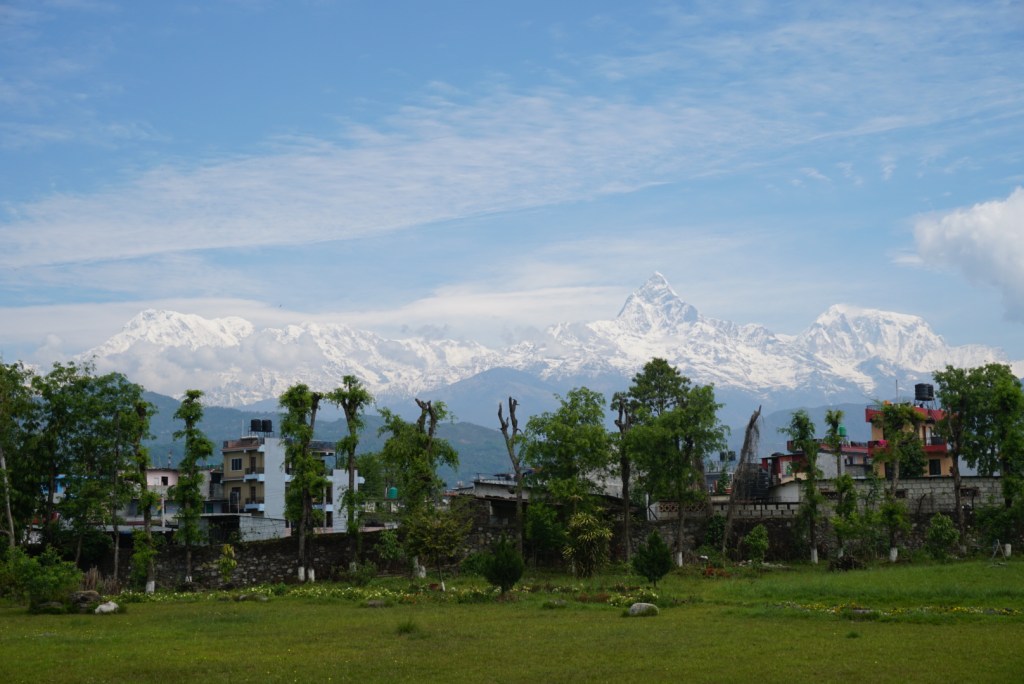
The cab ride was hell. Two and a half hours of hairpin turns and suspension-crushing potholes was not much appreciated by two tired hikers in need of sleep, but it all was worth it when we arrived at our hotel in Pokhara. The rest of the evening was spent aimlessly wandering the beautiful city, in search of some new, more familiar cuisine, a fitting end to the trek of a lifetime.

Additional Sources
- Nepal Tourism Board
- Official trail distances and elevations
- Annapurna Circuit trekking map
- Wikipedia: Annapurna Circuit
- Backpacker Magazine
- The Common Wanderer
- Moon & Honey Travel
- Annapurna Circuit Trek (Video – long)
- Annapurna Circuit Trek (Video – short)
- Intrepid Travel: A good option if you want a guided tour
Opinion: The New Road
Background: Prior to around 2014, there was no improved road connecting Besisahar to Manang. Even earlier than that, there wasn’t a large road along the Kali Gandaki valley. If you do any significant reading on the Annapurna Circuit, you are more than likely to encounter travelers, especially older ones, sharing their opinions on the impact the new roads have had on the integrity of the trek. Some of these accounts can be quite discouraging, so I thought I would share my two cents for any prospective Circuit hikers.
In short, while I never experienced the pre-road version of the AC, I do not share the opinion that the road has substantially lessened the experience. For the most part, the NTB has done a fantastic job building footpaths that keep you far away from the eyesore or traffic sounds of a road. If I had to estimate, I would say that we spent ~75% of the journey on the complete opposite side of the valley from the road.
On the other hand, hiking along the road was almost always an option, and in fact it tended to be the easiest option. While I hope those writing scathing reviews about the decline of the Annapurna are not among the many groups who we watched take the flatter, more gradual path to the top, I suspect some of them might be. Generally, if you want to avoid the road you almost always can. If you are hiking with a guide or tour group and want to stay to the more difficult, but natural path, you should make that preference clear. Lastly, I would like to point out that this is not just my opinion, but that of a number of pre-road trekkers we encountered on our journey. While most noted that the Annapurna Circuit is gradually growing more popular, and thus more touristy, they all cited that they still come back time and time again because of how breathaking the adventure is, road or no road.

1 Comment