Drakensberg Grand Traverse
Giant’s Castle Game Reserve, South Africa
Length: 147mi (237km)
Days: 12-14 days
Difficulty: Expert (no maintained trail, potential for extreme weather, limited support / rescue options)
Gear: Standard gear, consider a 4-season sleeping bag
Completed: May 2019
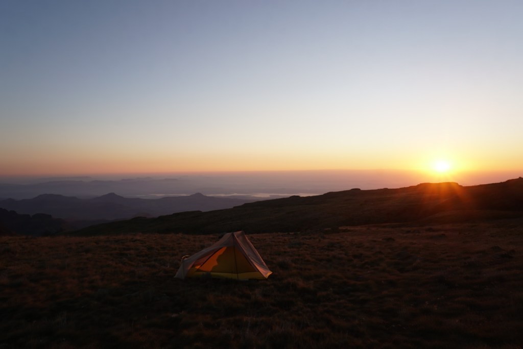
In summary: I have had the fortune of trekking a few of the world’s best backpacking routes and I can definitively say the Drakensberg Grand Traverse, or DGT as it is colloquially known, has been the most difficult I have ever been on. There is no better way to earn your thru-hiking stripes than battling rough terrain, extreme weather, altitude, and the infamous chain ladders in one of the most remote places left on earth. All great things in life are earned however, and the chance to experience a sunrise while camping along the “edge of heaven” is well worth it.
Preparation / Know Before You Go
Bring a GPS & PLB: The DGT is unmarked and unmaintained so a GPS is required. There is no set route for the trail, so the journey may vary significantly depending on where you source your coordinates. Shoot me a message through the contact form on this blog and I will happily send the ones that we used for a 12-14 day adventure. I would also recommend bringing a personal locator beacon (PLB) if your GPS doesn’t have one, as rescue in the case of emergency is difficult.
Bring appropriate gear for the elements: Technically, the DGT can be done year round. That being said, the trail is subject to extreme weather in all seasons. As moist air comes in from the ocean and runs into a 3,000ft. wall of rock along the escarpment, weather patterns can change rapidly and become quite dangerous. May through June is generally regarded as the sweet spot for trekking. You can go earlier when it is warmer, but precipitation levels tend to be much higher and you are at risk of getting caught in what I have been told are spectacular lightning storms. July & August are still considered to be part of the high trekking season, but always check the weather in advance because occasional blizzards from June – September can be severe. The good news is that these snowstorms tend to be quite predictable.
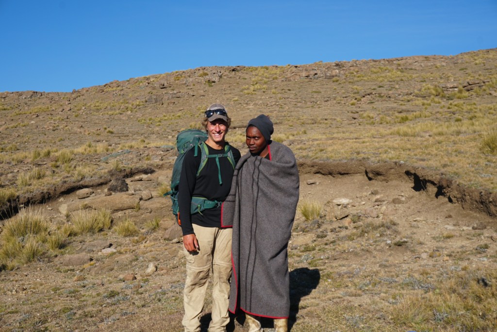
Exercise caution when passing through Basotho settlements: Getting to witness the lifestyle of these herdsmen is a highlight of the DGT, and most versions of the trail will bring you by some of their primitive huts and peat farms. As these isolated encampments are not occupied year round, most we passed through were empty. When they were in use however, many were guarded by loyal dogs. As herd theft is apparently quite common amongst the tribesmen, these dogs are trained to keep suspicious passersby at bay. We never had any issues ourselves, but I would recommend keeping some distance between yourself and the huts if you notice they are being occupied.
Keep boots in your tent: All of the Basotho herdsmen we encountered on our two day journey were genuinely friendly and curious people. Many paid us no mind after quickly passing to ask if we had and cigarettes or marijuana. In preparing for the trip however, I read a few accounts of petty boot theft. These accounts were corroborated by the only other backpackers we encountered on the trip, who were Drakensberg veterans. As a precaution, I would recommend bringing your boots inside at night.
Filter your water: This advice is not as obvious as it should be on almost all other treks. Lesotho is actually touted as touted as having some of the purest, safest water in the world, and by most accounts it is safe to drink without treating. I still believe this to be true, but anecdotally I wound up very sick with a viral infection days after returning to the United States from South Africa. It is far more likely that I picked up the illness in Johannesburg, but if I were to trek the DGT again I would not risk it.
Pronunciation: If you want to fit in with the locals, you should know it is pronounced ‘d-rah-kens-burg’ not ‘drake-ens-burg’.
Day One: Sentinel Car Park to Kubedu River (9.0mi)
The first day of our adventure along the border of South Africa and Lesotho began with an unexpected van ride from the quaint Witsieshoek Mountain Lodge to the trailhead at the Sentinel Car Park. The night before we had attempted to reach the car park in an Uber from Johannesburg, only to get stuck in a large pothole on an unpaved road. After a substantial bit of work in the dark, we were able to free the poor driver’s car from the ditch and reverse it back to the pavement. Stranded and still a few miles from where we intended to camp, we set our course for the nearby lodge. Fortunately, once there, we were able to convince the exceptionally kind and motherly night manager to let us pitch our tents near the maintenance shed for just a few rand. In the morning, we would catch a shuttle to the trailhead with handful of other guests who had come to explore the Royal Natal National Park.
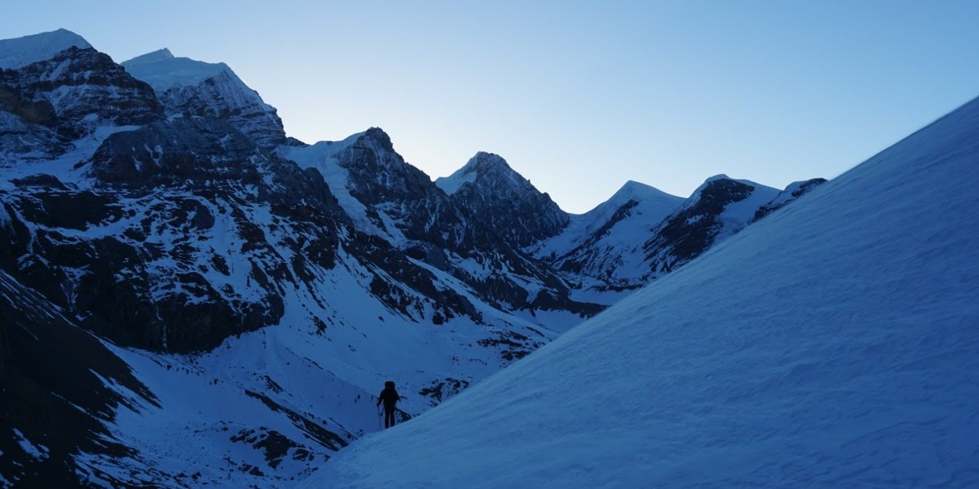
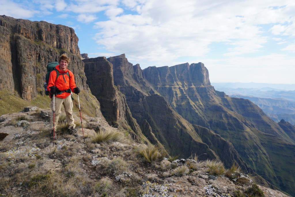
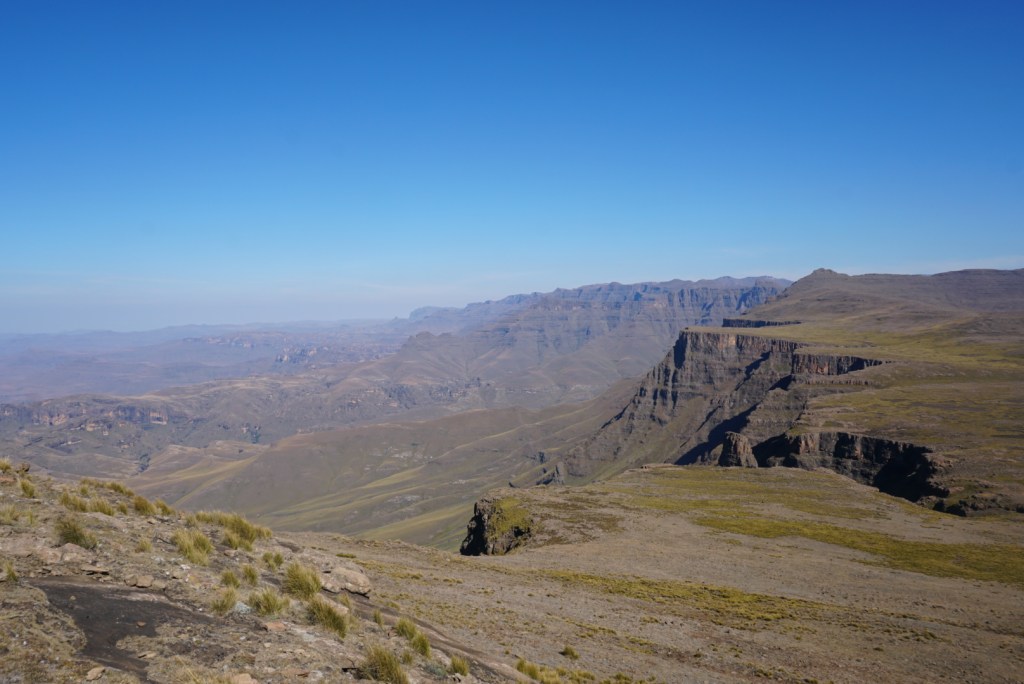
Upon arrival at the park, our frustrations from the evening prior melted away as we stood in the shadow of the grand Sentinel Peak. Filled with anticipation, we paid our park entry fee, and took off for the escarpment. From below, the massive rock formation looked like something out of a fairytale. A natural castle wall, protecting the mysterious kingdom of Lesotho from the wild lands below. After a massive set of switchbacks, we stood at the base of sheer cliff face, with the route’s infamous chain ladder before us. Nervously, we strapped all our gear in tightly and began the lengthy two-part climb to safety at the top of the escarpment. Most of the way up, I was torn between pausing to soak in the experience and just wanting to get myself and my pack to stable ground. Once at the top, we paused to acknowledge the insanity of the experience and to gaze out at the incredible view from the escarpment. We were in a new world, a rocky scrubland seemingly miles above the rolling green hills below.
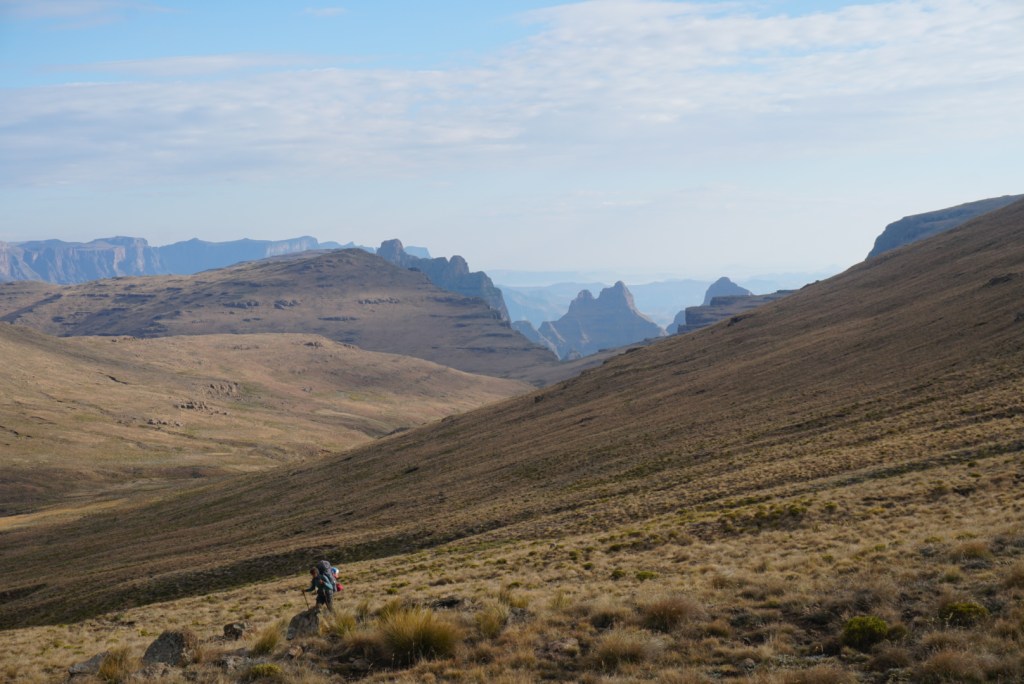
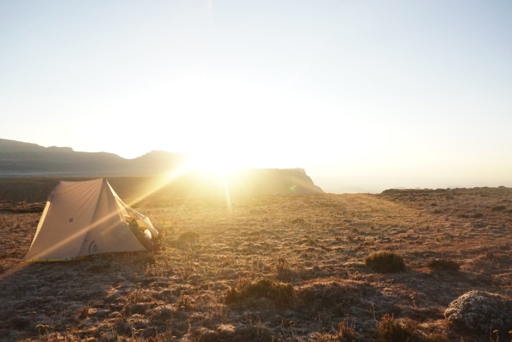
Continuing on, we knew we were likely to fall far short of Rat Hole, where we had intended to camp night one. The debacle from the previous night and the time intensive chain ladders had put us well behind schedule. Still, we were positive and moved as quickly as possible across the top of the plateau, guided by our GPS. The land was desolate and we enjoyed the solitude. From the ladders to camp, our only companions were a set of baboons, wild horses and a lone jackal, far in the distance, who fled as soon as he sensed our presence. About 3.5mi from our intended destination, we elected to stop as daylight started to wane. We camped near a scenic river and went to bed anticipating a long attempt to make up for lost time the following day.


Day Two: Kubedu River to North Peak (13.8mi)
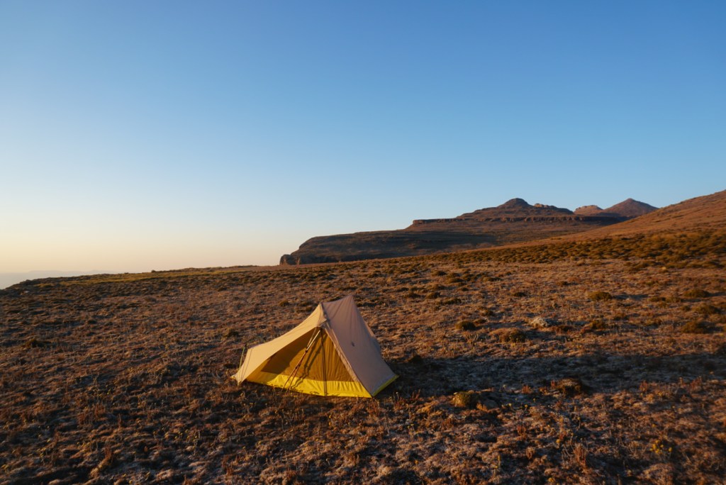
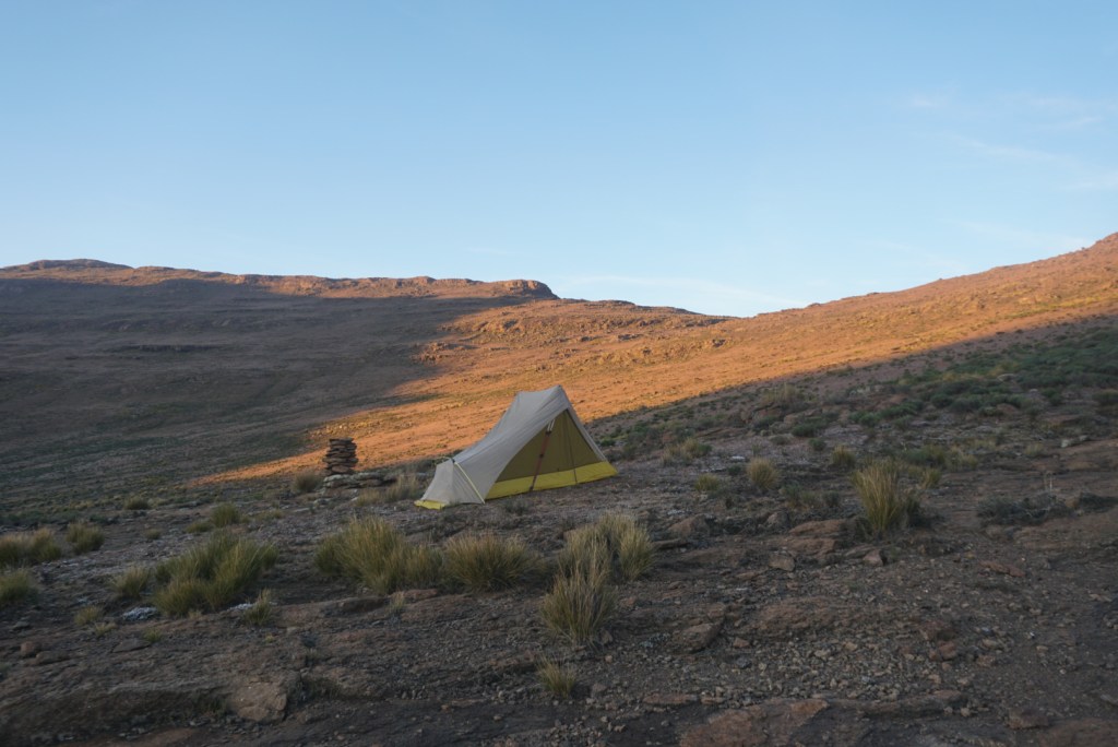
In all my days of backpacking I am not sure I have ever woken up so ready to get moving again. The night was miserable. Soon after we fell asleep, the temperatures outside plunged and everything froze. I hadn’t worn all of my layers, given it was well above the freezing point when we went to sleep, and I woke up around 1:30am shivering uncontrollably. The rest of the night was spent curled in fetal position, trying to get warm enough to fall asleep again. As we investigated the situation in the morning light, we found that both the insides and outsides of our tents were coated in a layer of frost. Our water bottles and filters had turned into bricks as well. We packed up quickly and set off at a quick pace in order to get the blood flowing again.
As the day drew on and our bodies warmed up, we started to better appreciate the scenery around us. For miles, all we could see were beautifully pristine rolling grasslands. When the sun finally breached the smooth peaks to the east, the plateau was bathed in a soft light that highlighted the thin blue streams cutting across the terrain. Eventually, the temperature rose to a point that we felt comfortable shedding our layers. By 11:30am, we reached Rat Hole. This validated our decision to stop short the night before. Even from our vantage point at the top of a hill, the waymarked cave that we were supposed to sleep in was nowhere to be seen.
After Rat Hole, we didn’t stop again until we reached the edge of the escarpment. There we sat for a long lunch while taking in expansive views of the South African wilderness below. The second half of our day was a relative blur. Post lunch, we made our best attempt to get back on schedule by pushing as quickly was possible. This goal was hindered by the relative instability of the terrain however. Over time, the rocks and lumpy scrub brush blanketing the floor took a toll on our ankles and lessened our pace. Approximately two miles from our intended campsite we decided to call it a day. Dusk was fast approaching, and we had just found the first instance of suitable terrain that we’d seen for miles. After quickly pitching my tent, I wandered to the top of a nearby hill where I could sit and take in an ethereal sunset. The sun disappears so fast in Lesotho, but not before briefly illuminating the entire cloudscape in a vibrant mix of red and orange tones.

Morning frost in camp 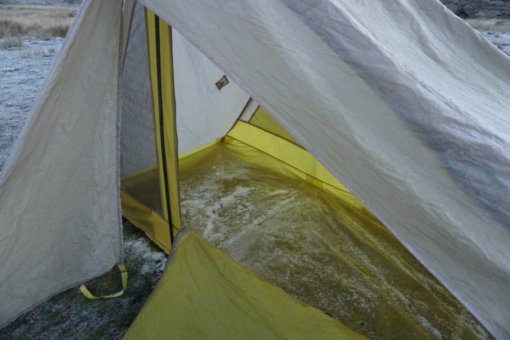
Condensation formed a layer of frost inside the tent as well 
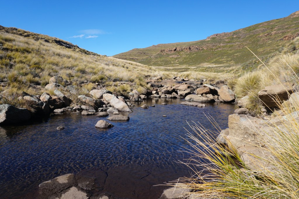
A tiny waterfall and pool, we would have swam had it not been so cold 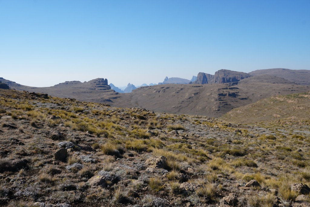
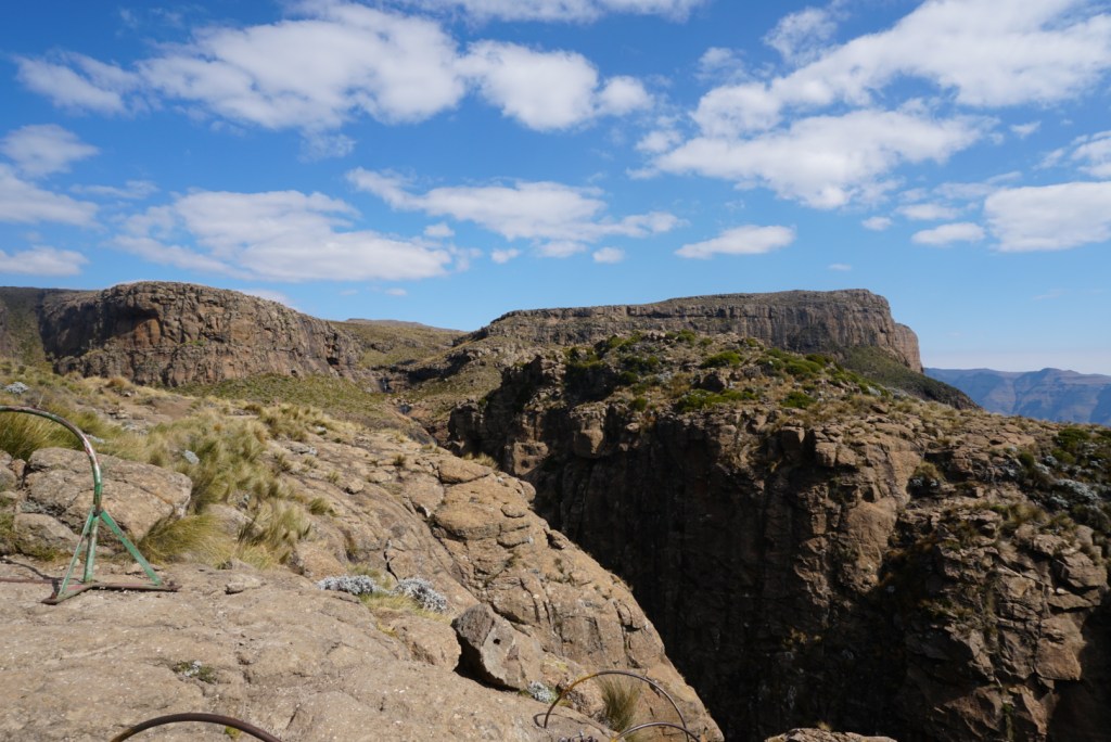
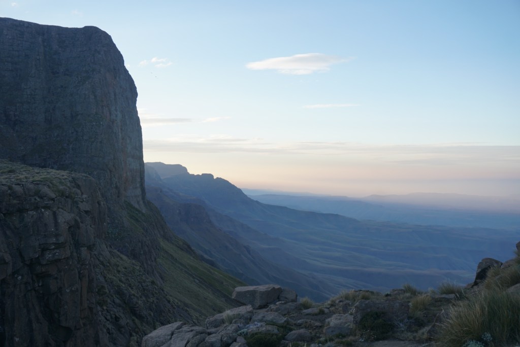
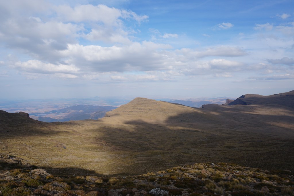
Approaching the escarpment from the east 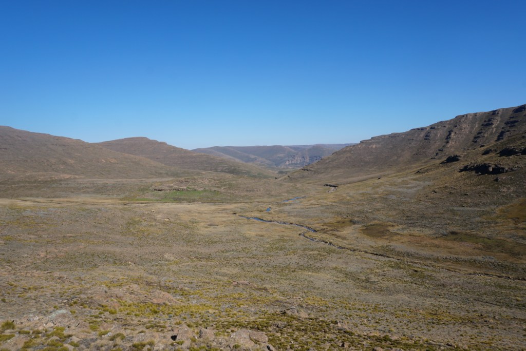
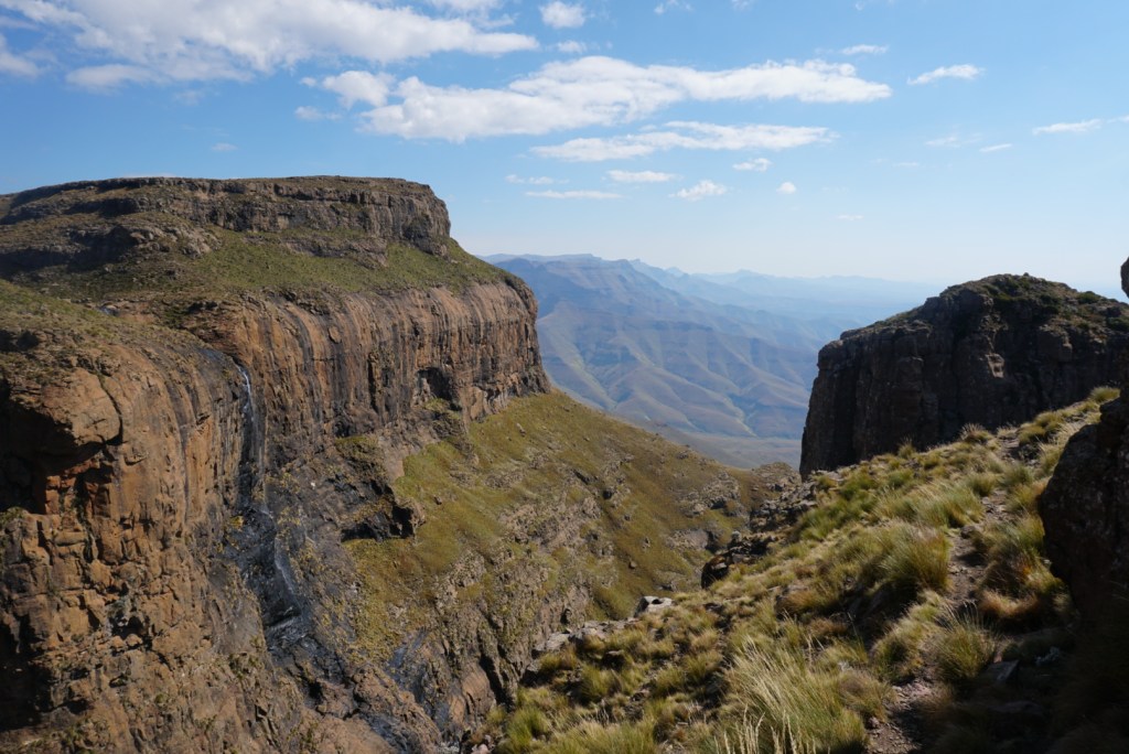
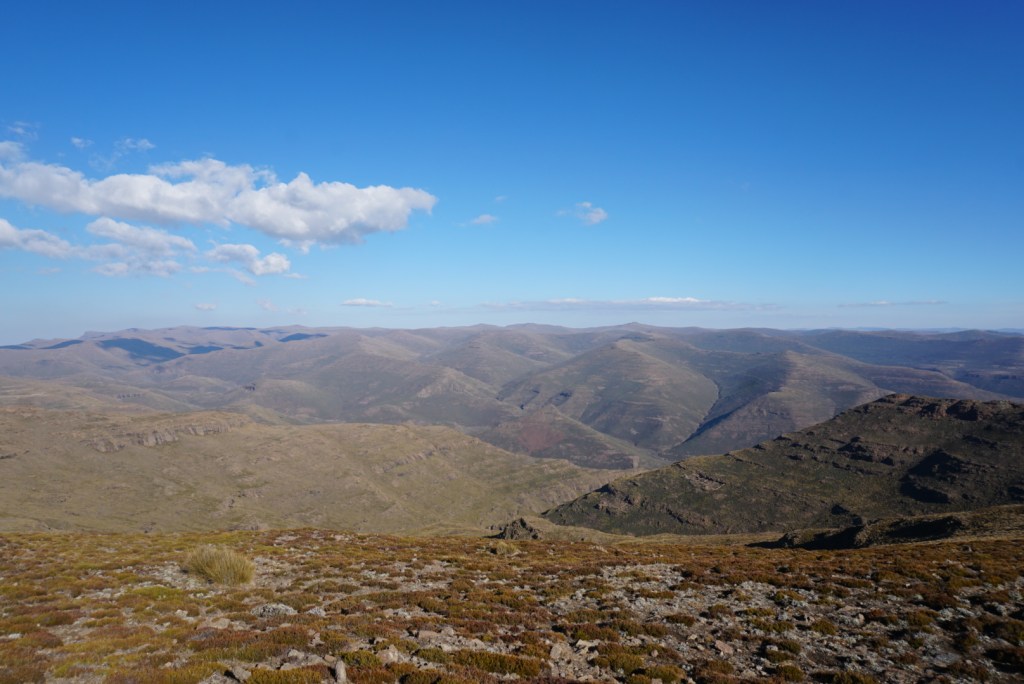
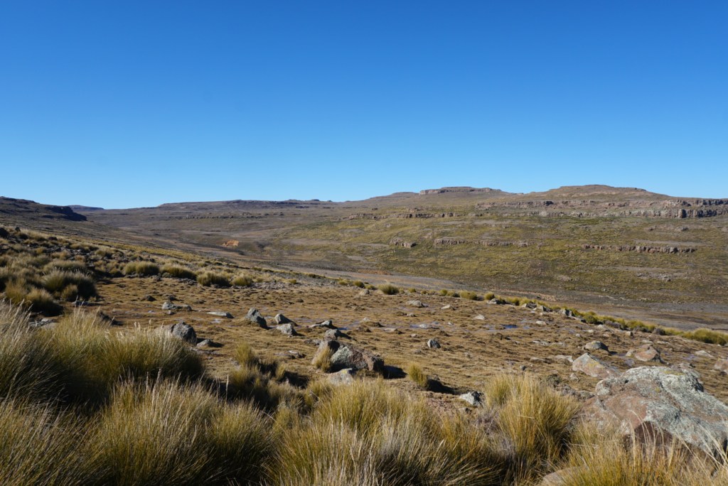
The rolling hills of Lesotho 
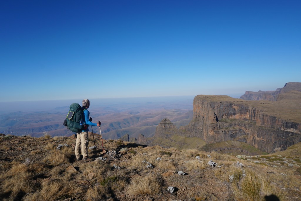
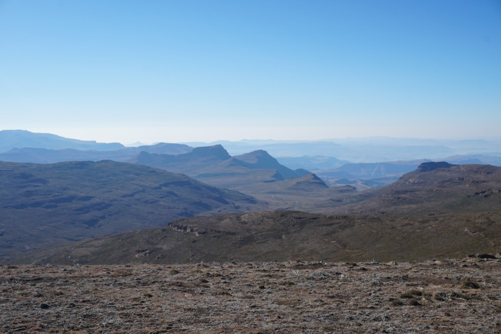
A look at the jagged South African mountains beyond the escarpment 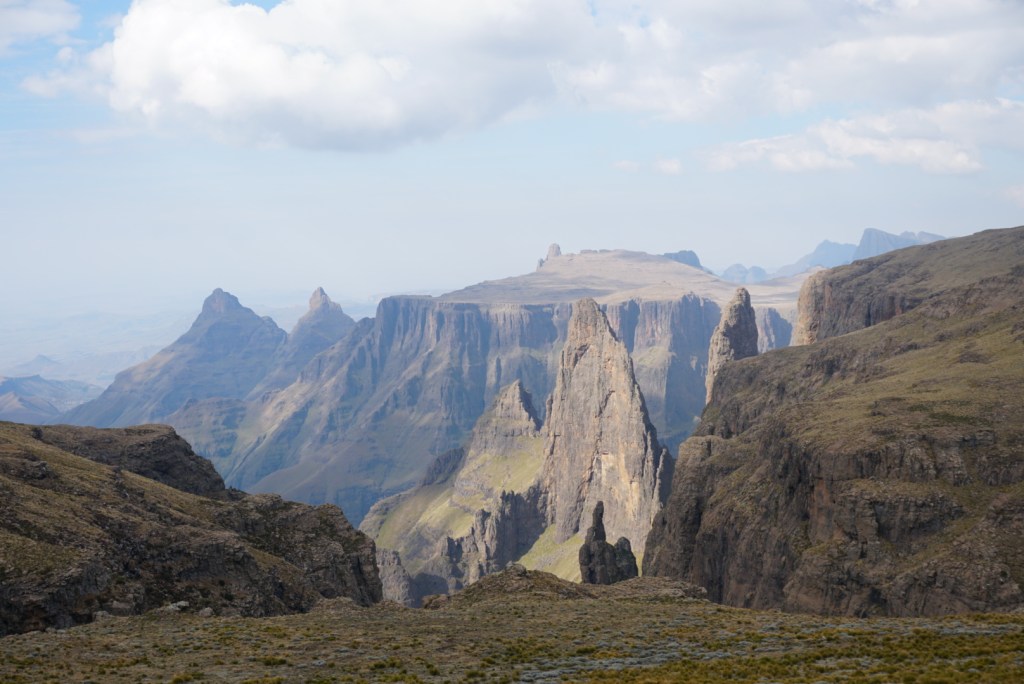
We would hike the rim of the escarpment all the way to the opposite ridge 
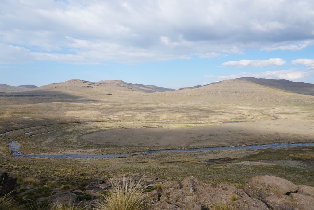
The hills at dusk 
My best attempt at capturing a DGT sunset
Day Three: North Peak to Ndumeni Cave (13.8mi)
In order to try and get ourselves back on schedule, Ben and I agreed that it would be prudent to get an extra early start to day. This made for a real grind, but fortunately we had gotten some much needed rest the night before and were up for a challenge. We walked from before dawn till after dusk. This afforded us the chance to really experience the beauty of the untouched landscape in all lights of the day. The dramatic shadows cast by the escarpment and surrounding peaks offered a type of eerie setting that I had never experienced before. It reminded me of the iconic “everything the light touches” scene from Disney’s Lion King.
After hours of tiptoeing the edge of the escarpment, dancing along the naturally imposed border between South Africa and Lesotho, we reached Ndumeni Cave. Once again, the cave was nowhere to be found. We never seemed to have much luck finding the caves on the grand traverse, but we were more than content pitching our tents on the flat land near our GPS waymark. Dinner was a little bit of a challenge as we struggled to get our stove hot enough to cook our rice and soup, but eventually we worked it out. As I sat at the threshold of my tent in the consuming darkness, I couldn’t help but wonder at the constellation of lights from distant farmhouses miles beneath us. It was humbling to think of the thousands of people going on with their evenings as usual, as we sat perched, thousands of feet above them, in perfect solitude.


Day Four: Ndumeni Cave to Nkosazana (14.1mi)
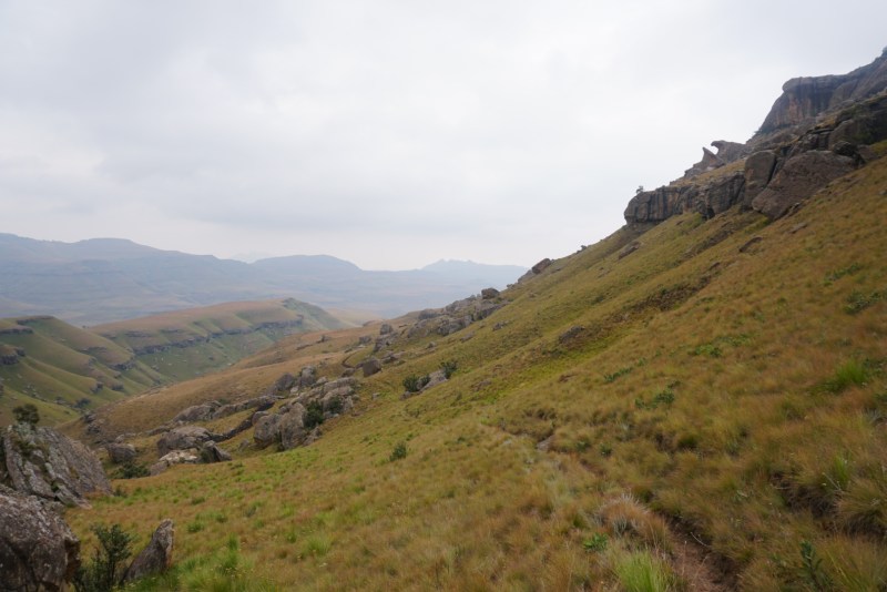
Day four on the Drakensberg was a day of firsts. Notably, it was the first day in which we were hiking according to our original itinerary. This was welcomed, but by no means signalled an easy day ahead. We began our morning by hiking along a thin ridge for about 300m. with a slick rock face on our right and the precipice of the escarpment on the left. It was a nerve-wracking and tedious portion of the trail, as one misstep would clearly result in your demise a couple thousand feet below. On the bright side, the views were incredible from our precarious position.
After clearing the ridgeline and returning to the rolling highland terrain, we had our second first of the day. After walking along the banks of a small stream for a mile or so we noticed our first (and last) Lesothan tree! For a few days we had been discussing theories of why the landscape was so devoid of trees, but this observation shifted the conversation to questioning how this lone tree had gotten there and managed to survive clinging to the edge of the eroded riverbank. This did last long however, because in no time we were out of breath, struggling to finish our second 2,000ft. climb of the day.
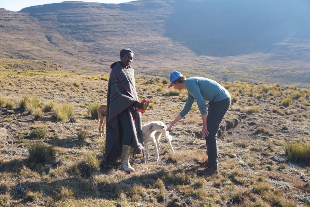
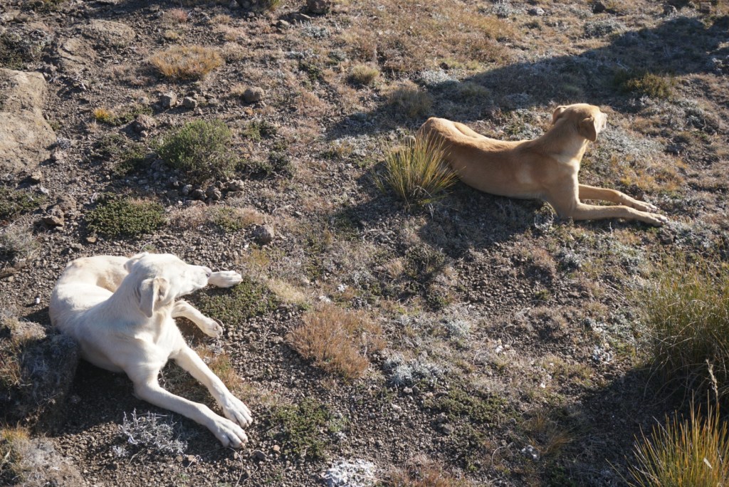
The last significant first of the day was our first human encounter. Some time in the early afternoon after finishing a steep climb and subsequent descent, we paused to refill our water and rest at a crystal clear stream near a flock of sheep. We were not there long before two young Basotho herdsmen with their dogs came out of nowhere to greet us and ask if we had any sweets. We told them we didn’t and after that they just sat nearby, observing us while we filtered our water. They were dressed in tribal garb that you would expect to see on the cover of a National Geographic magazine. Each of them had rust colored robes, wool blankets draped around their shoulders, and loincloths. They also wore heavy white rubber boots that stood out amongst the more modest attire. After 20 minutes or so of sitting in silence, they hailed their dogs, bid us farewell, and left to move closer to the sheep herd.
We were certain that would be a our last encounter of the day, but ultimately we were wrong. After setting up our camp in a shallow valley under the cover of nightfall, I took my lantern to a nearby stream to get some water for cooking. When I turned to navigate back, I saw two faint lights on the hillside. Disoriented, I moved towards the one that didn’t happen to be Ben’s. As I crept closer, I heard voices coming from inside a small cave and so I decided to announce my presence. To my surprise, I was greeted with an enthusiastic reply in English. Inside, I met two South Africans, one 25 and the other 50-something, who would be among the most interesting trekkers I have ever met. It turned out they were DGT regulars, drawn to the emptiness and lawlessness of Lesotho. After Ben joined, we sat for dinner with them while the older fellow regaled us with incredible stories of lightning storms, the herdsmen, and other misfortunes on the trail. A favorite was his tale of getting into a stone throwing match with a group of Basotho herdsmen who had been on their way to raid another tribe. We also learned about the co-dependence between the herdsmen and their dogs, who were used to protect herds from troublesome jackals. Everytime our new friend would get to the climax of a story or deliver the punchline to a joke, he would let out a loud “YOPE” which was a trademark expression of his. I’d been reading Jack Kerouac’s On The Road while hiking, and couldn’t help but draw parallels to the character of Dean Moriarty.


Day Five: Nkosazana to Injisuthi (12.0mi)
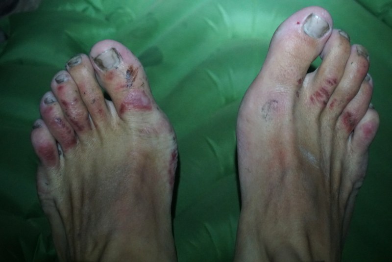
We awoke on day five both refreshed, as a result of our great evening the night before, and with a little sense of dread. They day would start and finish with two ascents, each over 1,500ft. To make matters a little worse, my feet had become infected as a result of the damp conditions. The night before, in an attempt to cope with the intense cold, I made the mistake of putting socks on at night while my feet were still damp from fording small rivers. I went to sleep with standard blisters on my toes, but woke up with a bloody infection that had spread to the arches of my feet as well. From this point on, I made a point to air them out whenever possible.
Unexpectedly, I found our first early morning summit to the top of Champagne castle, at almost 11,000ft. to be welcome. The huffing and puffing got the blood flowing and was instrumental in shaking off the effects of another frigid morning. At the top, we again were blessed with a fantastic panorama of the escarpment. To our left, we could see the shadowy peaks and ridges from where we had come, while to our right, we gazed upon the pronounced and seemingly untouched terrain we were about to traverse. Lesotho and the highlands it shares with South Africa may be one dimensional, but the landscape truly is unlike anything I can imagine seeing elsewhere in the world.
The rest of the day’s walking was expectedly difficult, but we did survive. Every time we passed evidence of Basotho micro-villages and huts, I would think back to the remarkable things we had learned in the cave the night before. As our own Dean Moriarty had put it, travelling through this part of Lesotho was truly like traveling back in time 500 years. Our final campsite at Injasuthi left much to be desired as it was uneven, rocky, and constantly exposed to what felt like hurricane force winds. Tired enough, we settled down nonetheless. I guess that is just the price you pay for 270 degree views and the ability to sleep steps from the edge of the world.

Day Six: Injisuthi to Langalibalele (11.8mi)
On day six, we woke ready for what was projected to be an easier day on the trail and it was glorious. We had weathered the windstorm from the night before and left camp excitedly knowing that we had no steep sections between us and Langalibelele. The GPS path took us along some lazily winding rivers and we made quick work of the section given the relatively smooth terrain. The views were more of the same, but it was sunny out and probably somewhere in the 60’s (fahrenheit) which felt comparatively amazing. The warmth and the easier walking gave us a chance to talk and really soak in the beauty around us.
We stopped for lunch at a great riverside spot, sitting before shimmering set of reflective pools. As we ate and washed our clothes, we were joined by friendly tribesman who sat on a small ledge just above us, peacefully weaving a basket and observing our movements. He beamed a smile every time one of us would look up and acknowledge him, but was otherwise silent.
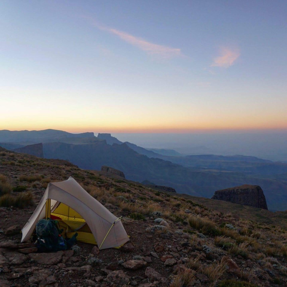
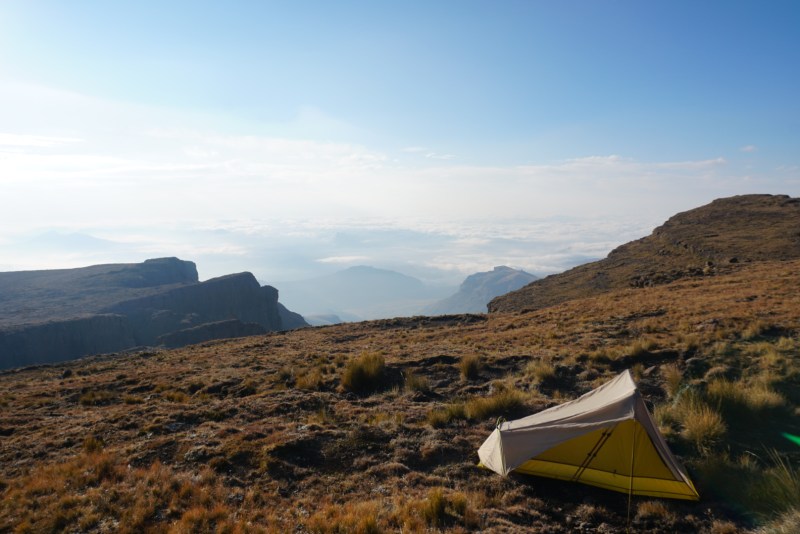
Due to the long lunch break, we still came into camp around dusk and set up at Langalibelele not too far from the escarpment. A strange weather pattern was doing unique things to the clouds along the edge of the cliffs, so after pitching, I laid down my pack and went to check it out. The sight was unbelievable. The wind coming heavily off the Lesothan highlands were suppressing the rise of thick clouds making their way in from the lowlands. The effect made it so that we were sitting above the cloud cover, only 100ft. from where the miles long layer began. I ended up scaling a nearby peak to get an even better view and snap photos. From my new vantage point, I could take in the contrast of the soupy storm clouds before me, and the perfectly clear sunset behind. As darkness started to fall, I euphorically scampered back to camp to eat dinner. Within 30 minutes, the black sky was illuminated by a stunning display of bright stars. It was the perfect end to a perfect day in the Drakensbergs.


Day Seven: Langalibalele to Loteni Camp (11.5mi)
Restoring balance to what was a perfect night before, the temperature plunged shortly after we fell asleep and this made rising at 6:00am near impossible. On the bright side, the infection in my feet appeared to be subsiding. They still were bloody and painful, but the receding infection gave peace of mind that I was not in any serious trouble. The first section of the day was tough. We started by crossing directly over a sizeable hill where the shrubs had grown high enough that some bush-whacking was required. Once we descended down the ridge on the opposite side however, it was mostly smooth sailing.
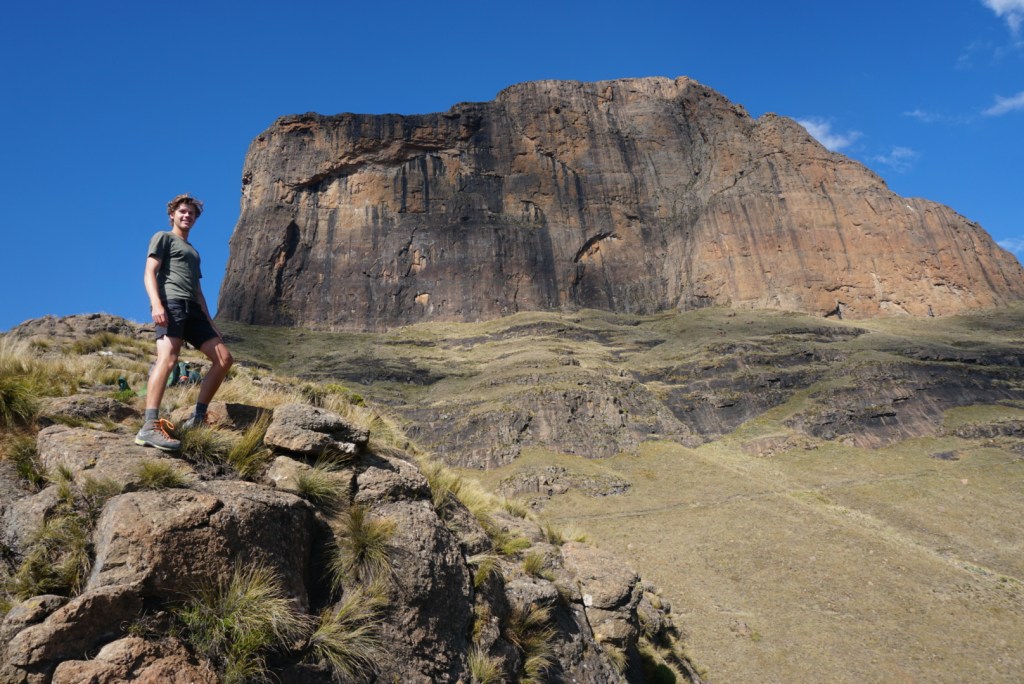
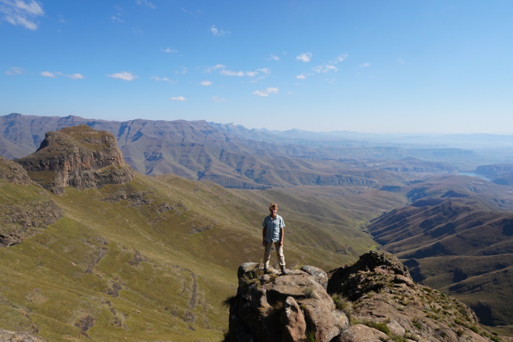
The true distance between the two camps turned out to quite minimal, and by lunch we were actually almost done with the progress that we had to make. The GPS had us taking a 3.5 mile out and back journey to the tip of a thin promontory ridge that jutted far beyond the escarpment. We decided to take this detour, but not before stashing our packs in a suitable hiding spot underneath some large boulders. Even without the extra weight, the climb was tough, but the view from Giant’s Castle as it was called, was well worth it. We sat for an hour or so, catching our breath, talking, and looking out at how the evening sun cast its long shadows on the national park below. Eventually, we hustled back to our gear and set up camp at Loteni just before dark. We had another two hours or so of magnificent stargazing before the waning moon rose and cast its light across the sky. As long as we had been out on the DGT, the moon had been close to full and intensely bright. At times, it would give the uncanny impression of a flashlight being shined on the tent.


Day Eight: Loteni Camp to Mkomhazi Camp (15.3mi)
Knowing we had one of our longest DGT days ahead of us, we were relieved to look over the topographic map on the Garmin and find that there would be no major altitude changes on the way to Mkomhazi. The terrain turned out to be solid too, and that buoyed our spirits. While hiking the backcountry of the ground traverse, we often found ourselves following along animal trails. These narrow paths were a godsend, as they would save our knees and ankles from having to deal with the toll of moving over the uneven yet rock hard lumps hiding beneath the tall grasses and shrubs. At times, it would appear the GPS coordinates were mapped with the intention of following a particularly well worn horse path. Still caution was necessary, follow the path too long and you would end up way off course. The riverside walk to Mkomhazi appeared to be a more populated section of the plateau, and as a result there was a tangled mess of sheep trails that we could take advantage of.
Despite hearing bells from grazing herds in the distance and passing by a number of huts, we didn’t see our first Basotho until the early afternoon, and when we did, they didn’t fit the profile of our past encounters. As the South Africans in the cave had told us, most tribesman we would meet were young boys (ages 15-25) sent to care for the flocks in winter while the adults retreat to milder climates in the northwest. The men we ran into on day eight, however, were in their 50s, carrying large backpacks, and without the typical attire or dogs of the herdsmen. Immediately, we recognized them as ‘dagga’ (marijuana) smugglers, who are known for carrying large loads down hidden passes in the escarpment to South Africa below. It was quite a sight, but the men gave us no trouble (they are not known to be an issue), passing by with a broad smile and enthusiastic wave.
The rest of the day we continued our flat walk across the plateau, distancing ourselves from the nearby escarpment. We passed by a couple more sets of herdsmen, and for the first time saw a girl amongst them, but nothing else was particularly notable. Aided by the flat terrain, we knocked the mileage out in record pace and for the first time were able to set up camp and relax before dusk. The night was passed as usual, troubleshooting the stove, cooking, reading, journaling, stargazing and just trying to stay warm.

Day Nine: Mkomhazi Camp to Sehong Hong (5.2mi)
Today was slated to be a pretty brutal day, combining a long trek with a trip to the summit of the tallest peak in southern Africa, Thabana Ntlenyana at 14,424ft. (3,480m.) Since we had one day of slack built into our schedule, and were nearing the end of our journey, we decided to treat ourselves to some rest and recovery by splitting the day into two. It was a wonderful decision. Ben was dealing with some stomach issues likely related to our super-fiber diet of oatmeal, rice, and lentils, while the blistering on my feet was spreading despite the infection abating.
Undeterred by our minor ailments, we were up and out at the crack of dawn. Before we even had a chance to get our bearings and settle into another days walking, we were faced with an immediate ascent straight to the top of Thabana Ntlenyana. The 2,000 foot climb took a grueling two hours on the way up, and another 45min. down. While the incline was not nearly as severe as what we had encountered in places like the Annapurna, the steady grade actually just prolonged the struggle. The views from the top of “The Beautiful Little Mountain” as it is called in Sesotho, were great, but the high winds were not, so before long we were back around ~12,000ft. where we decided to pull up and call it a day in a picture perfect spot steps away from a miniature stream.

Day Ten: Sehong Hong to Sani Pass (8.3mi)
We slept in through a chilly night, not waking until around 7:15am and it was wonderful! Every day prior, had risen just before the sunup and would be forced to start the breakfast making and camp teardown process in the frost. Though the morning was far from a warm start to the day, by the time Ben’s alarm went off the worst of the cold and ice had disappeared.
The days hiking began with a quick climb out of our idyllic little valley. When we reached the saddle of the ridge we were crossing, we could see Highway A14 in the distance, our first true sign of civilization since the faraway diamond mine we spotted a week or so ago. We came down a steep hill that turned out to be more treacherous than expected, and then commenced a long, flat walk along the highway to Sani Pass.
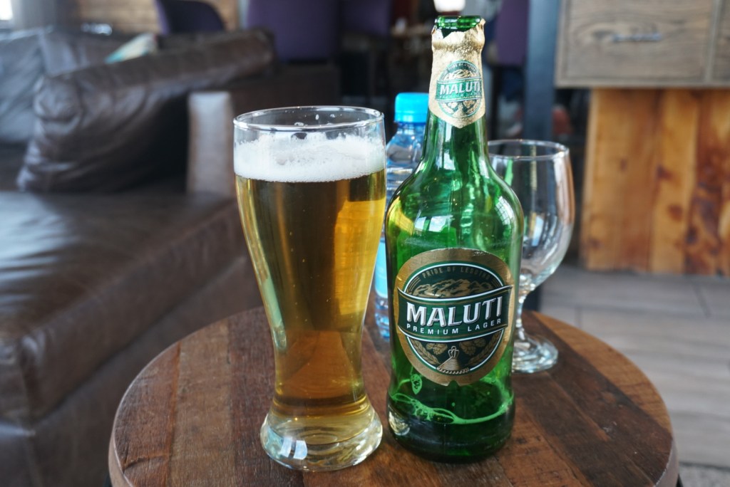
Sani, as a town, was not what we expected. It was constituted by 40-50 closely grouped stone huts, 3 tiny craft/souvenir stands, a rundown looking backpackers lodge plus poolhall, and then a fancy hillside lodge charging hundreds of rand per night for rooms. In need of a substantial meal, we beelined for the Sani Pass lodge where we found a bustling pub. It was the perfect place to kill the afternoon and evening. We purchased some large Lesothan beers, ordered double helpings of food, watched rugby, and chatted with a smattering of visitors from around the world. It was a great time and we were reluctant to leave. When we did, our new friends were grimacing as the cautioned us about going back into the cold. The inn was full however, and apparently you are charged to pitch a tent around the town, so we had no choice. After walking about a kilometer to a clearing at the edge of the escarpment, we set up and went to sleep totally refreshed.

Day Eleven: Sani Pass to Moon Camp (10.9mi)
The sausage platter, beers, and dose of company we had enjoyed the day prior left us feeling recharged as we got off to our usual early start. Additionally, our hiking had returned us to the escarpment after two and a half days spent more inland, so we did our best to soak up the spectacular views on our second to last day in the Drakensberg. Otherwise, the walking for the day was typical of the traverse. This region of Lesotho proved to be much more mountainous than where we had started in the east, so the day involved a lot of ups and downs. Fortunately, none of the altitude changes were of the 2,000ft. magnitude that we had experienced one too many times already.
We stopped for lunch atop a prominent ridge and ate slowly while admiring the panoramic views. As we were enjoying ourselves and only had three miles left, we debated passing most of the day there, but eventually some strong winds forced us to move on. About a mile or so into the final push, we came across a lone herdsman who greeted us with a very friendly hello as he passed by. As Ben had given up on his oatmeal, he decided to offer it to the young boy. As we caught up to him and passed off the food, we learned that he spoke some elementary English. It turned out he was the youngest boy in his family and had the privilege of attending school in Maseru for a few years. After his brother died however, he was forced to drop out and take responsibility for the sheep herd in the south. Life sounded tough on the plateau. He mentioned constantly having to protect the herd from jackals, and told us a story about having some sheep stolen by other herdsmen who shot rifles at his hut to keep him scared and inside. It was fascinating.
After a half hour or so, the conversation wore out so we thanked him for his company and bid him farewell. By the time we continued on and tackled our last couple miles, it was near dusk in camp. We were positioned in a sheltered bowl, sloping down from a drawn out hill, and the waymarker on our Garmin pointed us to precisely the only spot flat enough to pitch our tents. Once I was set up, I fell asleep immediately and Ben had to wake me for dinner. It appeared that despite my relative comfort towards the end of the journey, I was still just as exhausted.
Day Twelve: Moon Camp to Mzimude Cave (9.6mi)
Though our second to last night felt warmer than usual, I still woke to a frost lining on both the inside and outside of my tent. As I stood shaking it out, I joked with Ben about whether it was actually getting warmer or if we had just frozen all of our nerve endings off over the past two weeks. Spirits were very high as we commenced our final full day in the beautiful, but trying Drakensberg mountains. In true DGT fashion, it would be a tough day of walking.
Much like the day prior, we started with a big ascent and continued bobbing up and down for the remainder of the way. Nonetheless, the anticipation of reaching camp and prepping for a descent into South Africa carried us through. Around 10:45am, we stopped for our first break after stumbling upon a tiny waterfall and a picturesque little pond. Given the great progress we had made, we decided to roll the break into lunch and lounged until about 2:00pm just napping, eating, and washing clothes. Eventually, we mustered up the courage to attack our final 1,000+ft. climb of the trip. As we neared the end of our ascent close to an hour later, we were puzzled by what seemed like an impassable rock wall at the top of the ridge. By putting faith in our GPS however, we were eventually led to a small gap where we were able to climb through to a secluded valley on the other side. It was the perfect setting for a wild camp.
Despite the name Mzimude Cave, we didn’t locate the small cave burrowed into the edge of the escarpment until we were already pitched and 400ft. above it in elevation. Regardless, we were happy with our spot which offered more fantastic views of the land below. As night fell, we could see a cluster of twinkling lights below that we speculated were from Bushman’s Nek. Being able to see the finish line only elevated our excitement. I knew I would miss the rugged beauty of Lesotho dearly, but proper food, company, and a shower were calling.


Day Thirteen: Mzimude Cave to Bushman’s Nek (12.0mi)
We woke on day thirteen feeling an immense sense of accomplishment, despite still having a 5,000ft. descent between us and Bushman’s Nek. To further commemorate the moment and prepare for the day, we helped ourselves to a double breakfast by eating through the reserve rations. Though I savored the excess calories, I couldn’t help but note that it would be the last time that I’d be eating oatmeal for a long while.
As expected, the Drakensberg Grand Traverse forced us to earn our way out of Lesotho. After a mini-climb out of our secret valley, we were faced with a harrowingly steep and unstable trek down a hillside and into a cramped valley that would show us out of the mountains. Despite a couple stumbles, we eventually made it, and began a more level walk along a river. This continued for a few miles. Despite carefully tracking our GPS, we were certain that every time we finished working around the base of a prominent hill, it would be our last. Each time our hopes were dashed as another came into view. Finally, we reached a large clearing, where our GPS indicated a sharp left turn, and escorted us to the rim of the escarpment. We paused a minute to take in the bittersweet moment, then plunged over the edge and down a narrow hillside sheep trail.
The path down was steep, and once off the escarpment, we were through into a new environment with a new weather pattern. In no time, we found ourselves enveloped by a thick fog and were forced to put on rain jackets. This soupy fog would eventually turn into a storm, but we couldn’t have cared less. We were happy to have survived thirteen days in wild Africa, completely unsupported. It wasn’t easy, but it was certainly worth it. As we descended the last miles in the rain, we recalled the highs and lows of our adventure, jogging memories before we would attempt to call our folks later that evening. Soon, we reached the South African border post and an exit sign indicating the border of Drakensberg National Park. Triumphantly, we posed for a few photos, and then took off in search of a celebratory meal.


Additional Sources
- The Drakensberg Grand Traverse blog (where I pulled my coordinates)
- Hiking South Africa
- Gossamer Gear
- Trek Addict
- Drakensberg weather and climate
- Drakensberg Grand Traverse (Video-long)
- Drakensberg Grand Traverse (Video-short)

2 Comments