West Highland Way
Milngavie, Scotland
Length: 96mi (154km)
Days: 5-7 days
Difficulty: Easy (well maintained trails, facilities present along the way)
Gear: Standard gear
Completed: July 2019
In summary: Regarded as perhaps the best hike in the United Kingdom, the West Highland Way allows for a humble, yet immersive journey across a timeless landscape. Choose your adventure: take part in the rich culture of the trail and indulge yourself with cozy trailside pubs and lodges, or embrace the independent nature of your inner Highlander and revel in the solitude of wild camps. Whichever you prefer, the blue lochs, conic hills, and rural farms of the Scottish Highlands will transport you to another time, when kilted warriors by the name of MacGregor or MacDonald fought for control over this rugged, but beautiful terrain.
Preparation / Know Before You Go
Pick your pace. The West Highland Way is a great trek for both beginners looking to soak up some time on the trail, as well as ultralighters hoping to zoom on by. The route is divided into 8 sections that can be conquered in any number of ways. The West Highland Way Trail Association has some suggested itineraries that I would recommend for your planning purposes. For the record, we opted for a slightly modified version of ‘WHW3’.
Bring bug spray and a head net. This is the golden rule for comfort along the WHW. Especially near the lochs and wetter sections of the trail, evening swarms of biting flies called ‘midges’ made setting up camp unbearable. These critters come out in the thousands and can fit through mesh head nets if standing still, so bring spray and work fast!
Bring a raincoat and duck’s back. Fog and rain are WHW staples and we certainly encountered this predictably unpredictable weather over the course of our journey. So bring proper rain gear, and be sure to store it top of pack!
Book lodging in advance. By no means do you need a hotel during this journey, but if your heart longs for a stay in a quaint B&B on the Scottish countryside, then get a reservation. Around 30,000 people will complete the full route every year, so you can imagine that all the boutique trekker’s hotels sell out quickly.
Buy a trail map. They can be purchased in most of the small outdoors or trinket shops in Milngavie. They make for great souvenirs and will point out side-attractions / points of interest that a GPS or phone map may not.
Day One: Milngavie to Drymen (11.8mi)
I cannot think of a more auspicious way to start a long hike than beginning in the town of Milngavie, Scotland. After disembarking our morning train from Glasgow, we instantly fell in love with the village that seemed to have sprung up around the trailhead. The town was cute and everybody around us wore a broad smile, offering up words of encouragement as our loaded backpacks gave clear indication of our intentions. We had made it no further than 30 yards down the red brick road when an elderly gentleman stopped us and demanded to take our photo underneath the ‘famous obelisk’, marking the origin of West Highland Way. After a quick pastry stop at a local bakery that was just too tempting, Annelise and I commenced our journey.
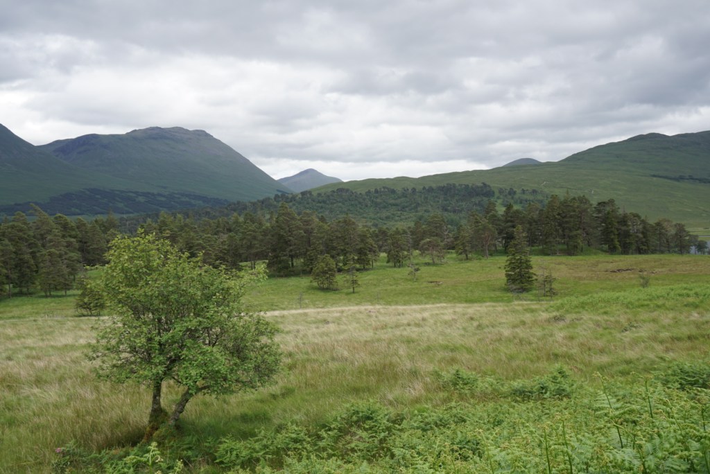
The first day on the Highland Way is a rather plain, but enjoyable necessity. Though on the fringe of the rugged highland wilderness, Milngavie is still connected to Glasgow metro, and as expected we had to work our way out of the inhabited areas. The day was perfect however, and with the sun shining bright even the journey across the transect was energizing. As the day drew on, sheep farms slowly replaced suburban homes, and soon we found ourselves out in the plains. What struck us immediately was the vibrant green hues of the local grasses. It felt as if we were viewing the world through a filter.
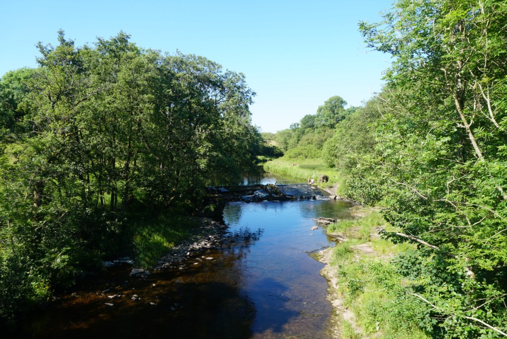
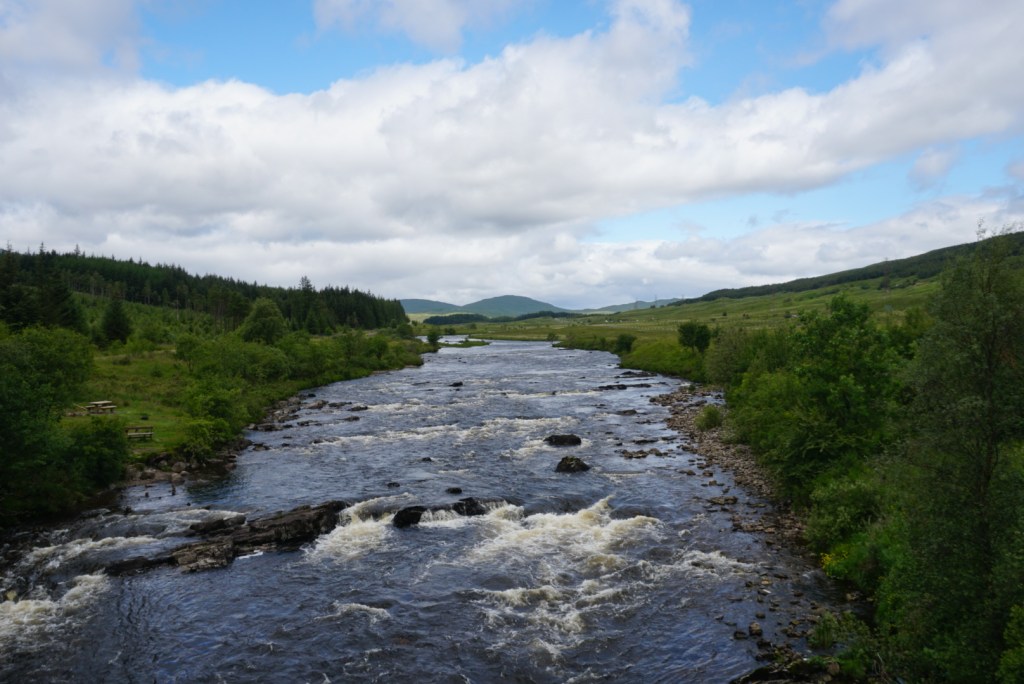
Around 4pm we stopped for a relaxing break along a scenic trailside river. The afternoon had proven to be rather hot, so a quick dip in the cool waters did us wonders. Fully refreshed, we tackled the final few miles in a single push. At Drymen, we ran across a backpackers campsite where, for a few pounds, we could enjoy a flat backyard spot with a shower, clean bathroom, and good company. We accepted the offer and spent an unusual night under the sun. Given our northerly position and proximity to the solstice, the sun would not set until 10pm., and then it would reappear promptly at 4am. This definitely took some getting used to.


Day Two: Drymen to Rowardennen (14.9mi)
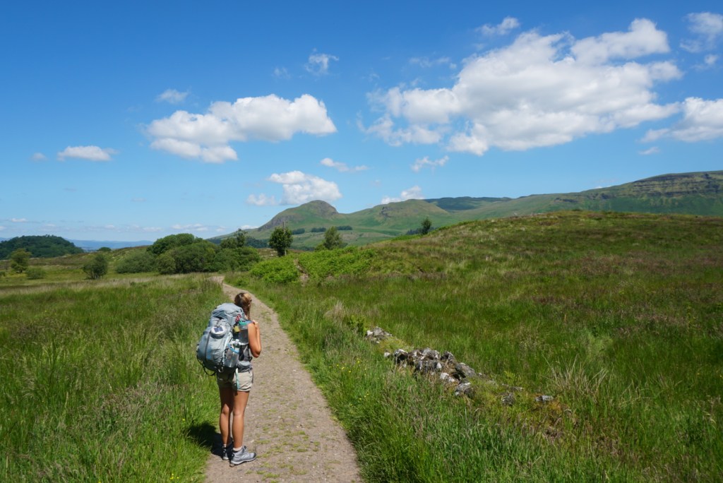
We were fortunate to begin our second day on the trail much like we did the first, in gorgeous morning sun. Though that sun rose before it was welcomed, the warmth we felt at 7am made packing up early much more achievable than on prior trips. The hiking picked up right where we had left off the evening prior, making our way across rural sheep farms. What was interesting to us was that in order to traverse each farm, we would have to pass through a series of private iron gates to ensure no animals broke free of their expansive pens. It was a unique set up, but it was inspiring to see such a healthy partnership between the trail association, hikers, and local farmers.
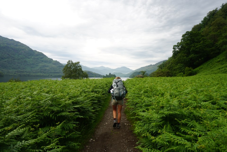
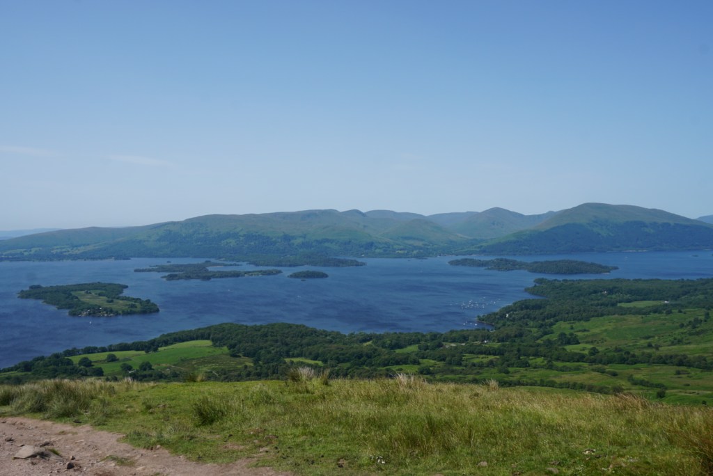
A few hours into the morning we passed through the final rusty gate, and found ourselves staring down a scenic expanse of low grassy hills. It appeared we were moving further from civilization and closer to the heart of the highlands. After steadily moving over and around the series of hills, we reached a viewpoint from which we could see the shining blue waters of Loch Lomond below. Energized, we made for the shores, which we reached in about 45min.
Where the trail met the loch, we ran into a small town called Balmaha, that was evidently a popular jumping off point for tourists moving deeper into the Trossachs National Park. We stopped for a moment to watch dinghies, ducklings, and kayaks move lazily in and out of the town’s tiny bay before continuing the WHW along the Loch’s shore. The rest of the day was quite crowded, but enjoyable all the same. We never strayed far from the shore over the final 6-7 miles and the views were great. It was tempting to join the vacationers, soaking up the afternoon sun on pebbled beaches, but we were on a mission. Eventually we reached Rowardennen, where we camped in a shaded site not far from a backpacker’s youth hostel. A consuming swarm of biting midges put the only damper on the day as it limited bathing / cooking options, but before long we were comfy and cozy within the safety of our tent.


Day Three: Rowardennen to Inverarnan (14.0mi)
The third day on the trail was a tale of two halves, though unfortunately our slow start in the morning meant that we would complete a majority of our hiking during the less pleasant second half. We woke late to the sun shining off the calm surface of Loch Lomond, and then packed up quickly to minimize bites from the ever-present midges. The hiking for the day was straightforward, a direct path along the shore of the 24 mile long loch.
Probably around noon, a thick fog started to roll in over the surrounding hills, providing an ominous setting to go along with the eerie silence of the great loch. We had the trail to ourselves, but the atmosphere inexplicably compelled Annelise and I to speak in hushed tones so as not to disturb the fragile peace. A few hours in, we came across a set of landmarks that added some intrigue to the days walking. The first was a batch of moss covered stone ruins that we later learned were likely the remnants of a illicit 18th century whisky distillery. The second was a sign indicating the presence of Scottish outlaw Rob Roy MacGregor’s cave. As alleged descendants of the MacGregor clan and Rob Roy himself, we looked hard for the cave, but were not able to spot it via the short side hike. Still, coming to wander the lands of our ancestors and getting to sit steps from where Rob Roy hid out from the Duke of Montrose was a meaningful and unforgettable experience.
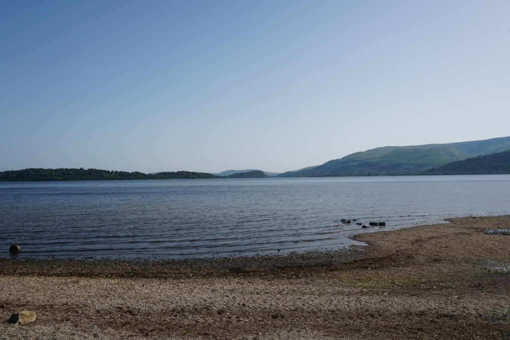
The latter portion of the day was a little bit of a blur as the fog turned into a downpour and sullied the mood. Despite an attempt to wait out the storm in a cozy backpackers room at the Inversnaid Inn, we ran out of time and were forced to continue with our rain jackets and duck’s backs drawn tight. The dark clouds and distorted sunlight made for some great photographs and the rain helped us comprehend the region’s vibrant green character, but otherwise we moved as quickly as possible. By mid-evening we reached the northern terminus of the Lomond, paused for a minute to take the view in, and continued to Inverarnan. There we were pleased to find a local pub and large campground, near full up. We paid a small rental fee for one of the last spots, grabbed a drink, then enjoyed a good night’s sleep.

The lakeside trail 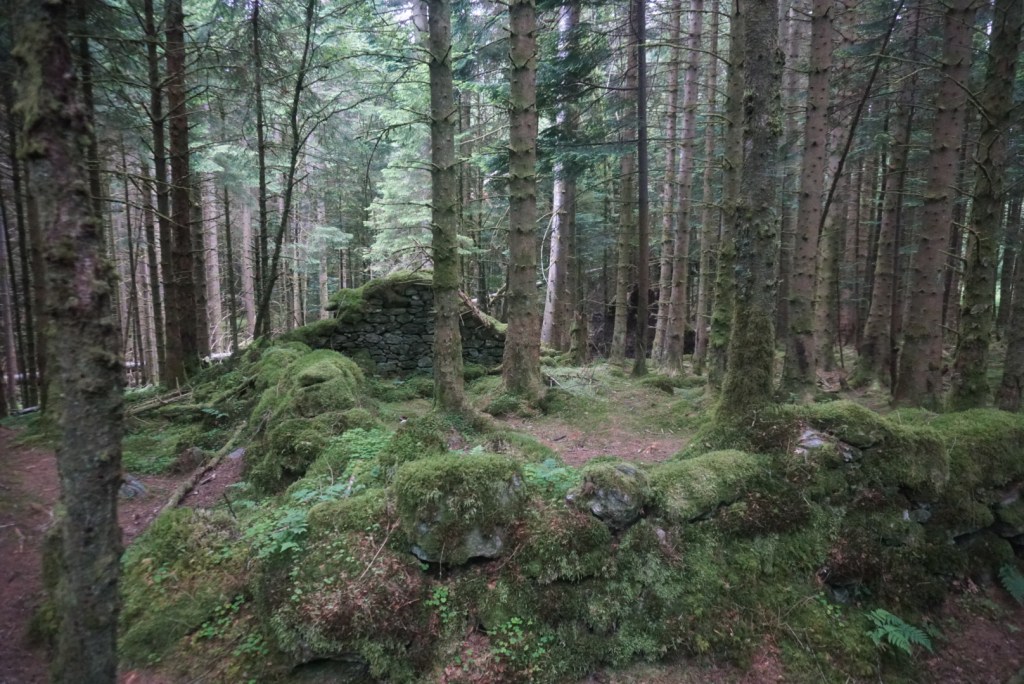
The Wee Bruach Caoruinn farmstead and distillery ruins 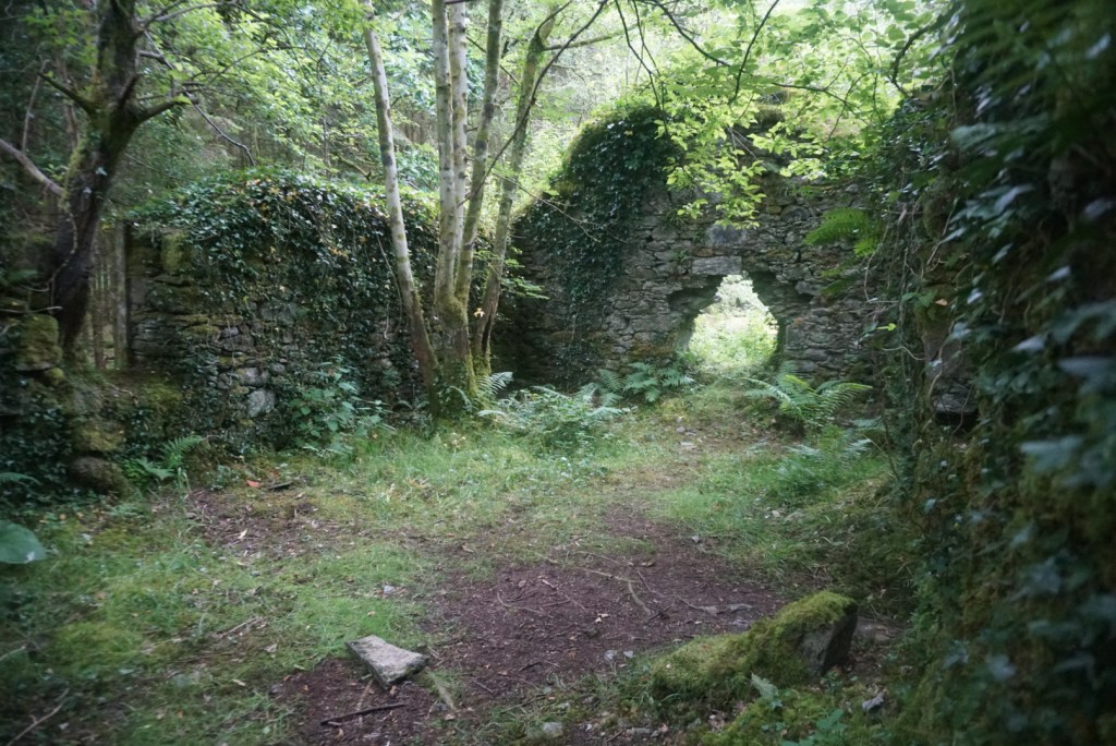
Another section of the Wee Bruach Caoruinn ruins 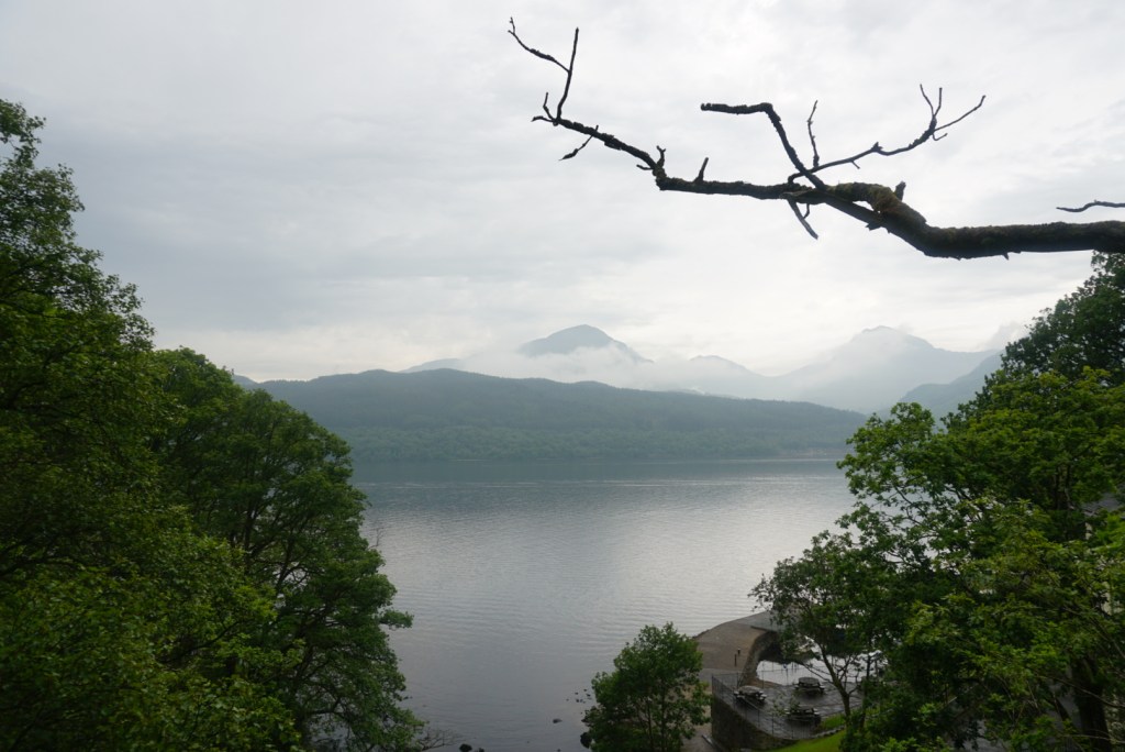
The clouds over Loch Lomond from the Inversnaid Inn 
The sign indicating the footpath towards Rob Roy’s Cave 
The alleged location of Rob Roy’s Cave 
Further along the West Highland Way 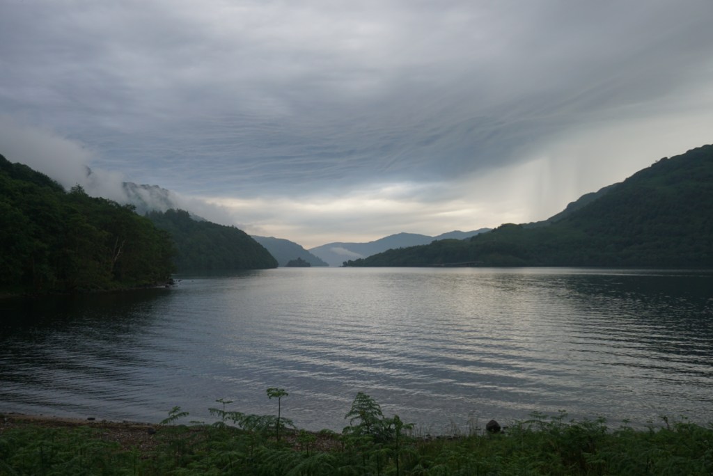
The north end of Loch Lomond
Day Four: Inverarnan to Tyndrum (12.0mi)
Once again, we were slow to leave camp in the morning. The exposure to the elements from the day prior had left us tired, and the general lack of a proper night made it difficult to wake at a true dawn. Unfortunately, if was clear from when we did wake up that we had another wet day ahead off us. Nonetheless, having left Loch Lomond, we were in for a change of scenery and that made the walking quite enjoyable.
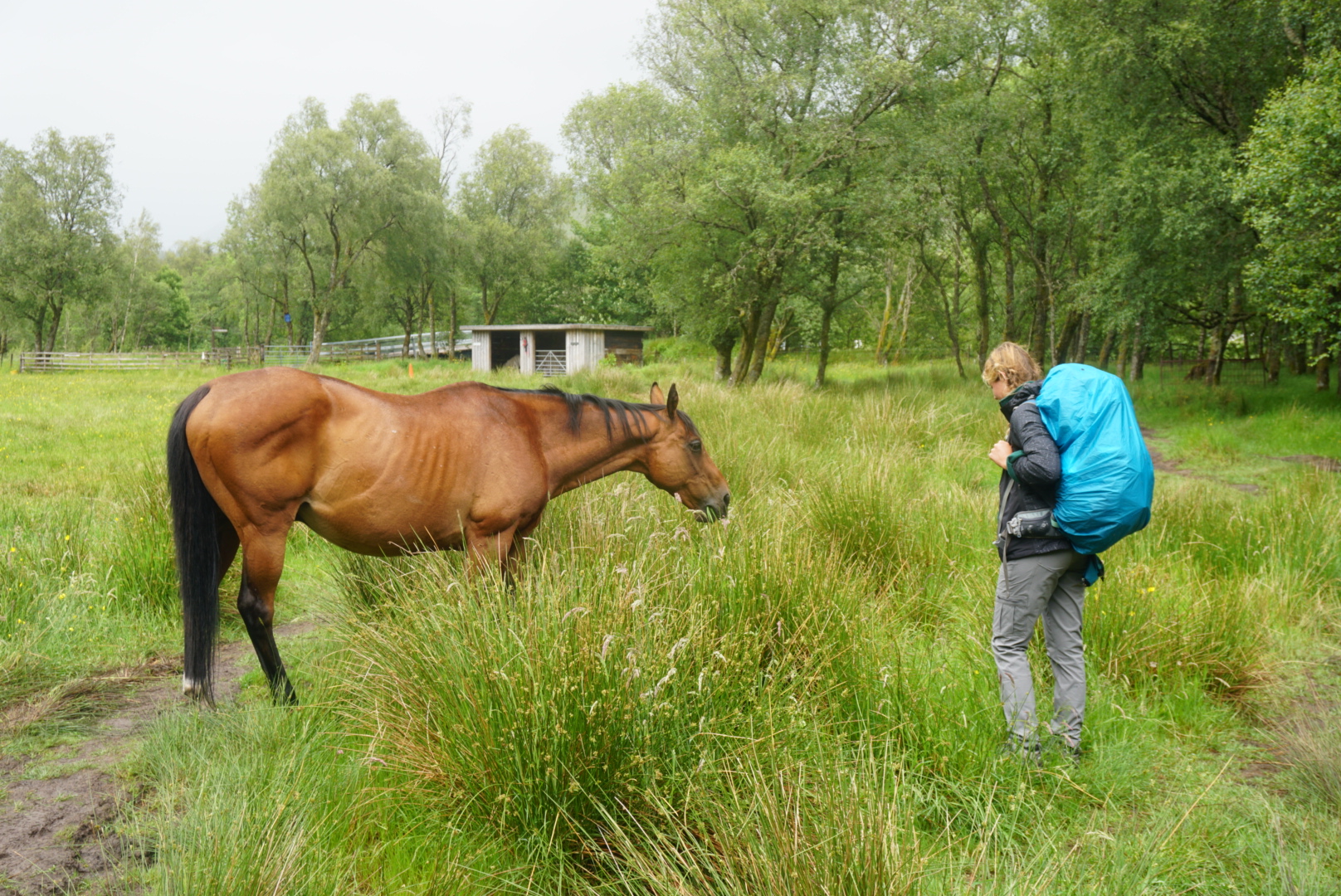
We began the day following the River Falloch, which was among largest of Lomond’s countless tributaries. This path led us north and further into the green moors so well associated with Scotland’s highlands. Every once in a while we would pass a small village or lone farmhouse, and many times the trail would take us right through some accommodating local’s property. Occasionally our paths would cross that of sheep, horses, and best of all burnt orange Highland cows with their U-shaped horns and comical bangs. Sadly, none of the cows were very photogenic.
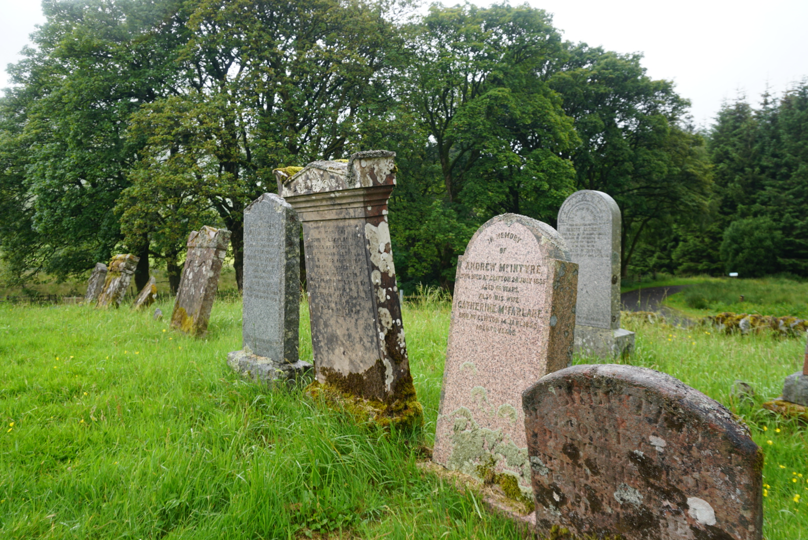
Ancient history lessons were a notable feature of the day as well. Nearing a spot on our map marked as the ‘Kirkton Farmhouse,’ we came across a sign alerting us to a medieval cemetery nearby. As my sister walked ahead, I poked around, astonished to find that some of the burial stones dated back to the 7th and 8th centuries. The cemetery would not be our only discovery of the day however. Nearing our destination of Tyndrum, we crossed through a park known to be a battleground in which Robert the Bruce (King of Scots), narrowly escaped death at the hands of the famed MacGregor clan. In that park we came upon a lochan (pond) where legend has it, the future king threw his heavy sword in order to flee the scene faster. Many have tried searching lochan, but still none have located the lost sword.
After a full and wet day of walking, we reached the small roadside town of Tyndrum. Thoroughly soaked and quite cold, we decided it would be the perfect place to splurge on a hotel room and recuperate before our longest day on the trail. We made do with the last room available at the quaint Tyndrum Inn and relished the luxury of a warm bed.


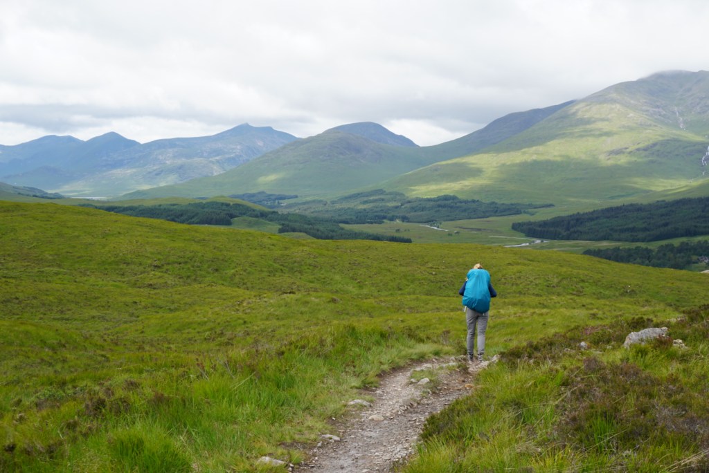
Day Five: Tyndrum to Kingshouse (19.0mi)
Waking up on a mattress after a few long days of hiking can work wonders for morale, and after a classic Scottish breakfast of porridge, toast and black pudding (personally not a fan) in the adjacent pub, we were ready to conquer the long day ahead. After leaving Tyndrum, we quickly found ourselves back in the open countryside. The small rolling hills we had grown accustomed to were also steadily getting larger and steeper. Some had reached grades at which the all encompassing green grass could no longer grow on the slopes, and I would have ventured to classify them as mountains or ‘beinns’ in Gaelic. The fact that we had left earlier than other days also meant that the day’s walking would be a more social experience. Trekkers always tend to be a morning crowd, so we ran into a few small groups on the trail, chatted them up, and asked for photos when we could.
Around noon or so, we reached tiny riverside town Bridge of Orchy. Clouds had been threatening us with rain all morning, but since they had so far held up we decided to push onwards and defer our break until we reached Inveroran about two miles further. Fortunately, our gamble paid off and we reached the classic Inveroran hotel just as the rain finally broke through. We spent a long afternoon break in the inn’s rustic pub. I enjoyed some pints and talked another WHW couple while Annelise, who was feeling a little under the weather, slept in the booth. Once sufficiently warm, we strapped up and continued along the way.
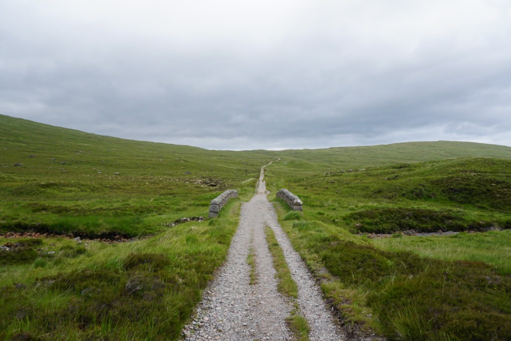
The latter portion of the day was long and lonely, but fortunately very flat. Though still early afternoon, clouds had blanketed the sky and I believe convinced many of our fellow hikers to hunker down at the trailside inns. Remarkably, as Annelise and I traversed the Highlands for another 10 miles or so, we were spared any serious rain until the last half mile. The air was misty and the ground wet, but it was more than we could ask for. Until we made made camp mid-evening, we enjoyed fast-paced walking, beautiful scenery, and complete solitude. Nothing moved on the moorland aside from tall grass blowing in the wind.


Day Six: Kingshouse to Kinlochleven (9.0mi)
Though slated to be our shortest day on the West Highland Way, we were under no impression that Day 6 would be our easiest. As we sat in our tent and examined the map, the words ‘Devil’s Staircase’ jumped off the page, surely indicative of a formidable climb. Nevertheless, we emerged to a beautiful campsite (perhaps my favorite of the trip), packed up our things, and seized the day.
The morning’s hiking began in the shadow of the prominent Buachaille Mor (or ‘Stob Dierg’), a mountain that when viewed from the east resembled a perfect pyramid, with its bare rock peak protruding from the green valley floor. As we made our way through the valley and around the mountain, the view slowly changed and passable climbing routes emerged on the back side. Before long, we arrived at the Altnafeadh car park, where we joined a set of enterprising day hikers who had journeyed across the highlands with the sole purpose of conquering ‘The Devil’s Staircase’. As expected, the journey to the top of the staircase was arduous. The path consisted of a long set of switchbacks that were deceptively steep. The only thing the climb had going for it was that the zenith was clear and no false peaks stood in the way of our eventual success. After a 45 minutes or so of hard work, we reached the top of the staircase and stopped for lunch in a windy spot with panoramic views of the surrounding moors and mountains.
After eating, we descended the saddle of the mountain on the following side and made our way downhill towards Kinlochleven. Immediately after crossing over the Devil’s Staircase, we could see our environment starting to change. Large conic peaks still dominated the horizon, but the bare green moors we had grown accustomed to were soon substituted for equally green forests that thickened as we approached the valley town. Making quick work of the favorable decline, we arrived just before dinner. It was the perfect place for us to spend our penultimate evening on the trail. The old mining town appeared to be right out of a postcard. Antique smelting furnaces juxtaposed against bright colored row houses with well-manicured lawns and garden gnome collections. Eventually we located our campsite, a riverside inn with an attached pub, just steps away from where the trail resumed once more.

Buachaille Etive Mor (‘Stob Dearg’) as viewed from camp 
A closer look at the pyramidal Buachaille from across the moor 
The oft-photographed Lagangarbh cottage, alone in the valley 
Smiling through the pain halfway up ‘The Devil’s Staircase’ 
Atop ‘The Devil’s Staircase’ saddle 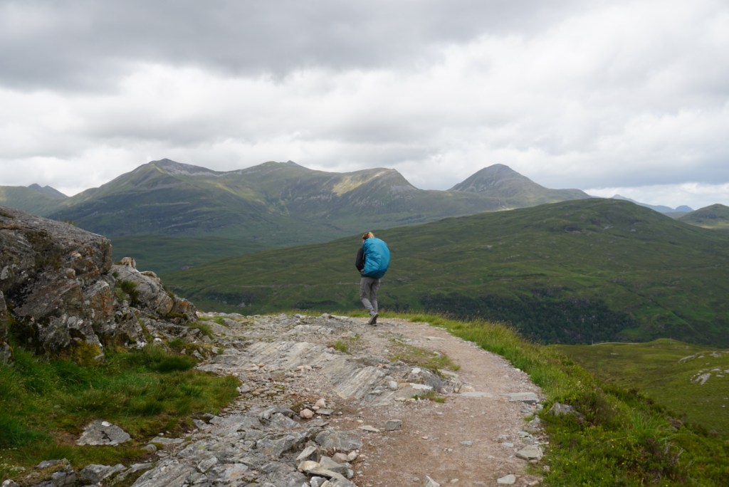
Beyond the saddle, headed towards Kinlochleven 
The River Leven valley 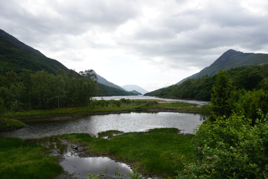
The view from The MacDonald campground on the shores of Loch Leven
Day Seven: Kinlochleven to Fort William (14.9mi)
On the morning of Day 7, an unusually high amount of condensation and relative lack of daylight signalled to us from inside the tent that that some adverse weather had overtaken our beautiful little valley overnight. We were relieved to emerge and find that it was just an episode of particularly thick, oppressive fog. Still, as is the norm on the last day of a long journey, we ate breakfast quickly and were roaring to go. The density of the fog was such that water accumulated on our clothes just moving around outside, but beyond the five extra minutes we spent waterproofing our supplies, it did nothing to slow us down.
Our 15mi. push for the day began as we reluctantly trudged up the nearby hillside and out of the secluded Kinlochleven valley. Before long however, the road leveled and we were in the base of a new alpine valley, following a channel that had been carved by millennia of runoff. Over the course of the day, we would alternate between untamed moorland and rural pasture, every once in a while passing near a ruined homestead. The solemn tone set by the fog added to the imagery, and gave the impression of travelling through time over an ancient land once traversed by my ancestors. This feeling was only amplified as the day went on and we approached the open green hills that had served as the natural set for Mel Gibson’s Braveheart.
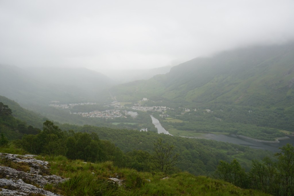
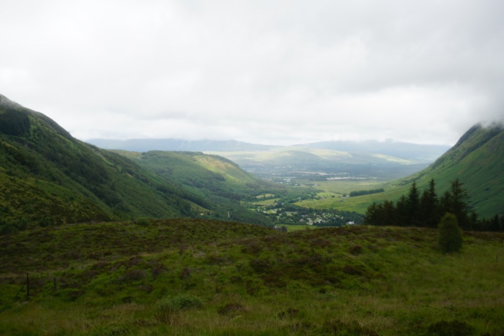
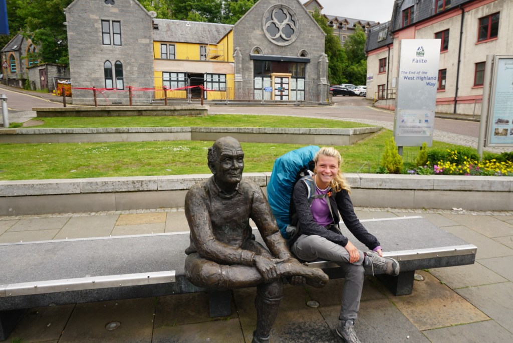
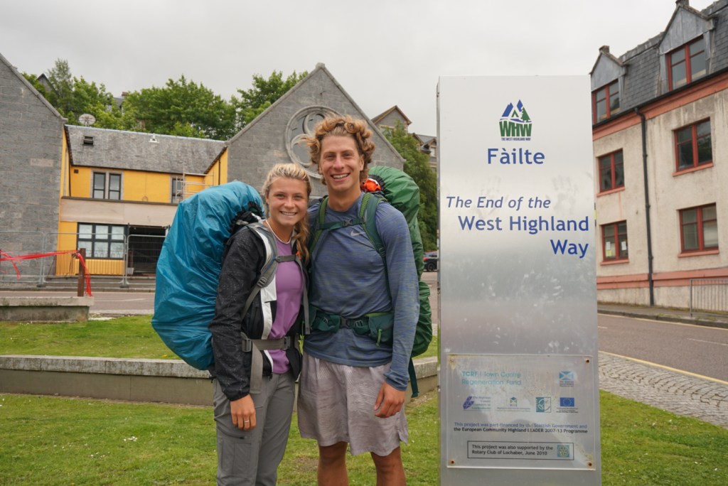
Around early afternoon, the fog finally abated enough to reveal two great sights. One being the nearby peak of the formidable Ben Nevis mountain, the tallest in the United Kingdom. The other being the outskirts of Fort William in the valley below. After a quick side trek out the the ruins of an iron age fort called Dun Deardail (would not recommend as little could be seen of the yet un-excavated fort) , we caught our second wind and pushed on at an anxious pace. Before long, we had fully descended from the mountains and found ourselves road walking through the charming maritime town. A mile or so later we passed mile marker 96, entered the iconic Gordon Square, and then snapped a few photos before plopping down on the commemorative hiker’s bench nearby. It was the perfect end to an imperfect, yet unforgettable highland adventure. A glass scotch from a local distillery over dinner would then round out our authentic Scottish journey across the famed West Highland Way.


Additional Sources
- The official West Highland Way website (a must visit)
- Sample travel itineraries
- Watch Me See
- Monkeys and Mountains
- Walkhighlands.co
- Wikipedia page
- Mac’s Adventure (a guided option)
- The West Highland Way in 3 Minutes (video – short)
- West Highland Way Walk (video – long)
