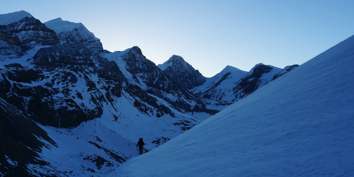
New River Gorge Traverse
New River Gorge National Park, West Virginia
Length: 23.1-26.8mi (37.2-43.1km)
Days: 2
Difficulty: Easy to moderate (well maintained, basic facilities, moderate elevation change)
Gear: Standard
Completed: June 2021
In summary: Despite its status as one of America’s newest national parks, the New River Gorge (NRG) area offers scenery that rivals many of the system’s most iconic reserves. The Traverse in particular is a strikingly diverse trail that follows the eponymous New River through dense forests and overgrown mining ruins. Backpacking is still new to the park, and thus there are opportunities for trailblazing trekkers to be amongst the first to enjoy quiet, low traffic routes.
Preparation / Know Before You Go
This is not an official route. You will not find the New River Gorge Traverse anywhere on a map and park officials won’t know what you are talking about if you inquire, and that is because I made it up. To give credit where credit is due, I strung this route together based on an account given by 30+ year NRG veteran Eve West (link). Should more trekkers continue to take advantage of this great trail, I would propose that the park officially commemorate Eve by naming a trail or route after her.
Transportation options are limited. In the backwoods of West Virginia there are few 3rd party transportation options. Should you set out to complete this trail, you will need to pre-arrange travel between the trailheads. Since we hiked as a group, we opted to bring two cars and drop them at opposite ends of the route.
Water filtration products are necessary. Since the park is still growing into into its new, elevated status, even the official campsites are primitive. Water filtration devices will be necessary as potable water is not available on the trail.
Customize your route. The NRG Traverse offers a number of opportunities to add to or customize your route should you choose. For starters, you can opt to begin your journey at either the Thurmond or Minden trailheads. Additionally, the Long Point Trail and Kaymoor Miners Trail are popular side-treks that can add attractions to your experience.
Go whitewater rafting. While the purpose of this site is not to plug other excursions, we went rafting the day after our backpacking trip (Adventures on the Gorge) and had an incredible time. The New River Gorge and nearby Gauley River are world class rapids that offer chaotic fun for all ages. When in Rome…
Suggested Route
Since there is no official backpacking route in New River Gorge and the Traverse is an amalgamation of a couple popular trails, I wanted to lay out the whole route in one place for convenient trip planning:
- Start: Rend Trail @ Thurmond Trailhead (Alternate option: start at the Minden Trailhead)
- Hike ~1.8mi.
- Connect: Arbuckle Connector Trail from the Rend Trail
- Hike ~0.3mi.
- Connect: Southside Trail from the Arbuckle Connector Trail
- Hike ~7.0mi.
- Stop: Camp and recharge at the Brooklyn Campground
- Connect: From the Brooklyn Campground, connect to the Cunard River Access Rd.
- Hike ~1.5mi.
- Connect: Kaymoor Trail from the trailhead along Cunard River Access Rd.
- Hike ~6.6mi.
- Connect: Kaymoor Miner’s Trail from the Kaymoor Trail
- (Alternate option: Hike to the bottom of the Kaymoor Miners trail for ~800 stairs and ~0.5 extra mi.)
- Hike ~1.0mi
- Connect: Fayetteville Trail from the Kaymoor Miner’s Trail
- (Alternate option: Add the Long Point Overlook to your trip for an extra 3.2mi round-trip)
- Hike ~3.9mi.
- Connect: Bridge Trail from the Fayetteville Trail
- Hike ~0.9mi.
- Finish: End the New River Gorge Traverse from the Bridge Trail Trailhead
Day One: Thurmond Trailhead to Brooklynn Campsite (9.1mi)
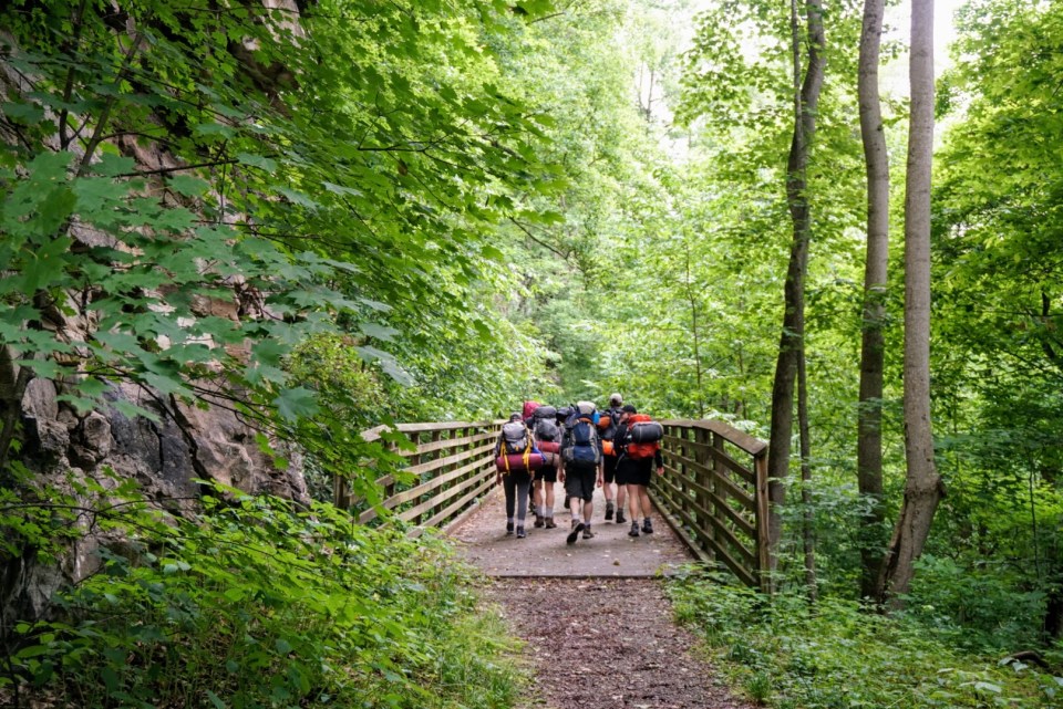
The first full day of our much anticipated New River Gorge backpacking trip came with its fair share of misfortune, but we weathered the ups and downs and enjoyed the time outdoors nonetheless. Our morning started early, as we sought to get a fast but relaxed start to a relatively brief day on the trail. After dropping our cars at the separate trailheads, we set off on our journey from a non-descript parking lot in the town of Minden, WV. This stretch of trail was calm and beautiful. Birds sang and bright orange newts (called ‘red efts’) dotted the path. Things were going swimmingly, until approximately 1.5 miles into the Rend Trail we encountered an impassable fence. It indicated that a key bridge section was out and the trail would be closed until further notice.
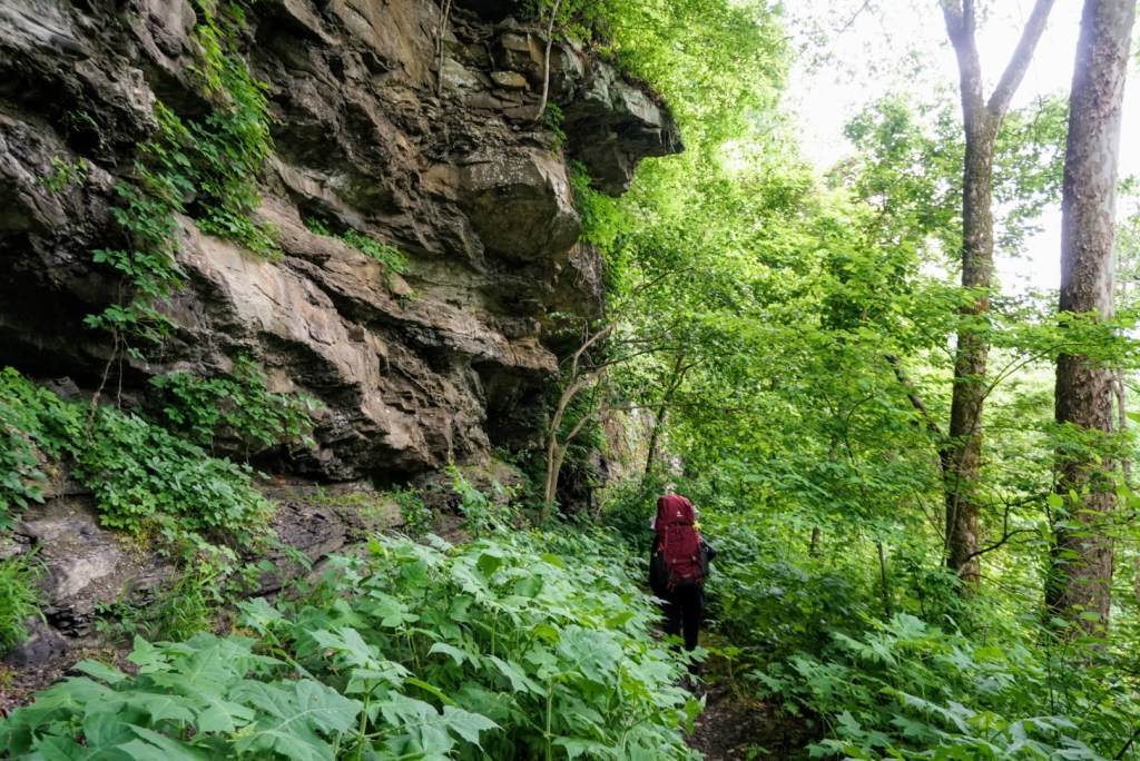
Frustrated, we were forced to retreat and start shuttling our crew of 8 people to a new trailhead (the Thurmond one) 20 minutes away. By the time this was complete, it was already ~2pm. There was some apprehension about whether we had enough time to complete our mileage for the day, but we had come far enough and elected to continue onwards. As we descended into the Appalachian wilderness however, our worries waned. The early path was clean, well marked, and remarkably scenic. On the left we skirted sheer rock cliffs, some still lined with coal, while on the right we were smothered by dense forest.
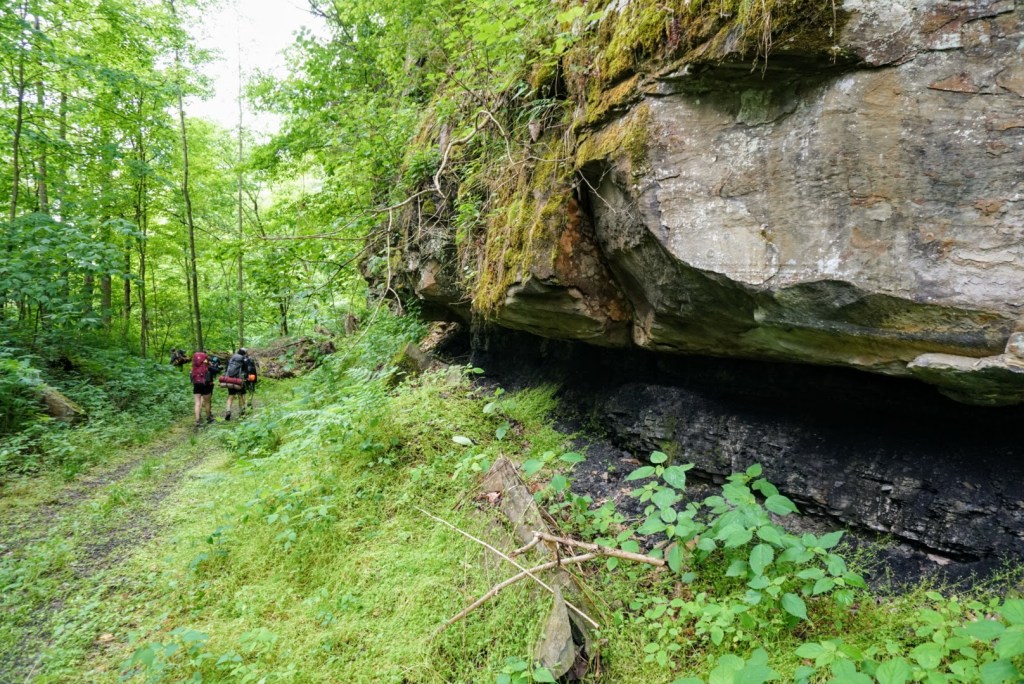
Hustling throughout the afternoon, we reached the Arbuckle Connector in under an hour. The only interruption was a sudden wipeout on a slick bridge. No one was hurt, but we found all the bridges on the NRG Traverse to be quite treacherous, so trekkers beware. After a steep, narrow, but short descent we reached the Southside Trail, our home for the remainder of the day.
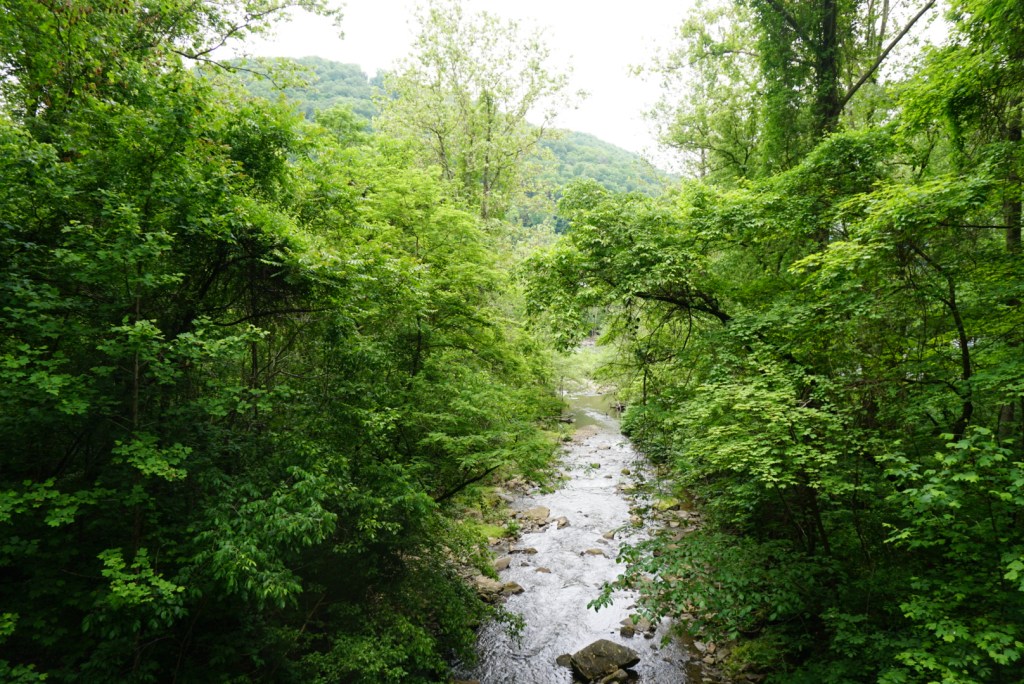
The Southside felt remote and at times it was a bit overgrown. The trail remained clear, but the only real signs that others had walked our path were the 100+ year old coke ovens and mining ruins that dotted the side of the trail every mile or so. It was hard to believe the same rugged, densely forested valley was once filled with bustling coal towns at the heart of the Industrial Revolution. We did appreciate the work the early industrialists had done to cut a flat path through the Gorge however, as the level ex-railroad tracks allowed us to knock out 7mi. in record time. With a half hour to spare before dusk, we arrived in the riverside Brooklynn campground. The site included five sections large enough for groups, so we spread out and enjoyed a well-earned meal just before some heavy rains rolled into camp.


Day Two: Brooklynn Campsite to Bridge Trail Trailhead (14.0mi)
After enduring a stormy night, we woke to a clear but foggy morning. This provided an excellent backdrop for our morning chores as the thick fog formed low and close to the still, glassy water. When filling up our filters at the river’s edge I was astounded to find that the water was actually warm. It was a significant departure from the glacial rivers I was used to out west, and we would later learn the temperature was over 70 degrees (21 celsius)!
By the time we finished packing up camp, the fog had burned off and we were treated to a bright, sunny morning. This turned out to be a little bit of a curse however, as we began with a tough stretch of windy, uphill road walking. It was a very unpleasant mile and a half, but we made it to the Kaymoor Miners Trailhead without being run over by one of the resort buses, shuttling whitewater rafters to the nearby Cunard Boat Ramp. In no time, we were back in the wilderness, traversing the rim of the winding gorge. As it had the day before, the trail surprised us with its diversity. While still being immersed in the dense forests, the environment seemed to shift constantly between temperate and tropical. Massive trees would emerge out of nowhere, many covered in layers of moss, gigantic fungi, and thick canopy vines that appeared to be straight out of Tarzan. A bold member of our group considered swinging on the vines, but an exploratory tug seeded enough doubt in their stability that he decided not to.
Over the course of our adventure on the Kaymoor Trail, we steadily climbed up the canyon and I constantly felt we were tantalizingly close to a memorable viewpoint. With just a mile or so left in the section, that viewpoint materialized. We suddenly emerged from the cover of the thick canopy and found ourselves standing atop an open hillside clearing, evidently created by a landslide years ago. The spot was surreal. Across the way we could see the magnitude of the deep and immensely green gorge before us. To our left, we gazed up at the threshold of the forest, entangled in a massive web of vines and ivy. It seemed a gorilla or creature from Jurassic Park might emerge at any moment.
Following a quick water break on our favorite ledge, we continued on and in no time arrived at the Kaymoor Miner’s Trailhead, which was surrounded by relics of the old coal mines. Tired and facing a long upward trek out of the gorge, we dropped our packs to rest and do some nearby exploring. As the Miner’s Trail is a favorite day hike of park visitors, this was the most populated section of our journey and we enjoyed the company of some locals, two of which had come to run the 821 steps down the ruins of the old mine processing plant. As a sucker for historical ruins, I was convinced to make the short but grueling trek down with them. The quantity of ruins and photos I was able to snap made the side trek worth it, but I was definitely questioning my decision on the way back up.
To compound the pain from ascending 821 steps, our post-break climb towards the Fayetteville Trail was agonizing. Though our trek through the gorge was largely devoid of dreaded switchbacks, the Traverse seemed to pack roughly a third of our trip elevation gain into this single stretch. A bout of heavy rain prior to us reaching the top kicked us while we were down. Still, all survived and at the top spirits were immediately lifted as we could sense the finish line approaching.
Our final five miles through the Fayetteville and Bridge Trails were enjoyable, yet largely uneventful. Since clouds had rolled in and hampered visibility, we elected to skip over the highly recommended side trek along the Long Point Trail. Everything we’d read suggested the 3.2mi. out-and-back offered the park’s best views of the bridge, but we doubted we would be able to see much given the weather. With just under a mile left to go in our journey however, we did get our own spectacular look at the engineering wonder. The aptly named Bridge Trail actually passes directly under the massive New River Gorge Bridge. To enhance the effect, the dense forest canopy made it so that we were unable to see the structure until we were almost directly underneath it. Pictures truly do not do the landmark any justice, the new River Gorge Bridge is huge. Even standing just below, it was difficult to fathom how the bridge was built, or how it spanned, unsupported, across the entire gorge.
Following our crossing beneath the bridge, were were less than a mile away from a hot shower and warm clothes. The traverse tested us one last time with a rocky climb back to the level of the road, but we were determined and powered through with steeled reserve. Soon we were standing at our car, celebrating our success, and recounting fresh memories of our trailblazing traverse as a group.
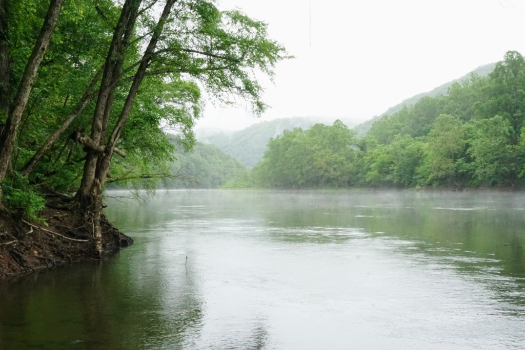
The New River at dawn from Brooklynn Campground 
Our group rejoicing in the end of the road walking 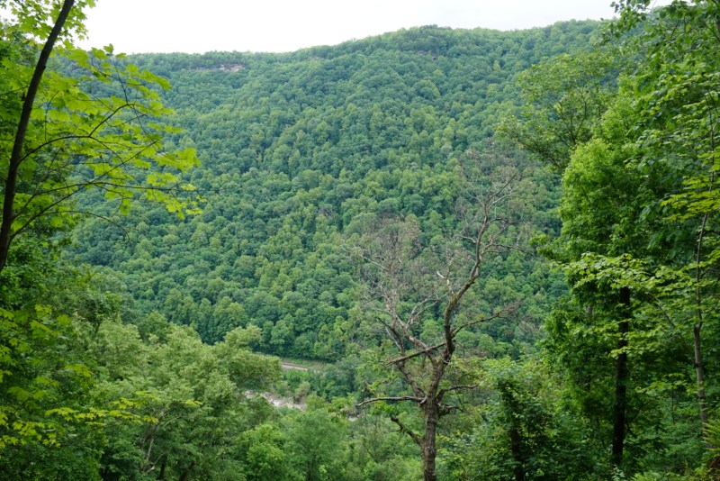
An overlook from the side of the Kaymoor Trail 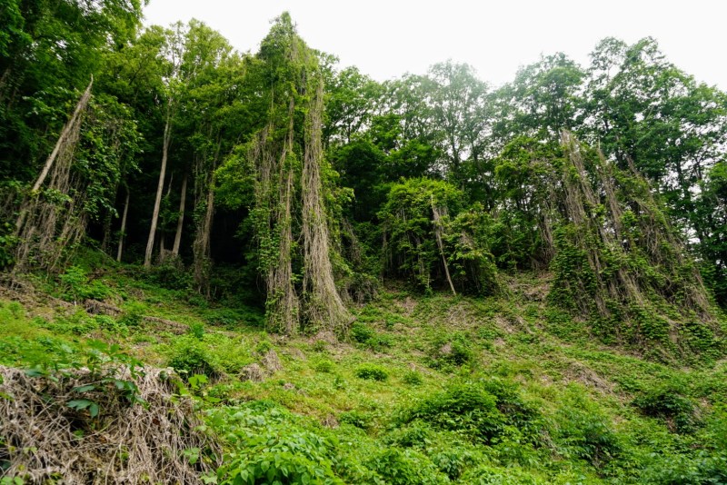
A setting out of Jurassic Park 
A peaceful trailside waterfall 
The powder house near the Kaymoor Miner’s Trailhead 
Remnants from West Virginia’s coal mining era 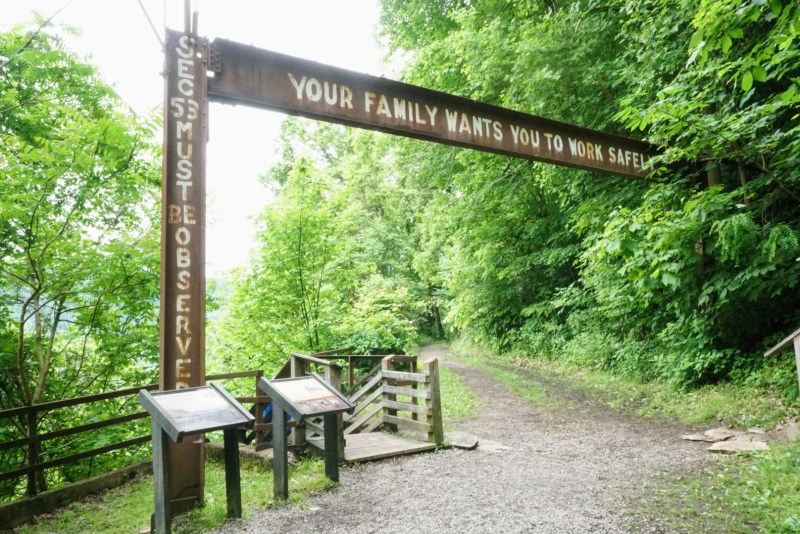
An ominous sign atop the steep ridge 
Ruins at the base of the Kaymoor Miner’s Trail 
A peak at the famous New River Gorge Bridge through the fog
