Minong Ridge Trail
Isle Royale National Park, Michigan
Length: 50.9mi (81.9km)
Days: 5-6
Difficulty: Hard (no facilities, isolation, rough terrain, and bugs)
Gear: Standard + GPS/PLB recommended
Completed: June 2022
In summary: At any given time there are likely more moose on Isle Royale than there are hikers, and that about sums up all you need to know about the Minong Ridge Trail, especially if you are an avid backpacker seeking solitude within an increasingly crowded parks system. Few places in America outside of Alaska or the Greater Yellowstone Ecosystem are better for spotting wildlife (we enjoyed double-digit moose sightings), plus the surrounding island scenery isn’t too bad either. The Minong is regarded as the isle’s most rugged and challenging backpacking route, which only adds to the adventure. You might battle through long travel, bugs, unpredictable weather, and real elevation swings, but the opportunity to camp under the northern lights on a remote island largely unblemished by human activity is worth it a thousand times over.
Preparation / Know Before You Go
Book your travel to the island well in advance: There are only two methods for getting to the remote Isle Royale, one is expensive and the other is quite time consuming. Despite the cost, I am a huge promoter of the Isle Royale Seaplane as it is by far the most convenient way to access the isle. Unlike the ferries, the seaplanes run seven days a week and offer multiple departure times over the course of the day. Also, unless you have access to a private boat, the park can only be accessed from three mainland towns: Grand Portage MN (ferry & plane), Houghton, MI (ferry & plane), and Copper Harbor, MI (ferry only).
The park closes seasonally: Isle Royale is only open each year from April 16 – October 31, making it one of just a handful of national parks that close seasonally. The timeframe for visiting may be even shorter if you don’t have access to a boat though, as the ferry and seaplane have even more constrained operating seasons. These seasons are weather dependent, but generally run from around mid-May through the end of September.
Bring bug spray & bug nets: Hordes of mosquitoes and biting black flies are present on the island and their presence tends to correspond with the peak visitation season from June to July. Experienced visitors recommend treating clothes and gear with permethrin spray before arriving on the island, but we were able to survive with DEET-based bug spray. There exist some pretty dramatic accounts of the Isle Royale bugs, but with copious amounts of OFF! we found them to be a tolerable nuisance. Bug nets add an extra layer of protection and go a long way for providing peace of mind.
Do not rely on the weather report: I don’t believe there is a weather station on Isle Royale and my hypothesis is that when you search the park on a weather app it is pulling data from Houghton, MI over 70mi. away. We had planned for a week of dreary rain based on our 10-day forecast and instead found ourselves battling through 90F heat on exposed ridges. The reading from Grand Portage, MN might be your best bet for an accurate forecast, but in reality, you should be prepared for anything.
The northern lights: The opportunity to see the northern lights (or ‘aurora borealis’) with minimal light pollution is a huge draw to the island. The timing of the borealis, however, can be difficult to predict. Visibility depends on a number of factors including cloud cover and the current sun cycle. Though it is imperfect, the best predictive tool I have found for measuring your chances of seeing the lights is this dashboard from NOAA. Hopefully you have more luck than us.
Pronunciation: You will hear all sorts of pronunciations of the park’s name, even from local Michiganders, but the technically correct one is “eye-el roy–uhl” not “eye-el roy-al”.
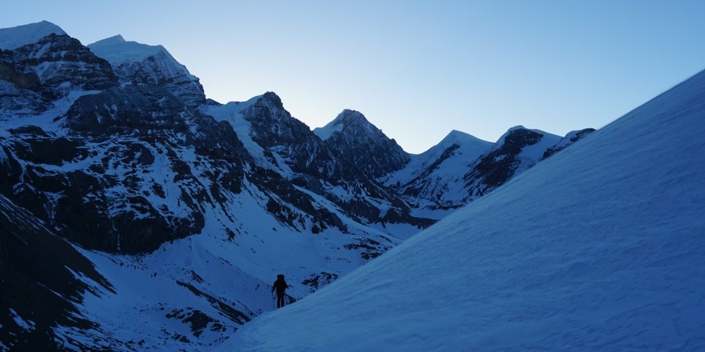
Day One: Windigo to Huginnin Cove (4.6mi)

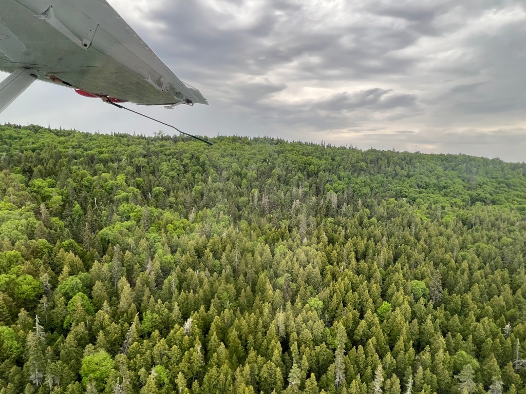


All adventures to Isle Royale begin well before the trailhead. For us, it began in the parking lot of Isle Royal Seaplanes, condensing our packs, weighing our gear, and steeling ourselves for what had the potential to be a bumpy plane ride through stormy conditions. In actuality, our journey had started 6 months earlier as we tried to figure the logistics of getting to the least visited national park in the lower forty-eight. For the purpose of the retelling however, I will skip over that part.
Promptly 15 minutes before we were scheduled to depart on the last flight of the day, we watched as our plane appeared over the nearby hills, narrowly cleared the nearby Portage Canal Bridge, and landed in the water right in front of us. A dirty, but happy, group of hikers clambered out, still reminiscing about their time on the island. Right after them came the pilot, who imparted to us the importance of packing up rapidly so that we could be wheels up before the looming storm reached Houghton. Not wanting to relive my experience in New Zealand, we acquiesced and were soon a few thousand feet above Lake Superior, watching distant lightning strikes through the plane’s window.
After approximately 25 minutes in the air, the Isle Royale started to come into view and pending another 15, we found ourselves rounding the mouth of Washington Harbor and preparing to land. As we descended, the pilot pointed out a nearby bald eagle’s nest, at which point an adult eagle flew the coop and passed directly under our plane. It felt like an omen, an auspicious start to an unforgettable trip.
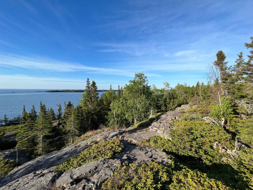
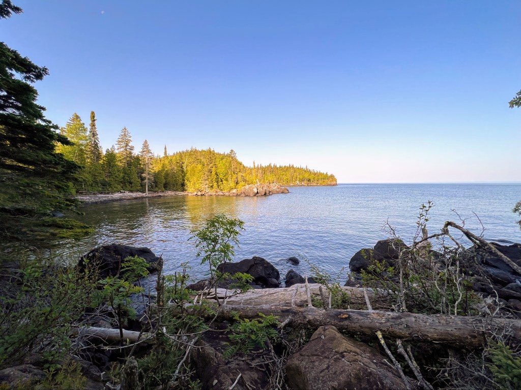
Once docked at Windigo, we popped into the small general store to register our trip and purchase some fuel. With supplies procured we made a quick exit, hoping to get a few miles in and reach Huginnin Cove before it got too dark. Already it was approaching 5:30pm and the overcast made it feel even later. The long summer days of northern Michigan would ensure that daylight was never an issue on the Minong Ridge, but none the wiser we hustled to the trailhead. Almost immediately, we were swallowed by the island’s thick boreal forests. Shrouded under the dense canopy we wove our way around Washington Harbor and began to follow a narrow ravine to the island’s western coast. Along the way, we talked excitedly about what was ahead and our desire to spot a few members of the island’s famous moose population.
To our surprise, it didn’t take long at all. Only an hour or so in, we found ourselves standing face-to-face with a young cow no more than 20 meters away. We nearly missed her. As we talked and walked on by the moose had stood frozen, patiently waiting for us to pass. It wasn’t until she was almost behind us that we noticed a large figure watching us from just beside the trail. After a split-second of panic, we paused to watch the beautiful creature. Eventually, she became comfortable with our presence and began grazing, working her way over a grove of saplings until the prime leaves led her out of sight. It was an incredible moment, but its reign as the highlight of the day lasted only until we arrived at Huginnin Cove. There we enjoyed dinner and a magnificent island sunset from our beachfront campsite. To this day, the spot remains amongst the best sites I have had the privilege of staying in.
Day Two: Huginnin Cove to North Lake Desor (13.9mi)
The morning light on Huginnin Cove 
Moving through the dense forest 
Our first look at the top of the Minong Ridge 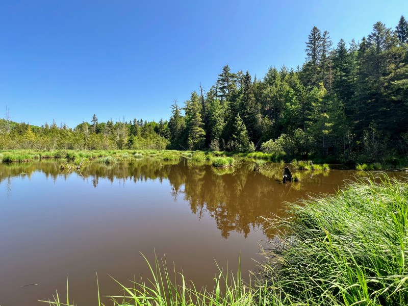
One of a thousand beaver ponds on the isle 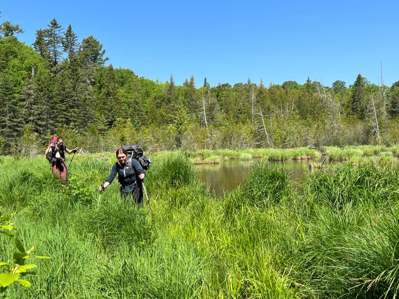
A tedious, muddy crossing 
A narrow boardwalk across the swamp 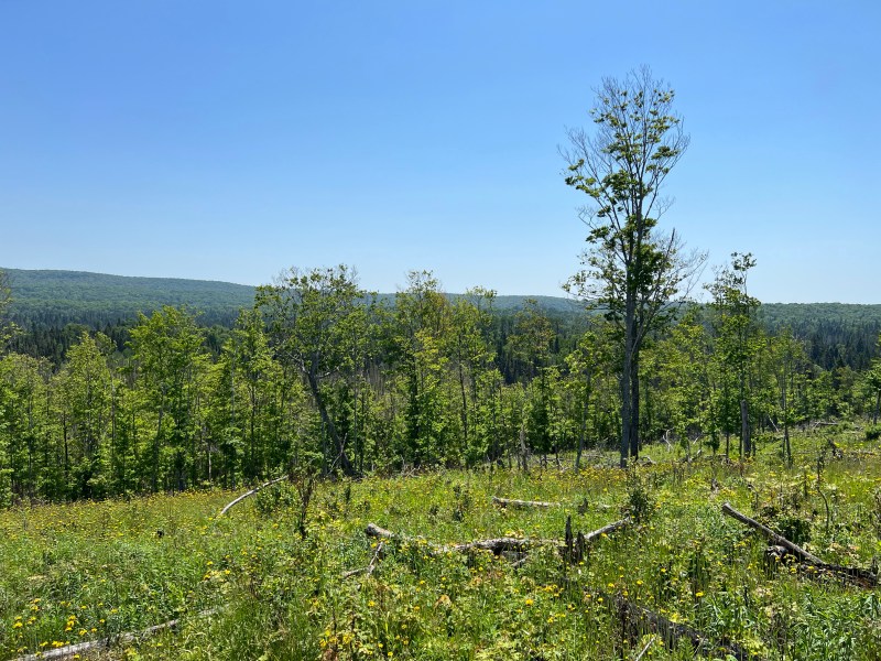
A regenerating burn zone with Greenstone Ridge in the distance 
Another beaver pond 
The ridge just before Lake Desor 
Lake Desor peeking through an aspen grove
There are few better ways to start a day than waking up at dawn to the meditative sound of gentle waves at your own private beach. Had I had a mattress and a real pillow, I may never have gotten up. The hard ground takes its toll however, and after a few minutes of relaxation, we unzipped our tent and stepped out into the pre-dawn light. A pot of coffee and pack of oatmeal later, we were on our way along Isle Royale’s western shore. Before reconnecting with the main route of the Minong, we enjoyed a few miles of scenic coastal walking, accentuated by natural arches, sea stacks, and uninterrupted views of the Minnesotan-Canadian coastline. The decision to weave the Huginnin Cove loop into our journey along the Minong was one we made at the last minute, but I would highly recommend it to anyone else looking to maximize their time on the island.
Just before we arrived at the trail’s junction and officially stepped foot on the Minong Ridge, our day really started. Abruptly, the trail pointed us away from the coastline and up a gnarly switchback. Again, we were making our way into the heart of the thick northern forests that seemed to blanket almost the entire island. For the next couple miles, we would track the thin dirt path through the woods until the trees gradually began to thin and we appeared atop a rocky clearing. A look down upon the forest canopy below signaled that we were now on the Minong.
Spoiled by the gentle grade and coastal breeze of our morning mileage, we were soon forced to adjust to “the ridge” portion of the trek. What had steadily led us up almost immediately sent us back down. Little did we know, this exhausting pattern of ascents and descents would come to define the remainder of the day.
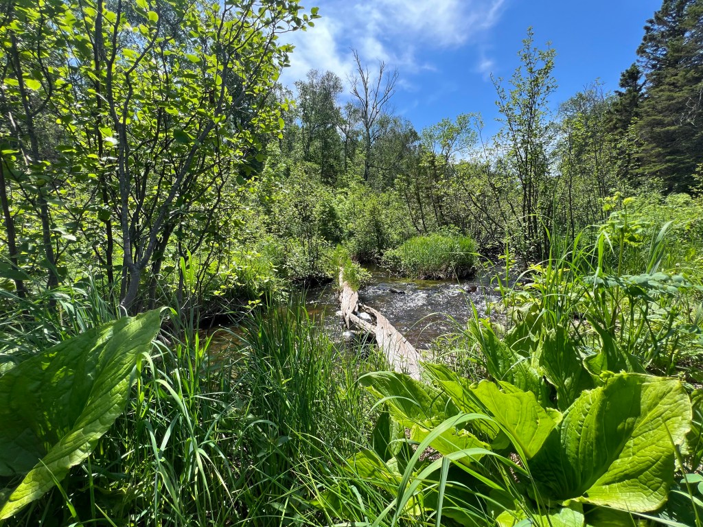
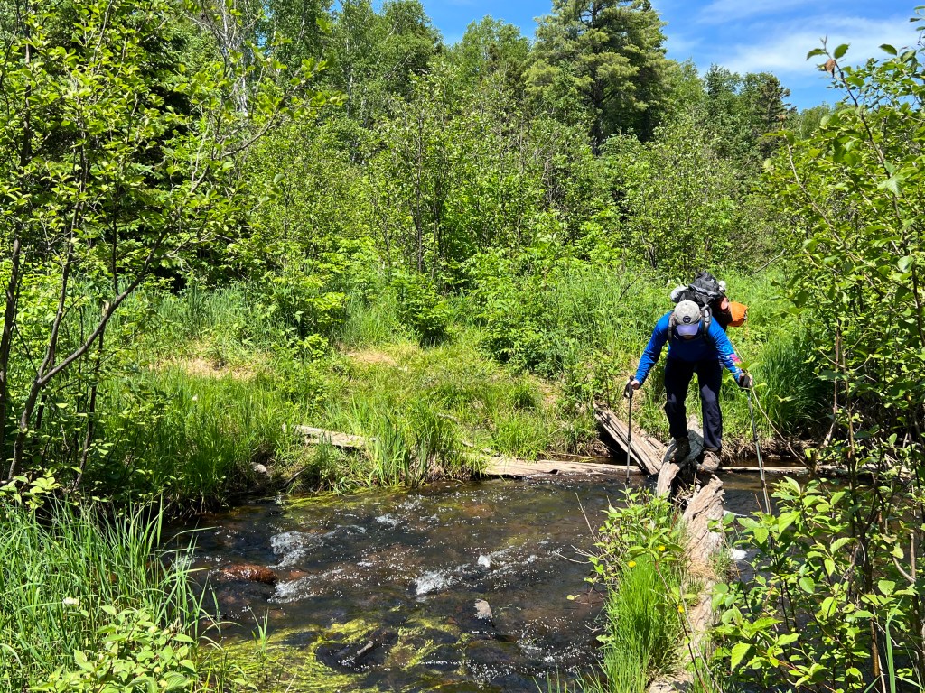
At the bottom of our first “bump” along the ridge, we came across a beaver pond, and to our surprise, the trail led us right across the top of the dam. This dam wasn’t so much a pile of sticks as it was a line of logs reinforced by tufts of tall grass. Thus, a crossing was possible but exceptionally tedious. Our walking sticks offered little help as they simply plunged through the muck when leaned on for balance. Just when we thought we all would make it safely across, Jordan suddenly lost his footing and found himself knee deep in the swamp. A new pair of socks and a lot of laughs later, we regrouped and were on our way again.
Through the remainder of the day, we soldiered on, steadily chipping away at our mileage and hoping for an early arrival at Lake Desor. The sun was out, and the set of exposed ridges offered little respite from the building heat. When stopping for water or to empty gravel from our boots, we often were forced to make a difficult choice between baking on the ridge or facing a swarm of mosquitos in the buggy lowland shade. Nonetheless, it was another memorable day on the trail. We added to our moose tally (surprising one that was headed our way on the trail), enjoyed several panoramic viewpoints, honed our dam-crossing abilities, and best of all, experienced everything in near-total solitude.
By the time the heat and constant change in elevation really began to wear us down, a sliver of blue peeked through an aspen grove due east, giving us our first glimpse of Lake Desor. This proved to be the morale boost necessary to propel us over the last few bumps and down into camp. We rounded out the evening with a well-earned meal and rejuvenating soak in Lake Desor.
Day Three: North Lake Desor to Todd Harbor (10.7mi)


Sunrise at Lake Desor could not have come soon enough. The more I have hiked over the years, the more I have come to believe that there is a sort of supernatural force governing life on the trail, enforcing a sense of balance. Climbs are followed by descents, easy miles by hard, and in this case a great night’s sleep was followed up by a restless one. Despite being relatively close to the water, we lacked the cool coastal breeze that made Huginnin Cove so peaceful. That made for a muggy evening that I, in particular, suffered through. Still, it was nothing that a strong cup of black coffee couldn’t fix.
The hiking began almost exactly how it had ended the day prior. Doubling back out of camp, we climbed our way right back onto the bumpy Minong Ridge route. Whatever grogginess that lingered from my poor night’s sleep was soon shaken off as the early mileage tested our cardio. Fortunately, we were able to sneak a couple of the harder morning miles in while a thin fog cooled the isle.
After traversing a handful of steep bumps and passing by the largest beaver dam I had ever seen, the fog began to burn off and the temperatures steadily rose. On the bright side, this brought improved views of Lake Superior and the Canadian shoreline across the way. To pass the time during ridgetop snack breaks, I began using my Isle Royale map, Garmin InReach, and questionable sense of direction to make dubious claims about the landmasses we were looking at in the distance. By the end of the hike, plans to visit Thunder Bay and Sleeping Giant Park for our next backpacking trip were in motion.
Another memorable moment from one of our day three snack breaks occurred when we heard a peculiar noise echoing from a valley below. Curious, we scanned the swampland and thick forests a few hundred feet below before we saw the movement of a moose grazing on the edge of a shallow pond. Every so often she would stop and let out a deep bellow. On the second or third instance of these calls, we saw movement again, out of the tall grass came a small calf. Thrilled, we watched as the calf awkwardly wobbled through the swamp to rejoin mom before they both began a slow retreat in search of greener pastures. It was a wonderful sight and one that we had a chance to share with two southbound hikers 15 minutes later when they asked if we had encountered a moose yet. After they longingly told us they had yet to see one after three days along the Minong, the moment felt even more special.
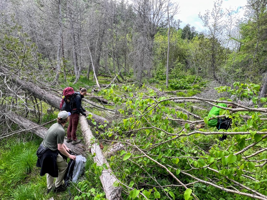
The midpoint of our third day on trail came right as we stumbled upon a lush grassy clearing just beside a small waterfall and rushing spring. Nestled in between two steep sections of the Minong ridge, it appeared the perfect spot to refill our water bottles, wash the unmentionables, and soak our feet. The only downside was that there was no break from the afternoon sun, so we elected to postpone lunch until we were further downstream. Once the packs were back on and we were ready to get rolling again, we noticed one small issue – the trail had disappeared. From where we stood, we had two options, we could follow a series of faint game trails that abutted the stream’s edge, or we could cross on an unsecured log. Hoping to avoid the possibility of taking an unexpected swim, we decided to test the game trails. After each one eventually petered out, we agreed we would have to try the log. One by one, we made the precarious crossing and fortunately nobody took a dip. Across, we noticed where a clear section of the trail picked back up and climbed our way back onto the ridge.
The remainder of our afternoon mileage largely followed this long, continuous, and densely forested section of the Minong. We never did end up crossing the stream again, and after coming to terms with the likelihood that my Garmin had tricked us, we stopped for a buggy trailside lunch. Nevertheless, it was a pleasant afternoon. Detached from the incessant ups and downs of the Minong’s most difficult section, we cruised along the isle’s spine and into camp where two more thrills awaited us.
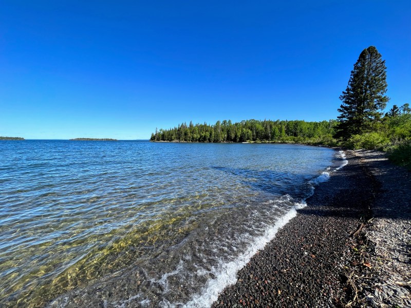
Firstly, perhaps a quarter mile away from Todd Harbor, we were startled by a crashing sound to our left, just off the trail. There, we spotted another moose a dozen yards away, this time fully grown. She stared curiously at us for a few seconds, likely assessing our intentions, then resumed her grazing. With beaver pond to our right preventing any detour, we eventually inched too close along the trail and she took off crashing through the woods. Our second thrill came when we finally arrived and saw the magnificent little lakeside beach that lined the Todd Harbor camp. It wasn’t quite as private as Huginnin Cove, but the sweeping views of Lake Superior were just as breathtaking. We grabbed the last available site in the campground (it wasn’t too crowded, but there were only 6 or 8 spots) and made a beeline for the water.
Day Four: Todd Harbor to East Chickenbone Lake (8.7mi)
Todd Harbor just before an early departure 
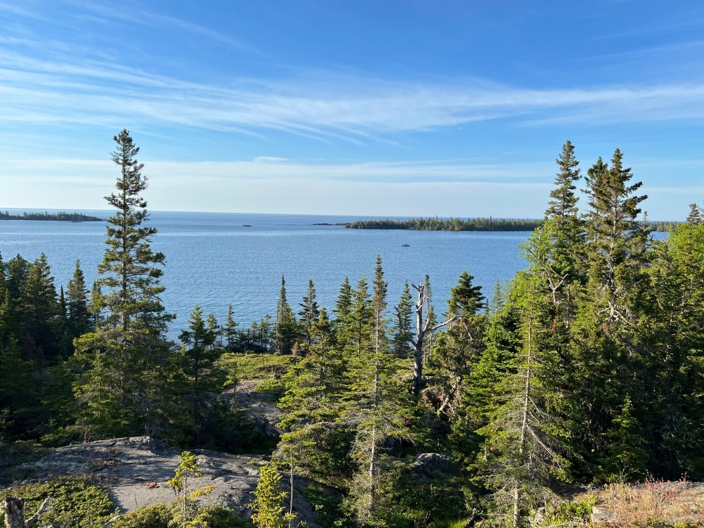
Otter Lake with Sleeping Giant Park visible across the channel 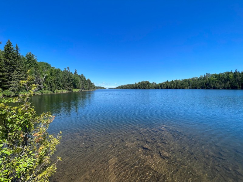
The beautiful McCargoe Cove 
The Voyageur II ferry dropping off passengers at McCargoe 
A beaver dam 
And the dam’s hard-working creator 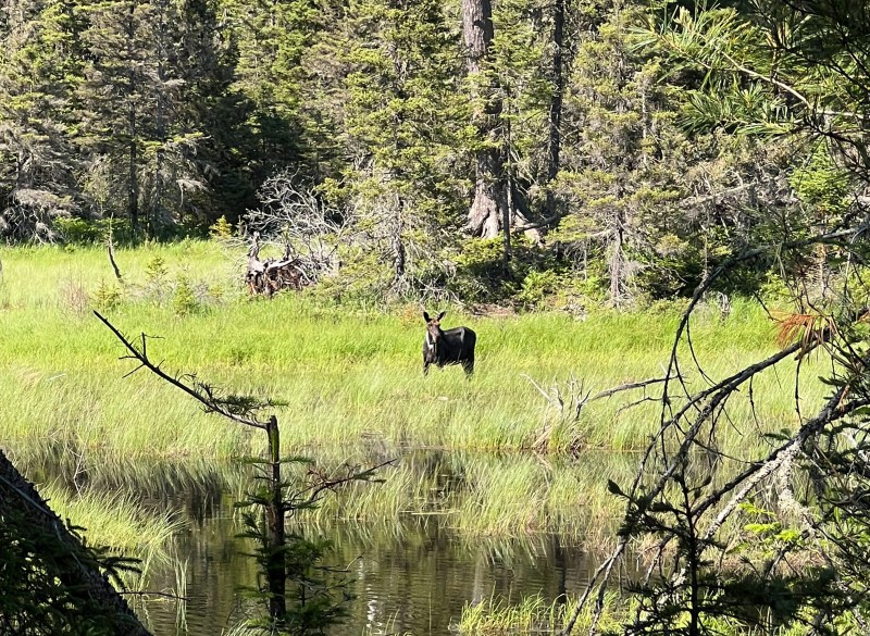
A moose grazing in the swamp 
Chickenbone Lake from the eastern end 
One of about four turtles that visited our campground 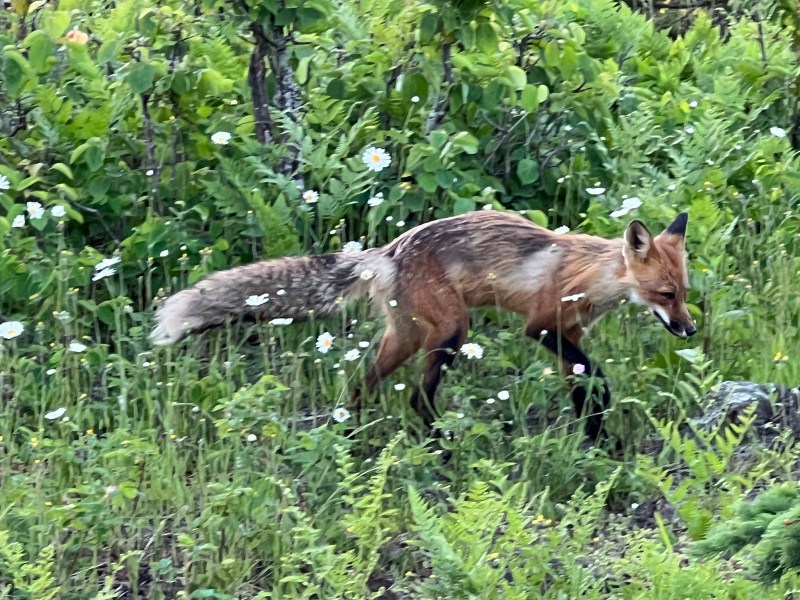
A beautiful fox that came dashing through camp
Coming off our second difficult day on the trail and a poor night of sleep, we decided to take our sweet time leaving Todd Harbor. By the time we rose and fired up the stove for some pancakes, only our neighbors were left in camp. A friendly father-daughter duo, they were taking their journey slowly, a few miles at a time. I envied them as we tried to get our legs moving again, feeling the effects of the days prior on our legs and shoulders. Still, spirits were high as we departed knowing that we had a shorter hike in store.
The walking started leisurely enough as we plodded northward, immersed in the forest despite remaining within a thousand or so feet of shore. After about an hour, it picked up. The trail sent us right back up a tall ridge that got the quads burning again and brought flashbacks of days two and three. Fortunately, this time the stretch of rapid elevation change didn’t last long and after some scenic views of Otter and Beaver Lake, we descended towards McCargoe Cove.
As we rolled into McCargoe just after noon, two things immediately stood out. The first was how picturesque it was, sitting at the base of a long inlet of placid blue water. While our campsite at Todd Harbor left little to be desired, I couldn’t help but feel a pang of jealousy as we passed the handful of wood huts and tent sites that looked over the cove. The second observation was how crowded it was. Now, on Isle Royale it only takes twelve people to constitute a crowd, but it still struck us as odd. We hadn’t seen a soul on the trail since Todd Harbor and it was still early for making camp. Additionally, many in the group seemed to lack gear that would suggest they were prepared for a night in the backcountry. Approximately 30 minutes later, the distant hum of an engine broke the silence of the cove and our questions about the group were answered. I had forgotten McCargoe Cove was one of the few ferry stops that provided day hikers and campers alike access to the west side of the island. As the Voyageur II arrived, we watched the group pack up and chatted with some rangers while preparing lunch. We were hoping for tips on where to find the bizarre bleeding tooth fungus, but sadly learned our odds were low around this part of the island. Eventually the ferry departed the way she came, and we were alone on the dock until a moose appeared on the opposite side of the cove, wading into the water to graze on some aquatic plants.
The hours ticked by as we sat near the McCargoe dock with the quiet confidence of backpackers who have just a few miles to go and plenty of daylight. Eventually, Chickenbone Lake beckoned and we resumed our journey by following the general path of our friend, the aquatic moose, who had disappeared into a nearby swamp. In a short while, the trail turned muddy and we soon found that several of the logs or boardwalks but it place by the park service had been submerged. It seemed the beaver dams that dotted the area were changing the landscape faster than the rangers could keep up. Fortunately, we had acquired a level of surefootedness from all of our earlier dam crossings and the muddy intersections no longer posed such a severe obstacle.
During what was probably our third successive dam crossing, a movement in the nearby water caught my eye and forced me to do a double take. Swimming in the little pond he had created was a beaver! Growing up in the Pacific Northwest, I was very familiar with beaver dams and ponds, but in all my time hiking and exploring I had never seen one. I’d gradually reached the point that even though we had already passed probably 50 dams on the Minong, it never remotely occurred to me that we could be lucky enough to see one of the inhabitants. I was overjoyed and held up the group for at least 20 minutes watching until he disappeared below the surface for what appeared to be the last time. Perhaps a hundred yards beyond the dam, we spotted our second moose of the day, grazing in a nearby swamp, but if felt like such an insignificant sighting compared to the beaver.
Just before 4pm, we arrived at our campsite for the evening – East Chickenbone Lake. In spite of the name, the site was, to our dismay, pretty far from the actual lake. In need of water for the evening, we set up camp and then made the steep trek down to the lakeshore. There we filled all the containers we had with water and for the third consecutive night had a proper bath. The water access point itself was quite treacherous and involved stepping over a silty slime that coated the bottom of the lake. Ironically, I teased our friend Jordan, the last one in, about the biting fish and sea lampreys that would probably take a liking to our blistered feet only to find a leech between my toes as I stepped out.
This was not the last strange occurrence of the evening. As we returned to camp exhausted and ready for bed, we drifted into some sort of wildlife witching hour. Soon, our camp was overrun with turtles who appeared to have climbed up the hill from a nearby swamp. Though they generally feared us, they made their way around camp poking around our tents and examining all of our gear. Then later, just as we were brushing our teeth and preparing to turn in, a gorgeous red fox ran right through the middle of our camp coming within a few feet of Emma as she stood frozen. It was so bizarre, the fox clearly saw and heard us but seemed to pay no mind as he went about his way.
Day Five: East Chickenbone Lake to Three Mile (10.3mi)
One of our last Canadian vistas along the Greenstone Ridge 
Descending the Minong for the final time 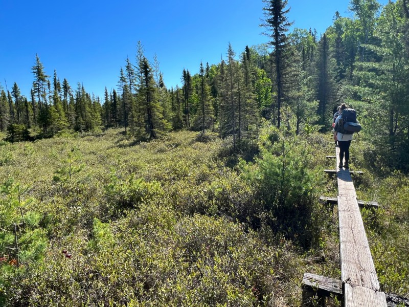
Thick bushes disguising a muddy swamp 
The dock and beach at Moskey Basin 
A garter snake returning from an afternoon swim 
A walk along the Lake Superior shoreline 
Lake Superior near Three Mile 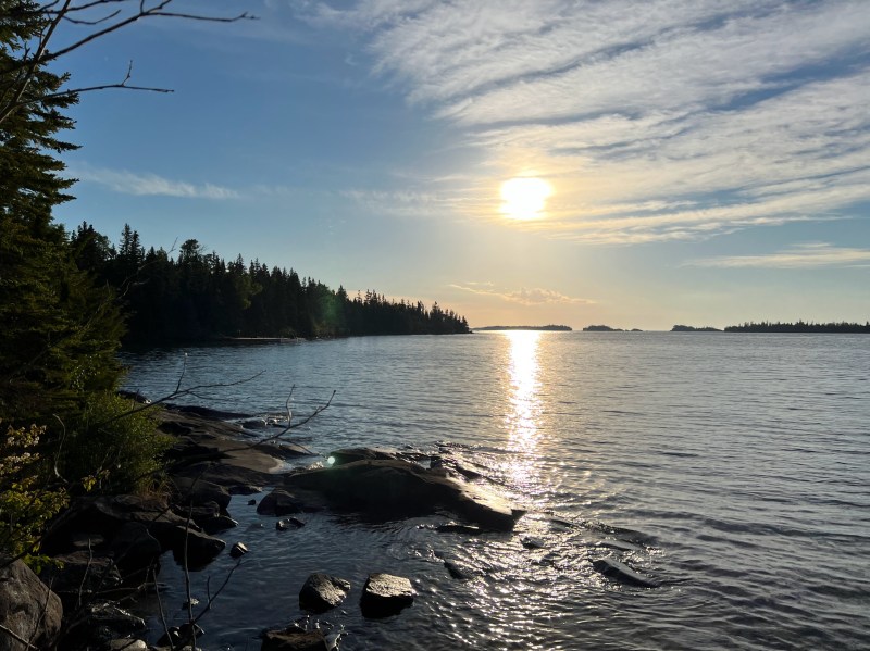
The setting sun from our lakeside campground
Our final full day in the backcountry got off to an uneventful, yet ceremonious, start as we packed up and descended the small hill that we had camped on the night before. At the bottom, within a few hundred yards of camp, we came to a fork in the road. Though we continued straight on through, this marked the technical end of the Minong Ridge trail, a bittersweet landmark despite the fact we still had a dozen miles to go. From this point forward, were officially walking on ‘The Greenstone,’ Isle Royale’s other famous cross-island trek.
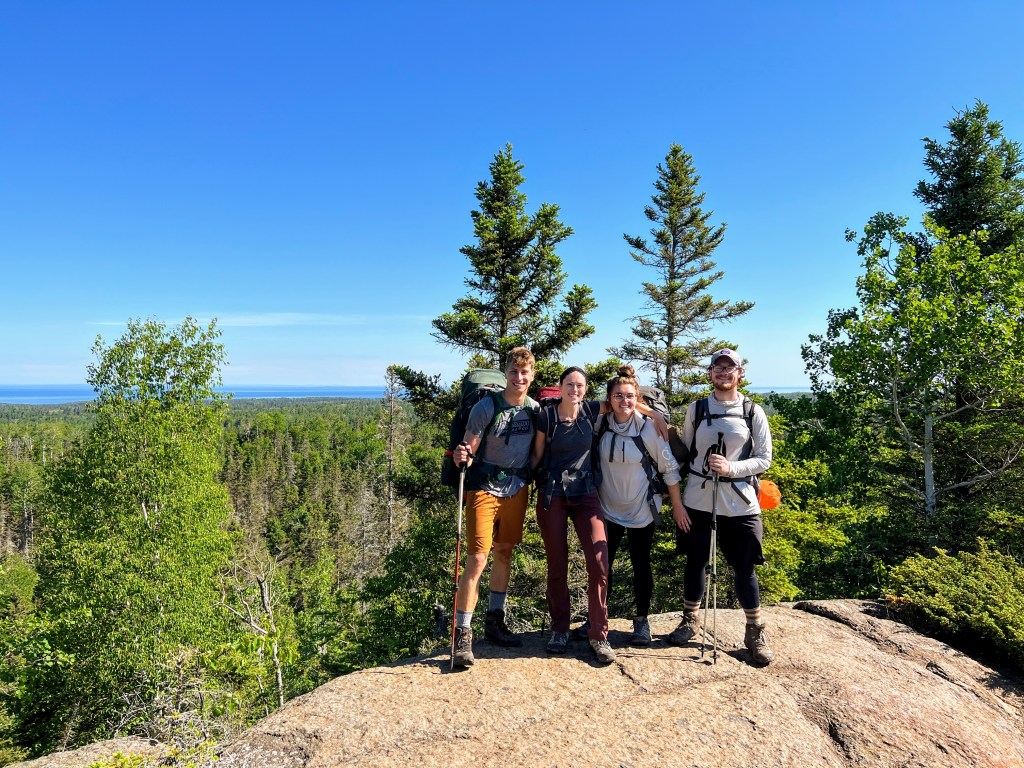
The day began with another climb onto a rolling ridge that, while still taxing on tired legs, paled in comparison to the steep grade and rough terrain that we had encountered on the Minong. Another thing we immediately found to be different as part of The Greenstone was the traffic. The route was by no means crowded, but within a mile or so of hiking we passed two other groups of backpackers who were undertaking a popular lollipop that loops around Moskey Basin and Lake Livermore. One of the parties consisted of a couple, coming in from West Chickenbone who we leapfrogged a couple times as our group would stop for water or to dig fruit snacks out the food bag. At a particularly scenic viewpoint not too far from Mount Ojibway, we crossed paths again and asked them to take our photo. Little did we know, that would be our last panoramic view from one of the Isle’s beloved ridges. Soon after, we reached another fork, took a right turn off the Greenstone, and descended towards the Daisy Farm campground, which was nestled right along the lakeshore.
There is always something so satisfying about finishing a long trek along a large body of water. It serves as the perfect finish line and as we pulled up to the Daisy Farm dock to look out over the lake, I could tell each of us was feeling that sense of catharsis. The thin crowd of people milling about the island’s largest campground only added to this effect. Though we still had miles ahead, we decided to soak it in and take a long break. We ate, read, slept, and poked around camp without the oppressive weight of our packs. By the time we moved on to make the short trip down the coast and past the lighthouse to Three Mile, we were feeling refreshed, ready for another fifty miles. When we rolled into camp and found no vacant sites, even that could not break our spirits. Eventually, we located a kind hiker who was only mildly annoyed to have to share his private beachside site with a group of backpackers. Later that evening someone in camp informed that a dead moose was decomposing near one of the other sites. The repugnant smell apparently resulting in a few closures and significantly reducing the capacity of the small camp.
Day Six: Three Mile to Rock Harbor (2.7mi)


Though only a couple miles stood between us and celebratory beers at the Rock Harbor Lodge, we decided to start our day at dawn in hopes of beating the rest of the Three Mile crowd to the premium sites. In spite of our best efforts, the plan was eventually foiled by a particularly slow-to-rise crowd around the Rock Harbor campground. Nonetheless, the rush out of camp proved well worth it as we had one of the busiest, most scenic stretches of the trail to ourselves.
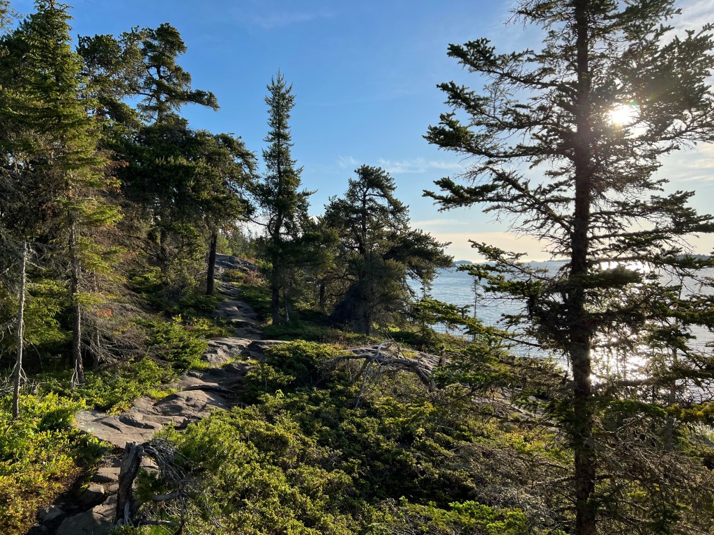
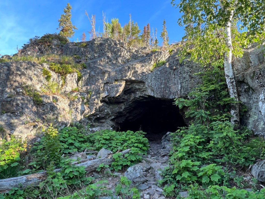
Embracing the calm, sleepy aura of the isle at dawn, we hiked largely in silence, accompanied by the sound of gentle waves lapping against the protected harbor. We didn’t stop until about halfway through our journey, when we took a short break at a trailside landmark known as Suzy’s Cave. As we polished off our supply of CLIF Bars and Welch’s fruit snacks (a personal favorite when hiking) for breakfast, I took a few minutes to poke around and do some extremely elementary spelunking. After clambering uphill to the mouth of the cave, I decided to crawl through to the other side of the shallow passage. There, I came upon a series of footpaths that led up the back side of the large rockface that the inland sea arch had been carved into. When I reached the top, I was faced with a magnificent view of Rock Harbor that seemed a fitting finale for a tough, but memorable, week. Just as I had finished soaking in some of my last moments on the trail and was prepared to head back down, a fox emerged from behind some bushes a few feet away. Upon recognizing my presence, he paused, calmly sat, and stared curiously forward. After a brief moment, he gave a short nod, as if to congratulate me on the completion of our journey, and subsequently disappeared down the hillside towards the rest of the group. It seemed a symbolic ending to an wonderful trip.
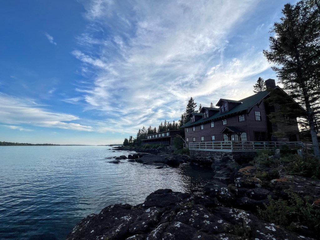
When we rolled into Rock Harbor an hour or so later, it was hard not to feel the excitement in the air. The small island “town” was a busy mix of recent arrivals and soon-to-be departures. Everyone was enthused about what they had experienced or were to experience on the island. After snagging our first wooden shelter of the trip, we made our way down towards the lodge with the whole day ahead of us. Deciding it was still too early for a pile of food and flight of beers, we elected to take another hike out to Scoville Point. It was rejuvenating to be moving around without the deadening weight of our packs and the hike turned out to be wonderful. Surprisingly, the wildlife on this end of the isle was quite active as well. Before finishing our little side quest, we had spotted nesting bald eagles, a family of sandhill cranes, and a mating pair of common loons.
With our hiking finally complete, we passed the remainder of our time on the island eating, drinking, and playing board games borrowed from the lodge. We made friends with several other groups of visitors, mostly visitors to the lodge who were generally eager to hear about what life was like on the Minong. Though we settled down for an early night’s sleep, we made plans for one last adventure: a 2:00am walkabout in search of the Northern Lights. Though the aurora ultimately eluded us, we did get a final thrill when we encountered a bull moose, no more than 10 meters away, in the pitch black.
Alternate Itineraries
There are a handful of side treks that you can do from the Minong Ridge Traverse and route modifications are encouraged. We added a sojourn to Huginnin Cove and found it to be our favorite campsite of the trip. Perhaps the most important logistical decision you will have to make in planning the Minong is whether to hike eastbound (Windigo –> Rock Harbor) as we did, or westbound (Rock Harbor –> Windigo), as most others do. This choice will have quite an impact on your overall experience, so to help, I have done my best to layout the advantages of each:
- Northbound:
- Allows you to get the hardest section out of the way first
- Grants opportunity to finish with a burger and brews at the Rock Harbor Lodge
- Ends in a part of the park with more day hikes and activities in case you finish early or with unused buffer days. This also comes in handy if you have the misfortune of facing flight / ferry delays or cancellations due to bad weather. These cancellations are uncommon, but not rare
- Southbound:
- Offers a more gradual ascent into the steeper section of the trail, best for those who would prefer to acclimate themselves with the rigors of backpacking
- Allows you to finish strong with the hardest sections (pack will be lighter)
- You can enjoy a more social experience with hikers headed your direction
- Can lead to arrival at more crowded campsites earlier in the day (Three Mile, Daisy Farm)
