
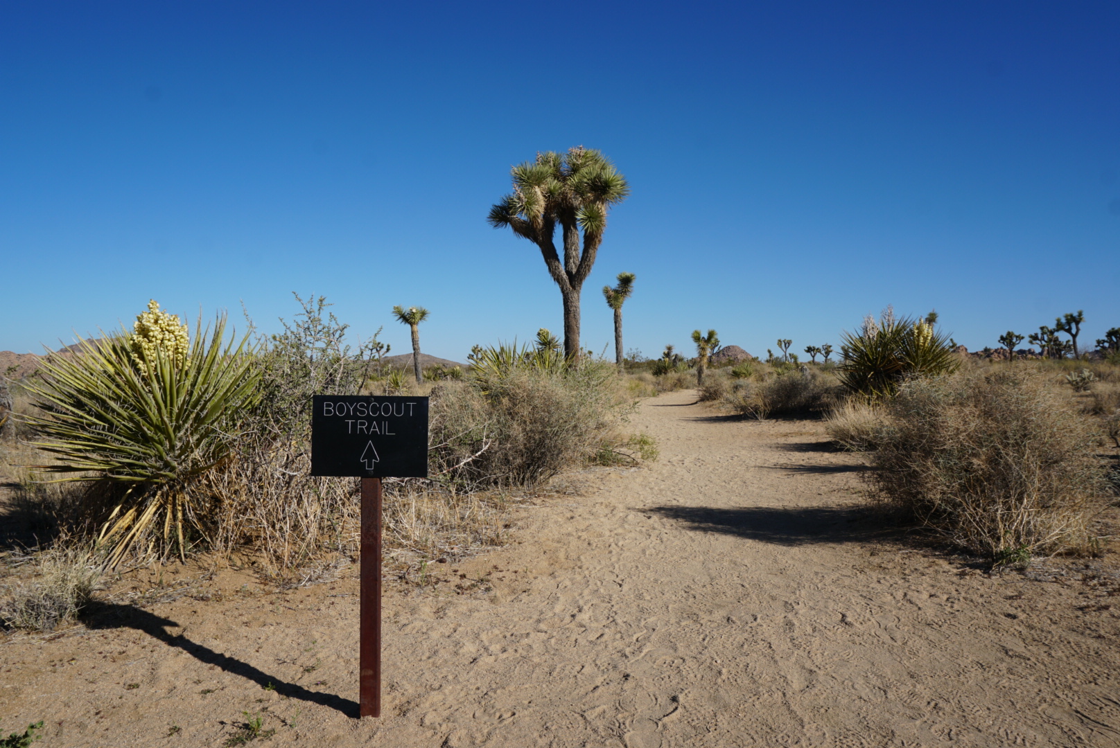
The Boy Scout Trail
Joshua Tree Natl. Park, California
Length: 16mi. (25.7km.), with extensions 23.5mi. (37.8km.)
Days: 2
Difficulty: Easy (trails clear and elevation gain reasonable, but beware of extreme temperatures)
Gear: Standard gear + extra water (no source along route)
Completed: April 2022
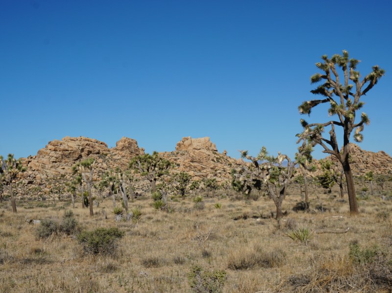
In summary: Due to its hot and rather unforgiving environment, Joshua Tree is not particularly known for backpacking. However, if you are determined and willing to take some extra precautions, most local experts would recommend fulfilling your sense of wanderlust on the Boy Scout Trail. An out-and-back trek that spans 8mi. each way, the Boy Scout Trail offers a look into the variety of landscapes that make up the Mojave portion of the park. Groves of the eponymous Joshua Tree dot the first portion of the hike, while the latter half serves up impressive mountain vistas and sunscapes. The possibility of spotting some elusive bighorn sheep or the rare desert tortoise only adds to the hike.
Preparation / Know Before You Go
Register before you hit the trail: Though permit availability does not limit the supply of backpackers in Joshua Tree, you are required to register for safety reasons. Your car is at risk of being searched / towed if you have not registered.
There is no water: There are no reliable water sources along the route, so it is critical that day hikers and backpackers alike bring extra water. To help us complete the journey without a cache, we packed food that did not need to be cooked or rehydrated.
Extreme heat is common: Keep an eye on the forecast and prepare for the extreme. There is practically no shade along the entire route and the park service recommends tourists avoid all long hikes when temps approach triple digits. For this reason, avoid the trail (and Joshua Tree altogether) in the summer months. Sunscreen and sunglasses are a must as the desert rock is reflective, only adding to the sun’s intensity.
Consider adding in some side hikes: The Boy Scout Trail itself is an 8 mile out-and-back, but a handful of side trails branch off from the main trail. Consider adding in some variety by including side routes like Willow Hole or the Big Pine trail.
Camp only in approved areas: Dispersed camping is allowed in Joshua Tree NP, but there are some areas that are off limits for conservation. Check before you go, but as of our trip, backpackers on the Boy Scout Trail were required to camp on the western side of the path.
Day One: Keys West Trailhead to Big Pine Trail via Indian Cove (16.5mi)


Sitting in the Keys West parking lot and arranging gear at 10:00am, the first thing we noticed was that it was already quite warm. By the time we finally ditched the car, lathered up with sunscreen, and hit the trail, the heat was even more intense. Despite planning a spring trip to Joshua Tree and being blessed with a cooler weekend, there was no escaping the Mojave sun. As a couple of Chicagoans on vacation however, we elected to embrace the warmth and spirits were high as desert sand replaced the parking lot beneath our feet.
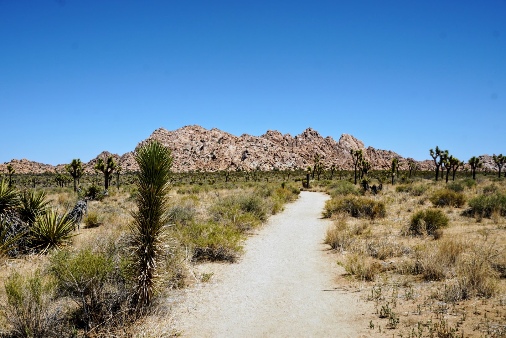
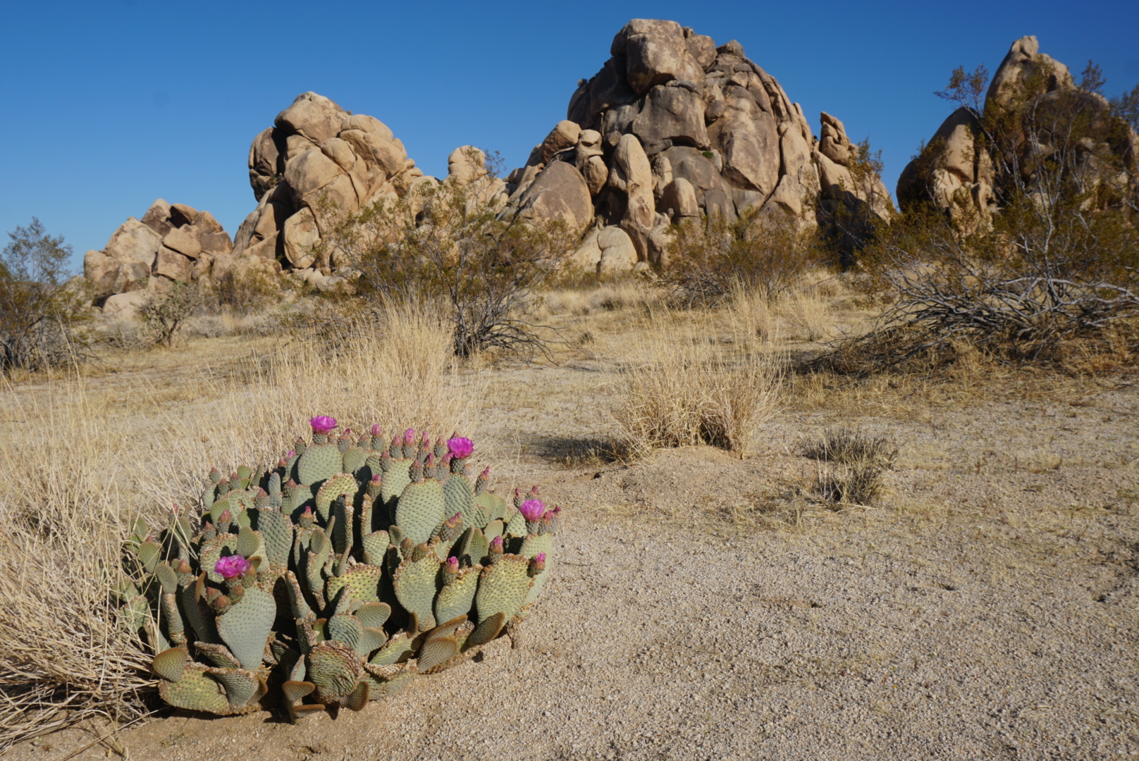
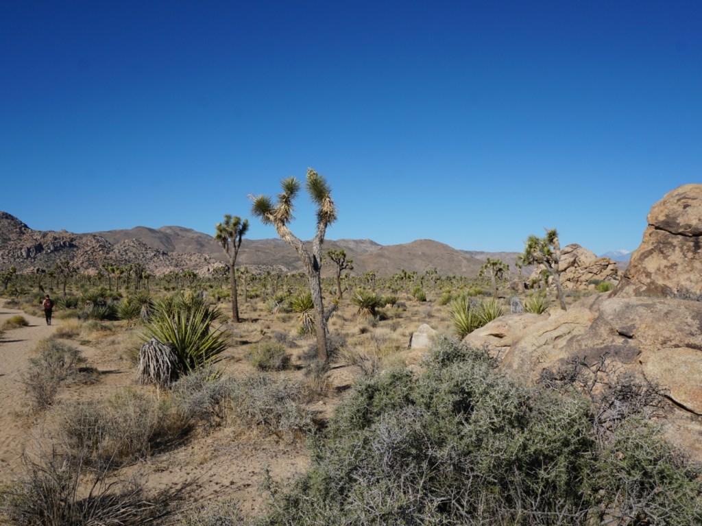
Accustomed to steeper terrain, Emma and I felt as if we were flying over the gentle grades around Keys West. This, combined with fresh legs and a sense of wonder from walking amongst the Joshua Trees, yucca, and prickly pear propelled us to an early arrival at the Willow Hole junction. Impressed with how quickly we were covering ground, we disregarded our late start and decided to take the well-regarded detour towards Willow Hole. A hard right turn steered our course away from the endless flat path across the Mojave and toward the low ridges that dotted the horizon.
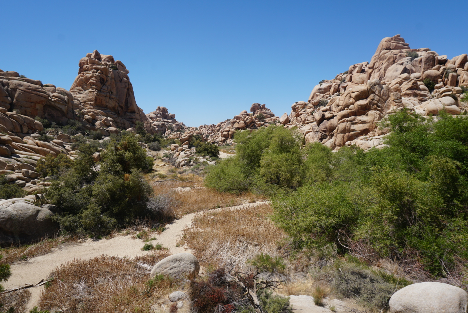
In no time, the trail brought us to a dried-up wash that steadily meandered its way through an opening in the rocky outcroppings. As the sand got finer beneath our feet, the ridges got higher on either side until we were surrounded by what would probably classify as a miniature mountain range. We’d later learn this area was called the “Wonderland of Rocks”. Just as we were discussing how it would be the perfect place to learn to boulder, a couple of dirty guys appeared with crash pads strapped to their backs and waved hello. About a half mile later, we came across a conspicuously green thicket of desert willows, indicating the trail’s terminus. Almost certain that the dense stand of trees was concealing an oasis, we charged ahead until we came out on the other side. Quiet and scenic, we chose this secluded spot to stop for a quick lunch break.
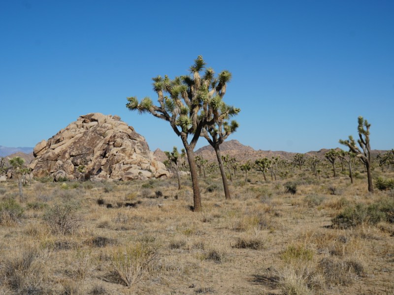
After lunch we did a little exploring, performing our best Bighorn Sheep impressions on the smooth rock. Once tired of climbing around, we retraced our steps all the way back to the junction. By this time, we were in the heat of the day and starting to sunburn despite the frequent re-application of sunscreen. As we walked, I realized my immense gratitude for both the flat terrain and my strategic decision a week prior to trade my man-bun in for a short fade. The flat path through the dispersed forest of Joshua Trees continued for a little over four miles, at which point, the outcroppings began to reappear.
Just like at Willow Hole, a wash emerged as we approached the rocks and gradually the outcroppings grew into mountains even larger than before. Soon we would find ourselves descending from the high plateau via a narrow canyon. The descent offered some impressive views of the distant Copper and Bullion mountains, and even more importantly it provided some occasional shade. After an hour of hiking and a few water breaks, we reached Indian Cove at the base of the mountain range. Here we were faced with a flat, barren valley dominated by dirt, prickly pear, and desert scrub. The remaining hike to the trailhead was unremarkable, especially since we knew we were turning right back around. Determined not to cheat the mileage however, we continued the whole way.
By the time we reached the trailhead, the sun was starting to get low. An anxious sense of urgency started to set in as we were still miles from where we intended to stop for the night. Quickly, we hopped back on the trail and into the mountains, following the Boy Scout all the way to its junction with the Big Pine Trail. At this point daylight was nearly gone, but the idea of covering some new ground beyond the Boy Scout was tempting. In the end, curiosity won the day and we took the detour, hiking another mile or so until it was too dark to continue. There was no shortage of flat, sandy ground, so after pitching the tent and devouring a dinner of packaged tuna, we settled into a comfortable sleep.
Day Two: Big Pine Trail to Keys West Trailhead (7.0mi)


At 2am, the jarring sound of a phone alarm signaled the beginning of our second day out on the Boy Scout Trail. Though we planned to get an early start, the purpose of the alarm was not to hike, but rather a reminder to check for stars. While alarms aren’t usually a necessity given the quality of sleep one gets on a thin camping mat, Joshua Tree was an International Dark Sky Park and after our experience in overnighting in Canyonlands we didn’t want to risk missing the display.
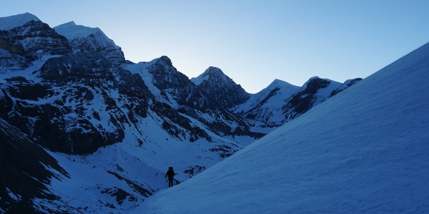
As the brain fog cleared and I was able to take stock of our surroundings, I was stunned. There were few stars, but the mountain range we were sleeping in was completely illuminated by an eerie glow. Without taking hardly any time for my eyes to adjust, I could see seemingly for miles from the threshold of my tent. Directly above, a new moon hung, casting a shadow-less radiance across the range. It felt as if I were looking through a telescope, the texture and impressions on the moon were clearly visible to the naked eye. Though it was far from what was expected, the alarm had proven to be well worth it, even if the concentrated moonlight made falling back asleep quite difficult.
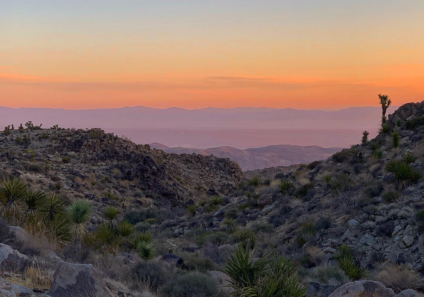
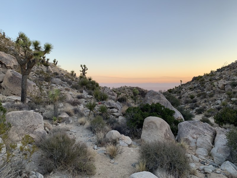
Just a few hours after dozing off for the second time, we woke again. This time the sky was painted by a soft violet hue by the pre-dawn sun. Estimating that we were only a few tenths of a mile from the end of the Big Pine, we decided to hike the last bit without bringing packs or deconstructing camp. We figured the more arduous tasks could be saved until the sun was up and our blood was flowing. Sure enough, we reached the end of the trail within fifteen minutes. It was marked by a low, green pine that stood out against the brown and grey palettes of high desert rock. Just past the pine was a wide gulley that led to a view of the distant mountains and the valley of Twentynine Palms. At any other time of day, the vista would have resembled those we had seen the day prior. However, at the crack of dawn, it revealed a colorful sunrise that justified waking up for it. After enjoying the peaceful scene for a few minutes, we made our way back to camp, packed up our gear, and once again began following that narrow path across the wilderness.
Gradually, as if carried away by the cool morning breeze, our remaining mileage began to dwindle. Preoccupied by the sights and sound of a Mojave morning, we hardly spoke as made our way back towards the car. As advised, we kept a keen eye and ear out for the sign of a Bighorn Sheep or rare desert tortoise. We had been told they were most active during the mornings, but aside from the birds returning to the yucca and a lone black-tailed jackrabbit, the desert was still. No later than 24 hours after we had arrived the day prior, we found ourselves strolling back into the Keys West parking lot. After providing a quick trail report to those about to embark on their own adventure, we climbed back into the car and were off in search of a cold drink and much-needed shower.
Alternative Route
While we thoroughly enjoyed our experience on the Boy Scout Trail and were able to add in some variety with the Willow Hole and Big Pine extensions, I am a strong believer that loops or lollipop hikes are always preferable to an out-and-back. Unfortunately, it was not until after our adventure that I learned of an alternative route that can be created by stitching the Boy Scout Trail together with some of the other nearby trails.
If you only have one vehicle and want to avoid retracing your own steps, I would strongly consider testing out the following 14.2 mile route. It can be completed in either direction. The route does involve small sections of road walking and skips over the Indian Cove portion of the Boy Scout Trail, but in my opinion that was the least impressive section of our trek.
Sample itinerary:
- Start: Keys West Parking Lot –> Big Pine Trail (still consider the Willow Hole extension)
- Big Pine Trail –> Maze Loop Trailhead
- Maze Loop Trailhead –> Bigfoot Trail
- Bigfoot Trail –> Quail Springs Historical Trail
- Quail Springs Historic Trail –> Quail Springs Recreation Area
- End: Quail Springs Recreation –> Keys West Parking Lot (via road)
More details about the route can be found on its AllTrails page at this link.

