Length: 96mi (154km) Days: 5-7 days Difficulty: Easy (well maintained trails, facilities present along the way) Gear: Standard gear Completed: July 2019
In summary: Regarded as perhaps the best hike in the United Kingdom, the West Highland Way allows for a humble, yet immersive journey across a timeless landscape. Choose your adventure: take part in the rich culture of the trail and indulge yourself with cozy trailside pubs and lodges, or embrace the independent nature of your inner Highlander and revel in the solitude of wild camps. Whichever you prefer, the blue lochs, conic hills, and rural farms of the Scottish Highlands will transport you to another time, when kilted warriors by the name of MacGregor or MacDonald fought for control over this rugged, but beautiful terrain.
Preparation / Know Before You Go
Pick your pace. The West Highland Way is a great trek for both beginners looking to soak up some time on the trail, as well as ultralighters hoping to zoom on by. The route is divided into 8 sections that can be conquered in any number of ways. The West Highland Way Trail Association has some suggested itineraries that I would recommend for your planning purposes. For the record, we opted for a slightly modified version of ‘WHW3’.
Bring bug spray and a head net. This is the golden rule for comfort along the WHW. Especially near the lochs and wetter sections of the trail, evening swarms of biting flies called ‘midges’ made setting up camp unbearable. These critters come out in the thousands and can fit through mesh head nets if standing still, so bring spray and work fast!
Bring a raincoat and duck’s back. Fog and rain are WHW staples and we certainly encountered this predictably unpredictable weather over the course of our journey. So bring proper rain gear, and be sure to store it top of pack!
Book lodging in advance. By no means do you need a hotel during this journey, but if your heart longs for a stay in a quaint B&B on the Scottish countryside, then get a reservation. Around 30,000 people will complete the full route every year, so you can imagine that all the boutique trekker’s hotels sell out quickly.
Buy a trail map. They can be purchased in most of the small outdoors or trinket shops in Milngavie. They make for great souvenirs and will point out side-attractions / points of interest that a GPS or phone map may not.
Day One: Milngavie to Drymen (11.8mi)
I cannot think of a more auspicious way to start a long hike than beginning in the town of Milngavie, Scotland. After disembarking our morning train from Glasgow, we instantly fell in love with the village that seemed to have sprung up around the trailhead. The town was cute and everybody around us wore a broad smile, offering up words of encouragement as our loaded backpacks gave clear indication of our intentions. We had made it no further than 30 yards down the red brick road when an elderly gentleman stopped us and demanded to take our photo underneath the ‘famous obelisk’, marking the origin of West Highland Way. After a quick pastry stop at a local bakery that was just too tempting, Annelise and I commenced our journey.
The first day on the Highland Way is a rather plain, but enjoyable necessity. Though on the fringe of the rugged highland wilderness, Milngavie is still connected to Glasgow metro, and as expected we had to work our way out of the inhabited areas. The day was perfect however, and with the sun shining bright even the journey across the transect was energizing. As the day drew on, sheep farms slowly replaced suburban homes, and soon we found ourselves out in the plains. What struck us immediately was the vibrant green hues of the local grasses. It felt as if we were viewing the world through a filter.
Around 4pm we stopped for a relaxing break along a scenic trailside river. The afternoon had proven to be rather hot, so a quick dip in the cool waters did us wonders. Fully refreshed, we tackled the final few miles in a single push. At Drymen, we ran across a backpackers campsite where, for a few pounds, we could enjoy a flat backyard spot with a shower, clean bathroom, and good company. We accepted the offer and spent an unusual night under the sun. Given our northerly position and proximity to the solstice, the sun would not set until 10pm., and then it would reappear promptly at 4am. This definitely took some getting used to.
The plains of Dumgoyne, just beyond the Glengoyne Distillery and eclectic Beech Tree Inn
Entering the rural highlands
Our riverside resting spot
A lonely farmhouse near Drymen
The last mile into our first night’s camp
Day Two: Drymen to Rowardennen (14.9mi)
We were fortunate to begin our second day on the trail much like we did the first, in gorgeous morning sun. Though that sun rose before it was welcomed, the warmth we felt at 7am made packing up early much more achievable than on prior trips. The hiking picked up right where we had left off the evening prior, making our way across rural sheep farms. What was interesting to us was that in order to traverse each farm, we would have to pass through a series of private iron gates to ensure no animals broke free of their expansive pens. It was a unique set up, but it was inspiring to see such a healthy partnership between the trail association, hikers, and local farmers.
A few hours into the morning we passed through the final rusty gate, and found ourselves staring down a scenic expanse of low grassy hills. It appeared we were moving further from civilization and closer to the heart of the highlands. After steadily moving over and around the series of hills, we reached a viewpoint from which we could see the shining blue waters of Loch Lomond below. Energized, we made for the shores, which we reached in about 45min.
Where the trail met the loch, we ran into a small town called Balmaha, that was evidently a popular jumping off point for tourists moving deeper into the Trossachs National Park. We stopped for a moment to watch dinghies, ducklings, and kayaks move lazily in and out of the town’s tiny bay before continuing the WHW along the Loch’s shore. The rest of the day was quite crowded, but enjoyable all the same. We never strayed far from the shore over the final 6-7 miles and the views were great. It was tempting to join the vacationers, soaking up the afternoon sun on pebbled beaches, but we were on a mission. Eventually we reached Rowardennen, where we camped in a shaded site not far from a backpacker’s youth hostel. A consuming swarm of biting midges put the only damper on the day as it limited bathing / cooking options, but before long we were comfy and cozy within the safety of our tent.
A grassy knoll not far from Drymen
A fern covered field providing plenty of food for grazing sheep
Rolling green hills and a clear walking path
A small natural creek, irrigating the green fields nearby
Loch Lomond from above
A scenic sheep farm on the way to Balmaha
The shores of Loch Lomond
Day Three: Rowardennen to Inverarnan (14.0mi)
The third day on the trail was a tale of two halves, though unfortunately our slow start in the morning meant that we would complete a majority of our hiking during the less pleasant second half. We woke late to the sun shining off the calm surface of Loch Lomond, and then packed up quickly to minimize bites from the ever-present midges. The hiking for the day was straightforward, a direct path along the shore of the 24 mile long loch.
Probably around noon, a thick fog started to roll in over the surrounding hills, providing an ominous setting to go along with the eerie silence of the great loch. We had the trail to ourselves, but the atmosphere inexplicably compelled Annelise and I to speak in hushed tones so as not to disturb the fragile peace. A few hours in, we came across a set of landmarks that added some intrigue to the days walking. The first was a batch of moss covered stone ruins that we later learned were likely the remnants of a illicit 18th century whisky distillery. The second was a sign indicating the presence of Scottish outlaw Rob Roy MacGregor’s cave. As alleged descendants of the MacGregor clan and Rob Roy himself, we looked hard for the cave, but were not able to spot it via the short side hike. Still, coming to wander the lands of our ancestors and getting to sit steps from where Rob Roy hid out from the Duke of Montrose was a meaningful and unforgettable experience.
The latter portion of the day was a little bit of a blur as the fog turned into a downpour and sullied the mood. Despite an attempt to wait out the storm in a cozy backpackers room at the Inversnaid Inn, we ran out of time and were forced to continue with our rain jackets and duck’s backs drawn tight. The dark clouds and distorted sunlight made for some great photographs and the rain helped us comprehend the region’s vibrant green character, but otherwise we moved as quickly as possible. By mid-evening we reached the northern terminus of the Lomond, paused for a minute to take the view in, and continued to Inverarnan. There we were pleased to find a local pub and large campground, near full up. We paid a small rental fee for one of the last spots, grabbed a drink, then enjoyed a good night’s sleep.
The lakeside trail
The Wee Bruach Caoruinn farmstead and distillery ruins
Another section of the Wee Bruach Caoruinn ruins
The clouds over Loch Lomond from the Inversnaid Inn
The sign indicating the footpath towards Rob Roy’s Cave
The alleged location of Rob Roy’s Cave
Further along the West Highland Way
The north end of Loch Lomond
Day Four: Inverarnan to Tyndrum (12.0mi)
Once again, we were slow to leave camp in the morning. The exposure to the elements from the day prior had left us tired, and the general lack of a proper night made it difficult to wake at a true dawn. Unfortunately, if was clear from when we did wake up that we had another wet day ahead off us. Nonetheless, having left Loch Lomond, we were in for a change of scenery and that made the walking quite enjoyable.
We began the day following the River Falloch, which was among largest of Lomond’s countless tributaries. This path led us north and further into the green moors so well associated with Scotland’s highlands. Every once in a while we would pass a small village or lone farmhouse, and many times the trail would take us right through some accommodating local’s property. Occasionally our paths would cross that of sheep, horses, and best of all burnt orange Highland cows with their U-shaped horns and comical bangs. Sadly, none of the cows were very photogenic.
Ancient history lessons were a notable feature of the day as well. Nearing a spot on our map marked as the ‘Kirkton Farmhouse,’ we came across a sign alerting us to a medieval cemetery nearby. As my sister walked ahead, I poked around, astonished to find that some of the burial stones dated back to the 7th and 8th centuries. The cemetery would not be our only discovery of the day however. Nearing our destination of Tyndrum, we crossed through a park known to be a battleground in which Robert the Bruce (King of Scots), narrowly escaped death at the hands of the famed MacGregor clan. In that park we came upon a lochan (pond) where legend has it, the future king threw his heavy sword in order to flee the scene faster. Many have tried searching lochan, but still none have located the lost sword.
After a full and wet day of walking, we reached the small roadside town of Tyndrum. Thoroughly soaked and quite cold, we decided it would be the perfect place to splurge on a hotel room and recuperate before our longest day on the trail. We made do with the last room available at the quaint Tyndrum Inn and relished the luxury of a warm bed.
A lone farmhouse along the trail
A curious horse we encountered passing through private property
The Kirkton cemetery
A small underpass below the railroad tracks
The scenic Scottish railway
A much needed break in the clouds
Day Five: Tyndrum to Kingshouse (19.0mi)
Waking up on a mattress after a few long days of hiking can work wonders for morale, and after a classic Scottish breakfast of porridge, toast and black pudding (personally not a fan) in the adjacent pub, we were ready to conquer the long day ahead. After leaving Tyndrum, we quickly found ourselves back in the open countryside. The small rolling hills we had grown accustomed to were also steadily getting larger and steeper. Some had reached grades at which the all encompassing green grass could no longer grow on the slopes, and I would have ventured to classify them as mountains or ‘beinns’ in Gaelic. The fact that we had left earlier than other days also meant that the day’s walking would be a more social experience. Trekkers always tend to be a morning crowd, so we ran into a few small groups on the trail, chatted them up, and asked for photos when we could.
Around noon or so, we reached tiny riverside town Bridge of Orchy. Clouds had been threatening us with rain all morning, but since they had so far held up we decided to push onwards and defer our break until we reached Inveroran about two miles further. Fortunately, our gamble paid off and we reached the classic Inveroran hotel just as the rain finally broke through. We spent a long afternoon break in the inn’s rustic pub. I enjoyed some pints and talked another WHW couple while Annelise, who was feeling a little under the weather, slept in the booth. Once sufficiently warm, we strapped up and continued along the way.
The latter portion of the day was long and lonely, but fortunately very flat. Though still early afternoon, clouds had blanketed the sky and I believe convinced many of our fellow hikers to hunker down at the trailside inns. Remarkably, as Annelise and I traversed the Highlands for another 10 miles or so, we were spared any serious rain until the last half mile. The air was misty and the ground wet, but it was more than we could ask for. Until we made made camp mid-evening, we enjoyed fast-paced walking, beautiful scenery, and complete solitude. Nothing moved on the moorland aside from tall grass blowing in the wind.
A river crossing near the aptly named Bridge of Orchy
Encounters with other hikers are always a photo opportunity
The expansive highlands south of Inveroran
A small forest tucked in amongst the hills
The open highlands
The long road towards Kingshouse
Our campsite at Kingshouse
Day Six: Kingshouse to Kinlochleven (9.0mi)
Though slated to be our shortest day on the West Highland Way, we were under no impression that Day 6 would be our easiest. As we sat in our tent and examined the map, the words ‘Devil’s Staircase’ jumped off the page, surely indicative of a formidable climb. Nevertheless, we emerged to a beautiful campsite (perhaps my favorite of the trip), packed up our things, and seized the day.
The morning’s hiking began in the shadow of the prominent Buachaille Mor (or ‘Stob Dierg’), a mountain that when viewed from the east resembled a perfect pyramid, with its bare rock peak protruding from the green valley floor. As we made our way through the valley and around the mountain, the view slowly changed and passable climbing routes emerged on the back side. Before long, we arrived at the Altnafeadh car park, where we joined a set of enterprising day hikers who had journeyed across the highlands with the sole purpose of conquering ‘The Devil’s Staircase’. As expected, the journey to the top of the staircase was arduous. The path consisted of a long set of switchbacks that were deceptively steep. The only thing the climb had going for it was that the zenith was clear and no false peaks stood in the way of our eventual success. After a 45 minutes or so of hard work, we reached the top of the staircase and stopped for lunch in a windy spot with panoramic views of the surrounding moors and mountains.
After eating, we descended the saddle of the mountain on the following side and made our way downhill towards Kinlochleven. Immediately after crossing over the Devil’s Staircase, we could see our environment starting to change. Large conic peaks still dominated the horizon, but the bare green moors we had grown accustomed to were soon substituted for equally green forests that thickened as we approached the valley town. Making quick work of the favorable decline, we arrived just before dinner. It was the perfect place for us to spend our penultimate evening on the trail. The old mining town appeared to be right out of a postcard. Antique smelting furnaces juxtaposed against bright colored row houses with well-manicured lawns and garden gnome collections. Eventually we located our campsite, a riverside inn with an attached pub, just steps away from where the trail resumed once more.
Buachaille Etive Mor (‘Stob Dearg’) as viewed from camp
A closer look at the pyramidal Buachaille from across the moor
The oft-photographed Lagangarbh cottage, alone in the valley
Smiling through the pain halfway up ‘The Devil’s Staircase’
Atop ‘The Devil’s Staircase’ saddle
Beyond the saddle, headed towards Kinlochleven
The River Leven valley
The view from The MacDonald campground on the shores of Loch Leven
Day Seven: Kinlochleven to Fort William (14.9mi)
On the morning of Day 7, an unusually high amount of condensation and relative lack of daylight signalled to us from inside the tent that that some adverse weather had overtaken our beautiful little valley overnight. We were relieved to emerge and find that it was just an episode of particularly thick, oppressive fog. Still, as is the norm on the last day of a long journey, we ate breakfast quickly and were roaring to go. The density of the fog was such that water accumulated on our clothes just moving around outside, but beyond the five extra minutes we spent waterproofing our supplies, it did nothing to slow us down.
Our 15mi. push for the day began as we reluctantly trudged up the nearby hillside and out of the secluded Kinlochleven valley. Before long however, the road leveled and we were in the base of a new alpine valley, following a channel that had been carved by millennia of runoff. Over the course of the day, we would alternate between untamed moorland and rural pasture, every once in a while passing near a ruined homestead. The solemn tone set by the fog added to the imagery, and gave the impression of travelling through time over an ancient land once traversed by my ancestors. This feeling was only amplified as the day went on and we approached the open green hills that had served as the natural set for Mel Gibson’s Braveheart.
Around early afternoon, the fog finally abated enough to reveal two great sights. One being the nearby peak of the formidable Ben Nevis mountain, the tallest in the United Kingdom. The other being the outskirts of Fort William in the valley below. After a quick side trek out the the ruins of an iron age fort called Dun Deardail (would not recommend as little could be seen of the yet un-excavated fort) , we caught our second wind and pushed on at an anxious pace. Before long, we had fully descended from the mountains and found ourselves road walking through the charming maritime town. A mile or so later we passed mile marker 96, entered the iconic Gordon Square, and then snapped a few photos before plopping down on the commemorative hiker’s bench nearby. It was the perfect end to an imperfect, yet unforgettable highland adventure. A glass scotch from a local distillery over dinner would then round out our authentic Scottish journey across the famed West Highland Way.
Kinlochleven shrouded in morning fog
Ruins of an old Scottish homestead
The outskirts of Fort William from the mountain
Ben Nevis, the peak of course disappeared for our photograph
Length: 147mi (237km) Days: 12-14 days Difficulty: Expert (no maintained trail, potential for extreme weather, limited support / rescue options) Gear: Standard gear, consider a 4-season sleeping bag Completed: May 2019
In summary: I have had the fortune of trekking a few of the world’s best backpacking routes and I can definitively say the Drakensberg Grand Traverse, or DGT as it is colloquially known, has been the most difficult I have ever been on. There is no better way to earn your thru-hiking stripes than battling rough terrain, extreme weather, altitude, and the infamous chain ladders in one of the most remote places left on earth. All great things in life are earned however, and the chance to experience a sunrise while camping along the “edge of heaven” is well worth it.
Preparation / Know Before You Go
Bring a GPS & PLB: The DGT is unmarked and unmaintained so a GPS is required. There is no set route for the trail, so the journey may vary significantly depending on where you source your coordinates. Shoot me a message through the contact form on this blog and I will happily send the ones that we used for a 12-14 day adventure. I would also recommend bringing a personal locator beacon (PLB) if your GPS doesn’t have one, as rescue in the case of emergency is difficult.
Bring appropriate gear for the elements: Technically, the DGT can be done year round. That being said, the trail is subject to extreme weather in all seasons. As moist air comes in from the ocean and runs into a 3,000ft. wall of rock along the escarpment, weather patterns can change rapidly and become quite dangerous. May through June is generally regarded as the sweet spot for trekking. You can go earlier when it is warmer, but precipitation levels tend to be much higher and you are at risk of getting caught in what I have been told are spectacular lightning storms. July & August are still considered to be part of the high trekking season, but always check the weather in advance because occasional blizzards from June – September can be severe. The good news is that these snowstorms tend to be quite predictable.
Exercise caution when passing through Basotho settlements: Getting to witness the lifestyle of these herdsmen is a highlight of the DGT, and most versions of the trail will bring you by some of their primitive huts and peat farms. As these isolated encampments are not occupied year round, most we passed through were empty. When they were in use however, many were guarded by loyal dogs. As herd theft is apparently quite common amongst the tribesmen, these dogs are trained to keep suspicious passersby at bay. We never had any issues ourselves, but I would recommend keeping some distance between yourself and the huts if you notice they are being occupied.
Keep boots in your tent: All of the Basotho herdsmen we encountered on our two day journey were genuinely friendly and curious people. Many paid us no mind after quickly passing to ask if we had and cigarettes or marijuana. In preparing for the trip however, I read a few accounts of petty boot theft. These accounts were corroborated by the only other backpackers we encountered on the trip, who were Drakensberg veterans. As a precaution, I would recommend bringing your boots inside at night.
Filter your water: This advice is not as obvious as it should be on almost all other treks. Lesotho is actually touted as touted as having some of the purest, safest water in the world, and by most accounts it is safe to drink without treating. I still believe this to be true, but anecdotally I wound up very sick with a viral infection days after returning to the United States from South Africa. It is far more likely that I picked up the illness in Johannesburg, but if I were to trek the DGT again I would not risk it.
Pronunciation: If you want to fit in with the locals, you should know it is pronounced ‘d-rah-kens-burg’ not ‘drake-ens-burg’.
Day One: Sentinel Car Park to Kubedu River (9.0mi)
The first day of our adventure along the border of South Africa and Lesotho began with an unexpected van ride from the quaint Witsieshoek Mountain Lodge to the trailhead at the Sentinel Car Park. The night before we had attempted to reach the car park in an Uber from Johannesburg, only to get stuck in a large pothole on an unpaved road. After a substantial bit of work in the dark, we were able to free the poor driver’s car from the ditch and reverse it back to the pavement. Stranded and still a few miles from where we intended to camp, we set our course for the nearby lodge. Fortunately, once there, we were able to convince the exceptionally kind and motherly night manager to let us pitch our tents near the maintenance shed for just a few rand. In the morning, we would catch a shuttle to the trailhead with handful of other guests who had come to explore the Royal Natal National Park.
Upon arrival at the park, our frustrations from the evening prior melted away as we stood in the shadow of the grand Sentinel Peak. Filled with anticipation, we paid our park entry fee, and took off for the escarpment. From below, the massive rock formation looked like something out of a fairytale. A natural castle wall, protecting the mysterious kingdom of Lesotho from the wild lands below. After a massive set of switchbacks, we stood at the base of sheer cliff face, with the route’s infamous chain ladder before us. Nervously, we strapped all our gear in tightly and began the lengthy two-part climb to safety at the top of the escarpment. Most of the way up, I was torn between pausing to soak in the experience and just wanting to get myself and my pack to stable ground. Once at the top, we paused to acknowledge the insanity of the experience and to gaze out at the incredible view from the escarpment. We were in a new world, a rocky scrubland seemingly miles above the rolling green hills below.
Continuing on, we knew we were likely to fall far short of Rat Hole, where we had intended to camp night one. The debacle from the previous night and the time intensive chain ladders had put us well behind schedule. Still, we were positive and moved as quickly as possible across the top of the plateau, guided by our GPS. The land was desolate and we enjoyed the solitude. From the ladders to camp, our only companions were a set of baboons, wild horses and a lone jackal, far in the distance, who fled as soon as he sensed our presence. About 3.5mi from our intended destination, we elected to stop as daylight started to wane. We camped near a scenic river and went to bed anticipating a long attempt to make up for lost time the following day.
Sentinel Peak from beyond the car park
Royal Natal National Park, South Africa
The edge of the escarpment, new Sentinel Peak
The chain ladders
The second set of ladders
The end of the chain ladders
Looking out from atop the escarpment
Lesotho, near the edge of the plateau
Day Two: Kubedu River to North Peak (13.8mi)
In all my days of backpacking I am not sure I have ever woken up so ready to get moving again. The night was miserable. Soon after we fell asleep, the temperatures outside plunged and everything froze. I hadn’t worn all of my layers, given it was well above the freezing point when we went to sleep, and I woke up around 1:30am shivering uncontrollably. The rest of the night was spent curled in fetal position, trying to get warm enough to fall asleep again. As we investigated the situation in the morning light, we found that both the insides and outsides of our tents were coated in a layer of frost. Our water bottles and filters had turned into bricks as well. We packed up quickly and set off at a quick pace in order to get the blood flowing again.
As the day drew on and our bodies warmed up, we started to better appreciate the scenery around us. For miles, all we could see were beautifully pristine rolling grasslands. When the sun finally breached the smooth peaks to the east, the plateau was bathed in a soft light that highlighted the thin blue streams cutting across the terrain. Eventually, the temperature rose to a point that we felt comfortable shedding our layers. By 11:30am, we reached Rat Hole. This validated our decision to stop short the night before. Even from our vantage point at the top of a hill, the waymarked cave that we were supposed to sleep in was nowhere to be seen.
After Rat Hole, we didn’t stop again until we reached the edge of the escarpment. There we sat for a long lunch while taking in expansive views of the South African wilderness below. The second half of our day was a relative blur. Post lunch, we made our best attempt to get back on schedule by pushing as quickly was possible. This goal was hindered by the relative instability of the terrain however. Over time, the rocks and lumpy scrub brush blanketing the floor took a toll on our ankles and lessened our pace. Approximately two miles from our intended campsite we decided to call it a day. Dusk was fast approaching, and we had just found the first instance of suitable terrain that we’d seen for miles. After quickly pitching my tent, I wandered to the top of a nearby hill where I could sit and take in an ethereal sunset. The sun disappears so fast in Lesotho, but not before briefly illuminating the entire cloudscape in a vibrant mix of red and orange tones.
Morning frost in camp
Condensation formed a layer of frost inside the tent as well
A tiny waterfall and pool, we would have swam had it not been so cold
Approaching the escarpment from the east
The rolling hills of Lesotho
A look at the jagged South African mountains beyond the escarpment
We would hike the rim of the escarpment all the way to the opposite ridge
The hills at dusk
My best attempt at capturing a DGT sunset
Day Three: North Peak to Ndumeni Cave (13.8mi)
In order to try and get ourselves back on schedule, Ben and I agreed that it would be prudent to get an extra early start to day. This made for a real grind, but fortunately we had gotten some much needed rest the night before and were up for a challenge. We walked from before dawn till after dusk. This afforded us the chance to really experience the beauty of the untouched landscape in all lights of the day. The dramatic shadows cast by the escarpment and surrounding peaks offered a type of eerie setting that I had never experienced before. It reminded me of the iconic “everything the light touches” scene from Disney’s Lion King.
After hours of tiptoeing the edge of the escarpment, dancing along the naturally imposed border between South Africa and Lesotho, we reached Ndumeni Cave. Once again, the cave was nowhere to be found. We never seemed to have much luck finding the caves on the grand traverse, but we were more than content pitching our tents on the flat land near our GPS waymark. Dinner was a little bit of a challenge as we struggled to get our stove hot enough to cook our rice and soup, but eventually we worked it out. As I sat at the threshold of my tent in the consuming darkness, I couldn’t help but wonder at the constellation of lights from distant farmhouses miles beneath us. It was humbling to think of the thousands of people going on with their evenings as usual, as we sat perched, thousands of feet above them, in perfect solitude.
Sunrise from camp, above the clouds
A steady uphill climb along the border
A lookout along the escarpment
Panoramic view of southern Lesotho
Horse skull next to the trail
A heavenly break in the clouds
Day Four: Ndumeni Cave to Nkosazana (14.1mi)
Day four on the Drakensberg was a day of firsts. Notably, it was the first day in which we were hiking according to our original itinerary. This was welcomed, but by no means signalled an easy day ahead. We began our morning by hiking along a thin ridge for about 300m. with a slick rock face on our right and the precipice of the escarpment on the left. It was a nerve-wracking and tedious portion of the trail, as one misstep would clearly result in your demise a couple thousand feet below. On the bright side, the views were incredible from our precarious position.
After clearing the ridgeline and returning to the rolling highland terrain, we had our second first of the day. After walking along the banks of a small stream for a mile or so we noticed our first (and last) Lesothan tree! For a few days we had been discussing theories of why the landscape was so devoid of trees, but this observation shifted the conversation to questioning how this lone tree had gotten there and managed to survive clinging to the edge of the eroded riverbank. This did last long however, because in no time we were out of breath, struggling to finish our second 2,000ft. climb of the day.
The last significant first of the day was our first human encounter. Some time in the early afternoon after finishing a steep climb and subsequent descent, we paused to refill our water and rest at a crystal clear stream near a flock of sheep. We were not there long before two young Basotho herdsmen with their dogs came out of nowhere to greet us and ask if we had any sweets. We told them we didn’t and after that they just sat nearby, observing us while we filtered our water. They were dressed in tribal garb that you would expect to see on the cover of a National Geographic magazine. Each of them had rust colored robes, wool blankets draped around their shoulders, and loincloths. They also wore heavy white rubber boots that stood out amongst the more modest attire. After 20 minutes or so of sitting in silence, they hailed their dogs, bid us farewell, and left to move closer to the sheep herd.
We were certain that would be a our last encounter of the day, but ultimately we were wrong. After setting up our camp in a shallow valley under the cover of nightfall, I took my lantern to a nearby stream to get some water for cooking. When I turned to navigate back, I saw two faint lights on the hillside. Disoriented, I moved towards the one that didn’t happen to be Ben’s. As I crept closer, I heard voices coming from inside a small cave and so I decided to announce my presence. To my surprise, I was greeted with an enthusiastic reply in English. Inside, I met two South Africans, one 25 and the other 50-something, who would be among the most interesting trekkers I have ever met. It turned out they were DGT regulars, drawn to the emptiness and lawlessness of Lesotho. After Ben joined, we sat for dinner with them while the older fellow regaled us with incredible stories of lightning storms, the herdsmen, and other misfortunes on the trail. A favorite was his tale of getting into a stone throwing match with a group of Basotho herdsmen who had been on their way to raid another tribe. We also learned about the co-dependence between the herdsmen and their dogs, who were used to protect herds from troublesome jackals. Everytime our new friend would get to the climax of a story or deliver the punchline to a joke, he would let out a loud “YOPE” which was a trademark expression of his. I’d been reading Jack Kerouac’s On The Road while hiking, and couldn’t help but draw parallels to the character of Dean Moriarty.
Camp at dawn
Looking out over the escarpment
As close as the wild horses would ever let us get
Never far from the edge on the DGT
Day Five: Nkosazana to Injisuthi (12.0mi)
We awoke on day five both refreshed, as a result of our great evening the night before, and with a little sense of dread. They day would start and finish with two ascents, each over 1,500ft. To make matters a little worse, my feet had become infected as a result of the damp conditions. The night before, in an attempt to cope with the intense cold, I made the mistake of putting socks on at night while my feet were still damp from fording small rivers. I went to sleep with standard blisters on my toes, but woke up with a bloody infection that had spread to the arches of my feet as well. From this point on, I made a point to air them out whenever possible.
Unexpectedly, I found our first early morning summit to the top of Champagne castle, at almost 11,000ft. to be welcome. The huffing and puffing got the blood flowing and was instrumental in shaking off the effects of another frigid morning. At the top, we again were blessed with a fantastic panorama of the escarpment. To our left, we could see the shadowy peaks and ridges from where we had come, while to our right, we gazed upon the pronounced and seemingly untouched terrain we were about to traverse. Lesotho and the highlands it shares with South Africa may be one dimensional, but the landscape truly is unlike anything I can imagine seeing elsewhere in the world.
The rest of the day’s walking was expectedly difficult, but we did survive. Every time we passed evidence of Basotho micro-villages and huts, I would think back to the remarkable things we had learned in the cave the night before. As our own Dean Moriarty had put it, travelling through this part of Lesotho was truly like traveling back in time 500 years. Our final campsite at Injasuthi left much to be desired as it was uneven, rocky, and constantly exposed to what felt like hurricane force winds. Tired enough, we settled down nonetheless. I guess that is just the price you pay for 270 degree views and the ability to sleep steps from the edge of the world.
A rock cairn, apparently used by the Basotho for navigation and to serve as a human-esque jackal deterrent
Sunset from the Injasuthi campsite
The condition of my feet following the infection
Day Six: Injisuthi to Langalibalele (11.8mi)
On day six, we woke ready for what was projected to be an easier day on the trail and it was glorious. We had weathered the windstorm from the night before and left camp excitedly knowing that we had no steep sections between us and Langalibelele. The GPS path took us along some lazily winding rivers and we made quick work of the section given the relatively smooth terrain. The views were more of the same, but it was sunny out and probably somewhere in the 60’s (fahrenheit) which felt comparatively amazing. The warmth and the easier walking gave us a chance to talk and really soak in the beauty around us.
We stopped for lunch at a great riverside spot, sitting before shimmering set of reflective pools. As we ate and washed our clothes, we were joined by friendly tribesman who sat on a small ledge just above us, peacefully weaving a basket and observing our movements. He beamed a smile every time one of us would look up and acknowledge him, but was otherwise silent.
Due to the long lunch break, we still came into camp around dusk and set up at Langalibelele not too far from the escarpment. A strange weather pattern was doing unique things to the clouds along the edge of the cliffs, so after pitching, I laid down my pack and went to check it out. The sight was unbelievable. The wind coming heavily off the Lesothan highlands were suppressing the rise of thick clouds making their way in from the lowlands. The effect made it so that we were sitting above the cloud cover, only 100ft. from where the miles long layer began. I ended up scaling a nearby peak to get an even better view and snap photos. From my new vantage point, I could take in the contrast of the soupy storm clouds before me, and the perfectly clear sunset behind. As darkness started to fall, I euphorically scampered back to camp to eat dinner. Within 30 minutes, the black sky was illuminated by a stunning display of bright stars. It was the perfect end to a perfect day in the Drakensbergs.
A Basothan hut and peat farm
The reflective pools by our lunch spot
Moving through an uninhabited settlement
Approaching Langalibalele
Clouds blowing off the escarpment
Another view of the clouds along the escarpment’s edge
Looking out over the edge
Day Seven: Langalibalele to Loteni Camp (11.5mi)
Restoring balance to what was a perfect night before, the temperature plunged shortly after we fell asleep and this made rising at 6:00am near impossible. On the bright side, the infection in my feet appeared to be subsiding. They still were bloody and painful, but the receding infection gave peace of mind that I was not in any serious trouble. The first section of the day was tough. We started by crossing directly over a sizeable hill where the shrubs had grown high enough that some bush-whacking was required. Once we descended down the ridge on the opposite side however, it was mostly smooth sailing.
The true distance between the two camps turned out to quite minimal, and by lunch we were actually almost done with the progress that we had to make. The GPS had us taking a 3.5 mile out and back journey to the tip of a thin promontory ridge that jutted far beyond the escarpment. We decided to take this detour, but not before stashing our packs in a suitable hiding spot underneath some large boulders. Even without the extra weight, the climb was tough, but the view from Giant’s Castle as it was called, was well worth it. We sat for an hour or so, catching our breath, talking, and looking out at how the evening sun cast its long shadows on the national park below. Eventually, we hustled back to our gear and set up camp at Loteni just before dark. We had another two hours or so of magnificent stargazing before the waning moon rose and cast its light across the sky. As long as we had been out on the DGT, the moon had been close to full and intensely bright. At times, it would give the uncanny impression of a flashlight being shined on the tent.
Another pristine mountain pond
Looking east towards Loteni Camp
The view from the tip of Giant’s Castle
Another viewpoint on the way to Giant’s Castle
Loteni Camp
Day Eight: Loteni Camp to Mkomhazi Camp (15.3mi)
Knowing we had one of our longest DGT days ahead of us, we were relieved to look over the topographic map on the Garmin and find that there would be no major altitude changes on the way to Mkomhazi. The terrain turned out to be solid too, and that buoyed our spirits. While hiking the backcountry of the ground traverse, we often found ourselves following along animal trails. These narrow paths were a godsend, as they would save our knees and ankles from having to deal with the toll of moving over the uneven yet rock hard lumps hiding beneath the tall grasses and shrubs. At times, it would appear the GPS coordinates were mapped with the intention of following a particularly well worn horse path. Still caution was necessary, follow the path too long and you would end up way off course. The riverside walk to Mkomhazi appeared to be a more populated section of the plateau, and as a result there was a tangled mess of sheep trails that we could take advantage of.
Despite hearing bells from grazing herds in the distance and passing by a number of huts, we didn’t see our first Basotho until the early afternoon, and when we did, they didn’t fit the profile of our past encounters. As the South Africans in the cave had told us, most tribesman we would meet were young boys (ages 15-25) sent to care for the flocks in winter while the adults retreat to milder climates in the northwest. The men we ran into on day eight, however, were in their 50s, carrying large backpacks, and without the typical attire or dogs of the herdsmen. Immediately, we recognized them as ‘dagga’ (marijuana) smugglers, who are known for carrying large loads down hidden passes in the escarpment to South Africa below. It was quite a sight, but the men gave us no trouble (they are not known to be an issue), passing by with a broad smile and enthusiastic wave.
The rest of the day we continued our flat walk across the plateau, distancing ourselves from the nearby escarpment. We passed by a couple more sets of herdsmen, and for the first time saw a girl amongst them, but nothing else was particularly notable. Aided by the flat terrain, we knocked the mileage out in record pace and for the first time were able to set up camp and relax before dusk. The night was passed as usual, troubleshooting the stove, cooking, reading, journaling, stargazing and just trying to stay warm.
Camp at Mkomhazi, as far as we would ever get from the escarpment
Day Nine: Mkomhazi Camp to Sehong Hong (5.2mi)
Today was slated to be a pretty brutal day, combining a long trek with a trip to the summit of the tallest peak in southern Africa, Thabana Ntlenyana at 14,424ft. (3,480m.) Since we had one day of slack built into our schedule, and were nearing the end of our journey, we decided to treat ourselves to some rest and recovery by splitting the day into two. It was a wonderful decision. Ben was dealing with some stomach issues likely related to our super-fiber diet of oatmeal, rice, and lentils, while the blistering on my feet was spreading despite the infection abating.
Undeterred by our minor ailments, we were up and out at the crack of dawn. Before we even had a chance to get our bearings and settle into another days walking, we were faced with an immediate ascent straight to the top of Thabana Ntlenyana. The 2,000 foot climb took a grueling two hours on the way up, and another 45min. down. While the incline was not nearly as severe as what we had encountered in places like the Annapurna, the steady grade actually just prolonged the struggle. The views from the top of “The Beautiful Little Mountain” as it is called in Sesotho, were great, but the high winds were not, so before long we were back around ~12,000ft. where we decided to pull up and call it a day in a picture perfect spot steps away from a miniature stream.
The summit of Thabana Ntlenyana
The view from my tent window
Though impromptu, one of our favorite campsites of the trip
Day Ten: Sehong Hong to Sani Pass (8.3mi)
We slept in through a chilly night, not waking until around 7:15am and it was wonderful! Every day prior, had risen just before the sunup and would be forced to start the breakfast making and camp teardown process in the frost. Though the morning was far from a warm start to the day, by the time Ben’s alarm went off the worst of the cold and ice had disappeared.
The days hiking began with a quick climb out of our idyllic little valley. When we reached the saddle of the ridge we were crossing, we could see Highway A14 in the distance, our first true sign of civilization since the faraway diamond mine we spotted a week or so ago. We came down a steep hill that turned out to be more treacherous than expected, and then commenced a long, flat walk along the highway to Sani Pass.
Sani, as a town, was not what we expected. It was constituted by 40-50 closely grouped stone huts, 3 tiny craft/souvenir stands, a rundown looking backpackers lodge plus poolhall, and then a fancy hillside lodge charging hundreds of rand per night for rooms. In need of a substantial meal, we beelined for the Sani Pass lodge where we found a bustling pub. It was the perfect place to kill the afternoon and evening. We purchased some large Lesothan beers, ordered double helpings of food, watched rugby, and chatted with a smattering of visitors from around the world. It was a great time and we were reluctant to leave. When we did, our new friends were grimacing as the cautioned us about going back into the cold. The inn was full however, and apparently you are charged to pitch a tent around the town, so we had no choice. After walking about a kilometer to a clearing at the edge of the escarpment, we set up and went to sleep totally refreshed.
Maluti, Lesotho’s premier (and maybe only) beer
Sani Pass Lodge, the Highest Pub in Africa
Day Eleven: Sani Pass to Moon Camp (10.9mi)
The sausage platter, beers, and dose of company we had enjoyed the day prior left us feeling recharged as we got off to our usual early start. Additionally, our hiking had returned us to the escarpment after two and a half days spent more inland, so we did our best to soak up the spectacular views on our second to last day in the Drakensberg. Otherwise, the walking for the day was typical of the traverse. This region of Lesotho proved to be much more mountainous than where we had started in the east, so the day involved a lot of ups and downs. Fortunately, none of the altitude changes were of the 2,000ft. magnitude that we had experienced one too many times already.
We stopped for lunch atop a prominent ridge and ate slowly while admiring the panoramic views. As we were enjoying ourselves and only had three miles left, we debated passing most of the day there, but eventually some strong winds forced us to move on. About a mile or so into the final push, we came across a lone herdsman who greeted us with a very friendly hello as he passed by. As Ben had given up on his oatmeal, he decided to offer it to the young boy. As we caught up to him and passed off the food, we learned that he spoke some elementary English. It turned out he was the youngest boy in his family and had the privilege of attending school in Maseru for a few years. After his brother died however, he was forced to drop out and take responsibility for the sheep herd in the south. Life sounded tough on the plateau. He mentioned constantly having to protect the herd from jackals, and told us a story about having some sheep stolen by other herdsmen who shot rifles at his hut to keep him scared and inside. It was fascinating.
After a half hour or so, the conversation wore out so we thanked him for his company and bid him farewell. By the time we continued on and tackled our last couple miles, it was near dusk in camp. We were positioned in a sheltered bowl, sloping down from a drawn out hill, and the waymarker on our Garmin pointed us to precisely the only spot flat enough to pitch our tents. Once I was set up, I fell asleep immediately and Ben had to wake me for dinner. It appeared that despite my relative comfort towards the end of the journey, I was still just as exhausted.
Dawn near Sani Pass
Another angle from our campsite near Sani
The views from our return to the escarpment
Our new Basotho friend
Ben greeting the herdsman’s dogs
The dogs, thin as could be
Our less than level campsite positioned on the long slope
Day Twelve: Moon Camp to Mzimude Cave (9.6mi)
Though our second to last night felt warmer than usual, I still woke to a frost lining on both the inside and outside of my tent. As I stood shaking it out, I joked with Ben about whether it was actually getting warmer or if we had just frozen all of our nerve endings off over the past two weeks. Spirits were very high as we commenced our final full day in the beautiful, but trying Drakensberg mountains. In true DGT fashion, it would be a tough day of walking.
Much like the day prior, we started with a big ascent and continued bobbing up and down for the remainder of the way. Nonetheless, the anticipation of reaching camp and prepping for a descent into South Africa carried us through. Around 10:45am, we stopped for our first break after stumbling upon a tiny waterfall and a picturesque little pond. Given the great progress we had made, we decided to roll the break into lunch and lounged until about 2:00pm just napping, eating, and washing clothes. Eventually, we mustered up the courage to attack our final 1,000+ft. climb of the trip. As we neared the end of our ascent close to an hour later, we were puzzled by what seemed like an impassable rock wall at the top of the ridge. By putting faith in our GPS however, we were eventually led to a small gap where we were able to climb through to a secluded valley on the other side. It was the perfect setting for a wild camp.
Despite the name Mzimude Cave, we didn’t locate the small cave burrowed into the edge of the escarpment until we were already pitched and 400ft. above it in elevation. Regardless, we were happy with our spot which offered more fantastic views of the land below. As night fell, we could see a cluster of twinkling lights below that we speculated were from Bushman’s Nek. Being able to see the finish line only elevated our excitement. I knew I would miss the rugged beauty of Lesotho dearly, but proper food, company, and a shower were calling.
All smiles on the last full day
Our mini “waterfall” and lunch spot
The small gap in the rock wall right of center
The secret valley on the other side of the ridge
Another spectacular Drakensberg sunset
Day Thirteen: Mzimude Cave to Bushman’s Nek (12.0mi)
We woke on day thirteen feeling an immense sense of accomplishment, despite still having a 5,000ft. descent between us and Bushman’s Nek. To further commemorate the moment and prepare for the day, we helped ourselves to a double breakfast by eating through the reserve rations. Though I savored the excess calories, I couldn’t help but note that it would be the last time that I’d be eating oatmeal for a long while.
As expected, the Drakensberg Grand Traverse forced us to earn our way out of Lesotho. After a mini-climb out of our secret valley, we were faced with a harrowingly steep and unstable trek down a hillside and into a cramped valley that would show us out of the mountains. Despite a couple stumbles, we eventually made it, and began a more level walk along a river. This continued for a few miles. Despite carefully tracking our GPS, we were certain that every time we finished working around the base of a prominent hill, it would be our last. Each time our hopes were dashed as another came into view. Finally, we reached a large clearing, where our GPS indicated a sharp left turn, and escorted us to the rim of the escarpment. We paused a minute to take in the bittersweet moment, then plunged over the edge and down a narrow hillside sheep trail.
The path down was steep, and once off the escarpment, we were through into a new environment with a new weather pattern. In no time, we found ourselves enveloped by a thick fog and were forced to put on rain jackets. This soupy fog would eventually turn into a storm, but we couldn’t have cared less. We were happy to have survived thirteen days in wild Africa, completely unsupported. It wasn’t easy, but it was certainly worth it. As we descended the last miles in the rain, we recalled the highs and lows of our adventure, jogging memories before we would attempt to call our folks later that evening. Soon, we reached the South African border post and an exit sign indicating the border of Drakensberg National Park. Triumphantly, we posed for a few photos, and then took off in search of a celebratory meal.
Mzimude camp on our final morning
The slender valley that we would follow out of the mountains
Our final time at the edge of the escarpment
The narrow sheep trails leading down from the mountains
Length: 171mi (275km) Days: 16-18 southern half from Aqaba to Dana (+20 to complete the northern half) Difficulty: Expert (no maintained trail, extreme temperatures, supply scarcity) Gear: Standard gear + GPS and extra containers for water Completed: April / May 2019
In summary: If you consider yourself a desert rat or an aspiring anthropologist, then the Jordan Trail is the perfect thru hike for you. An unmarked, GPS-based trek through the entire country, the relatively new trail system provides trekkers a chance to embrace the Bedouin culture while venturing across holy land. The journey is challenging, but the unforgettable opportunity to ‘discover’ the Lost City of Petra the way the ancient caravanners did is well worth it. There is no better time than now to hike the Jordan Trail, as it remains one of the best kept secrets in trekking.
Preparation / Know Before You Go
Buy a reliable GPS with a PLB: The Jordan Trail is largely unmarked and unmaintained, with the exception of some rock stacks in tight canyons. To find your way, I would recommend using a true GPS (as opposed to a phone) that allows you to chart your own course and position relative to the advised path. As parts of the trail are extremely remote, I would also suggest bringing along a personal locator beacon, or GPS with PLB-capabilities, to ensure you can get help if something goes wrong.
Download coordinates ahead of time: Maps and coordinates can be found in a number of formats here.
Prepare for water scarcity: The Jordan Trail traverses a desert, so it should be no surprise that water is hard to come by, especially towards the end of the trekking season (November – April). The trail association’s GPS coordinates mark potential water sources, but we found a number of them to be dried up. Even during the peak season when the climate is wetter, it can be over a day between refill sites from Aqaba to Wadi Rum. We carried 7-8 liters of water each, and even then had a couple of close calls. It should also go without saying that filtering water from old wells and wild springs is recommended.
Take advantage of the Bedouin hospitality: While hiking, you are sure to come across the Bedouin people, usually herding goats or camels and living off the land. In my experience travelling, I have never come across a friendlier or more welcoming bunch of people. We were invited to tea countless times and provided dinners at which no payment was accepted. Enjoy your time with these people, as it is part of what makes the trekking experience so special. It is worth noting that most abide by a code of social conservatism, so please be respectful of their beliefs and customs. For example, if invited to spend the night in a Bedouin camp, know that it is commonplace for men and women to sleep in different spaces.
Decide your hiking direction, section and distance: The JT is divided into 8 distinct regions, presenting hikers with 9 potential entry/exit points. While it officially runs from north (Um Qais) to south (Aqaba), it’s common for hikers to head in either direction. One thing to keep in mind is that the southern portion of the trail is drier and hotter, so take that into account when timing the trip and selecting your direction. Since we had ~3 weeks and wanted to cover Petra, we elected to hike from Aqaba to Dana.
Day One: Aqaba to Final Camp (11.4mi)
The morning of our first day on the trail began with an early cab ride from our hotel in the city of Aqaba to the trailhead a couple of kilometers south. There we stopped at a local inn for a continental breakfast and then departed from a signpost on the nearby beach. Given that Aqaba is officially the ‘end’ of the Jordan Trail, the day’s hiking was relatively unremarkable. It would have been incredible, coming from the north, to finish the grueling trek by jumping in the Gulf of Aqaba, but since we were just getting started there was no swimming for Ben and me.
Slowly, we worked our way across the foothills by the shore, passed some industrial parks and highways, and then climbed into a shallow set of mountains from which you could see across the gulf to Egypt and Israel. The primary terrain was sand or loose gravel, so our movements were labored and in the heat of the day we thoroughly exhausted ourselves. We were also carrying 15 days worth of rice, orzo, oatmeal, and beans, so the extreme pack weight compounded our struggles. After a midday siesta in which we took shelter from the direct sun, we continued onwards, anxious to reach camp before nightfall.
We cut it close arriving well after dusk, but succeeded in making camp on a windy hilltop just before the sky went pitch black. We went to sleep exhausted, but looking around, we could tell we had better days in store. Civilization had disappeared and we were immersed in the desert landscape, a great backdrop for trekking.
The trailhead or finish line, depending on which direction you’re headed
The Gulf of Aqaba from the trailhead
Foothills east of Aqaba
Final Camp
Day Two: Final Camp to Wadi Waraqa (16.1mi)
Slated to be one of our longest days on the trek, we made sure to get an early start to our second day. Almost immediately, we were tasked with working our way up a narrow canyon in order to cross over a tall hill. Though the going was tough, the scenery was much improved from the day prior and that lifted our spirits. Our remaining issue was that the sun rose early, and despite starting the prior day with 7.5L of water each, we were in need of a refill.
Around noon, we reached the town of Titen. To our dismay, it looked like a ghost town. Most of the residences were built like compounds with high walls, and we saw no signs of life. Eventually, we spotted what looked like a gas station a half mile down the town’s single road and opted for the detour. When we arrived, we were greeted with open arms by a couple of Jordanian soldiers who informed us that we had stumbled upon a border checkpoint near Saudi Arabia. Nevertheless, they were friendly and it appeared we had broken up what was a monotonous day. The whole barracks came out to greet us while the commanding officer ordered our waters filled and tea served. We had lunch with the men and rested before heading back out into the barren desert.
We didn’t make it far into the latter half of our journey before needing to take a second siesta. Around a mile or so outside of Titen we happened upon a large, solitary tree, the first we had seen with a dense enough canopy to offer shelter from the sun. We learned pretty quickly that in late spring, the heat would make hiking between 1-3pm unbearable. Once the air had cooled, we powered through the remainder of the journey feeling refreshed, stopping only to admire herds of camels, or to tell the Bedouin in a beat up Toyota pickup that we were walking by choice and did not need a ride.
By early evening we came to Wadi Waraqa, a great sandy campsite in a shallow valley that is likely a riverbed during the short rainy season. Sites were well positioned, with each having its own well. We had an initial scare, as the water level was too low for us to reach in each well, but after some exploring I found a rusty bucket on a rope that had been stashed in a bush nearby. A long drink of water and a sponge bath went a long way for us, and I felt we were starting to settle in to life on the trail.
Open canyon in the southern desert
Our sanctuary tree, a rare spot of shade
Camels grazing on the scrub brush
Wadi Waraqa at dusk
Day Three: Wadi Waraqa to Wadi Rum Village (12.8mi)
Day three was a definite turning point for us on the trail, and we rose at 5:00am with a new sense of confidence. Our first two days had been harsh, but we learned to make adjustments (starting before dawn, resting in the afternoon, leveraging the locals for water) and felt that we now had a game plan for success in the unforgiving desert.
We started the day wandering the famous Rum desert, weaving around picturesque sandstone mountains, or ‘jebels’ in Arabic. Due to the way in which these jebels abruptly stood out from the otherwise flat expanse, most better resembled enormous boulders. As we approached, we marveled at the soft stone walls, naturally sculpted into ornate honeycomb patterns that glowed with red and orange hues in the soft morning light. Before long, the sun rose and so did the temperature. However, we were in search of a water source marked Qattar Spring on our GPS so we decided to push further into the afternoon than usual.
Finding the spring turned out to be more challenging than we thought. It was marked as being somewhere on a massive jebel, and after climbing around the cliff for 30min. in the heat of the day, we gave up and redirected towards a small tree growing horizontally from the rock. Just as we reached the shady spot, we noticed a small hose, protruding from a crevasse in the rock that was filled with water. This made for a wonderful siesta. The next couple hours were spent sleeping and reading; we could see our destination of Wadi Rum on the horizon so we enjoyed our little oasis knowing we didn’t have far to go.
Eventually, it was time to push forward, so we climbed down and made our way to the village. Wadi Rum is one of the most popular tourist destinations in Jordan, so as we walked we observed Toyotas zooming by, taking visitors to the luxury Bedouin camps in geodesic domes around the desert. Upon arrival, it was almost dusk and we found the backpackers hostel that was on our map had closed. Alternatively, we identified a large dirt lot with space for our tents. We tried to ask some locals nearby if we could camp there, and though they spoke some broken English they didn’t seem to understand. We later recalled that land ownership is tenuous in Bedouin culture, and they probably couldn’t see why we needed their permission. After settling, we walked the town and purchasing some sodas and Jordanian ice cream, which immediately became a trip staple.
A prominent jebel rising above the red sand
The textured sandstone walls
Our little ‘oasis’, a tiny spot of shade on the side of a cliff
Panoramic view of the Wadi Rum desert
Our impromptu campsite in a vacant lot
Day Four: Wadi Rum Village to Al-Shakriya (7.5mi)
As our sleep was frequently interrupted by a pack of stray dogs fighting outside our tent, we got off to a slow start to Shakriya. Ben also found in the morning that one of the dogs had taken his left boot. We couldn’t find it anywhere, but the crisis was averted when the presumed culprit dragged it back into camp as we were packing up.
As for the walking, it was short but memorable. The same pack of dogs that was tormenting us at night, decided to be amicable in the morning and followed us out of town. As we walked along the road to the Wadi Rum visitor center, more and more joined us from nearby houses. Before long, we were shepherding 15 or so dogs on our way. The visitor center offered a quick respite, and gave us a chance to read up on the local history featuring Lawrence of Arabia and the Arab Revolt.
After a couple more kilometers, we arrived in Al-Shakriya. Similar to the villages we had encountered before, it was very sleepy. The compound-style houses made it difficult to find anyone, but eventually we chanced upon a group of kids that were thrilled to see us. We asked them if there was a shop nearby, and they took us to their home where the patriarch of the family treated us like honored guests. We sat for an hour or so, talking and learning about the Jordanian and Muslim culture. The father was a game warden at the nearby park and tasked with protecting rare oryx, but like so many other men he also ran a small shop out of his garage. We stocked up on treats for the evening, then walked to some sand dunes a hundred meters outside of town. Before long, the energetic kids found us again. It was nice to have some extra hands as we collected scrap wood and built an open fire hot enough to cook our tougher beans and lentils.
The “Seven Pillars of Wisdom” rock formation named after TE Lawrence’s book
Our campsite outside of Shakriya
Day Five: Al-Shakriya to Rock Bridge of Kharaz (9.9mi)
Our fifth day on the trail would end up going down as one of the most memorable days of my life. We woke early, and after a quick oatmeal breakfast we hit the road. The prior day had been very hot, so we were hoping to knock out the full 16km before lunch and our daily siesta. The scenery was beautiful. For miles all we could see were untouched sand dunes and ruddy brown jebels rising sharply above the orange dunes. We didn’t see another soul for the whole journey, and it was surreal to have the silent desert to ourselves.
Though our progress was slowed by the terrain – while marvelous to look at, the deep sand dunes made for strenuous walking – we were able to accomplish our goal of reaching camp just as the afternoon heat bordered on unbearable. As we arrived, coming around the corner of a large jebel, we were abruptly faced with two surprises: One, there was a massive rock bridge providing an impressive backdrop for what our GPS showed as the campsite. And two, a small crowd of Bedouins were camped out, sitting in the shade with their camels, smoking hookah, drinking tea, and watching the day go by. They enthusiastically waived us over, so we obliged and learned that one of the group members was an American trekker headed south on the trail.
After a long afternoon of drinking tea, riding camels, and talking (sometimes about heavy topics like Jamal Khashoggi, King Abdullah, and US-Arab relations) in the shadows of the arch, we started to set up camp. Just as we began to unpack, one of the men named Omar reappeared with three camels and invited us to join him for the evening. After a little discussion, Ben and I decided it was too unique of an opportunity to pass up. We said goodbye to our new American friend, climbed onto Omar’s camels, and took a bumpy ride across the desert. A mile or so later, we arrived at a nondescript jebel. In very elementary English, Omar told us we had arrived and led us through a narrow passageway to the middle of the mountain. There we found two other men and a whole camp replete with goats, dogs, chickens and camels.
We dropped our packs and Omar led us to the other side of the mountain where a small kinked hose seemed to be hanging from the jebels summit. It was explained, mostly through gestures, that water from the rainy season was trapped in the jebel, and the Bedouin knew the location of these secret pools where water was stored. We drank as much as we could and got the closest thing to a shower that we would have on the trail. When we returned to camp, we saw Omar’s tent-mates Muhammad & Abu Suleiman were preparing a feast of chicken, rice and mystery stew in a below-ground pit fire. After sharing the delicious meal over a fire and tea, sleeping mats were rolled out for us and we went to sleep in the open air, under an incredible canopy of stars.
The northern end of the Wadi Rum desert, outside of Shakriya
Untouched, yet treacherous sand dunes
The rock arch and Bedouin camp
Omar allowing us a ride on his camels
An obligatory photo op at the Rock Bridge of Kharaz
In search of a hidden spring atop Jebel Kharaz (never found)
Our friend Omar, mixing the animal feed
Around the campfire after dinner
Day Six: Rock Bridge of Kharaz to Humeima (11.8mi)
As we slept without tents, both Ben and I rose early to the morning light. To our surprise, our new friends were also awake and they appeared to be taking apart the camp. Omar brought us some bread, and explained they were moving another 2km. or so, to a new site. They had already released the camels and goats, fixed with bells so they would later be able to herd them back to the new, yet temporary home. He even showed us how they had tied the camels front legs together to shorten their stride and prevent them from going too far. After breakfast and another trip to the watering hole, Ben and I set out to New Humeima. We had strayed from our intended course, but to save time decided to beeline for the town, rather than backtrack to the trail recognized by our Garmin.
The unchartered course turned out to be no problem at all. Like the days before, deep sand taxed our bodies, but we made good time and felt fueled by the high of the day we had just enjoyed. Around lunch, we arrived in New Humeima. It was a small, roadside town that served as a refuelling station for travelers and truckers taking the long highway from Amman to Aqaba. We stopped for a long rest there and of course got some ice cream. As the afternoon heat passed, we pushed onwards and crossed an immensely flat and barren landscape in search of the Old Humeima ruins where we planned to camp.
After what felt like an eternity of walking, we spotted the ruins and did a little exploring. There wasn’t too much to see in terms of the ruins. All we found were some old aqueducts, wells and a couple of rubble piles that indicated former buildings. We would later learn, however, that the ruins were a very important archeological site for clues as to what life was like in the Nabatean, Abbasid and Umayyad periods. After perusing the ruins for 20 minutes or so, we noticed a truck approaching from a settlement not too far in the distance. Before long it pulled up to us, and two boys no older than 15 got out. They told us they were friends of Abu Sabuh, and would take us to to his homestay. We had been told Abu Sabuh was a supporter of the Jordan Trail, so we followed orders and climbed into the back of the truck. We were soon greeted by an old toothless man who spoke good English. He was friendly, but things got a little dicey when he tried to charge us $70JD for two people. It seemed extreme given the local exchange rate, but after showing him we only had $50JD left and needed some emergency funds, we settled on $40JD for the night. If he was frustrated by our inability to meet his fare, he didn’t show it, and we enjoyed a pleasant, traditional dinner. We also felt a little better about the value we received, as his wild stories of snake bites and kooky thru-hikers from around the world were worth at least a few dollars.
Packing up, somehow the entire camp would end up fitting in the Toyota’s flatbed
An ancient Nabatean well, part of the Humeima ruins
A dusty, bumpy ride to Abu Sabuh’s
Day Seven: Humeima to Wadi Aheimar (16.3mi)
Setting off on the Jordan Trail, we had expected to come across serene desertscapes, and humbling ancient ruins. What we encountered on the road to Wadi Aheimar however, came as a great surprise. After a quick breakfast with Abu Sabuh and a water resupply, we were on the road again. In no time, we completed a short stretch along a rural road, and found ourselves descending into a narrow canyon, undetectable from our previous position above. Over the next couple hours, we wandering through an ever narrowing canyon. The slim gap above often coming within a foot or two of closing entirely.
The route was unlike anything I had ever hiked before. Ben likened the day to the Zion Narrows, but remarked that the lack of a crowd made Wadi Aheimar even better. Smooth sandstone walls lined an undulating, ribbon-like path worn away by centuries of flash floods. Even as afternoon approached, the narrow passageway kept us sheltered from the blistering sun above and treated us to a spectacular light show as the few rays that were able to pierce through the gap highlighted to orange, red and yellow hues of the worn rock. It was impossible to tell what was going on at sea level 150ft. above, but in our private canyon we were enjoying a spiritual calm.
As is always the case in nature, a sense of balance was restored to us by the end of our day. Perhaps due to the excessive load of water we were carrying, about 2/3 of the way into the day, the chest strap on my backpack burst and my waist buckle concurrently failed. This immediately concentrated the immense weight I was carrying onto my shoulders. After a failed attempt to rectify the issue, we high-tailed it through the rest of the day. Exhausted, sore, and short on expletives, we made it to camp just before dusk. I hardly ate dinner as I spent most of the evening working over my straps with my multi-tool, When my chest strap clicked into place after an hour of work, I screamed for joy and went to sleep with a renewed sense of anticipation for the next leg of the trail.
Abu Sabuh’s homestay at dawn
The Wadi Aheimar canyon
A quick rest break atop a sandstone perch
The narrow canyon rim above
The canyon at dusk
Day Eight: Wadi Aheimar to Wadi Gseib (9.7mi)
Despite our very best efforts to ration supplies, the 16 mile day prior put us in a tight spot water-wise. We commenced the day with a quick Snickers bar breakfast in order to avoid cooking oatmeal and hit the road. The day began along a riverbed before we skipped over a pristine, yet challenging sand dune. Around midday, the alarm bells really started to ring as we were each down to our last liter or so, and the temperature was steadily rising. Soon after we decided to push the Garmin SOS button if we reached camp without a refill, a Jeep was spotted on the horizon. We took off on a jog and found a couple of workers who had no water. Miraculously, as we tried to convey our concerns to the them in hopelessly broken Arabic, a lone Bedouin approached with his donkey. We turned our attention to him, and kindly, he offered to take us to some “maiy”.
After a detour of 20 minutes or so, we discovered a small camp where our guardian angel had a large cistern full of water. He patiently watched as we stuffed our packs and stomachs with as much as we could carry, then refused to take any payment for his services. Nevertheless, we showered him with as much gratitude as we could, before bidding our farewells and continuing on. The remainder of our day took us through a maze of white sandstone canyons. We had a tough little uphill section, but as it was concise and the adrenaline of the day was fueling us, we elected to push through the heat of the day and into camp. The highlight from the final leg was when we saw a large snake which fortunately did not look venomous, and fled immediately.
In camp it was still sunny, so we lounged beneath a couple of trees and read to pass the time. Before long a group of three Bedouins came by, and enthusiastically invited us to tea. This evolved into them showing us how to extract freshwater from the seemingly bone dry riverbed by digging down with pickaxes and shovels. We shared some good laughs all together, and soon after we were invited to dine with them by the leader of their hunting group, referred to only as “The President.” We watched with interest as they prepared a great feast of Bedouin bread (similar to naan), potatoes, and chicken, all cooked underground. Ben was even given the honor of finishing the bread by flinging the hot embers of the fire across the dough. It was another great meal and night of sleeping under the stars with unexpected guests.
The sand dunes we had fortune of starting with
The narrow sandstone canyons that served as home for the day
‘The President’ preparing dinner
Making Bedouin bread
Ben trying his hand at the breadmaking
Day Nine: Wadi Gseib to Wadi Al-Saif (7.7mi)
The hiking on day nine was scheduled to be short, so we took our time in the morning saying goodbye to our new friends and filling our water bottles from the muddy hole we had dug yesterday. We had learned the hard way that in the Middle Eastern desert, it is essential to be an opportunist when it comes to water. The trekking was similar to the day before. We navigated our way through some tight canyons, which proved to be a challenge given our GPS path was not the most precise at a micro-level. Fortunately, every time we thought we had finally gotten lost, one of us (usually Ben) would spot a delicate rock cairn that got us back on track. After climbing out of one of the canyons for what appeared to be the final time, we were treated with a view of the sandstone peaks all around us. It was remarkable how much the scenery differed from the open desert we had become familiar with pre-Humeima.
We stopped for a great afternoon lunch of Nutella tortillas before making the final push into Wadi Al-Saif. We ran into a couple hunting parties along the way, consisting of men with large rifles and their weary donkeys. It didn’t look like anyone was having much success. Our friends the night before had told us that they were in search of gazelles, but we hadn’t seen any from our time in the area. After an unexpectedly strenuous final push into Al-Saif, we were stunned to come over the last hill to see 8 or so green tents pitched in the site below. As we approached, we were greeted by a tour group consisting mostly of French Canadians. We planned to keep our distance from the scattered group, but just as we were settling for dinner, their Jordanian guide came to our site and compelled us to join them for dinner.
Originally, we politely declined. We explained that we did not want to crash their evening, or steal the meals that the Canadians had likely paid handsomely for. This excuse did not fly with the man in charge however, and after explaining that the Bedouin culture called for hospitality, community and the sharing of resources no matter how scarce, we gave in. For the second night in a row we had a feast and good company! I think it did both Ben and I a lot of good to socialize freely, in English, with people other than each other.
Our morning view after a night in the open air
The mountain range from near Wadi Al-Saif
The monolith looming over the Wadi Al-Saif campsite
Looking towards Petra, somewhere in the distant range
Day Ten: Wadi Al-Saif to Wadi Sabra (10.9mi)
Our 5:00am wake up call proved to be well worth it as we finished packing up just as the French Canadians were sitting for breakfast. We had another wonderful meal and afterwards spent an hour or so sitting and talking with the lead guide. After counseling us on what to expect from the next couple of days, he filled our water bottles and sent us on our way. The sun was up and the day’s hiking led us through and over some more spectacularly colorful canyons. The rock was distinctly layered, almost white in some areas and orange like the Wadi Aheimar narrows in others. Even better, some of the canyons were still a little wet, and the colors of the rock were accented by verdant green bushes and bright pink wildflowers.
Not too long after a long lunch break in which we, for the tenth day in a row, enjoyed Nutella and tahini tortillas, we left the canyons. They were replaced by a stretch of road walking in which we crossed over a series of desolate hills. Over the course of this section we encountered two cars, both of which stopped and offered us a ride. The drivers appeared confused by the concept of backpacking, but as we repeated “almushi” and mimed walking symbols to indicate our intent, they let us be. As we reached the top of the final roadside hill, a small town came into view. It was the first sign of civilization that we had received for a couple of days, but it disappeared as quickly as it came when we bent towards a dry riverbed and continued our journey.
Around 3pm, we reached our intended campsite near Gaa’ Mriebed. However, the GPS waymarked site was unimpressive and as we had both daylight and a long day scheduled we pushed on a little further. A few miles down the road there was a marking for the Wadi Sabra pools and dreaming of being able to bathe, we set that as our destination. Despite the gradual re-emergence of wildflowers and large bushes that stoked our expectations, our dreams of swimming were eventually dashed. In early May, the Wadi Sabra pools were small and bug infested. Still, they provided plenty to filter and allowed us to cook some of our more water intensive lentils and pasta for dinner.
Traversing a narrow, rocky canyon
The view from atop a ridge, surrounded by deep ravines
Deep red rock and the emergence of some wildflowers
The greenery signals the presence of a small stream
Multi-colored cliffs and a geographically appropriate “camel crossing” sign
Colorful campsite near the Wadi Sabra pools
Day Eleven: Wadi Sabra to Petra (11.7mi)
Expectations were high for our eleventh day on the trail, and the thought of reaching Petra lifted our spirits significantly. Wanting more time amongst the ruins, we left early and did not stop for a rest break until we reached what we thought was the site of an ancient amphitheater halfway to our destination. There was little to see other than what looked like a couple of large rectangular, and human-cut stones, so we we made the stop quick. No more than 5 min. beyond where we originally stopped, however, we came upon the actual amphitheater. It was stunning, set directly in the massive cliffside and remarkably well preserved. We dropped our packs and immediately started exploring. After walking around a bit and taking in the same view the ancients enjoyed, we stumbled upon a placard that indicated the amphitheater was Roman and built in the 6th century as an event space that could hold up to 800 people.
Energized by our find, we continued on to Petra at a rapid pace. We powered through a grueling hill in the midst of the morning heat, and at the top, the modern city of Petra came into view on a distant hillside. We knew we were closing in, but still, despite the unobstructed view, we could see nothing of what was to come. We soldiered on across some open plains and over time grew to understand the wonder’s “Lost City” moniker. Finally, after another hour or so of walking, we noticed a small hole in a large cliff that resembled a doorway. Naively, we mistook the simple structure for the waymarked “Snake Monument”, and took off directly for it. When we arrived, we found the structure to be filled with goats and unheralded by any historical markers so we used the cave as a shady lunch spot and place to gather our bearings. Around 15min. into our lunch a truck appeared out of nowhere, and some park rangers got out to greet us. They were very friendly and just wanted to check in as they had spotted us entering the monument from behind. After flashing our permits, they explained to us the best way to proceed and took off. We finished our lunch and then continued as we had been instructed to.
As we edged closer to the park, we started to notice more and more hill carvings that signalled the nearby city. To our surprise, it appeared a large community of Bedouins were still living just outside the main park boundary, having repurposed a number of the less spectacular tombs, caves, and facades as homes. We admired these unique dwellings until, seemingly out of nowhere, Petra revealed itself. After rounding a corner, we were suddenly faced with a series of sandstone cliffs blanketed in remains of the ancient city. Following our Garmin, we weaved our way into the thick of the park by climbing up to the High Place of Sacrifice where we could truly marvel in the sheer size of Petra. We were anxious to explore further, but given the steep climb, high heat, and weight of our packs, we elected to get some rest and save the exploring for our next day. Still, the walk to the city was marvelous, taking us past the grand Treasury and through the famous Siq, a narrow 2km. road that led the ancient Nabatean caravans through thick sandstone walls and into the heart of Petra.
While downing some cold drinks and ice cream at a local convenience store, the shop’s proprietor asked us if we needed a place to stay. We said we were interested, and he called down a man who said that he could offer us board for 15JD a night. Ben stalled while I price checked a couple more legitimate establishments, but after finding nothing cheaper than 120JD we accepted. The man led us to what turned out to be 3 room private hostel. The accommodations were modest, but we couldn’t have cared less. They had a functional shower and after eleven days in the dust and dirt, that was all that mattered.
Deep canyons beyond Wadi Sabra
The Roman Amphitheater from below
The Roman Amphitheater from above
The small tomb we comically mistook for Snake Monument
Modern use of the ancient carvings
The grounds outside the Garden Temple and Lion Monument
Beautiful marbled sandstone inside the Triclinium
Atop the High Place of Sacrifice
The park from above
Day Twelve: Petra
Taking an extra day to explore Petra is a must for any thru-hikers taking part in the Jordan Trail. Though the GPS route does a great job of planning a relatively comprehensive path through the monument, I would recommend setting aside AT LEAST one full day in order to properly soak in the magnitude of the ancient site.
There are a myriad of great resources for learning about Petra, so for brevity’s sake I won’t go into detail about our time there. Perhaps I will save the pages I assure you I could write for a future post, but I will at least share some photos and two pieces of wisdom that I would want all visitors to have in mind:
Visit the Petra Museum: Just steps from the entrance to the park, the Petra Museum is a remarkably well executed exhibit that succinctly conveys the rich history of the city from the Edomite era through to that of the Byzantines. If possible, view the museum before touring the park, as it really sets the stage for what you are about to see.
Come early, stay late: As one of the seven wonders of the world, Petra is by far the most popular attraction in Jordan and probably the whole Middle East for that matter. Getting an early start or a late finish helps you not only avoid bustling crowds, but also see the monument in a new light. The park managers are also relatively lenient around closing time if you are respectful and don’t appear suspicious. By stopping for an evening tea at a small hut overlooking the Treasury, I managed to enjoy a leisurely exit through the Siq in almost complete solitude.
The Obelisk Tomb positioned near the Siq’s entrance
The Siq, replete with worn ornamental carvings along its walls
The Treasury (Al-Khazneh) in the morning light
The Petra Theater
The remainder of the grand Colonnaded Street
Reliefs anchoring the entrance to the Lion Triclinium
Admiring the Monastery, the largest of Petra’s monuments (154 ft. tall)
A panoramic view from the zenith of the Umm al-Bayara trail
Ornate Nabatean tombs along the Royal Tombs trail
The Siq opening into the Treasury
Day Thirteen: Petra to Little Petra (7.8mi)
I cannot say that on Day 13 we were happy to be leaving Petra, but we understood the necessity and were looking forward to what was in store the rest of our journey. Thus, we rose early and entered the park for the third and final time. The GPS had us exiting the park via a new route that took us through a nice canyon just off of the Siq. The path turned out to be a bust however, since no more than a hundred meters from where we were supposed to exit, we encountered an insurmountable rock wall. Slightly discouraged, we backtracked and took the standard way to the Monastery, through the Siq and across the Colonnaded Street.
Though delayed by our earlier mishap, we still couldn’t resist the chance to spend a little more time in the presence of the Monastery so we stopped for a long drink of tea before exiting the park from behind. This new leg of the journey wrapped us along a narrow mountain pass and spit us out back in the rolling desert foothills. Just like that, all signs of the historic site and bustling tourist attraction disappeared. Ben and I continued on for a couple uneventful miles before pausing for a long lunch break at an early Edomite excavation site. Here we found piles of stone formed into makeshift huts that a sign indicated were from 6000-8000 BC and indicative of man’s first attempt at a village lifestyle. In no hurry, we poked around before continuing on to Little Petra.
Upon arrival at the entrance of the park, we had our first and only unpleasant experience with locals. A couple men claiming to be affiliated with the park, tried to convey to us that we should stay with them in an Abu Sabuh-style homestead. We were interested, but really didn’t have the money they were hoping for. When we politely declined, one of them became upset and tried to intimidate us with threats we may be arrested for camping inside the park despite our insistence that our site was beyond the boundary. After a little back and forth, we decided to grab our things and hurry through the monument. The park proved to be a worthy stop with ornate Nabatean tombs and facades, but we were admittedly de-sensitized from our time in ‘Big Petra’. After a quick hike at a brisk pace, we exited the site via a demanding set of stairs and arrived at a gorgeous hilltop campsite.
The remainder of the night was pleasant. We had a natural fire and watched a breathtaking sunset that seemed to paint the sandstone hills in gold. The mood was slightly disrupted however, when Ben went to move a rock for the fire that broke in half and revealed a monstrous yellow scorpion beneath. It was safe to say that we slept with our boots inside our tents this night, and that turned out to be a prudent move. A week later, when consulting a hotel copy of Lonely Planet, we learned that we had encountered the particularly dangerous Deathstalker scorpion, and that they were common in the Little Petra area.
The back door to and from Petra
The Bayda ruins (circa 8,500 BC)
The Little Petra Triclinium along the Siq al-Barid
Our campsite just beyond Little Petra
As close as we were willing to get to the Deathstalker scorpion
Day Fourteen: Little Petra to Ras Al-Feid (14.3mi)
A longer day on the trail got off to glorious start as we hiked a scenic ridge down to a pretty well constructed dirt road. For the first time, we spent a majority of the day working with established trails. This made the walking smooth and fast, even with close to a full load of water. The climate was also shifting, despite another day of intense sun the air felt cooler and the landscape was getting greener. We even passed a couple commercial reservoirs that gave us hope our water supply would be less of a concern over the last stretch of trail. Soon after we left the road, we were surprised to encounter a couple Americans and their guides hiking the opposite direction from Dana to Petra. It turned out that this was a much more popular section of the trail, as we would encounter a couple more trekkers over the next couple of days.
We stopped for lunch at an idyllic spot and as we had been making great progress, spent much of the day there. We held a vantage point that allowed us to see out of the mountains and down to the flat desert stretching for miles below. Far in the distance we could make out a couple of small Israeli settlements just across the border. Post-lunch, we took advantage of the cooler weather and spent a little time reading and trying to even out our incurable farmer’s tans. When we continued we were in good spirits and enjoyed great conversation as we comfortable traversed a series of ridges.
By Day 14 of our journey we had become well aware that luck never lasts too long on the Jordan Trail and that manifested itself again over the last 1.5 miles of our journey to Ras Al-Feid. The waymarked campsite turned out to be well off the beaten path, and to get there we had to make an onerous descent down a steep hillside and then an equally challenging ascent to the top of a large hill. The only positive of the taxing, 1.5 hour detour was that we stumbled upon a small water source along the way, though even that was cloudy and filled with larvae. Once situated, we found the hilltop to be incredibly windy. Even with some solid stones to anchor my pitch, I had some apprehensions about leaving my tent should it decide to take flight. Nevertheless, our stakes proved secure and the exertion of the evening made it sleep possible despite the racket from the wind pounding at our tents.
The road and distant greenery were welcome sights
Our favorite lunch spot of the trip
Ben admiring the views
My tent billowing in the gale force winds
Day Fifteen: Ras Al-Feid to Wadi Malaga (8.5mi)
What we imagined to be a shorter, easier day on the trail in the end turned out to be quite a challenge. The day started with the reverse of what we had ended the previous evening with, a long backtrack to the main road with a layover at the secluded larvae pool we had discovered at the base of a stunted, gnarled tree. As mentioned previously, the water was quite off-putting, but we were running low and at this point knew much better than to pass up an opportunity to refill our HydraPaks. The refill put quite a strain on our filters, which were filthy, and altogether the process of straining and sterilizing the quantity we would need to get us through to Dana took just under 2 hours. By the time we were finished and back on the trail the sun was up and much hotter than it had been the day prior.
The real trekking for the day began in a canyon that soon turned quite lush and was fed by a small stream and series of pools. In hindsight, we wished we had gathered water from this idyllic spot, but never once did we regret our conservative approach. Too many times we had been let down by waymarked water sources that were dry or too difficult to locate. Reluctantly, after a short time in this oasis we were directed straight up a hill and out of the canyon. In such a tight spot, the GPS was very unclear regarding the best path out so the result was a free scamper up the hill. This proved difficult as the rabble was very loose, and larger rocks were frequently breaking away. Eventually, we reached the saddle, but not after overcoming a couple falls each.
Frustration persisted as we reached the the ridgeline and found ourselves facing a steep, long descent down the same tenuous rockfield on the other side. Our knees and ankles were certainly tested, and I was fortunately to come out uninjured from a decent forward fall that crunched my right elbow and wrist pretty good. When we finally reached the bottom, we were disappointed to find a slow, uneven walk the rest of the way to camp. By the time we arrived at our destination the sun was approaching the horizon. As we hastily unpacked, we were greeted by a German fellow who was coming from Dana and asked to pitch by us. It was a mutually beneficial arrangement. We greatly appreciated the company after a hard day, and he was in need of the coordinates for water sources. It was fortunate that he ran into us, as he did not seem fully prepared for what was in store.
Standard water source for the JT in late spring
Dry canyon beyond Ras al-Feid
The rocky road down to Wadi Malaga
Wadi Malaga around dusk
A look back at the foothills from our campsite
Day Sixteen: Wadi Malaga to Dana (14.6mi)
The final long push to Dana got off to a fast and early start as we wanted to make sure we made our 6:00pm pickup with plenty of time to spare. I had struggled with the campstove the night before as well, and after having fallen asleep with a half portion of exceptionally crunchy rice in my belly I was greatly looking forward to a proper meal. By 5:30am, we were loaded up and walking, just as the sun peeked over the eastern mountains to cast a soft blue glow across the rocky plains. We made quick work of the morning stretch as we found the ground leaving Wadi Malaga to be much more stable than it was coming in.
By midday, we had already passed the Edomite ruins and the posh Feynan Ecolodge, a popular respite for weary Jordan Trail travelers. Eventually, we bent our way back towards the hills and found ourselves at the base of a long, narrow canyon that was the last thing standing between us and our finish line, the old city of Dana 2.5 miles away. Even from this distance however, we could see a massive set of switchbacks at the end of the gorge, so we decided to take a break to recuperate before this final test.
After an hour or so of lounging in the shade and drinking what water we had left, we set off determined to cap off our adventure. In an hour we had reached the switchbacks and were tantalizingly close. It was a soul-crushing vertical climb, but after 30min. or so of numbly putting one foot in front of the other, we reached the top! The town was quiet as it was the first week of Ramadan and all the locals were fasting, but fortunately there was a hotel nearby and a couple of employees welcomed us with open arms. They made for good company as we recounted our journey with them until our ride showed up. Generously, they opened a nearby convenience store just for us so that we could get a bite to eat despite the local restrictions and best of all, we got a camel’s bath as they sprayed us each down with a loose garden hose. It was a unceremonious, yet memorable conclusion to an incredibly challenging but rewarding trek.
The beginning of the canyon up to Dana
Entrance to the Dana Preserve, just below the grueling switchbacks
The view from Dana towards Wadi Malaga and Israel in the distance
Soda and fresh water to celebrate the accomplishment
Length: 156mi (251km) Days: 16-20 to Birethanti (+1 day to Dhampus, -5 days if you finish in Jomsom) Difficulty: Hard (extreme altitude and temperatures, seasonal exposure to ice and snow) Gear: Limited backpacking gear required. You will need layers for both cold & warm temperatures Completed: April 2019
In summary: One of the greatest alpine treks in the world, the Annapurna Circuit is one that all serious trekkers should have on their bucket list. This hike offers a spectacular opportunity to see some of the highest (and most dangerous) peaks in the Himalayas from all angles. Not only does the Annapurna provide some of the world’s best panoramas and mountain vistas, but it is also a culturally immersive journey. Staying in humble, family-run teahouses along the way, trekkers are sure to learn a lot about the Nepali / Tibetan culture and sacred sites along the way.
Preparation / Know Before You Go
Permits are required. All trekkers in the Annapurna region are expected to purchase a permit as well as a TIMS card in advance of hiking. These can be obtained for ~$40 USD at a Nepal Tourism Board (NTB) office in Kathmandu, or in cities closer to the trail such as Pokhara & Besisahar. You will encounter a couple of checkpoints along the trek, so ensure you are carrying these at all times.
Decide how you want to hike. There are a number of ways to hike the Annapurna Circuit, and groups of all types will be encountered on the trail. The easiest (and most expensive) way to trek is to go with an commercial tour group such as Intrepid Travel. The intermediate option is to hire a porter to carry your luggage, and the advanced option would be to hike unassisted. In my humble opinion, I would recommend one of the latter two options. While tour groups are fantastic for managing logistics and providing experts to point out interesting sights, you do sacrifice your autonomy and this could be critical if you need to take it slow or want to check out other things along the way. Although my hiking partner Ben and I decided to embrace the physical challenge of tackling the hike unsupported, hiring a porter is an admirable way to stimulate the local economy.
Dress for all possible weather. The Annapurna is notoriously difficult to pack for. Trekkers can expect to experience high temperatures while in the lowlands, and then extreme cold near the pass. Pack smart to avoid getting yourself into any trouble. Fortunately, you should have extra space in your bag since you will not need a tent or cooking supplies.
Educate yourself before you go. If there was one thing I regretted about my incredible journey to the Annapurna region, it was that I didn’t learn more about the local culture in advance. The Himalayas are one of the most sacred natural regions in the world, and though we picked up a ton of knowledge along the way, I wish I had more appreciation for the place and people prior to hiking. Read up on Buddhist culture, buy a guidebook, and stop in at the ancient monasteries along the way to ask questions of the friendly students and monks. If you treat them with respect and display ample curiosity, they may even invite you in for a private tour of spaces not usually open to tourists.
Treat teahouse proprietors with respect. It is well documented in other travel blogs that you can often receive free lodging in exchange for ordering your meals at a particular teahouse. If you are offered a discount, accept it! But don’t be an asshole tourist and harass the innkeepers for cheaper rates. Rarely is lodging more than $5-10 USD (500-1,000 NPR) per room, so you can pay it. Additionally, don’t stay in one lodge and purchase meals from another. That is a faux pax and disrespectful, as the food is generally where the money is for the locals.
Prepare for altitude and take it SLOW. I highly recommend a quick health check up in your home country before heading to extreme elevation. HAPE and HACE (high altitude pulmonary / cerebral edema) are serious concerns as you will reach altitudes of over 5,400m. (17,750ft.) on the journey. The itinerary below is designed to help your body acclimatize, but some people require more or less time than others. Make sure you spend at least one day on an acclimatization hike, and if you feel sick or drunk near the pass, head to lower elevation. As an extra precaution, I received an EKG and altitude medication prescription before departing.
Eat the Dal Bhat! One, because it is delicious. Two, because it usually comes with unlimited rice and lentil soup that will help remediate your caloric deficit. It used to be the case that dal bhat was the only dish that most teahouses carried, but almost all have since expanded their menus. Still, there is a reason the locals say: “Dal Bhat power, 24 hour!”
Day One: Kathmandu to Bhulbhule (5.5mi)
Despite being a short hiking day, our first on the Annapurna Circuit was a long and exhausting day of travel. We caught the 7:00am tourist bus from Kathmandu and took the bumpy 5+ hour ride up to the mountain town of Dumre, were we and a kind Austrian couple jumped off. We split a cab with them, and in no time were at the trailhead in Besisahar. We grabbed a bite at a local restaurant, got our TIMS cards stamped at the checkpoint, and embarked on the journey on a lifetime.
Being in the lowlands at ~800m. above sea level, the surroundings were lush and verdant. The couple miles we were able to get in before dark were along the edge of a narrow valley dotted with terrace farms. As we passed through some of the farms, following the familiar red & white trail markings, young children would run out of houses to come say ‘hello’ and ask us for treats. We had been instructed not to hand out anything, but we found the kids friendly and entertaining nonetheless. Though we had originally wanted to make more progress on our first day, nightfall came quickly on account of being tucked in the mountains, and we had to pull up in the town of Bhulbhule.
Our night in Bhulbhule was pleasant. We had a nice meal at the hands of the matriarch running the teahouse, and got our first look at the simple accommodations of a Nepali teahouse. Our room was clean, but a bare concrete room square two wooden beds and quilt blankets. As tired as we were, we had no problem falling asleep.
The trailhead in Besisahar. The white and red bars would be our guide for the next two weeks
One of many small farming towns we would pass through
The Heaven Guest House, our teahouse the first night
Day Two: Bhulbhule to Tal (17.5mi)
Our second day on the Annapurna was a beast. We made a decision to combine three lowland days into two, in hopes of earning ourselves an extra acclimatization day or tourist day in Pokhara, and ended up paying the price. We shoved off around 9:30am and enjoyed some fantastic hiking through terrace farms and small villages. The weather was superb, and every once in a while we could get a glimpse of the towering Himalayan peaks that would become our reality within a couple of days.
After around five hours of steady climbing, we reached the steepest and longest set of stairs I have ever seen in my life. Our map indicated that it would take 1hr. and 40min to move approximately 0.5km., and though we made good time, it was not too far off. Our troubles were rewarded by lunch in the hilltop village of Jagat, but the climbing took a toll on our legs. After a long break however, we soldiered on.
A mile or so into our second leg, our paths were blocked by an obstinate goat that just did not look friendly. When scrambling over some off-trail rocks to get around the path, we noticed a baby goat that had to have been birthed within the hour laying smack in the middle of the trail. It was quite a surprise and obviously the reason the goat was defending the path. Beyond that encounter, the rest of the journey was hell due to some unforeseen circumstances. Ben twisted his ankle pretty good on a loose rock,and I experienced a brutal episode of cramping in my quadriceps (likely tied to the earlier stairs). These ailments cost us a lot of time, and regrettably we were still on the trail well after dusk. When we finally limped into Tal, we crashed at the first guesthouse we saw, and forced ourselves to eat some dinner before bed.
A walk amongst the terrace farms
A shrine to a deceased community leader
The offending goat and its offspring
Donkey crossing
Day Three: Tal to Chame (15.1mi)
Remarkably, we awoke on day three feeling pretty refreshed and were without too much soreness! We spent much of breakfast cursing the day prior, but when we hit the trail the sun was shining and the air was sweet. The Himalayan Range is potentially the most breathtaking and peaceful setting in the world, so it was impossible to feel down for long.
The day’s walking took us along the edge of the valley formed by the Marsyangdi River. Like every day prior to the pass, it would be a steady climb. Fortunately, there were no soul crushing sets of stairs like the day prior. I wish I had taken a photo of these stairs to show you all. I have also run countless Google searches on the “Jagat stairs” to no avail. My hypothesis is that trekkers are so devastated upon seeing the stairs, that they forget to capture a picture of them for future war stories.
As we pushed through the roughly 15mi. day, we could start to see signs that our elevation was increasing. For one, the small villages that we passed through were changing. We were encountering fewer terrace farms, and it seemed that timber was taking over as the predominant industry. Toward the end of the day, we could hear the sound of axes and chainsaws echoing through the valley.
Our day ended in Chame, at one of my favorite guesthouses. We received a private little cottage for lodging, and the dining room was both cozy and packed with hardened trekkers from around the world. We spent some of our evening chatting with Germans over Tibetan tea and a warm fire, then ordered our first dinner of dal bhat. This teahouse was serving chicken with the dal bhat (first serving only) which provided some much needed protein. We ate like kings. I went to sleep having taken down two sizeable portions, while Ben impressively put down three.
Fresh peppers from the farm
An early glimpse of the Annapurna massif
A water generated prayer wheel in a timber town
Our guest cottages and a Weisang offering of burning pine
Day Four: Chame to Upper Pisang (8.7mi)
Day four was one of my favorites of the trek, and definitely the most enjoyable one in the “lowlands”. The sky was blue and the temperature perfect. By this point, we had reached ~3,000m. (~10,000ft.) of elevation and it really felt like we were in the mountains. The biggest challenge of the day was deciding when to stop for a photo, as I felt like every 5 minutes we were running into the “perfect shot” of Annapurna II.
The highlight of the day was around lunch. We had just scaled a sizeable incline, and at the top we noticed a couple of conspicuously modern buildings surrounded by apple orchards. We approached, and were thrilled to find that the building was a cafe selling fresh apple products. We loaded up on donuts, fresh apple juice, and dried apple chips. The food was phenomenal, and a much appreciated departure from a diet heavy in breads and rice. After stuffing our faces and grabbing a couple bags of apple chips for the road, we continued along the winding trail. Around early afternoon, we dropped to the level of the now raging river and crossed over and back a couple times. At this point the scenery was really starting to change, and by the time we made Upper Pisang, it was completely different.
Upper Pisang resembled something out of a travel magazine. Perched on steep rocky slopes and towering above its counterpart Lower Pisang, every single teahouse had a magnificent view of the massif and the sharp peaks of Annapurna II & IV. Immediately, Ben and I elected to head to the highest of the guesthouses in search of the primo panorama. We were thrilled with what we found, and after a quick respite, we hiked a couple more stairs to the large monastery right above us. The site was brilliant, decorated with bright colors and ornate carvings. We sat for a while on wool pillows and listened to a monk, playing the drums and cymbals. Once finished, the night was capped off with a thermos of Nepali milk tea and a heaping portion of dal bhat while we read and watched the sunset from our dining room windows.
Paintings and prayer wheels on a village entrance gate
Steep valley eroded by the Marsyangdi River
Fresh apple treats
The road to Manang
Annapurna II from the trail
Paungda Danda or “Heaven’s Gate” shrouded in clouds
Colorful monastery ceiling
Day Five: Upper Pisang to Braga (9.3mi.)
Day five was marked by a 6am wake up, as we hoped to catch the sunrise from the monastery. We were told that taking part in morning prayers can be a peaceful and auspicious way to begin any day of trekking, but unfortunately no monks were present. Nonetheless, we were able to watch as a friendly old woman tended to the grounds and started a weisang (incense) offering of pine branch and tsampa (a local grain often used in porridge). The morning view of Annapurna II was well worth rising for in itself. It was a clear blue day, and we spent a good amount of time watching in awe as clouds formed off the summit.
The rest of the day we kept climbing as we continued our rotation around the Annapurna range. Right off the bat, we were faced with a harrowing ascent that rivaled that of Jagat. Fortunately our path led us along switchbacks as opposed to stairs, but at 10,000 ft. of elevation we were huffing and puffing as we reached the top. When we immediately spotted a small wooden shack selling “apple pies” and yak cheese at the summit, we were overjoyed. We spent the equivalent of a whole meal’s worth of rupees on these incredible snacks, and then sat to enjoy the view.
As we continued on our way, we could really tell that we had entered a new environment over the last day or so. We were nearing the treeline and banks of snow could be seen dotting the hillsides around us. The villages themselves had changed as well. Stone replaced wood as the primary building material, and the cows from the lowland farms had been swapped for hardier yaks. The change of pace was welcomed though, and is part of what makes the Annapurna Circuit such an enjoyable trek.
The remainder of day five we found to be quite pleasant. The elevation gain was gradual, our lunch of yak macaroni was amazing, and towards the early evening we were given an impromptu tour of a local gompa (monastery) by young students. They told us about the stupas that blanketed the region and showed off a sacred handprint that was etched into a rock on the premises. Unfortunately, the language barrier made it very difficult to understand the significance of the revered handprint. The day finished in the town of Braga, just shy of Manang, in the Hotel Buddha. The culmination of a great day came when we were informed that for a couple rupees we could use the hotel’s electric water heaters for a HOT SHOWER!
Annapurna II from our teahouse deck
Morning prayers in Upper Pisang
The village of Pisang in the shadows of Annapurna II
The stunning view post-switchbacks
The stone village of Ghyaru
A peaceful yak enjoying the views
A photo op with the trail dog that followed us for well over a mile
The sacred handprint near Ngawal
Day Six: Rest Day – Kicho Tal (9.9mi.), then Braga to Manang (2.8mi.)
It is worth noting that for most trekkers on the Circuit, the “rest day” is not restful. The same should go for you if you elect to hike the circuit. Upon arrival in Braga, we were at over 11,000ft. (3,450m) and starting to stage for the pass. In order to assure that our bodies were ready for the extreme altitude, we elected to follow best practices and go for an acclimatization hike. This is when hikers day trip up to a high altitude to give your body a chance to adjust to the thinning air. Most trekkers do this and I would NOT recommend skipping it on the Annapurna. If you need a true rest day off your feet, then do this in addition to your acclimatization hike.
In Braga, there are two great options for your acclimatization hike: Kicho Tal (the Ice Lake) or Milarepa’s Cave. Kicho Tal is a sacred ice lake that is supposed to have reflective views of the Annapurnas when melted, and Milarepa’s Cave is a holy site where it is believed that a famous Tibetan philosopher meditated and lived off of stinging nettle. In the end, we elected to hike the Kicho Tal. After a slow and relaxing morning, we packed up a small day bag and set off.
The hike itself proved to be quite a challenge; the trail was steep and the weather harsh. Still, we had left our backpacks at the Hotel Buddha, and moving without them was liberating. After a couple hours of trudging our way through the snow, we made it to the lake. It being early April, Kicho Tal was still 95% frozen over, but there was a beautiful white stupa and the views at 15,000ft. were were worth it. With some good luck, we discovered an abandoned miners hut that we could crawl into for a lunch out of the wind.
The way down was quick and largely uneventful. We had made plans to swing by Sher Gompa, a 900 year-old women’s monastery, but got a little lost and overshot it. In the end, we skipped it, went back to the hotel to grab our bags, and completed the short, flat walk into Manang. We found Manang to be very enjoyable. It was one of the largest towns that we passed through, and as the last town before the pass that is inhabited year-round, it had more amenities. There was a cute one-room DVD movie theater, a small cultural center, and a local bakery at which we ordered some fantastic fresh apple crumble to cap off the day.
The Braga monastery and village below
The path to Kicho Tal
Nearing Kicho Tal
Lunch in the abandoned shelter
Ben at the lake’s edge
The stupa at Kicho Tal
Celebratory leap in thin air
Views on the journey down
Day Seven: Manang to Yak Kharka (5.8mi.)
After a great night’s sleep we woke up ready to tackle a more relaxing day seven on the trail. Interestingly, Ben and I found out over breakfast that we both had been having wild, lucid dreams over the last couple evenings. I don’t know if it was related to the altitude or the spiritual fabric of Nepal, but it was certainly a twist neither of us expected on the trip.
We started the day by checking in at the ACAP checkpoint, and then filling up at a clean water station gifted by the New Zealand government and operated by local women. Once we were on the trail, we were able to enjoy sunny skies and a steady ascent. The trail was busier (though not crowded) and we made conversation with a number of the groups we encountered. Since around Chame or Pisang, most of the trekkers making the journey had fallen into the same cadence, so we started to recognize faces from prior teahouses and the trail. It was quite fun to watch as this little community of Czechs, Germans, Dutch, French, Japanese, and Americans developed.
After a quick three hours or so, we arrived in Yak Kharka. We had the energy to go further, but it was not advised. Though the distances shortened considerably in the final days before the pass, it is vital to give your body time to acclimate prior to the big crossing. Instead, we spent the remaining hours of the day relaxing, reading outside, and making friends in the cozy teahouse dining room. Yak Kharka lived up to its name in that there were docile yaks roaming all around the small village, and every teahouse was serving up protein-packed yak-based meals. I opted for a yak burger, while Ben crushed a massive yak steak. The meal did a lot for our strength, and we fell asleep early, ready for the challenge of the next two days.
Annapurna III from Manang
Views of Annapurna II, IV and III exiting Manang
Beautiful stupa and prayer wheels in Manang
Peaks (L to R): Annapurna II, Annapurna IV, Annapurna III, Gangapurna
Chulu East and Chulu West
The Yak Kharka yaks
Day Eight: Yak Kharka to High Camp (5.0mi.)
As we anticipated a little bit of a log jam at the staging sites for the pass, we decided to get an early start out of Yak Kharka. Despite some snow on the ground from the night before, the sun was out and it gradually warmed. The walk was tiring, but we were hardened from the rigorous days prior and made quick work of the early sections. Upon conquering a steep hill 2/3 of the way to Thorong Phedi, we stopped for a quick breather at a remote teahouse with a number of other trekkers. A cup of lemon ginger and a quick photoshoot later, we finished the journey to Thorong Phedi.
At Thorong Phedi, we were faced with a decision: spend the night at the lodge there, or push to High Camp. We had read that some hikers struggle with the altitude at High Camp, but the idea of staying at the highest lodge on the trail and shaving some mileage off the big day was just too tempting to pass up. The final push was a challenge. The trail pretty much went 400m straight up a hill, no stairs, no switchbacks. Additionally, ice coated much of the path. Still, we made it, and feeling accomplished we grabbed a room at 15,900ft. (4,850m).
The rest of the afternoon and evening was spent lounging in the High Camp dining room, eating dal bhat and trying to nap. Overall, we felt great considering the altitude. Some hikers were complaining of headaches, but my only symptom was being tired, yet unable to actually sleep. We were told this was actually quite common, and that at extreme altitude your body can be working too hard to fully fall asleep. Fortunately, when it was time to go to bed, I was able to get some shut eye. This was not however, before stepping out for a moment to stargaze. The night sky at High Camp was incredible. With no significant light pollution at such an altitude, you could see millions of stars and the bright band of the Milky Way.
Lemon ginger tea near Thorong Phedi
Looking back towards Manang
Agony on the way to High Camp from Thorong Phedi
Our room at High Camp
The High Camp lodge
Evenings at High Camp
Day Nine: High Camp to Muktinath, via Thorong Pass (8.7mi.)
Our big day started at 4:30am. It might have been hard to roll out of bed that early, except our room was ice cold and we were anxious to get the blood flowing again. Still, we were shocked when we stepped outside and saw that a number of groups had left even earlier. Nevertheless, we strapped our headlamps on and took off across the snow.
We could not have picked a better day to cross the pass. There was not a cloud as far as the eye could see, and as the sun rose we were treated to picture perfect views of the great Himalayan peaks. The wind was cutting through our gloves and balaclavas pretty good, but the ground was frozen enough that it did not impact visibility at all. We were huffing and puffing as we made made climb without crampons (I would recommend them), but our legs and lungs were strong and by 7:15am we were standing atop Thorong Pass, the highest passes in the world!!!
The energy at the top was electric. Trekkers were shouting out of joy as they reached 17,770ft. (5,416m.), and even the Nepali guides and porters who had done the trek countless times looked genuinely thrilled. We snapped photos, ate celebratory chocolate bars, grabbed tea at the family run shack, and just relished a spectacular moment. Though we still had some exciting days ahead, this was definitely the highlight of the trip, and a memory that we had worked incredibly hard to make. After about 2 hours of taking it all in, we began our descent.
Very quickly, we learned the descent into Muktinath would not be something to take lightly. In a short time, we descended approximately 5,250ft. or 1,600m. on an icy and rocky path. This was very hard on the the knees, and each of us took a couple tumbles. On one of my missteps I ended up twisting my ankle pretty good and bending my hiking pole at a 90 degree angle. Later we would have to bend it back with the help of a large rock. Eventually however, we did arrive in Muktinath. It was a bustling town, and packed with Indian tourists who had come as part of a Hindu pilgrimage. We found a hotel and spent a little time walking the streets and shopping for family back home. Finally, we enjoyed a hot shower and then settled in for the night, still riding the high from our day on the pass.
The Himalayas at dawn
The sun prior to rising over the eastern peaks
Thorong La Pass (5,416m.)
Lemon ginger at the Thorong La teahouse
Colorful prayer flags along the pass
The procession of trekkers reaching the top
Thorong La mountain
Day Ten: Muktinath to Kagbeni (9.3mi.)
We had a relaxing day planned for day ten, so we took our time leaving in the morning and did not depart our hotel until around 9:45am. The slow pace was welcomed, as our bodies needed to recover from the strenuous day at Thorong La. Nonetheless, we still elected to take the longer scenic route to Kagbeni via a tiny village called Jhong. We had been told the main road to Kagbeni could be busy and very dusty, so we felt the extra mileage was worth it.
The scenery near Muktinath was completely different than what we had encountered on east side of the Annapurna range before the pass. The land was dry, dusty, and much flatter on account of a massive riverbed in between the Himalayan ranges. The region was clearly more inhabited, but still we felt a sense of isolation on the trail, and the new environment was appreciated. In Jhong, we came upon a fascinating 14th century monastery that was perched atop a sharp ridge and the ruins of an even older fort. The monastery had been severely damaged by the 2015 Nepal Earthquake and was undergoing restoration, but still we were able to go inside to peer at the intricate wall and ceiling paintings.
The remainder of the walking was uneventful. The path took us along remote farming roads and past herds of domesticated goats. The terrain resembled that of a desert until we came to Kagbeni, which was a scenic, dense, walled-in village at the edge of the massive riverbed. We descended into the town where we met a friendly German fellow who gave us teahouse recommendations and took as to a great German Bakery. After dinner, Ben and I walked over to another 14th century monastery belonging to the Sakyapa Buddhist sect (one of 4 major Tibetan schools). We paid for a tour, and were assigned a young boy with great English who lived and studied at the monastery. He was kind and patient as we peppered him with questions about Buddhism, the monastery, his life, and other sights / customs we had encountered in the region. It was a great ending to the day, and gave us both a lot more appreciation for the journey we had been on.
Jhong, with old fort ruins (left)
Jhong Monastery doors
Beautiful painting inside the damaged monastery
Desert landscape
Kagbeni, along the Kali Gandaki river
Day Eleven: Kagbeni to Chhairo (9.3mi.)
Day eleven on the Annapurna required us to run some errands, so we made quick work of the morning walk along the sandy, rocky riverbed. Our knees were feeling the residual effects of our recent climbs, but the flat ground felt good and really put into perspective the mountains on either side of us. By early afternoon we had reached Jomsom, where we got our permits stamped and went for a cash resupply at the only ATM on the route. There is a small airport and some bus stations at Jomsom, so this is a popular spot for many trekkers to end their journey. We could tell this was the case, as we encountered far fewer trekkers over next couple days and had lost touch with most of our little pre-Thorong La community.
After a great lunch of Thakali cuisine, the Thakalis are a prominent ethnic group in this region, we continued on. The rest of the trip was peaceful and uneventful, though we did make some last minute changes to our plans. Initially we intended to spend the night in Marpha, a sizeable riverside community similar to Kagbeni. However, just before dusk, as we neared Marpha, we came across a small village called Chhiaro that turned out to be a Tibetan refugee camp. As we ventured through, we were greeted be a couple of curious and happy children who wanted to play. We stopped for a bit, and ultimately decided we would rather spend our money in this community. We located the only inn in the village that we could find, and settled in.
It was a great evening. The children came back with some friends and a flat soccer ball, and we spent an hour or so before dinner kicking it around on the grassy patch outside our room. Our dinner did not disappoint either, the menu of traditional Tibetan food was a strong departure from the standard teahouse fare we had encountered elsewhere on the circuit. Most notably, Ben ordered this dish I could not venture to pronounce that tasted like sugared gnocchi. If passing through the area, I would strongly recommend all trekkers work Chhiaro into their itinerary.
Nilgiri North from the Kali Gandaki valley
Waterfall and family prayer flags outside of Chhiaro
Our guesthouse, Chiarro has struggled since China closed the Tibet border
Day Twelve: Chhiaro to Kalopani (10.6mi.)
The day started with a hearty and unique Tibetan breakfast, then by 8:30am sharp we were back on the road. Our ACAP map indicated it would be a brisk 4hrs. walk, but similarly to the day prior, we learned that it would take much longer on the scenic side of the river. Still, we enjoyed the trip and were happy to not be moving along the side of a road. The scenery offered some great views of the Nilgiri and Nilgiri North peaks, and generally resembled some of our early days on the circuit, though it was not nearly as difficult. Just before lunch, we got a fleeting look at the prominent summit of Dhaulagiri, which was once thought to be the tallest mountain in the world (now it is the 7th).
We found lunch spots to be harder to come by this day, as many of the small villages did not have a restaurant, but eventually we had a great meal in Kokethanti. Towards the end of our lunch, some clouds started to roll into the valley, so we hustled out and 20 minutes later found ourselves at our final destination in Kalopani. The lodge we found in Kalopani turned out to be a hospitality school offering on-the-job learning, so we treated ourselves to a great 4-course meal from the young chefs in training. Now that we were at lower elevation, we also decided to break our streak of sobriety and sample some of the Pine Forest’s local apple brandy and beer selection. Note: it is not recommended to drink alcohol prior to Thorong La, as it can exacerbate symptoms of altitude sickness.
Trailside overlook
The Kali Gandaki riverbed, looking back towards Muktinath
The Pine Forest Lodge with Tukuche Peak in the background
Day Thirteen: Kalopani to Tatopani (13.5mi.)
Happy Nepali New Year! We had a long, but fast day of steep downhills ahead of us for day thirteen. As we wound our way down mountain roads, we couldn’t help but notice trucks and motorcycles of well dressed locals headed in the opposite direction with food and bottles of beer strapped to their vehicles. Eventually, we ran into a friendly Nepali man who explained to us that at midnight on April 14th, they would be ringing in the year 2076. The chance to witness these holiday celebrations gave us a little extra energy for the day.
As we made the rapid descent towards Tatopani, we could see the landscape around us changing. It was becoming greener as grass replaced rock on hillsides, and the trees were getting taller. It seemed this part of the valley received significantly more rain than the other regions, and we spotted a number of small waterfalls along the way.
When we reached Tatopani, we were told that there was a popular hot spring nearby, that we could experience for around 150 rupees. We were delighted to hear this. I had started to experience some mild pain in my left quad, and we both felt the spring could be therapeutic. We couldn’t have been more satisfied as we sat in the natural jacuzzi-like spring and watched happy trekkers and religious pilgrims enjoying the two large cement pools. For dinner, we feasted on dal bhat and had some celebratory Namaste beers to ring in the new year. For the first time on the circuit, I went to bed feeling like I had overeaten.
Nepali water buffalo along the trail
Descending along the Kali Gandaki valley
The narrowing valley
Day Fourteen: Tatopani to Ghorepani (12.3mi.)
Day fourteen on the Annapurna went down as our toughest on the trail for two reasons. One, it was a steep uphill day, that saw us gain 1,670m., or approximately 1 mile, in elevation. Two, my quad injury devolved to the point where my left leg was almost completely lame. I held up well during the daunting 500m. vertical climb that started our day, but after that things got worse and I relied heavily on my trekking poles for stability. I limped my way into lunch at Sikha, and we discussed pulling out, but there was no road access so the only option really was to continue. After around 2.5 hours of rest and massage, I felt stable enough to continue.
Aside from the injury, the day was strenuous, but offered some great scenery. Climbing back into the mountains, we were able to see the surrounding peaks from a new perspective. When we finally made it to Ghorepani and crashed at the first inn available, we caught some incredible views of both the Dhaulagiri and Annapurna ranges. Beyond the views, the night at the inn was very pleasant. It appeared we were the only one’s staying there that night, so we had the full attention of the friendly innkeeper. As he served us the best chicken dal bhat of the journey, he made it clear to us in broken English, “I am Nepali, I love God. When you stay at my house, you are my God. When you happy, I happy. When you not happy, I sad.” We went to sleep thankful for his kindness and praying for better health in the morning.
Small terrace farms near Ghara
Herders leading a parade of goats
Dhaulagiri from our hotel deck
Day Fifteen: Ghorepani to Ghandruk (10.5mi.)
Thankfully, I awoke to find that the condition of my leg had significantly improved. Even better, it had improved to the point that I felt comfortable doing a pack-less 6:30am hike to the top of the popular Poonhill. The hike was through a forested ridgeline and took us up around 600m. of elevation. Surprisingly, we found the trail to be relatively crowded. It turned out the Poonhill was a popular hike for both day-trippers and backpackers on a short four day loop from Birethanti –> Ghorepani –> Ghandruk –> Birethanti. Still, despite the crowds, the view from the top of Poonhill was well worth the trouble. We marveled at the unobstructed, panoramic view from Daulagiri to Annapurna I and Muchapuchare, before eventually heading down. For a while, I had been growing worried that we would never get a clean look at Annapurna I on this journey.
After grabbing our packs, we embarked on an up and down day through dense, green, moss-covered forests towards Ghandruk. Within the first hour, we reached and crossed Deurali Pass, which was peppered with bushy trees of vibrant pink flowers. These were some of the first bright natural colors that we saw on the circuit. Over the course of the afternoon, passed a countless number of tourists doing the shorter hike and the porters carrying their gear. I have tremendous respect for the industrious porters. They would often be carrying the bags for two to three foreigners, all by a single rope affixed to their foreheads. Many of them were quite old, and I always found it amusing to watch a 50+ year-old Nepali woman carrying three bags by her head dust a conventionally fit European couple up a steep hill. My amusement did turn to shame however, as my leg tightened up again, and by the end of the day I was the one getting beat up the hills.
Around early afternoon, Ben and I stopped for a satisfying lunch in Tadapani. Shortly after continuing, we passed a lone teahouse where the proprietor was standing outside and trying to convince us to come in before it rained. As there didn’t appear to be any ominous clouds in the sky, we wrote her off as a persuasive saleswoman and continued on. 45 minutes later, we realized we had made a huge mistake. Out of nowhere as the soothsayer predicted, massive clouds rolled in and we were caught in a downpour. Shortly thereafter, the downpour turned into what felt like a cyclone. We took off running through the intense thunder and lightning, and soon we came upon a teahouse where the owners welcomed us with open arms. As we changed out of our sopping wet clothes, I heard a large ‘crack‘, saw a flash and then smoke coming from a tree outside our window. It appeared lightning had struck no further than 20 meters away. The remainder of the evening was quite peaceful however. As the storm raged outside, we huddled around a fire with other trekkers and a few guides who regaled us with stories of climbing expeditions, Nepali tigers, and the 2014 avalanche.
Dhaulagiri II, Dhaulagiri, and Tukuche Peak from Poonhill
Annapurna I (middle) and Annapurna South
Panorama view of both ranges
The pink blossomed trees with Dhaulagiri in the background
Day Sixteen: Ghandruk to Birethanti (12.5mi)
As was so commonly the case on this crazy adventure, our final day on the trail did not go as planned, but worked out for the best. We set off for Dhampus, the furthest of the two endpoints, after a quick 7:00am breakfast of Tibetan pancakes (a staple on the trail) and muesli. Within minutes, we passed through the full town of Ghandruk, and were faced with a narrow and treacherously steep set of switchbacks that led to the bottom of a ravine. It took a substantial amount of time before we reached the bottom, and there we were faced with a fork in the road. One path would take us on a 1.5 day journey to Dhampus, the other would lead to the traditional end of the trail in Birethanti. Given my quadricep was starting to act up again, we decided to play it safe and move towards Birethanti instead.
The new road led us steadily downwards along a small river for around three hours. Over the course of this time, my conditioned worsened, so I became increasingly grateful for our decision. Nonetheless, the idea of being hours away from a truly soft bed and a hot shower was motivation enough and we pushed onwards. Before long, we came around a small bend where we sighted the Birethanti bridge, also known as ‘the end of the road’. We were overjoyed! We purchased a meal and some celebratory ice cream, over which we recounted memories from our great journey. Afterwards we grabbed a cab and headed towards Pokhara.
The cab ride was hell. Two and a half hours of hairpin turns and suspension-crushing potholes was not much appreciated by two tired hikers in need of sleep, but it all was worth it when we arrived at our hotel in Pokhara. The rest of the evening was spent aimlessly wandering the beautiful city, in search of some new, more familiar cuisine, a fitting end to the trek of a lifetime.
One last look at the massif: Annapurna South & Hiunchuli
Background: Prior to around 2014, there was no improved road connecting Besisahar to Manang. Even earlier than that, there wasn’t a large road along the Kali Gandaki valley. If you do any significant reading on the Annapurna Circuit, you are more than likely to encounter travelers, especially older ones, sharing their opinions on the impact the new roads have had on the integrity of the trek. Some of these accounts can be quite discouraging, so I thought I would share my two cents for any prospective Circuit hikers.
In short, while I never experienced the pre-road version of the AC, I do not share the opinion that the road has substantially lessened the experience. For the most part, the NTB has done a fantastic job building footpaths that keep you far away from the eyesore or traffic sounds of a road. If I had to estimate, I would say that we spent ~75% of the journey on the complete opposite side of the valley from the road.
On the other hand, hiking along the road was almost always an option, and in fact it tended to be the easiest option. While I hope those writing scathing reviews about the decline of the Annapurna are not among the many groups who we watched take the flatter, more gradual path to the top, I suspect some of them might be. Generally, if you want to avoid the road you almost always can. If you are hiking with a guide or tour group and want to stay to the more difficult, but natural path, you should make that preference clear. Lastly, I would like to point out that this is not just my opinion, but that of a number of pre-road trekkers we encountered on our journey. While most noted that the Annapurna Circuit is gradually growing more popular, and thus more touristy, they all cited that they still come back time and time again because of how breathaking the adventure is, road or no road.
Length: 48mi (78.4km) Days: 3 to 5 Difficulty: Easy (well maintained, designated campgrounds / shelters) Gear: Standard gear + insect repellent. You can leave a number of items behind if staying in track shelters Completed: March 2019
In summary: The longest and most diverse of New Zealand’s 8 hikeable “Great Walks”, the Heaphy Track is a fantastic hike for trekkers of all ages and experience levels. The south island offers stunningly diverse scenery, rare wildlife, and a strong outdoorsy culture built around well maintained treks. I cannot think of a better option for those who want an exotic hiking experience, but may not feel entirely comfortable or capable of roughing it.
Preparation / Know Before You Go
The Heaphy Trek can be done year round. A moderate climate makes the Heaphy safe for walking year round. The peak season is the southern hemisphere summer from December to May, but off seasons do result in fewer crowds.
Permits / site reservations are required and can run out FAST. The “Great Walks” of New Zealand are a set of 9 outdoor adventures that are incredibly popular with locals and tourists alike. When we originally set out to backpack in NZ, our goal was to do the famous Milford Track. Sadly, even 8 months in advance, permits were sold out. Since the Heaphy Track is longer and offers more flexibility for your itinerary, permits are a little easier to come by. Still, you must have one and they do sell out. Friendly park rangers do walk the trails and patrol some of the campsites, so do not try to slip by without proper reservations.
The trailhead is far from any major city. Located near Bainham, the start of the Heaphy Track is a good bit off the beaten path. The nearest town of any size is Nelson, a bumpy 3hr. van ride away. The nearest major city is Wellington, which if you are familiar with local geography, you will know is on the North Island. Therefore, accessing the Heaphy Track is best done by coordinating with a tour company. We were able to secure our arrival through Golden Bay Air, which offered us not only a 5-seater flight from Wellington, but also a van ride to the trailhead. There are a number of operators that can assist with this travel, but be sure to arrange these well in advance.
Choose your sleeping accommodations. Save for a few exceptions (Lewis Hut, Scott’s Beach & Kohaihai), trekkers on the Heaphy will have a choice of each night of whether they would like to stay in a tent, or upgrade to a spot in a shelter or hut. When we completed the journey, campsites were $17NZD and huts / shelters $34NZD. Remember, this decision must be made in advance. For the most part, the campsites were very nice, but some such as Saxon and Mackay were on elevated platforms (hardwood). Also, know the difference between shelters and huts. Shelters are well maintained, enclosed buildings usually with running water and sleeping bunks. Huts on the other hand are open, and while offering raincover, they do not keep out sand flies / spiders (I personally would not pay for them).
Purify your water. Though most shelters and campsites have pumps or sinks, the NZ NP website mentions a giardia presence in the area. We saw signs in a few of the sites recommending water be boiled, so I would pack a filter and play it safe.
If flying, have a backup plan. If you fly in or out of the trek like we did, it is important to have a few days of slack in your itinerary. Even in the high season, occasional storms can make it impossible for small planes to service Takaka / Karamea. This almost burned us, so plan accordingly, pack extra ratios, and have backup plan!
Day One: Wellington to Brown Hut
Day One for us on the Heaphy Track was largely a day of travel. Since we didn’t know exactly how long it would take to get from Wellington to the trailhead on the South Island, we booked our first night at Brown Hut, no more than 1km. from the inception of the trail. The day began with an early morning drive from our hostel to the Wellington airport. As we arrived at our gate we were greeted by the friendly Golden Bay Air pilot, who then walked us out onto the tarmac and to our plane. The flight itself was pleasant, with great aerial views of the mountainous, vibrant green islands below. After roughly 40min. in the air, we landed on a narrow airstrip in the middle of a cow pasture. We stepped out into the sleepy farm town of Takaka, picked up some camping fuel that we ordered from the airline, and quickly boarded a van to the trailhead.
After a long and bumpy, but scenic car ride, we arrived at the trailhead and took a short walk to Brown Hut. It was no later than 1pm when we arrived, but as we had finished our walking for the day we spent the rest of the afternoon reading and exploring the nearby river. Our ability to enjoy the great weather and relaxing day was slightly dampened by the ever present sand flies, but nonetheless it was wonderful way to recover from the travel day. We resigned to our tents early, ready to tackle the first day of real hiking the next morning.
Aerial view of Takaka on the north side of the South Island
The Takaka Airport
Day Two: Brown Hut to Perry Saddle (10.9mi)
Enthusiasm for our our first day on the trail pushed us out of our sleeping bags and out of camp before sunrise. We made pretty quick work of the day, spending most of it winding our way slowly into the surrounding hills and thick beech forests. After stopping for lunch and a sunny nap at the Aerore Shelter, we ran into a friendly ranger who checked our permits and cautioned us of the large, flightless birds called ‘Wekas’ that are known for stealing food or camping equipment. No more than 5 minutes after he left, did we catch a glimpse of one before it took off into the woods. The remainder of the walking was as before, a slow and steady hill climb through thick forests. Towards the end of the day, we came to Flanagan’s corner, the highest point on the official trail at 915m. (3,002ft.) This point offered us a quick, but mandatory out-and-back detour to a private picnic bench and fantastic vista of the Aerore valley below.
After a brief stop at Flanagan’s Corner, we knocked out the last mile or so and arrived at Perry Saddle. It was a fantastic campsite next to a modern hut, carefully tucked in between two mountain peaks. As we were making camp, we were greeted by a talkative ranger who told us about the area, including details about a swimming hole and great day hike up Perry’s Peak nearby. We saved the hike for the next morning, but made sure to check out the swimming hole before bed. It was, as expected, freezing, but a great way to end the day and restore our tired legs.
The view from Flanagan’s Corner (915m.)
A cold dip in the secluded Perry’s Hut swimming hole
Day Three: Perry Saddle to Saxon (7.7mi)
Given we had a short day ahead, we took the ranger’s advice and elected to start the day with a hike up to Perry’s Peak (1,238m), but not before taking in some amazing views of the morning fog in the saddle. The total trip took about 2.5 hours, and as it was still morning it was a foggy trek. We left our packs at the hut, which was a smart choice given the steep and rocky journey to the peak. Fortunately, when we reached the summit, we were rewarded with 15 minutes of clear skies and amazing views as the clouds sunk into the lowlands below. After descending back to the saddle, we took one more dip in our beloved “mountain spa” and then departed for Saxon.
The weather was pleasant and so was the scenery. The path turned out to be relatively flat and this was a nice respite given our morning climb. After an hour or so in the woods, we emerged to Gouland Downs. The “downs” in NZ are large flat areas of tall grass and brown scrub brush that stand out against the contrast of the surrounding green hills. The Gouland Downs were the largest of the downs that we passed through, and the environment reminded me of photos I had seen of the African savannah. It was a stark change from what we had experienced thus far on the Heaphy. After traversing the plains, crossing winding streams, and almost losing my lunch to an emboldened Weka, we made it to Saxon. The campsite was set on uncomfortable raised wooden platforms to protect the scrub from tents, but there were no visitors in the hut so we spent most of the evening in there cooking and talking to two young German boys headed in the opposite direction.
Before turning in, we were blessed with the thrill of the trip when out of the down brush emerged a rare Takahe. Takahe are large, flightless birds endemic to NZ that were once thought to be extinct. We had been told to look out for them in the Saxon area, but were also cautioned by locals who had done the hike multiple times and had never seen one. Though it was dark and the bird kept its distance, we could not believe our luck and went to bed feeling both fortunate and accomplished.
Morning views from the Perry Saddle Campsite
Perry’s Peak prior to the fog clearing
Perry’s Peak after the fog cleared
Gouland Downs
Though a bridge was available, we preferred to ford the creek
Day Four: Saxon to James Mackay (7.3mi)
The highlight of day four came before we even emerged from our tents. I was startled awake by the sound of screeching Wekas and a commotion just outside our tents. When I drew my rainfly and peered out, I saw a Takahe just feet away, chasing away Wekas and exploring our campsite. Ben and I were stunned, and after watching for minutes from the seclusion of our tents, we slowly emerged to snap photos. The bird continued exploring, undeterred by our presence before disappearing into the brush again.
Due to the abbreviated day and some latent soreness from our summit the day prior, we made a slow exit from Saxon and spent much of the morning washing and sunbathing at a nearby stream. When we did depart, we found the hiking to be fast and pleasant. Like the days prior, we were treated to some incredibly diverse ecosystems. Moving between “downs” and small patches of alpine forest, our luck in spotting local wildlife continued. While walking, Ben’s sharp eyes detected both a Powelliphanta snail and a small owl along the side of the trail. Though not nearly as spectacular as a Takahe, the Powelliphanta are the world’s largest carnivorous snails and another one of the many unique species endemic to New Zealand.
Upon arriving at the James Mackay site, we found the accommodations to be modern and crowded. Though we were camping on the wooden platforms outside, we enjoyed the company of the Kiwi hut-goers nearby. We wrapped the day by bathing in a cold stream (the 3rd in three days!) while chatting with local hikers and taking recommendations from the resident park ranger for the days ahead.
The rare Takahe exploring our camp
Our campsite, while stiff the wooden flats are at least level
A quiet stream in the “downs”
Experimenting with the self-timer during lunch
Day Five: James Mackay to Heaphy Campsite (12.3mi)
Once again, day five on the Heaphy Track failed to disappoint in terms of biodiversity. We started early, hoping to separate ourselves from the other groups, and quickly transitioned from the hilltop hut into a thick beech forest. The hiking was mostly downhill as we worked our way to the coast, so we made quick work of the 12.3mi. day. As we reached Lewis Hut in the late morning, we popped out along a gorgeous, but sandfly-infested river. We tried to stop for lunch, but when the bugs became unbearable we continued along, criss-crossing a series of bridges before entering the coastal zone.
Had we hiked without delay, we could have easily made the Heaphy Hut by noon. However, we had been given a strong recommendation by the Mackay ranger to try some spelunking in an inconspicuous limestone cave along the way. Armed with a crudely drawn map, Ben and I made an unforgettable expedition.
After close to an hour of searching, we located the small cave with an outwardly flowing stream, perpendicular to a tiny bridge. We dropped our packs, affixed our torches, and cautiously ventured inside where we were immediately confronted by a cave spider about the size of my palm. We had been warned the spiders and crickets, though harmless, could reach the size of dinner plates so we were sufficiently on edge. Once deep enough, we flicked our torches off for as long as we could bear, and marveled at the thousands of fluorescent blue dots generated by tiny silkworms suspended from the cave ceiling. It was a beautiful experience similar to staring at a sky full of stars, but eventually we elected to leave the spiders behind and crawl out.
The remainder of the day was incredible. We knocked out the last mile of the day, finishing our journey on a pristine beach. We napped, clowned around in the pounding surf, and took independent walks down the beach to enjoy a little solitude. Refreshed, I fell asleep to the cacophony of nocturnal birds, dreaming about all the adventure we had just had.
Lunch spot along the Heaphy River
The hidden mouth of the cave beneath the large fern
A large Nelson Cave Spider
The back of the silkworm cave
A poor quality, long-exposure shot of the silkworms
The beach near Heaphy Hut
A sunset dinner at Heaphy beach
Day Six: Heaphy Campsite to Kohaihai (10mi)
With heavy hearts, we reluctantly embarked on what would be our last day along the Heaphy Track. Though beautiful and coastal, there was little to report on our journey to Kohaihai. Most of the hiking traversed a narrow, pristine coastline. Though picturesque, the ever-presence of biting sand flies ensured that the beaches remain untouched. At the top of Kohaihai bluff, we found a nice picnic table and discovered that the strong, warm breeze was enough to ward of most of the sandflies. We used that as an excuse for a long pit stop before pushing on to Kohaihai.
Upon reaching the southern trailhead, we mourned the end of our journey while simultaneously celebrating our fortune as we had arrived just before a large set clouds rolled in and brought an accompanying storm. The last moments of the trip were spent hiding out in our tents, scratching our bug bites, and polishing off the supply of freeze dried hiker meals.
The next morning we boarded another tiny plane, and suffered through two turbulent rides back to Wellington. Despite the discomfort of skirting a storm in a 5-seater aircraft, we had run out of food and were thankful to be able to escape on time.
The trail. Caution: high tides and falling coconuts
The morning view from Heaphy Hut
The end of the road!
Alternative Options
Overall, the Heaphy Track is a stunningly beautiful trek that I would recommend taking time to soak in. Admittedly though, the itinerary that Ben and I had laid out for our journey was particularly lengthy and slow. If I were to do the trail again, I would likely break it up into 4 hiking days as opposed to 5. That being said, ambitious trekkers often complete the trail in 3 days, and we even encountered an ultralight jogger at Saxon who was aiming to wrap it in two. While the large number of huts seeming offer an infinite number of options, here are two sample itineraries that could work for those wanting a faster pace:
4 Hiking Days Option 1) Trailhead to Perry Saddle Hut (10.9mi) 2) Perry Saddle to James Mackay Hut (15.0km) 3) James Mackay to Heaphy Hut (12.7km) 4) Heaphy Hut to Kohaihai Shelter (10.1km)
3 Hiking Days Option 1) Trailhead to Gouland Downs Hut (15.2km) 2) Gouland Downs to Lewis Hut (18.45km) 3) Lewis to Kohaihai Shelter (15.0km)
Keep in mind, shortening your itinerary will limit your time for extra attractions such as summiting Mt. Perry, exploring the limestone caves, and soaking up the sun at Heaphy Beach.
Length: 23mi (37km) Days: 2 to 3 Difficulty: Easy (well maintained, minimum elevation change) Gear: Standard gear + insect repellent Completed: July 2020
In summary: Relaxing riverside hike through vibrant forests with lots of water access points. Easy trip for children or newer backpackers who want well-maintained trails and open campsites in a relatively populated area. A short loop trip that is still regarded as one of the better backpacking routes in the Midwest.
Preparation / Know Before You Go
Permits may be required. Depending upon where you decide to park, you may be required to reserve a daily parking pass / permit before leaving a car. This can be done via cash or check at the campsites near either trailhead. The area is well managed and we did see a ticketed car upon our arrival so make sure you take this into account
Campsites near the trailheads fill fast. The Huron-Manistee forest is a popular area for hikers, campers, and fishermen, so if you plan to stay a night or two in either the Seaton Creek or Red Bridge campsite, I would recommend making a reservation. On the other hand, we had no problem with the backcountry sites. They are first-come-first-serve, but are plentiful and you should have no problem finding an open one as long as you are willing to be flexible.
The fishing in the area is great. If you enjoy fishing, this is a great little trek to bring a pole on. While I had no success personally, we saw a number of more experienced fisherman coming to shore with large trout, pike, and salmon from the river. Just make sure you purchase a Michigan fishing permit and adhere to catch limits.
The trail can get crowded. Despite being 25mi from Cadillac and over 100mi from Grand Rapids, the area is popular with all types of folks looking for some outdoor recreation. You can still grab a relatively secluded campsite if you would like more privacy, but this is not the ideal hike for those looking to be alone in nature. This holds especially true during the busy season from July – September.
Facilities are only available at each trailhead. While potable water and restrooms can be conveniently found at either end of the trail (Seaton Creek & Red River Bridge), backpackers should come with containers and plan accordingly for the 10+ miles in between.
Day One: Seaton Creek Campground to Campsite 10B (13mi)
The first of two days on the Manistee River Loop began with an important decision regarding which direction we wanted to hike. For context the Manistee River Loop is comprised of two different out-and-back trails that naturally connect to form a loop. The Manistee River Trail side (east) of the loop is known to be the more beautiful of the two sides as it hugs the winding river most of the way and offers a lot of diversity in terms of terrain. The North Country Trail side (west) joins part of the 4,600 mile long NCT, and is the longer of the two sides. Opting to get the tougher portion out of the way first, we made our way down to the suspension bridge near Hodenpyl Dam, crossed, and began moving counterclockwise on the trail.
After crossing the suspension bridge, we fumbled through a small mess of side trails and parking lots, until we were sure we had connected with the North Country Trail. This involved a few frustrating wrong turns, but it is hard to get too lost and before long we had it figured out (Pro-tip: Look for blue paint stripes on trees to indicate the proper NCT trail). Officially on the NCT, we began a slow climb towards a ridgeline sufficiently above the Manistee River basin. As a native Washingtonian used to spending time in the Cascades, it was hard to say whether we were atop hills or mountains, but nonetheless it was decent elevation gain for hiking in the Midwest. From the ridge, the trail wound through lush forests where we saw plenty of birds, chipmunks, and monarch butterflies. Around noon, we came across a sizeable garter snake that had just caught a frog in the middle of the trail. Mouth full, the snake tried to make a break for it, but soon gave up on the escape and was forced to take its meal with our cameras in its face.
The steady up and down hiking continued for most of the day, and we enjoyed the relative peace and quiet. Further from the river, we would discover the NCT side of the trail to be much less crowded than across the way. Overall, we found the hiking easy and enjoyable. It being mid-July, the skies were blue and the trees bright green. The forests offered noise protection from the canoers below and the trail was well-maintained. My only complaint was that we never came to a clearing or peak that presented a full view of the valley below us. We had made our way to decent altitude and through the trees could sample a view of rolling green hills, but a full panorama never came to fruition.
By early evening we had completed our stretch on the NCT and began a steady descent towards the Red River Bridge, a pseudo-halfway point on the journey. Since we had access to facilities and good fishing there, we paused for a couple hours and enjoyed the evening heat. After dinner, some swimming, and fishing, we continued along our way to the nearest wooded campsite. The sun set quickly and the mosquitos came out in force, but before long we came across campsite 10B, a great trailside location perched on a bluff above the river. We made camp with headlamps and bug nets on, then settled in for the night.
Manistee River near the suspension bridge
Huron-Manistee’s version of Horseshoe Bend
Hardwood forests along the North Country Trail (NCT)
Garter snake eating frog trailside
Swimming near Red River Bridge
Reflective waters from Red River Bridge
Day Two: Campsite 10B to Seaton Creek Campground (10mi)
After a breakfast of protein pancakes we packed up and set off on our return trip to Seaton Creek. Since the Manistee River Trail hugs the river more closely than the NCT, we had a moderately shorter day ahead of us. We couldn’t have asked for better weather and were in great spirits. The trail brought us some wonderful scenery right away. Much of the walking was along a steep cliff near to the water’s edge, this offered fantastic views of the river below as well as the rolling hills across the way which had been our home the day before. Unlike the day prior, there was no shortage of panoramic views.
The diversity of terrain and environment on the Manistee River side was surprising yet much appreciated. We started in hillside forests, dropped down into a mini swamp near the river, climbed back up into thin hardwood forests atop a cliff, and even skipped through a couple of open grass fields. Again, we saw lots of small fauna and were able to enjoy a number of monarch butterflies hanging around before their migration. As expected the trail was quite populated and every couple minutes or so, we would pass friendly hikers or campers taking a on a much later start to the day. Fisherman floated down the river in boats, and so did flotillas of day drinkers on kayaks and inner tubes. Some of these groups could be a little disruptive, but it never took more than a couple of minutes for them to float on by.
While we were very happy with how our short trip was planned out and never saw a need to break the mileage down into three days, we did see some campsites along the Manistee River side of the trail that made us envious. Most notably, around mile marker 7 we passed a family occupied site that was perched along the top of a cliff about 100ft. directly above the river. The site was spacious and the unobstructed views second to none. Mile markers 3 & 4 on the other hand offered some riverside spots that would allow one to cast for trout while sitting in the tent. Given more time, I would have loved to have spent another relaxing day fishing and cooking around one of these top notch campsites.
Slated to wrap the 10 mile hike around mid-afternoon, we took our time and even stopped for a mid-day fishing break. Nothing was biting (most fishermen or women will advise you not to fish during the heat of the day), but the water was surprisingly warm and I loved casting from my butt in the middle of the river. After a quick lunch and an even quicker nap, we powered through the last couple miles of the loop and reunited with our car at the Seaton Creek campground. While not a hike worth traveling cross country for, we thoroughly enjoyed our weekend journey and would highly recommend the Manistee River Loop to anyone passing through central Michigan.
Night one campsite near mile marker 10
Manistee River viewpoint from a cliff on the east side
Length: 32.8mi (52.8km) from Makah Trailhead to Rialto Beach. Option to extend another 18.3mi (29.3km) to Oil City Days: 3 to 4 (5 to 6 with extension) Difficulty: Hard (rocky scampering, steep passes requiring rope assist) Gear: Standard gear + rain essentials, water shoes for fording, bear canister (required), tide chart (required), GPS or PLB (highly recommended) Completed: September 2018
In summary: Gorgeous beach trek and a wonderful way to explore the most remote corner of the United States. Enjoy panoramic views of haystack rocks and fall asleep to the sound of the waves and gulls. Just be wary of the tides and come ready for sand / water. You are passing through a rainforest by the way.
Preparation / Know Before You Go
Getting therecan be difficult. The trailhead is far from nearby cities (~2hrs from Port Angeles and ~3.5hrs from Aberdeen). Trekkers should also arrange for a dropoff / pickup or transit between the trailhead and destination. There are no roads along this part of the coast so the drive is over 1.5hrs. from one end of the trail to the other. Fortunately, affordable parking can be arranged with the local Makah if you need to leave a car. Just look for the lawn signs steps from the trailhead and pay cash.
Follow the rules! This trek place takes place along some of Washington’s most beautiful, but also most vulnerable natural coastlines. Thus, much of the land is protected and hikers are required to follow a number of guidelines put in place by the NPS as well as various native tribes who have graciously opened their land for public use. Rules to know include:
The northern trailhead begins on the Makah Reservation and permits are required for access
These can be purchased at a number of locations in Neah Bay for ~$10. Check out the local shops and native museums while you are there!
Campsite reservations MUST be made with the National Park Service in advance (they book fast depending on season)
Many campsites have quotas to reduce wear. Find more information here.
Bring a bear canister and store all scented items in it at all times. You may not hang food.
This is actually more for racoons than bears. They are aggressive and have been known to run off with daypacks in the area
Canisters can be loaned from the NPS Wilderness Center though purchasing ahead of time will save you a detour
Get a tide chart and be wary of the tides. I cannot emphasize this enough. You can purchase tide charts at any local convenience store, gas station, Chamber of Commerce, etc. At the very least, having a tide chart and learning to read it will save you from trip delays. At most, it will save your life. If you are informed, this journey is very safe. As 90% of the trail is along the beach, it is nearly impossible to get lost! However, in some stretches the beaches are thin, rocky and bordered on one side by impassable cliffs. An official wilderness map will tell you how low the tide must be to pass at certain points along the trail and the tide chart will indicate at what times that is possible. Outside your window, the pass or entire beach will be swallowed up. Bring a GPS or PLB for emergencies, but do not chance it. The water is rough, the shores rocky, and I do not imagine the Coast Guard’s commute is short.
Purify your water. Though the route crosses a number of rivers, many of which are crystal clear, giardia is present in the area so never drink the water prior to cleansing it.
Day One: Shi Shi Trailhead to Seafield Creek Campground (7.3mi)
Day one got out to a slower start than anticipated after cell reception issues required a detour to the Quinault Ranger station in order to register and reserve campsites. By the time the drive was complete, Makah permits / tide charts were secured, and final gear checks made, it was around 1pm. Nevertheless, I happily embarked on a nice summer afternoon.
The trail started off with an unremarkable 2mi stretch through the coastal forest, but in no time I was spat out onto the beautiful Shi Shi Beach. My excitement was tempered relatively quickly however when I realized I had long missed the window for crossing the base of Point of the Arches. Fortunately, the 2hr tide delay offered a chance for some relaxing beach reading with the picturesque Point of the Arches haystack formation as my backdrop.
Around 4:30pm or so, the tide was low enough for me to get around the point, though not without getting soaked up to my knees. A short while later I reached the first overland pass, marked by a circular warning sign and a nearby rope and buoy. Like many of the other passes I would encounter, the steep path up the hill was slick with mud and I relied heavily on the rope assist. From the top of the cliffs, the view was incredible. Coastal forests in Washington tend to be sparse with wind-broken foliage, thus I was rewarded with panoramic views of the ocean and haystack rock formations. The sunset and dusk glow added to the effect (and picture quality), but also made it clear I needed to hustle.
As the sun went down and dusk turned to dark, it became pretty clear I was not going to make it to the Ozette campground as I had hoped. Instead I pulled out my headlamp and crawled over the rocky beaches at a snail’s pace. Amusingly, my lantern attracted insects and bats kept darting across my line of sight, some just feet from my face. Less amusingly, I found scampering across boulders and slick rocks to be very precarious in the dark and I didn’t make Seafield Creek until hours after dark. A set of colorful washed up buoys and retaining logs marked the site, and after a hasty dinner I was fast asleep.
Shi Shi Beach
High tide near Point of the Arches
Point of the Arches
Dusk beyond Point of the Arches
Rocky beach in Olympic National Park
Marker indicating overland pass
Keep an eye out for these markers, indicating impassible headlands
Ropes are used to scale / repel steep hills
View of haystacks from overland pass
Sea arch, “Father and Son” haystacks from overland pass
Day Two: Seafield Creek to Cedar Creek Campground (16.4mi)
Day two got off to an early start, as was mandated by the tides. Keen on avoiding another round of night hiking, I packed up and headed out on a foggy morning. The day started with some calm, quiet beach walking. Before long, I came to the Ozette River where I was greeted by a pair of massive golden eagles that had just been fishing. The river was just too large to jump so I had to drop my boots and ford it barefoot. Though not an absolute necessity, I would recommend water shoes for this reason. Some of the river bottoms could be slick or rocky.
Beyond the river, I entered the Ozette Indian Reservation. One of the special things about this trek is that in addition to it’s obvious natural beauty, it also leads trekkers through historically significant lands. The beach at Ozette is the site of an 18th century mudslide that swallowed an entire Makah village. Hundreds of years later, the space was excavated as part of a major archeological dig. Some of the buildings from the dig still stand abandoned. At the southern tip of the reservation I made my way around Cape Alava, a beautiful beach area popular with day hikers and overnighters looking for a shorter trip. To my right, Ozette Island and the Wedding Rocks loomed large out on the water. Though I could not see any, the barking of seals echoed landward from the isolated haystacks.
Near Wedding Rocks I stumbled upon a set of petroglyphs, one of my favorite sites from the trip. My map noted they were in the area, but after about 20-30min. of searching I gave up and decided to move on. As I did so I paused for a drink of water, looked behind me, and there they were. Large and impressively well preserved I could easily make out the whales, faces, and fertility symbols etched into the large boulders centuries ago.
The rest of the journey was long and grueling, but worth the effort. Much of the route required some pretty tough scampering over rocks and boulders often slick from high tide being caked in algae, barnacles and anemones. I did my best to disturb as little of the sealife as possible, but it was difficult. I put my hiking poles to the test, shoving them between rocks and into holes in order to preserve my balance. I would not recommend hiking without poles. If I’d have been without, I likely would have spent a significant amount of time on all fours exposing my hands to the sharp barnacles and mussels. The scampering did offer a glimpse into some massive tide pools which I really enjoyed and spent a lot of time exploring. Fluorescent anemones and colorful starfish reminded me of aquarium touch tanks from when I was a kid.
After over 16 miles I finally arrived at Cedar Creek, which was in my opinion the perfect campsite. No matter how you set your itinerary, I would recommend one night here. The tent spots were insulated from the coastal winds, but still close enough to the surf that you could fall asleep to the sound of the crashing waves. In true Pacific Northwest fashion, the sunny weather of the day was steadily exchanged for a coastal haze, and I was blessed with a natural shower as I made camp.
While the beaches are remarkably clean, washed up buoys dot the route
Rocky coastline
Beach overlook south of Yellow Banks
Picturesque Cedar Creek campground
Day Three: Cedar Creek to Rialto Beach (9.1mi)
The day three start was just as early but a little slower as some soreness and fatigue had set in from the rock scampering the day prior. By sunrise the rain had retreated and been replaced by a blanket of ocean fog. The fog was thick enough that despite there being no actual rain, it soaked my fleece and I was forced to switch to the rain gear. The actual walking started with a leisurely couple of miles down a large beach. Things became a little more complicated when I came to the only overland pass of the day. The hill had become very slick with mud and even with the rope assist ascending was a challenge. I managed to avoid any spills by leaning back a near 45 degrees and trusting the integrity of the rope. On the way down I wasn’t so lucky and a misstep resulted in a 15ft slide down the side of the hill. Fortunately no injuries were sustained and I was back on another beach, this one littered with huge old growth logs.
Around late morning I turned the corner on Cape Johnson and was one step closer to the home stretch. The tide was just low enough, but even then the strip of dry beach and rock was thin. Before long I came upon the Chilean Memorial, a small headstone memorializing the sailors of a notable shipwreck just offshore. This is one of two such memorials on the North Coast Route, as the surrounding waters are known to be one of the most treacherous nautical areas in the world. As I continued to work my way south, the weather improved and before long I was enjoying a perfectly warm but windy afternoon.
The end of my journey came ceremoniously upon reaching Hole-in-the-Wall, a natural sea arch that is a favorite tourist attraction along the Pacific Coast. Over the course of my three days on the route, I mostly enjoyed solitude, only passing three other groups of hikers headed in the opposite direction. Once I cleared Hole-in-the-Wall, I was on the populated Rialto Beach. I moved past day trippers and beachgoers who seemed to be wondering where the muddy guy in the large backpack came from. In no time I was sitting in the parking lot, awaiting my pick up and looking forward to a hot shower.
Beach at low tide
Waterfall near Cape Johnson
A particularly steep and muddy overland pass
Rocky coastline
Obligatory photo when passing other trekkers
Secluded beach photo taken from a homemade swing
Beach panorama
The Hole-in-the-Wall
Rialto Beach, just south of Hole-in-the-Wall
Rialto Beach
Alternative Options
Though my journey ended after three days at Rialto Beach, many people on the North Coast Route will continue south through Oil City. There are two obstacles to this journey that prospective hikers should be aware of:
The southern end of the North Coast Route requires very low tides to pass some of the headlands. Depending on when you go, tides may not dip below 2′ and thus the trip would not be feasible. This happened to be the case when I went and prevented me from completing the whole journey.
The Quillayute River at Rialto Beach is impossible to ford. Hikers thus have two options for continuing to Oil City. One would be to hike / hitchhike 9.1miles along the road from Rialto to the Third Beach trailhead. The other would be to call the La Push Harbormaster and ask him to ferry you across. I was told this could be done for $20-40, but was also warned that it should be arranged ahead of time since calling day of is not always reliable.
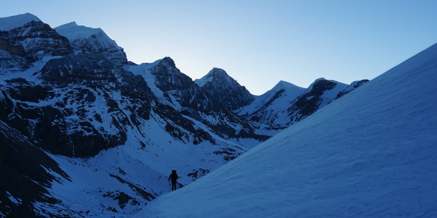
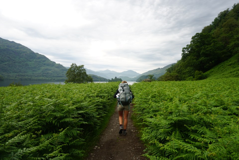
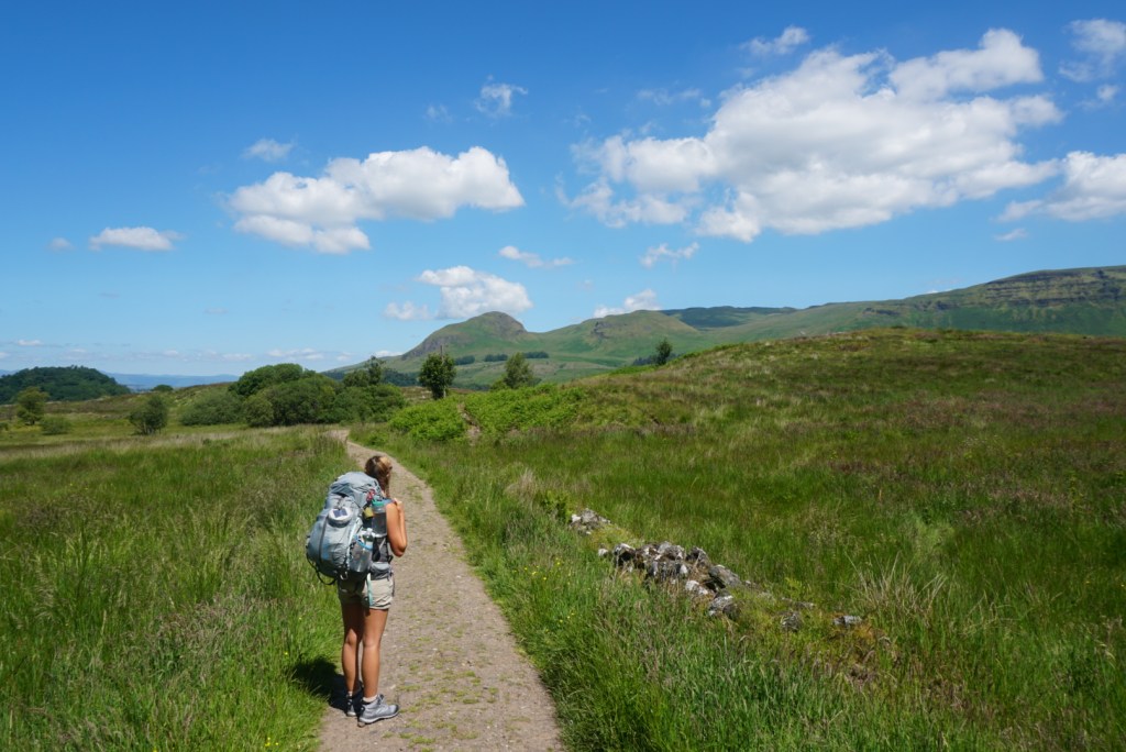

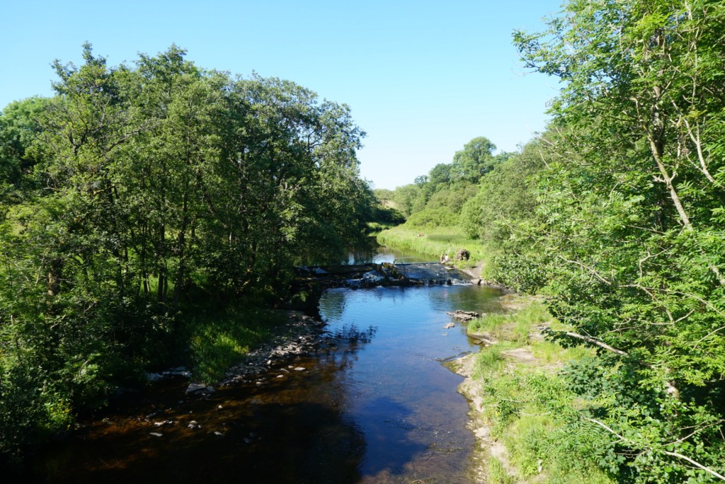


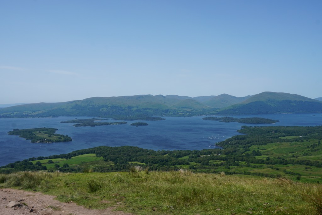

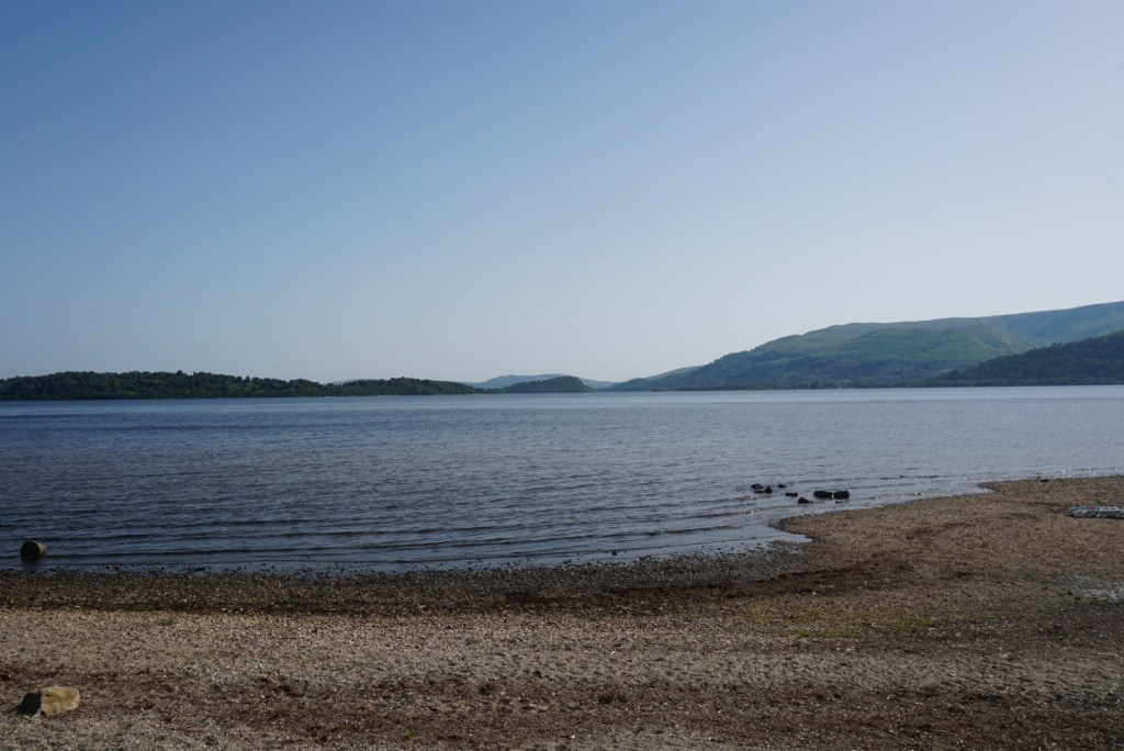

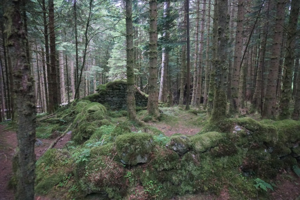
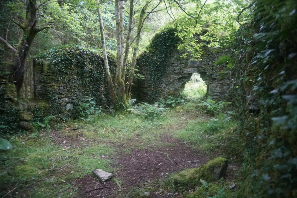
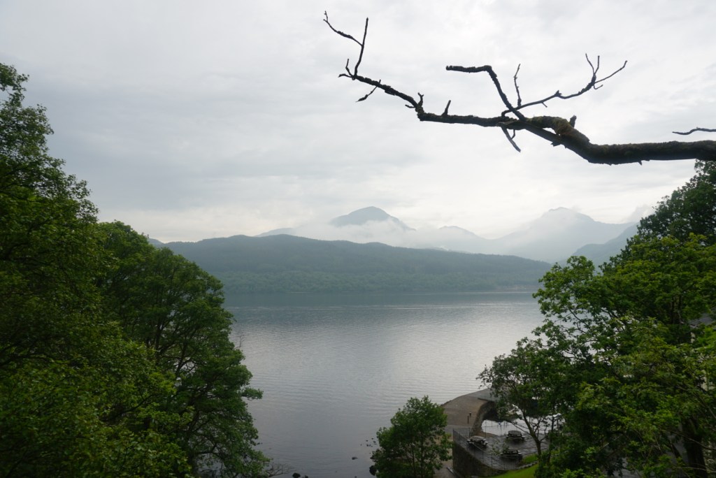


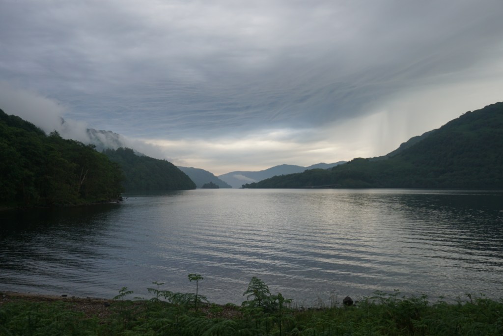

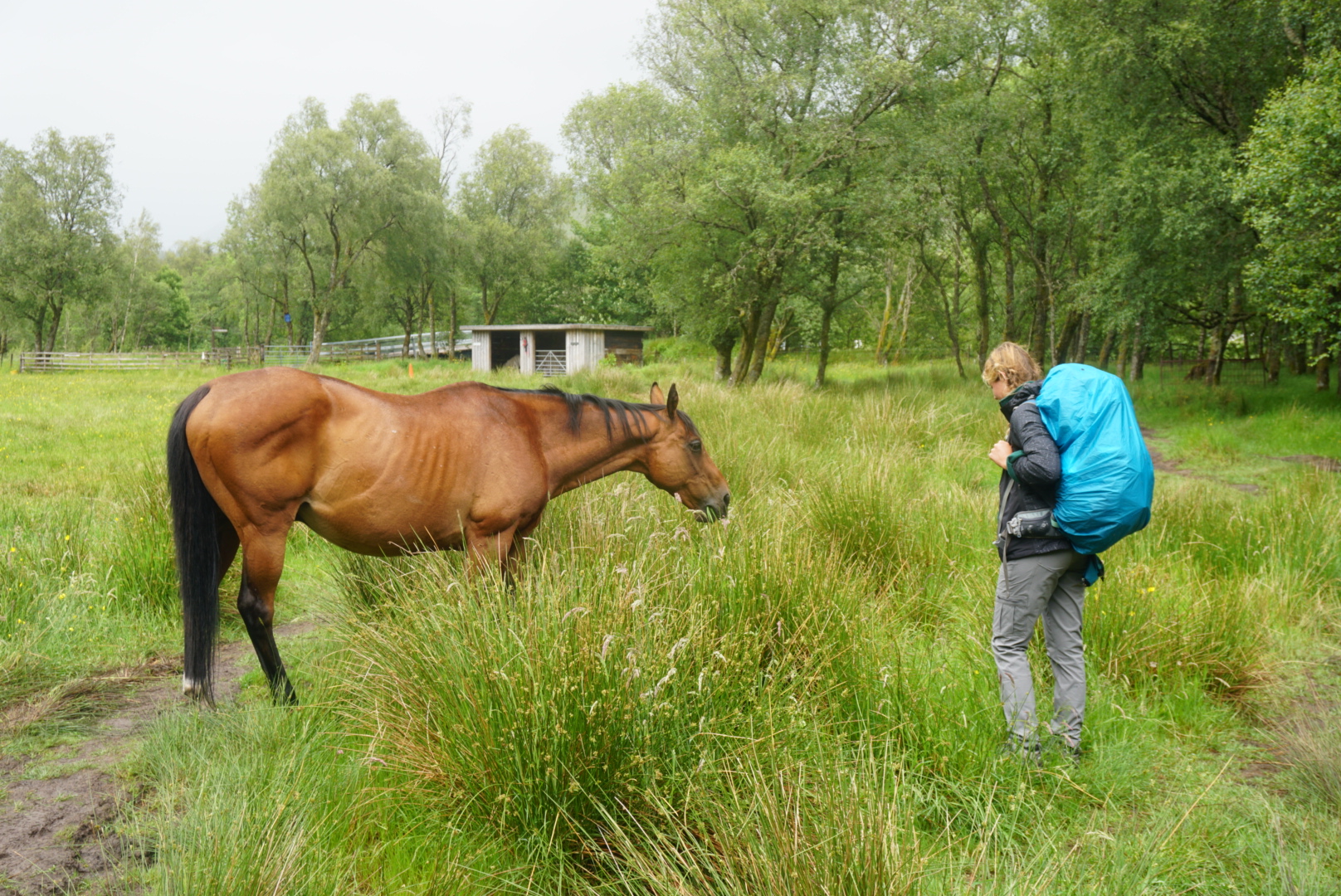
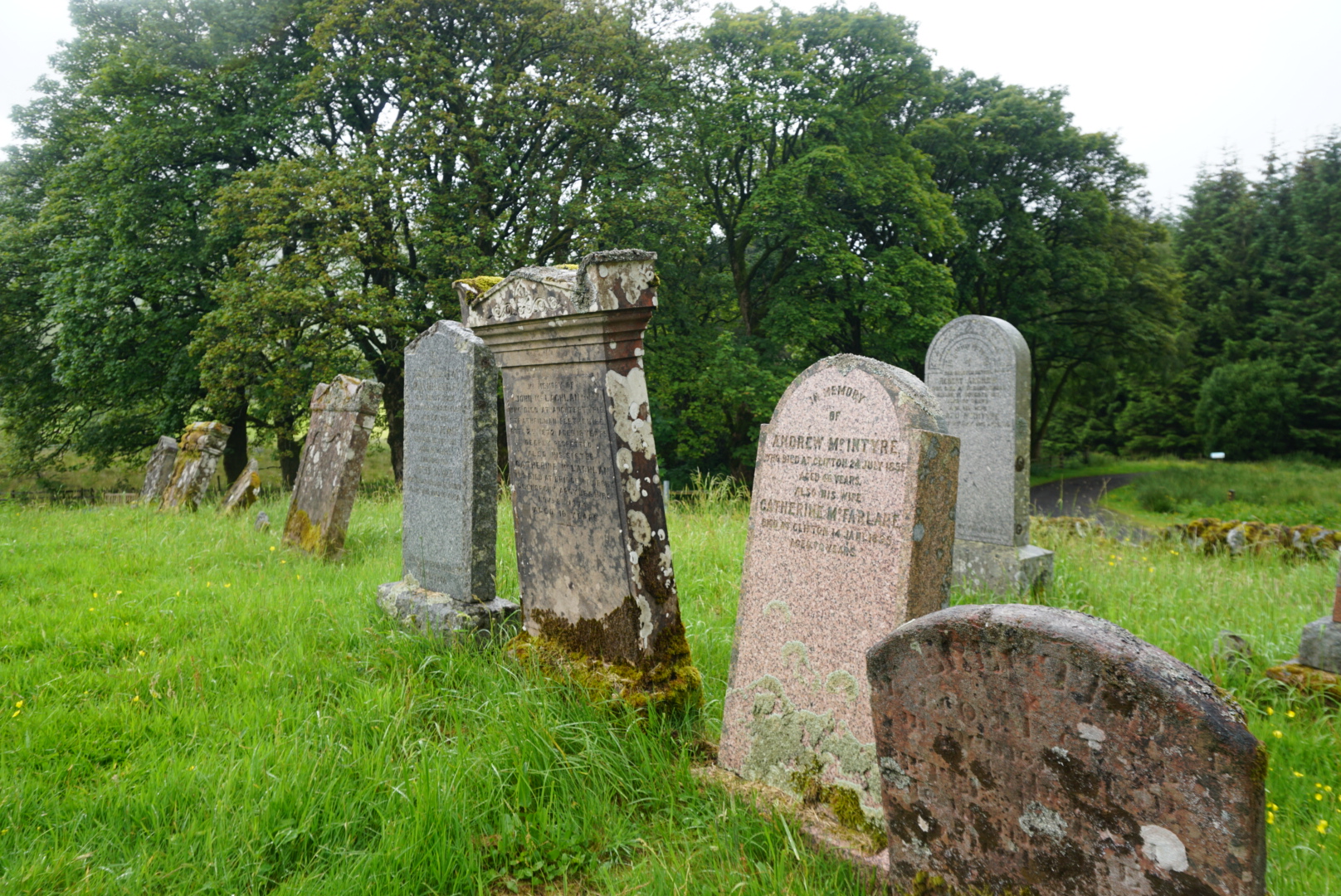

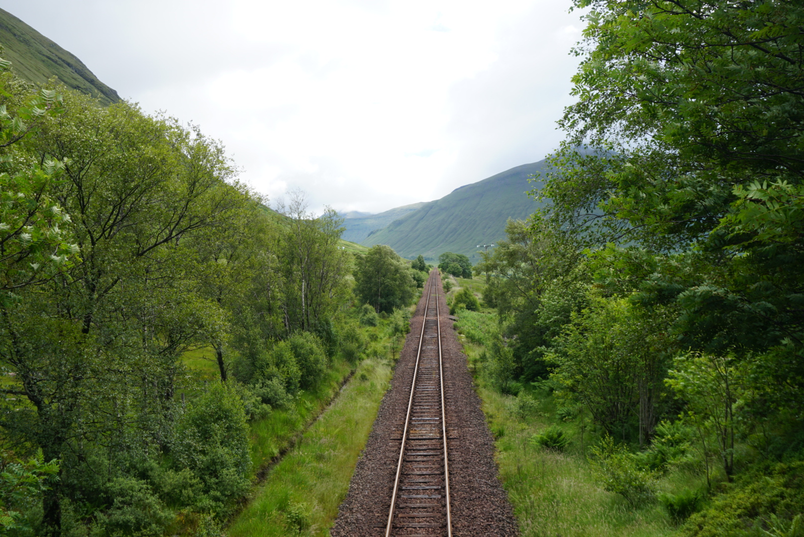
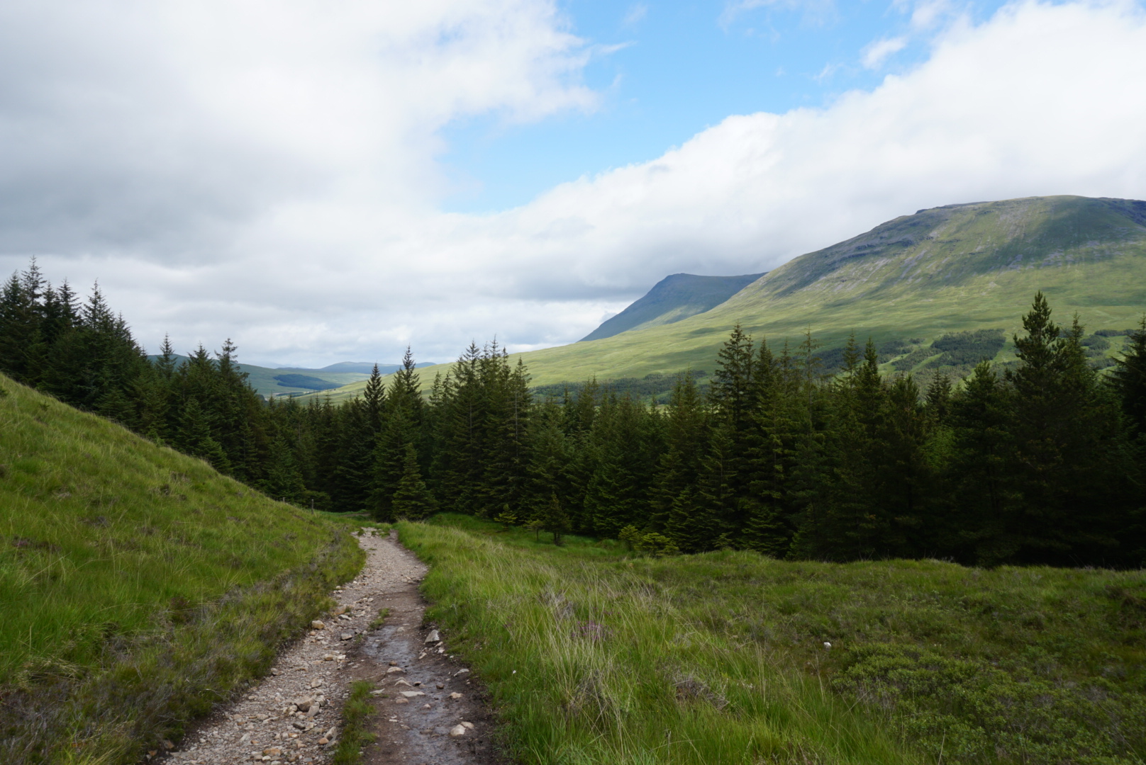
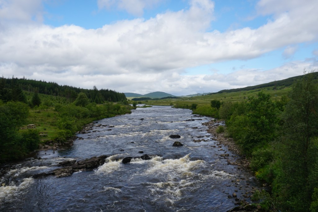

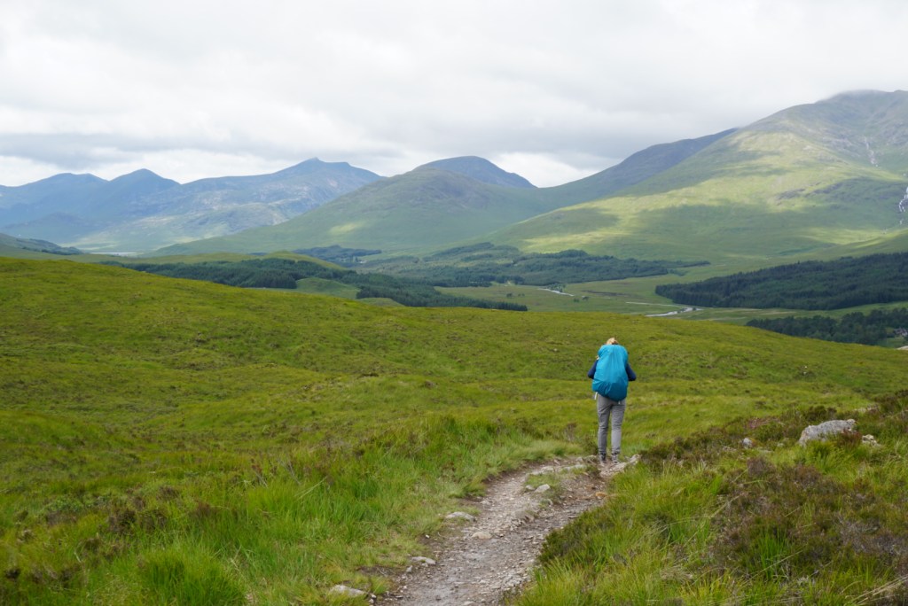
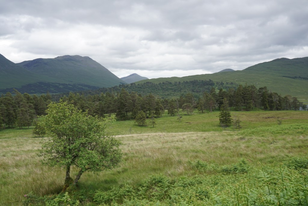

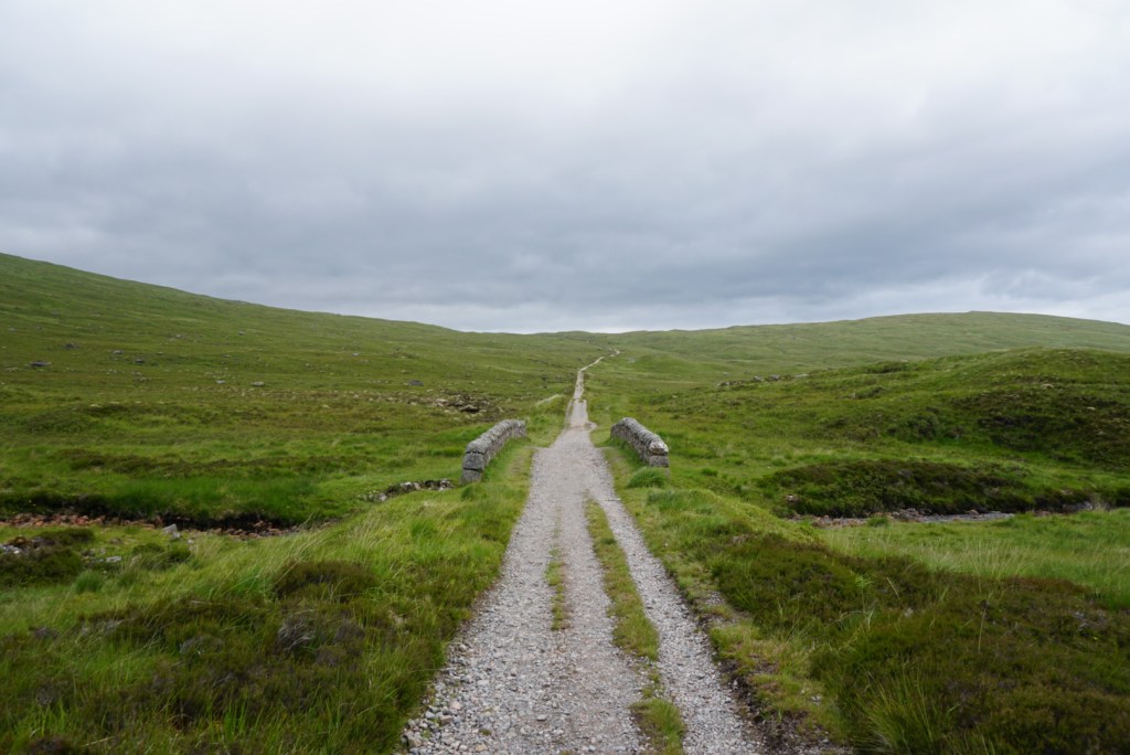


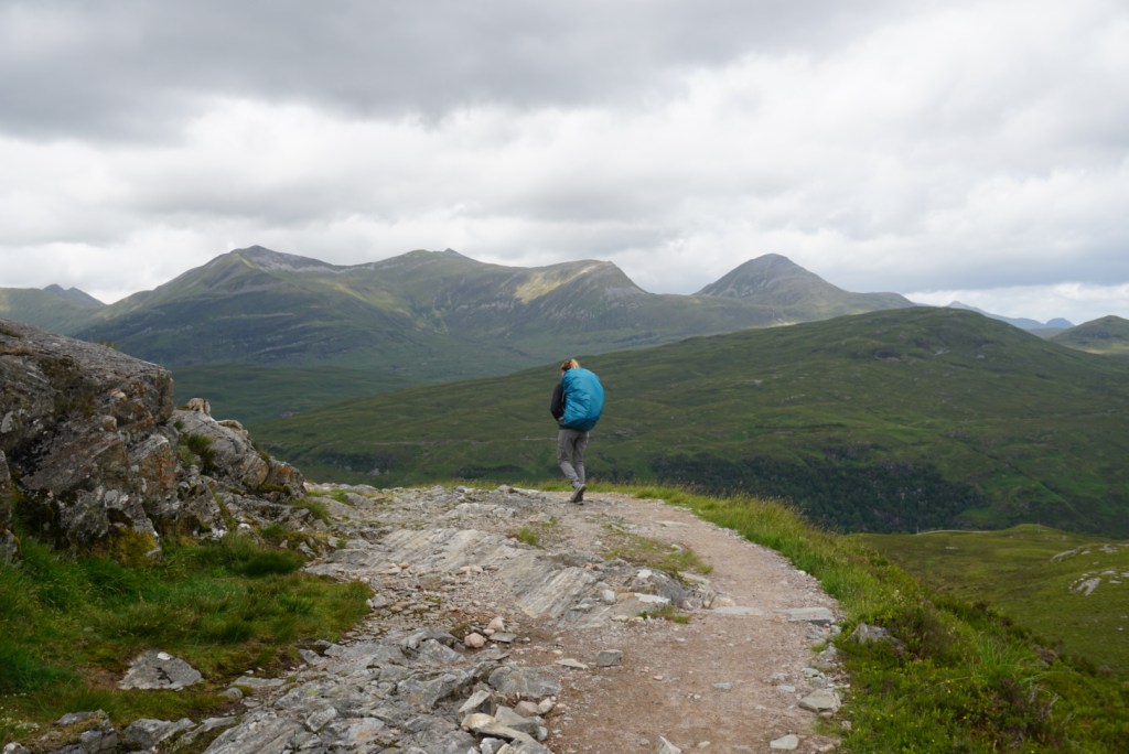

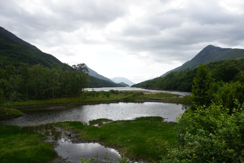
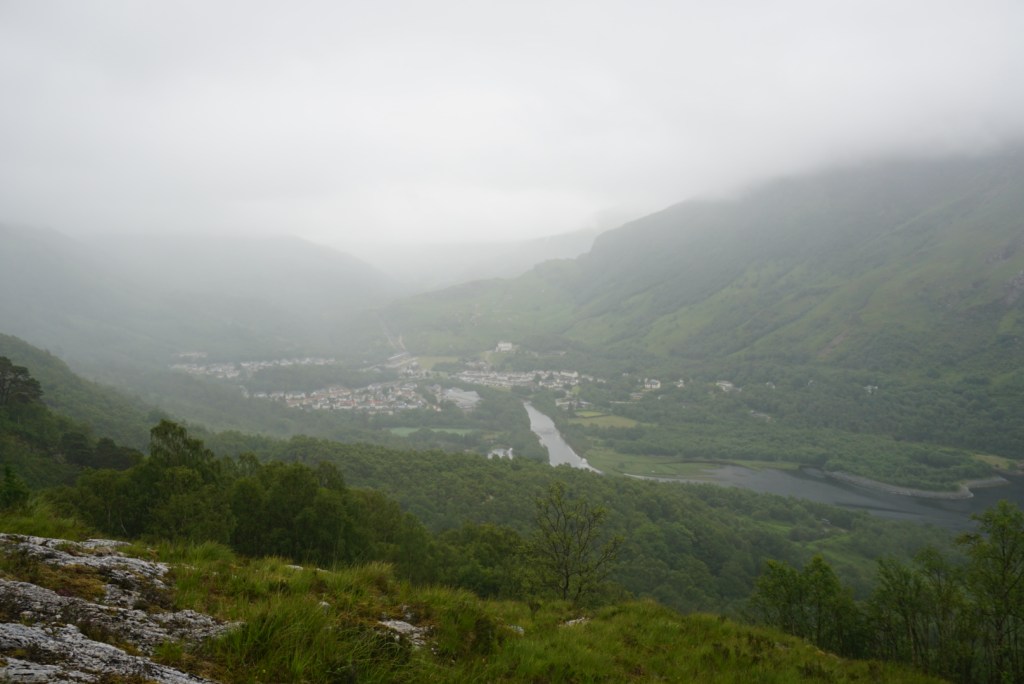

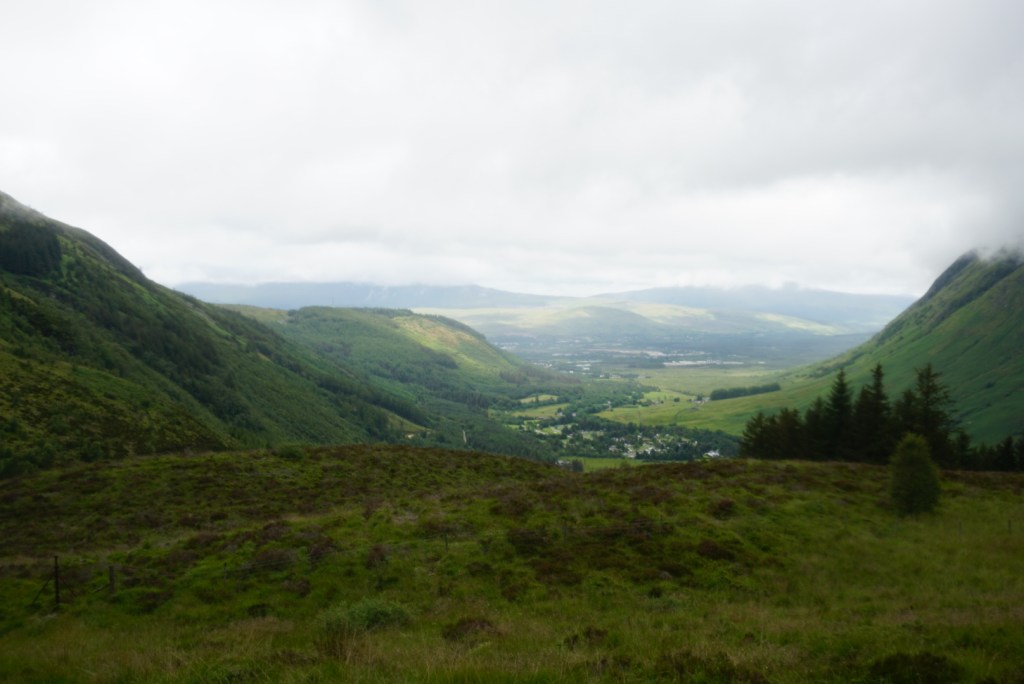

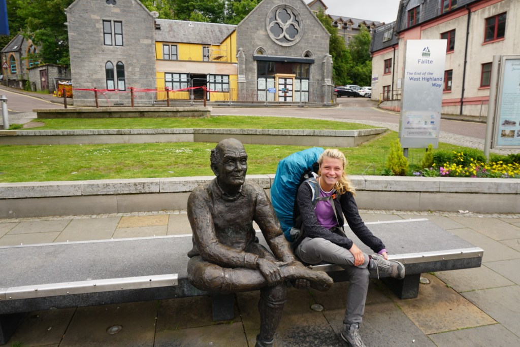
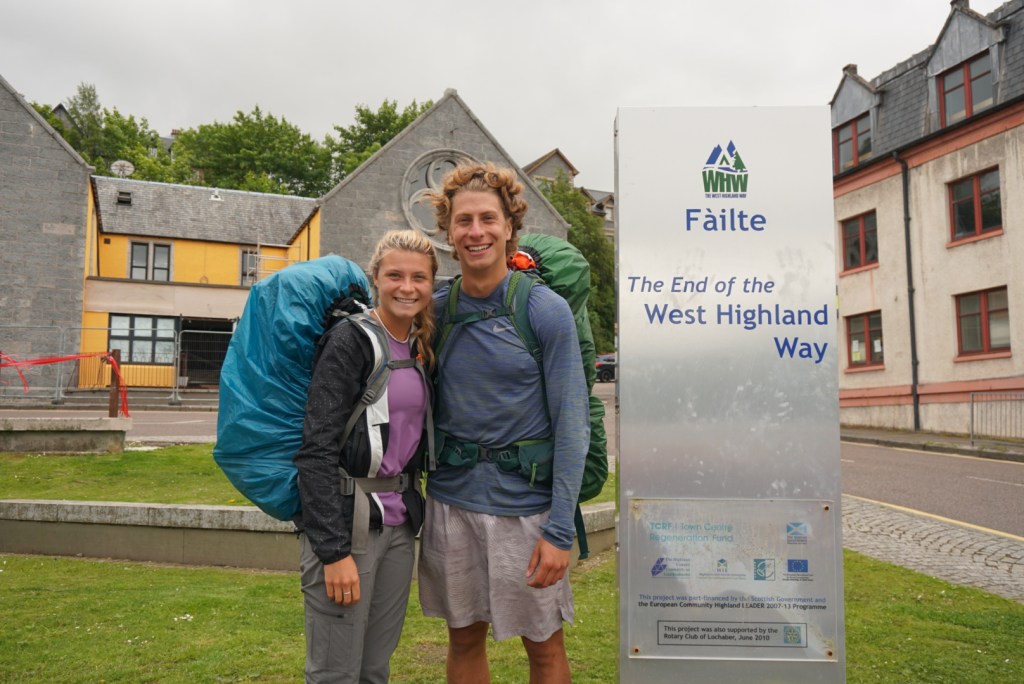
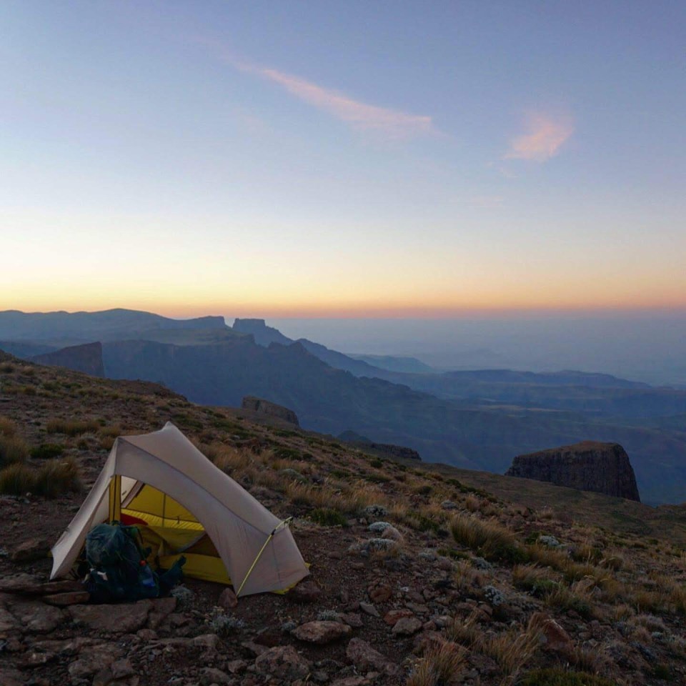
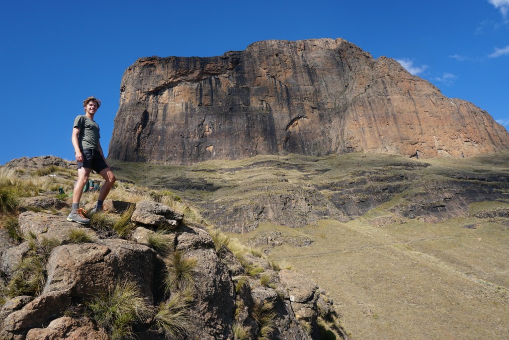
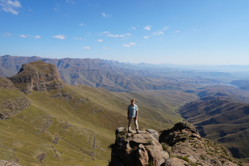


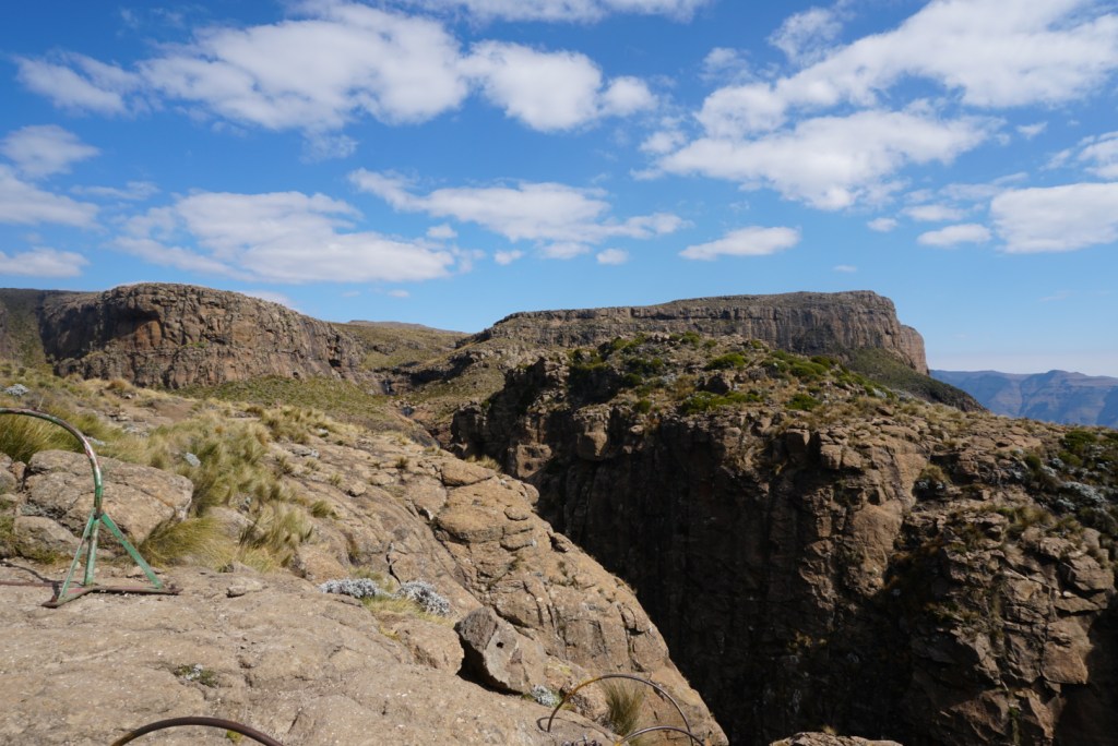
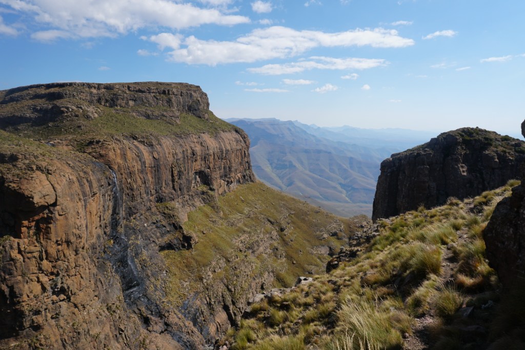
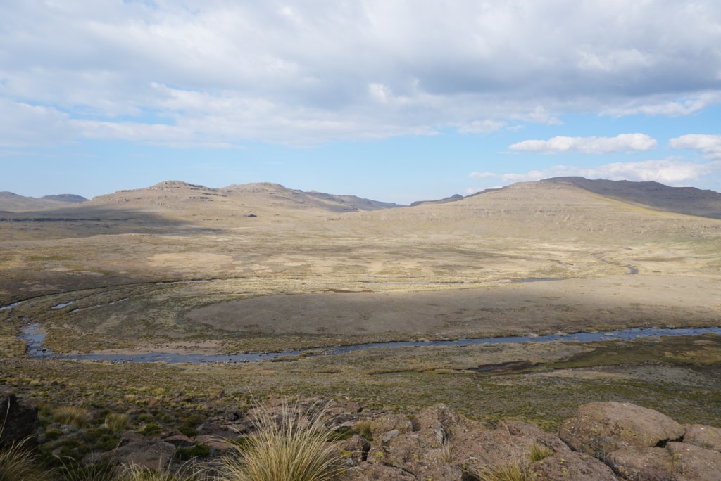

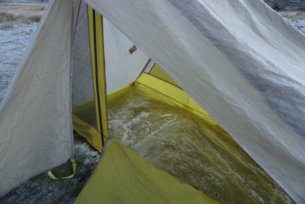

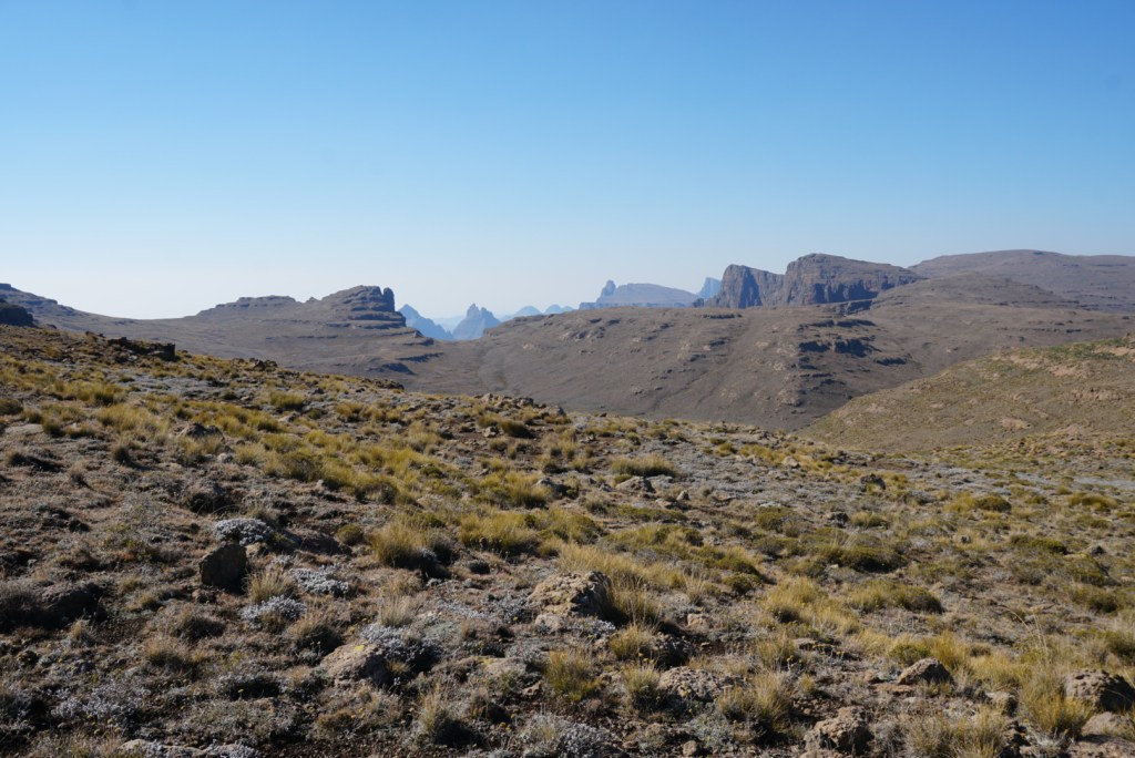
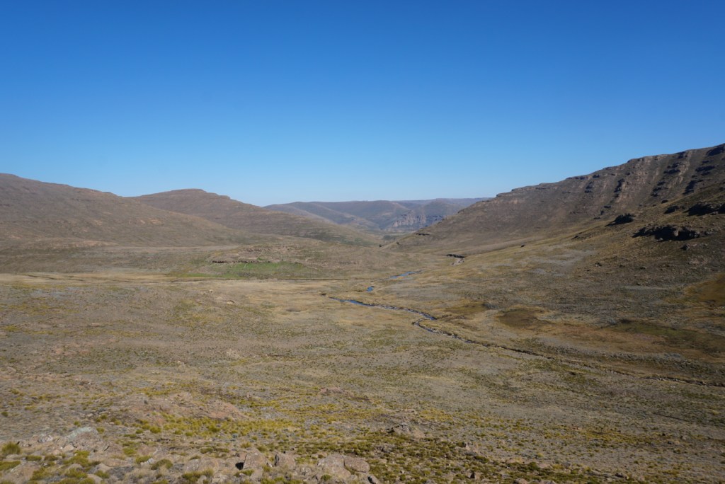

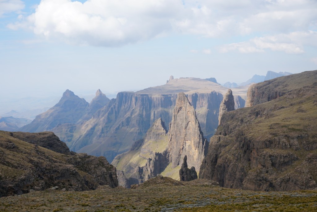


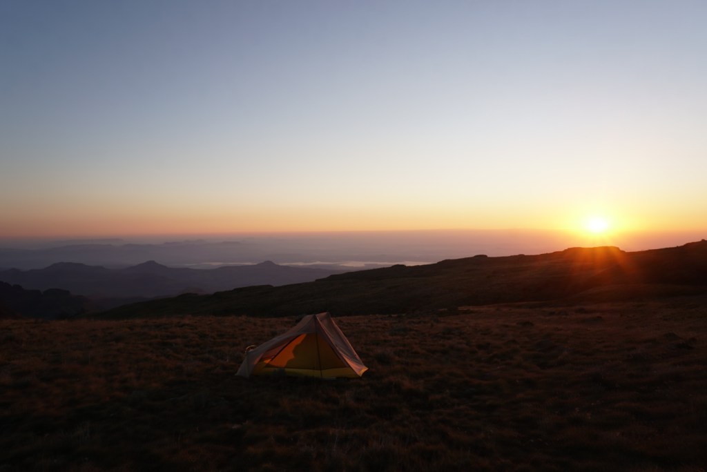
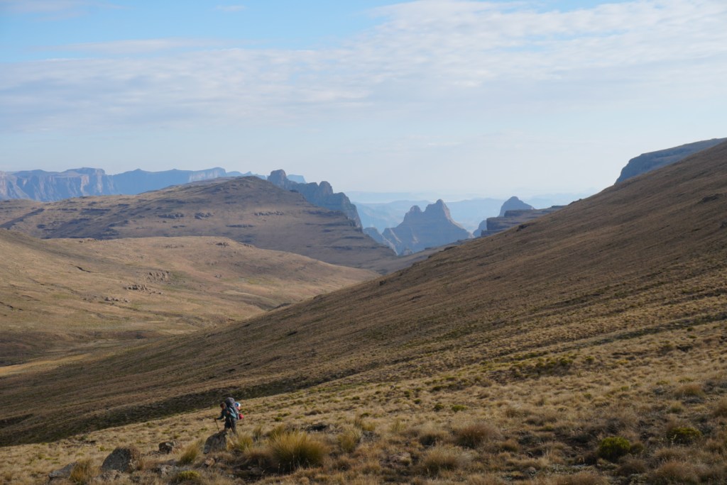
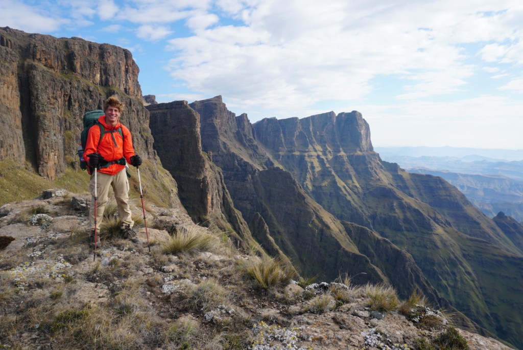
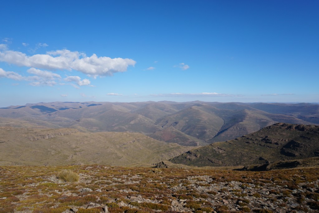


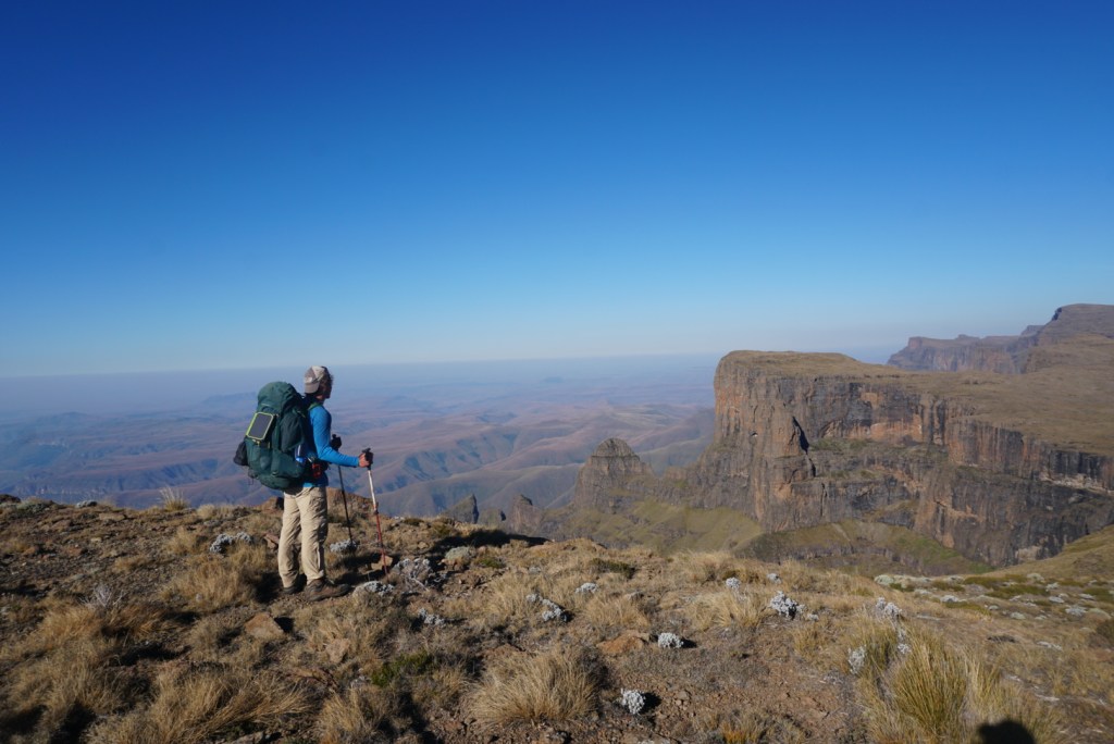


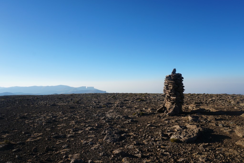

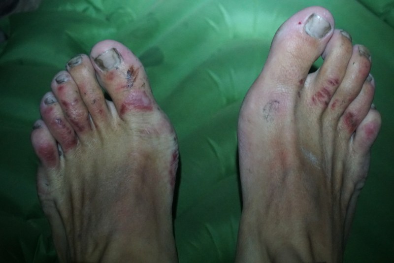

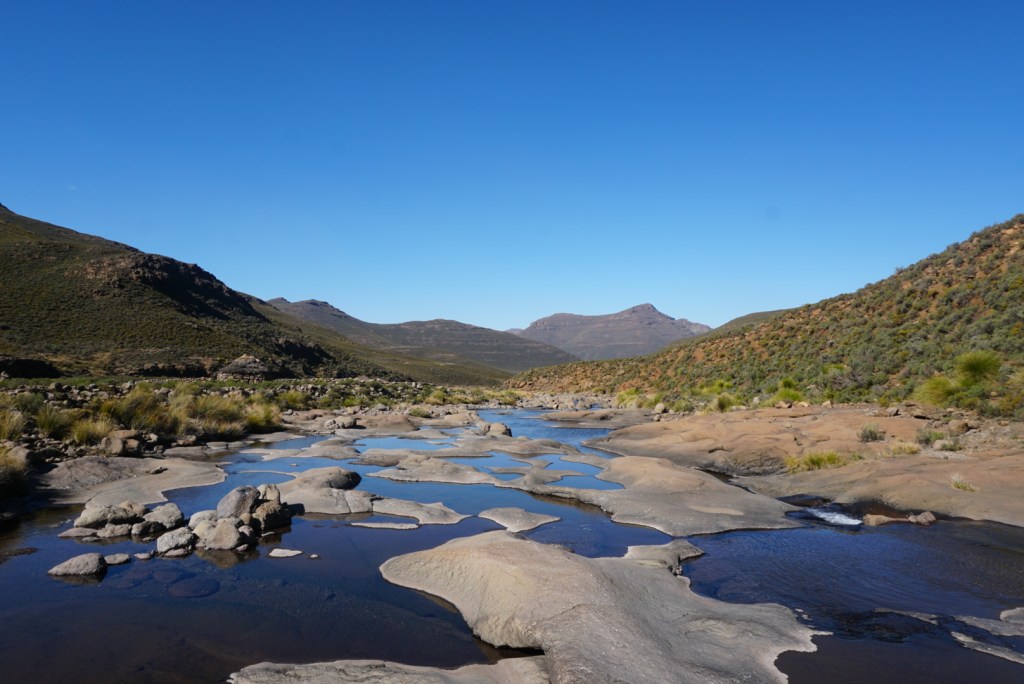
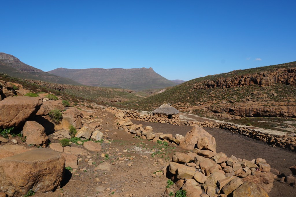


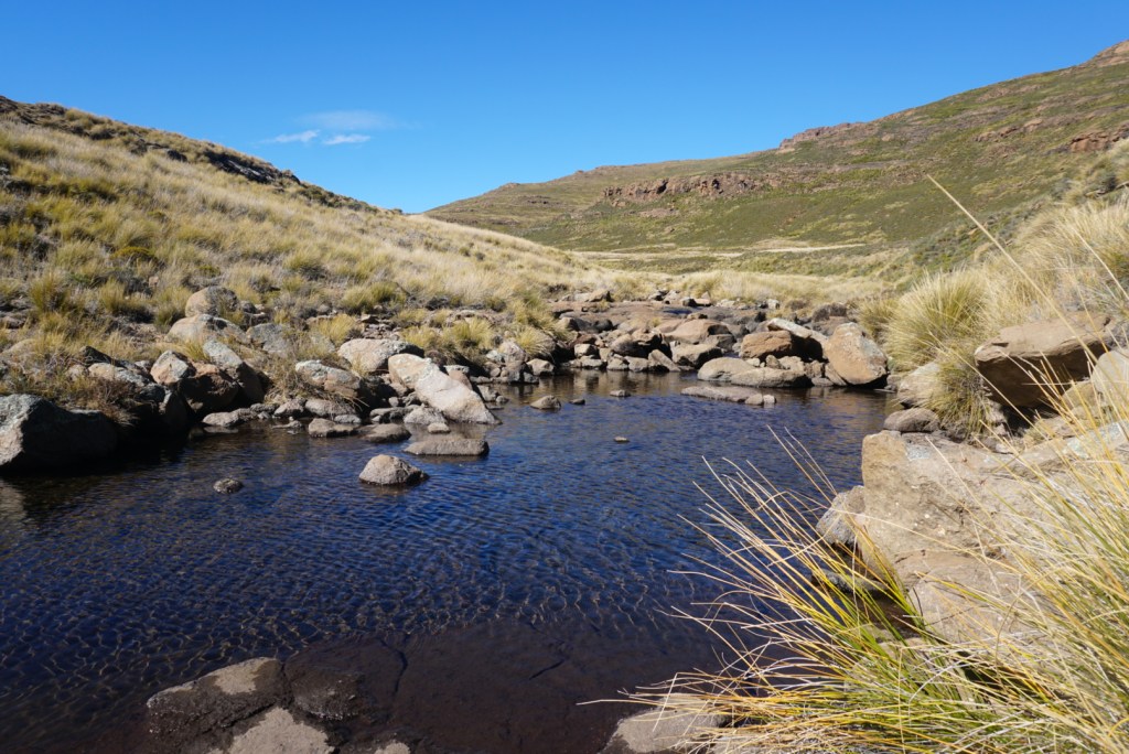


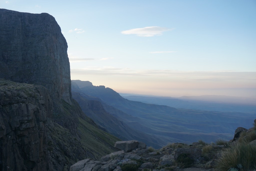


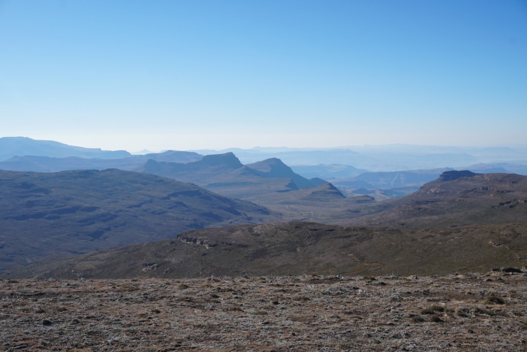
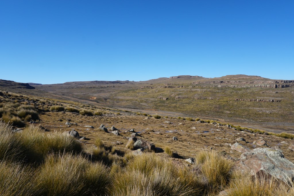

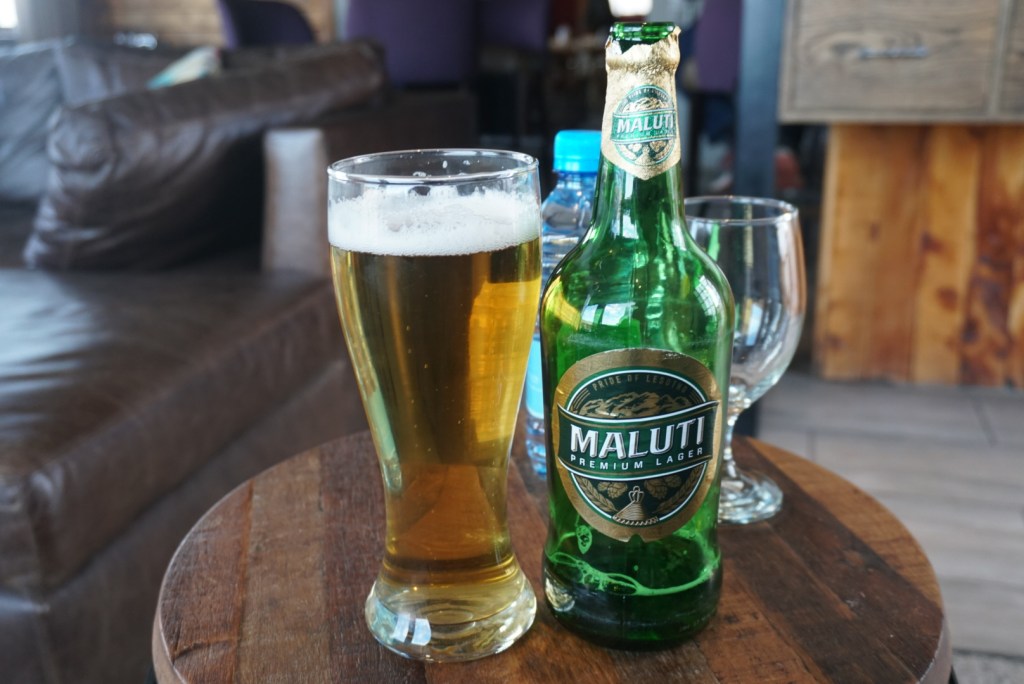

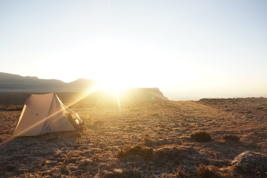
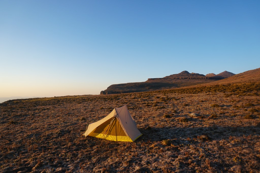
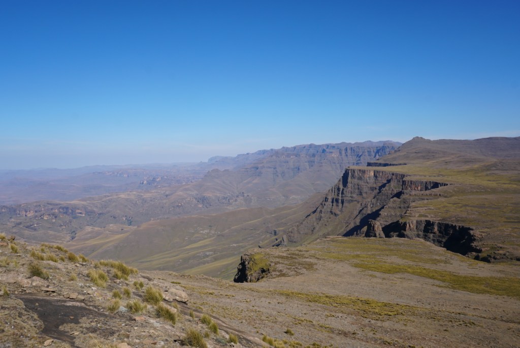
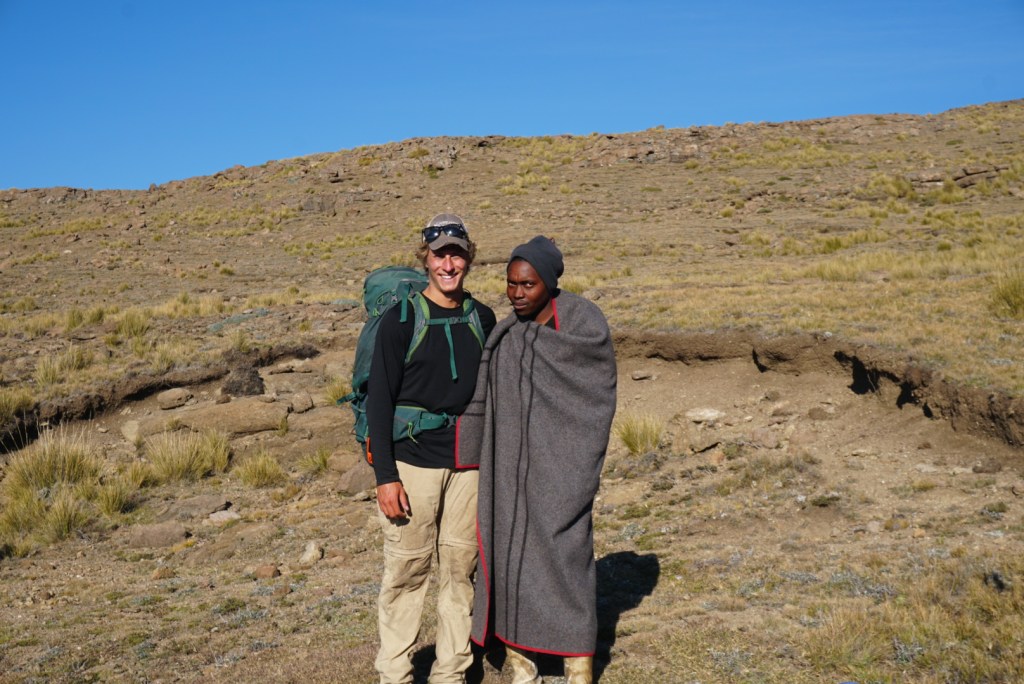
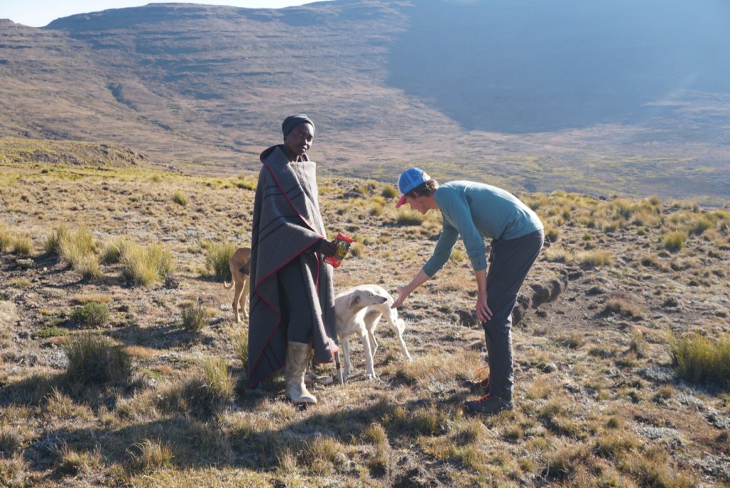
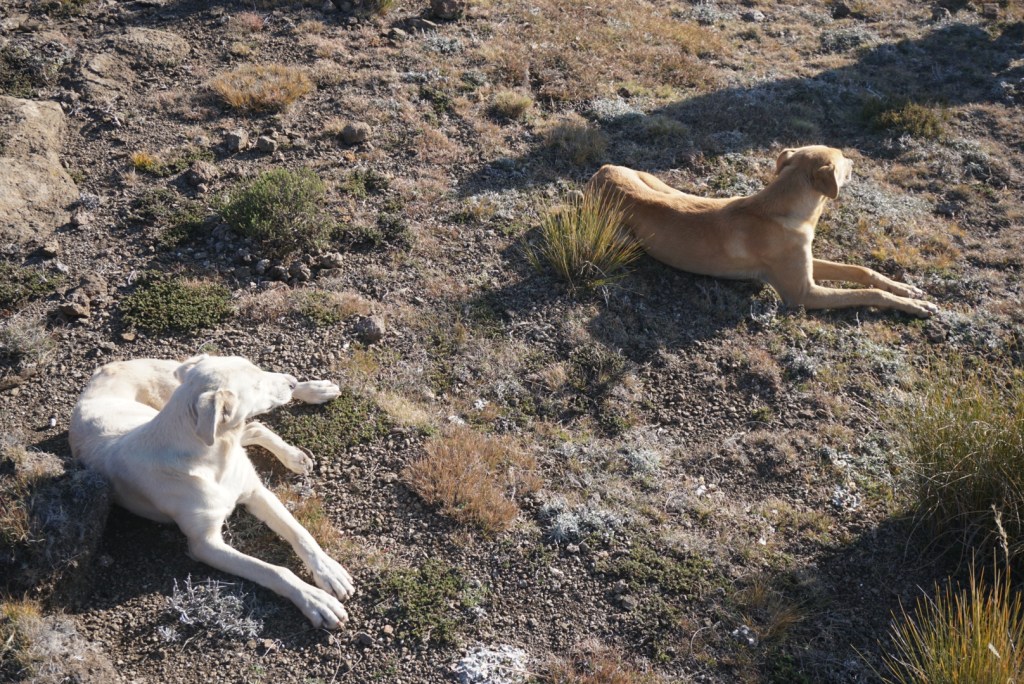
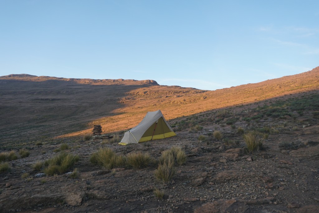


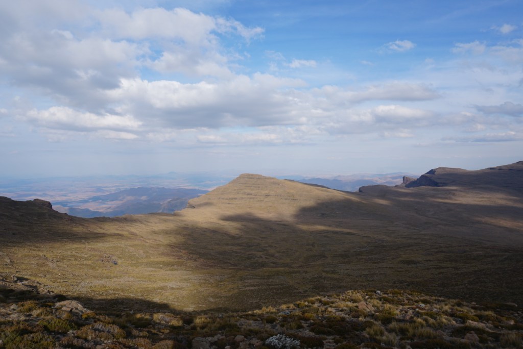

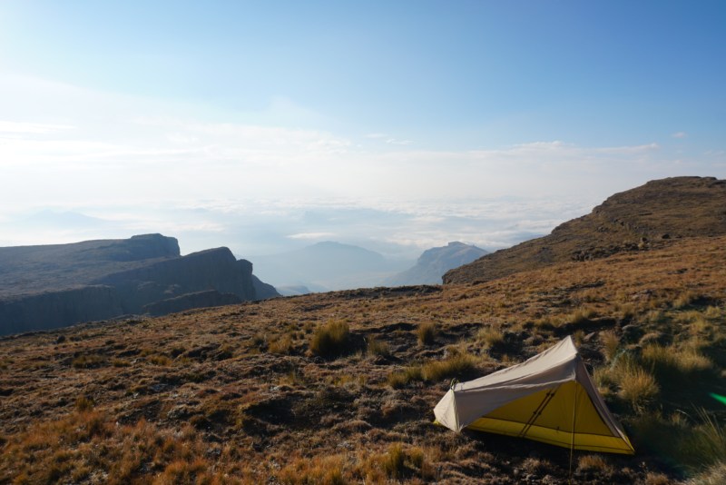


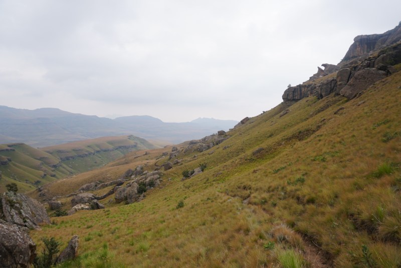


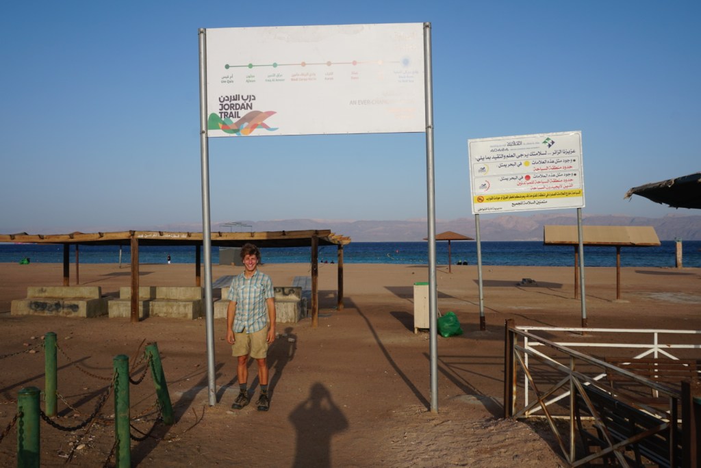
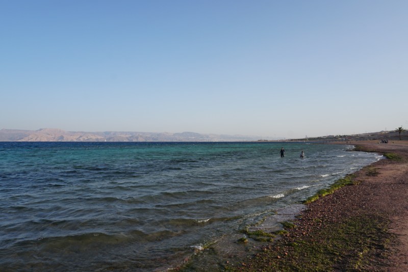
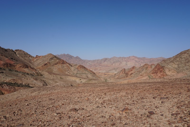


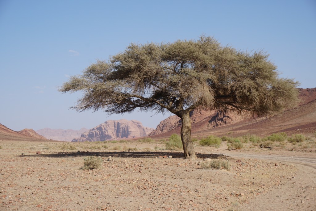

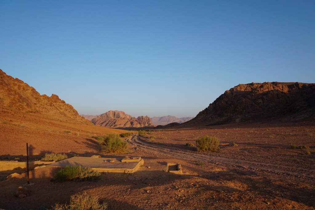
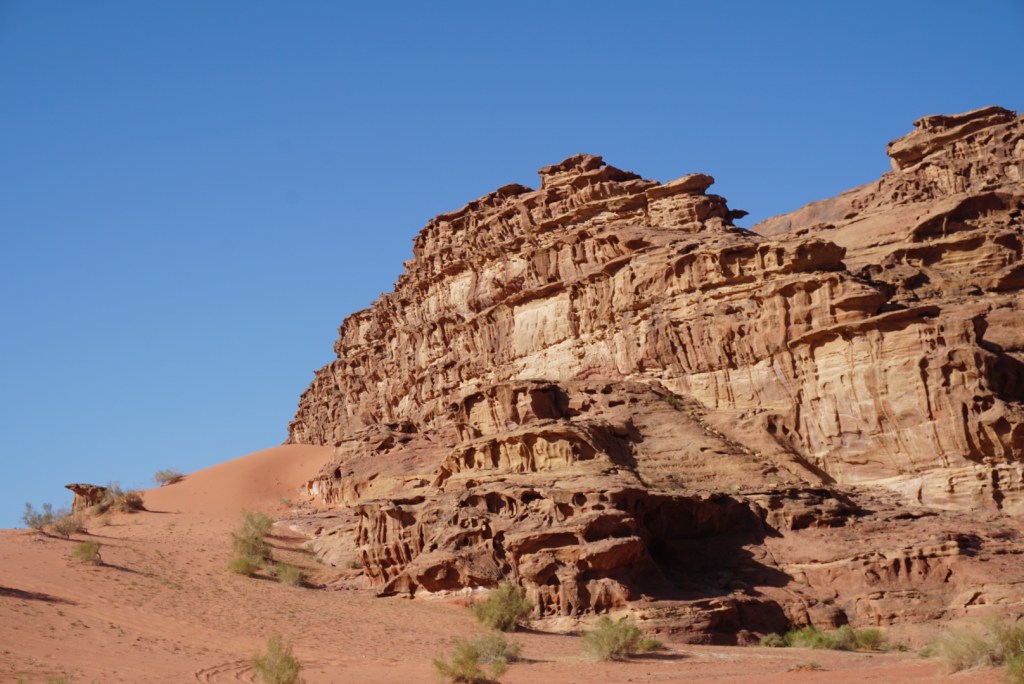


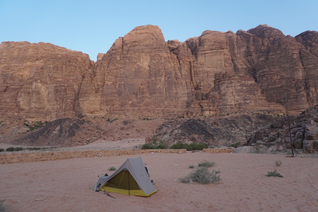

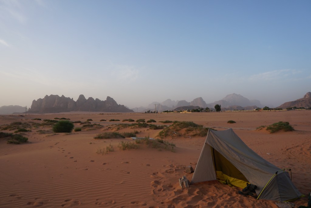


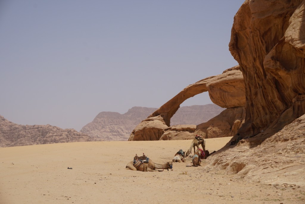


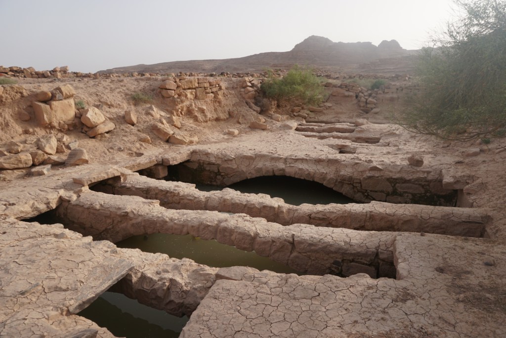

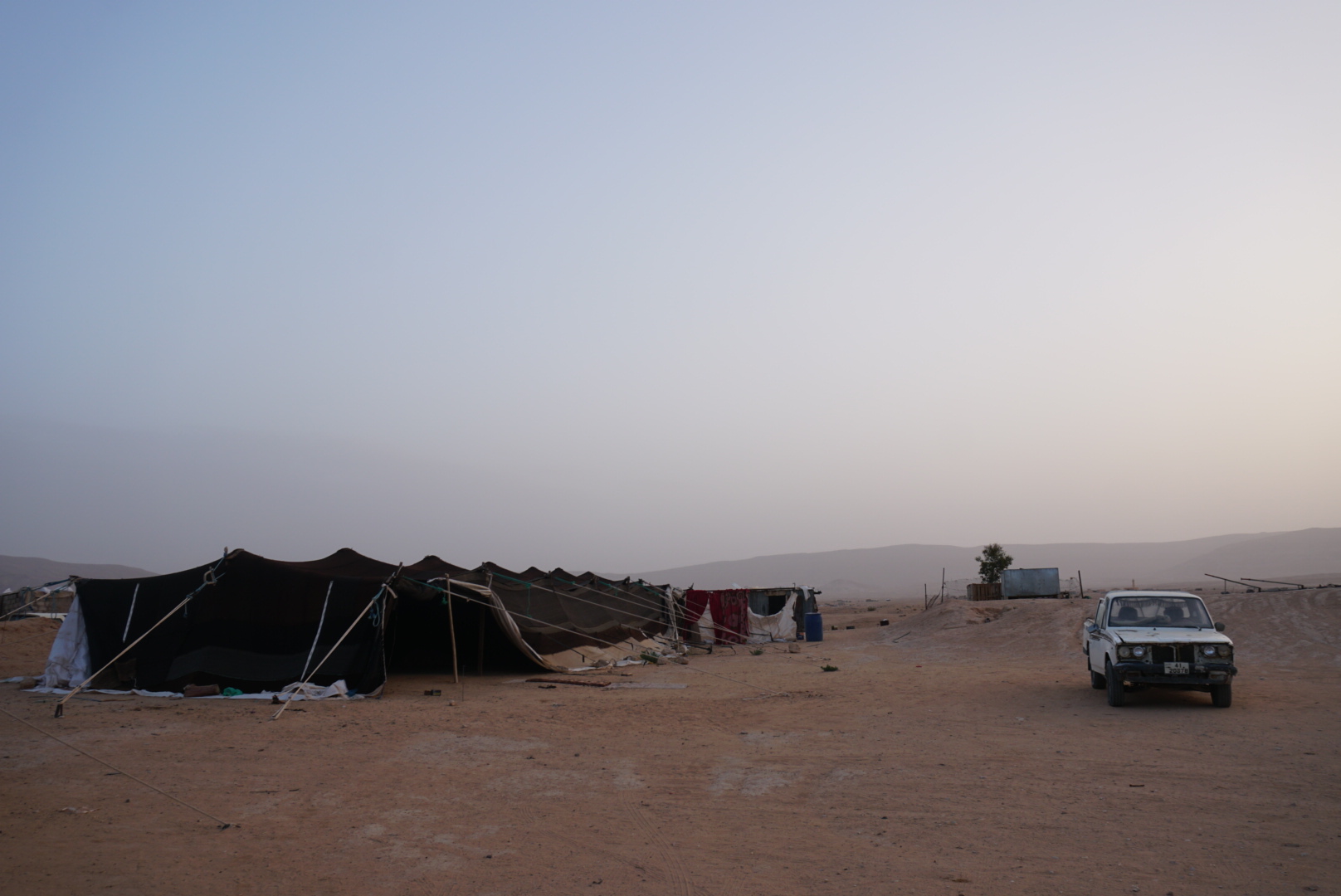
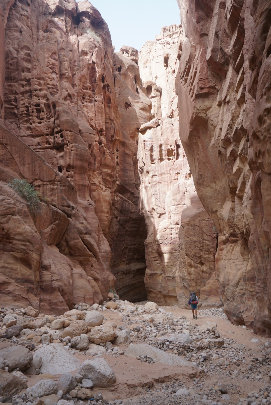

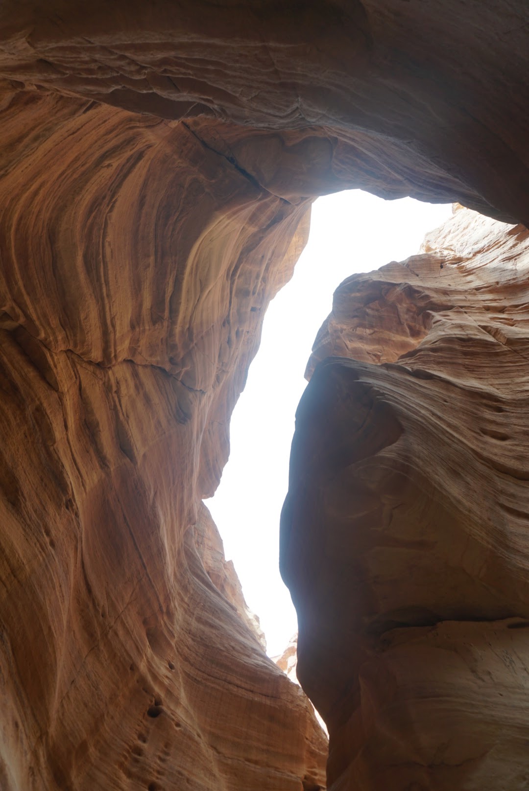
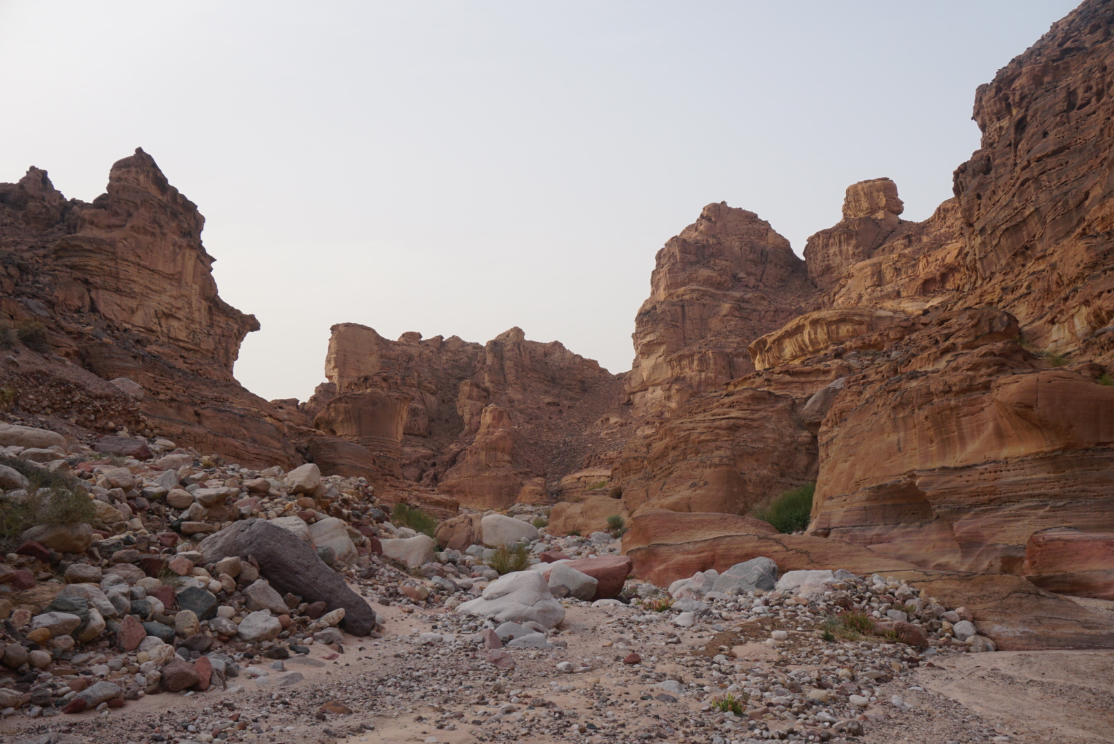
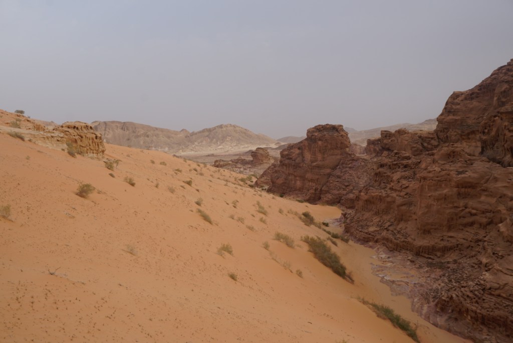


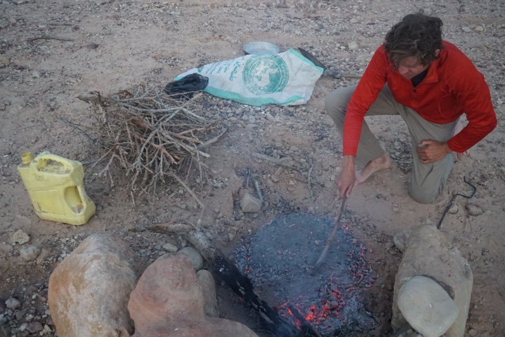
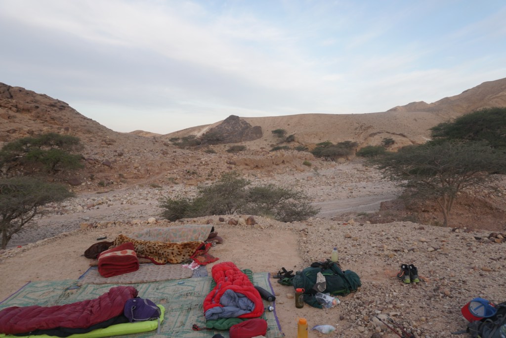


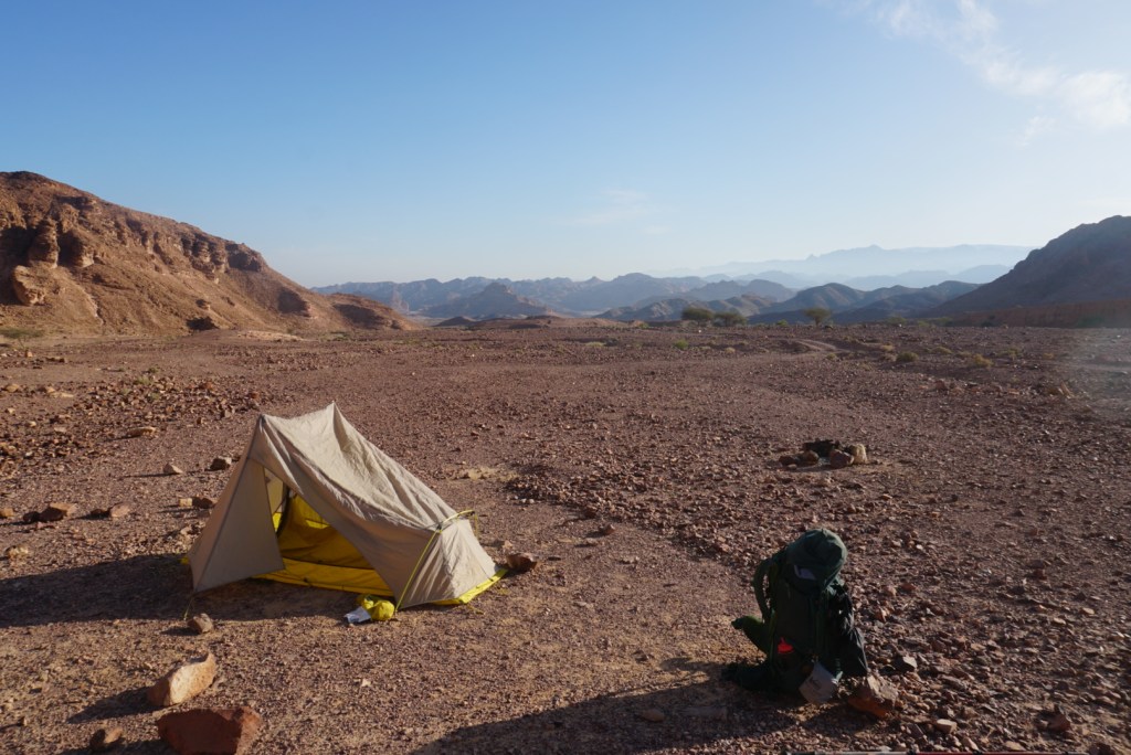
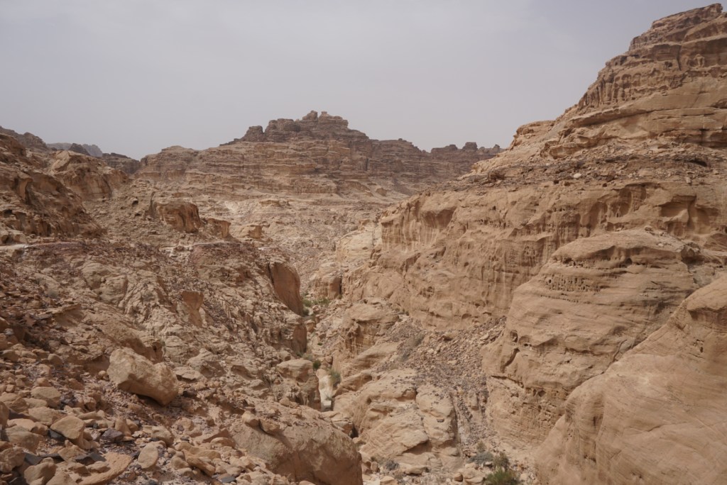

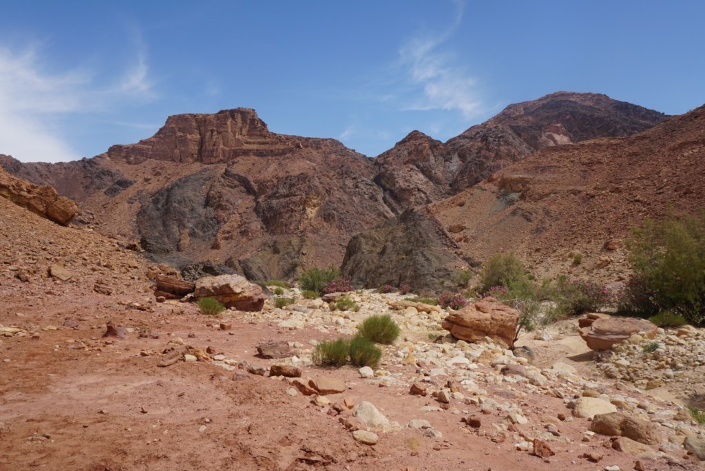

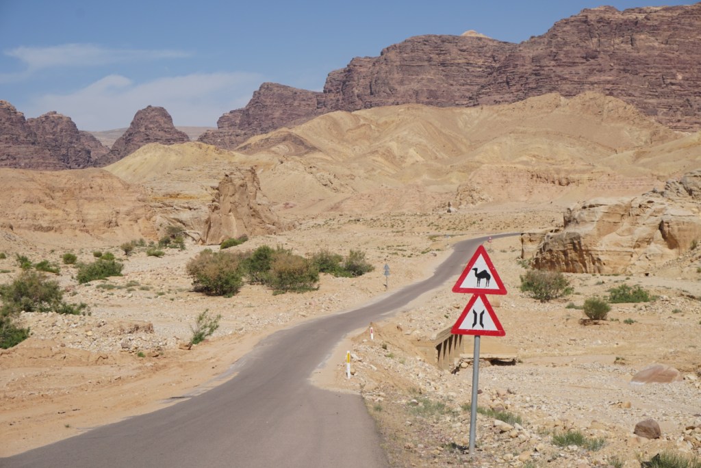
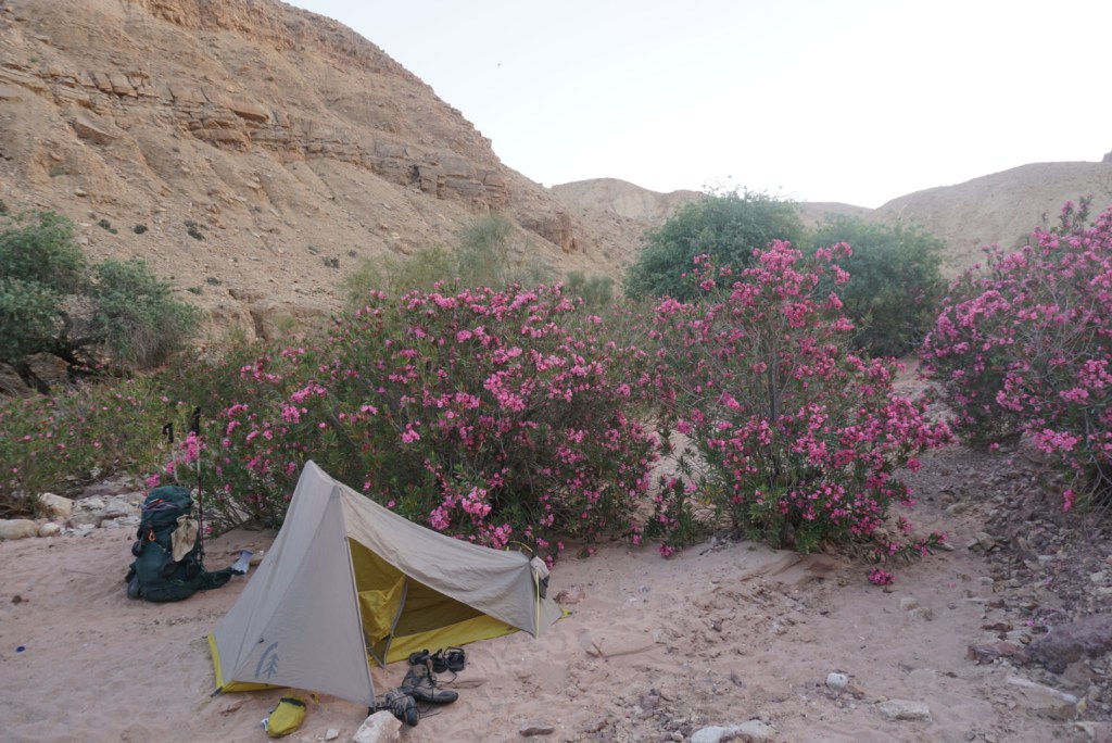

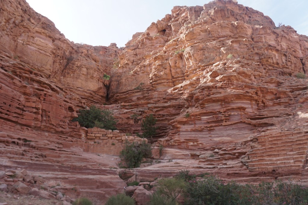
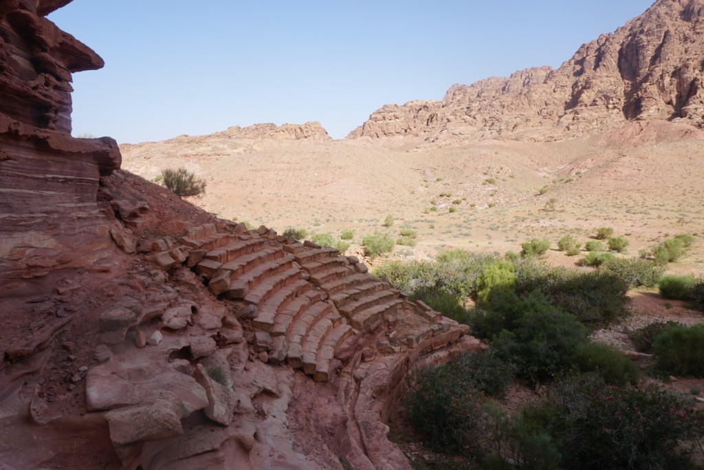


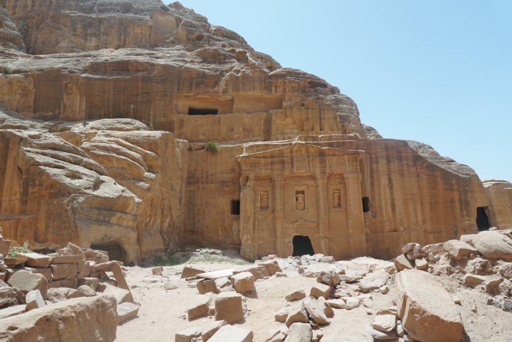

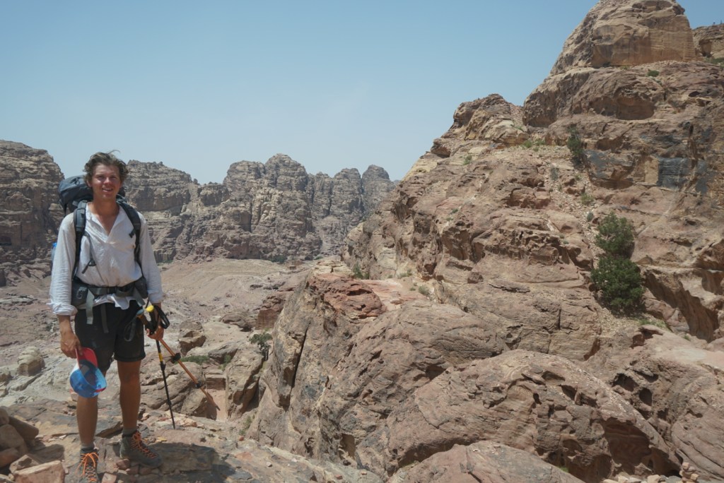
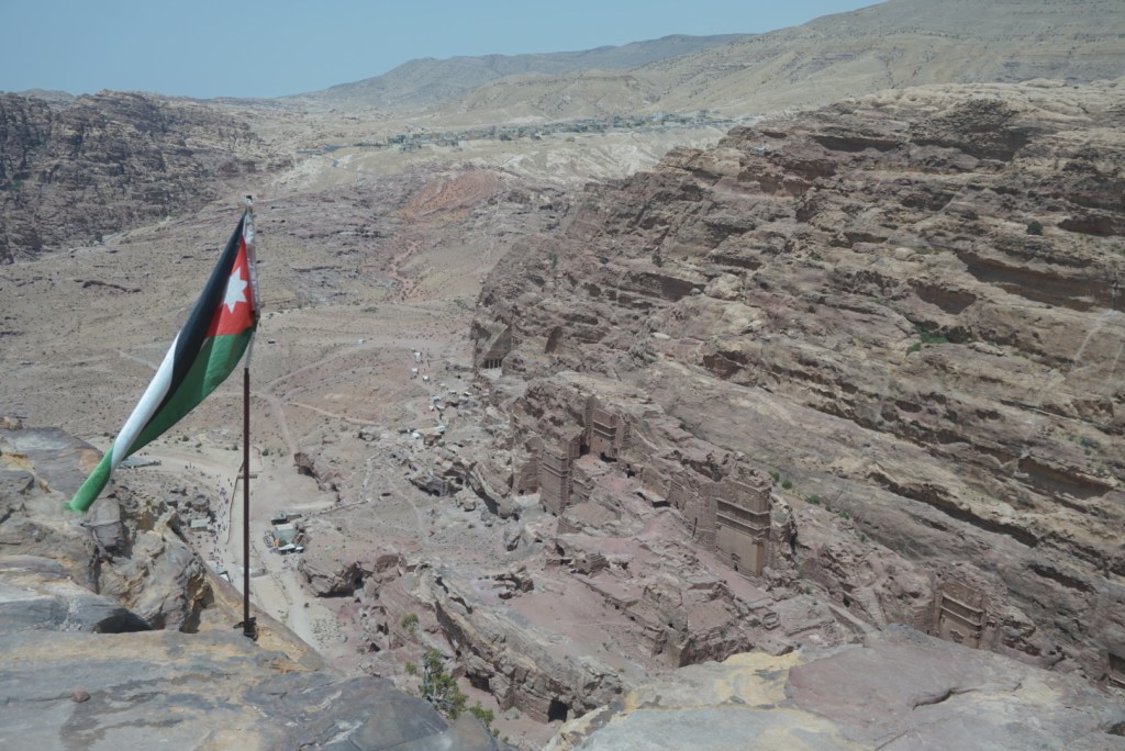

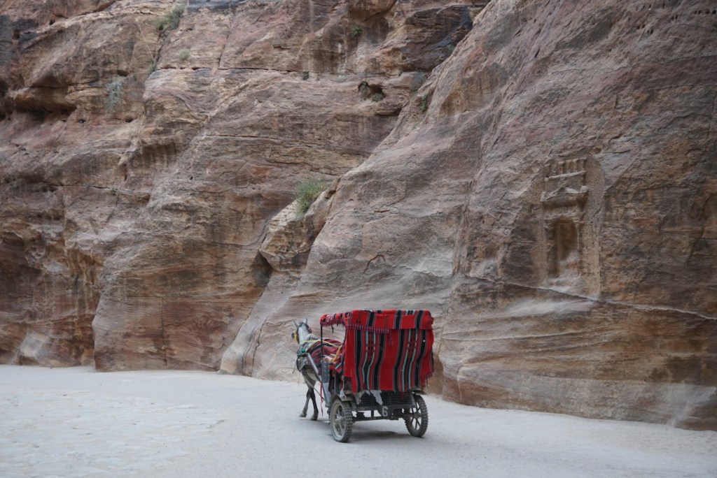

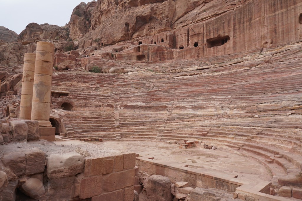
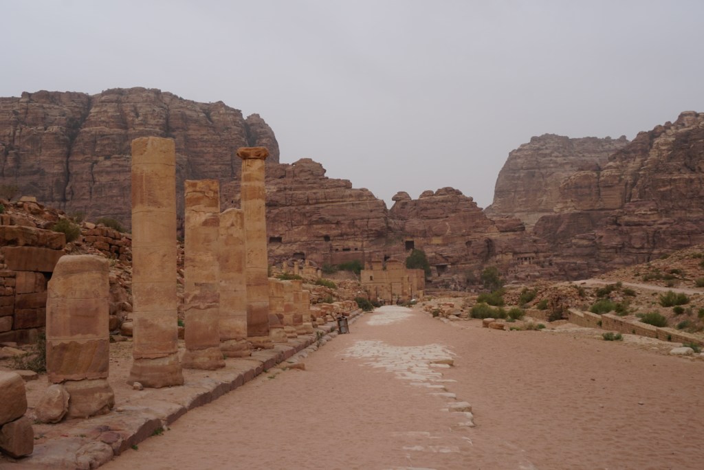

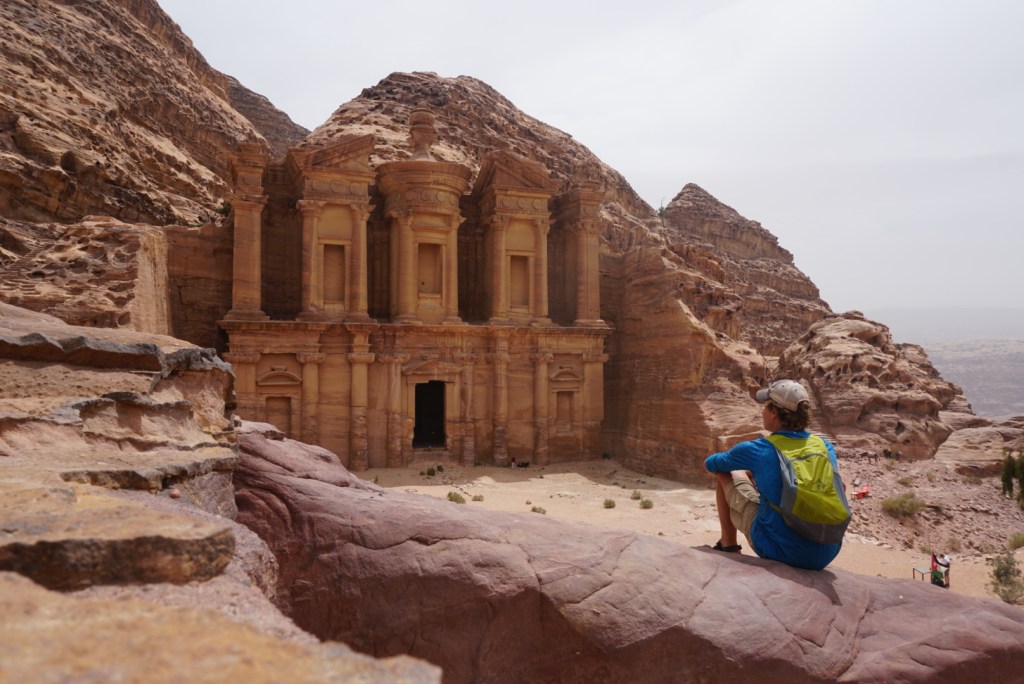


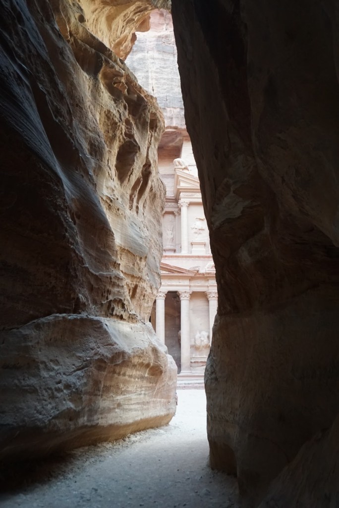

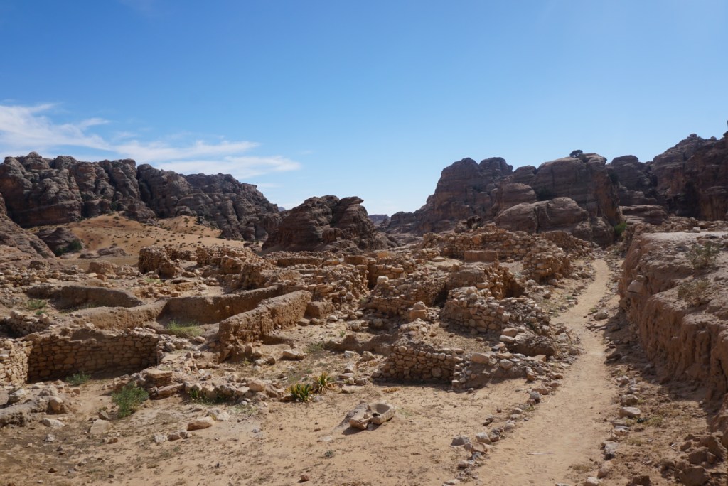
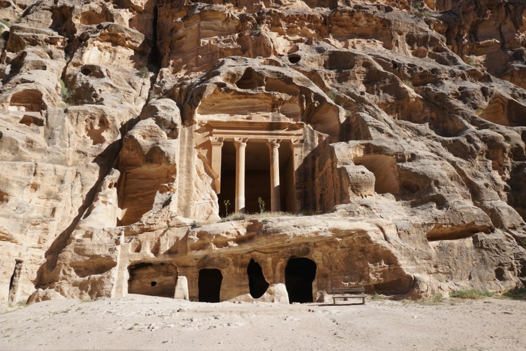
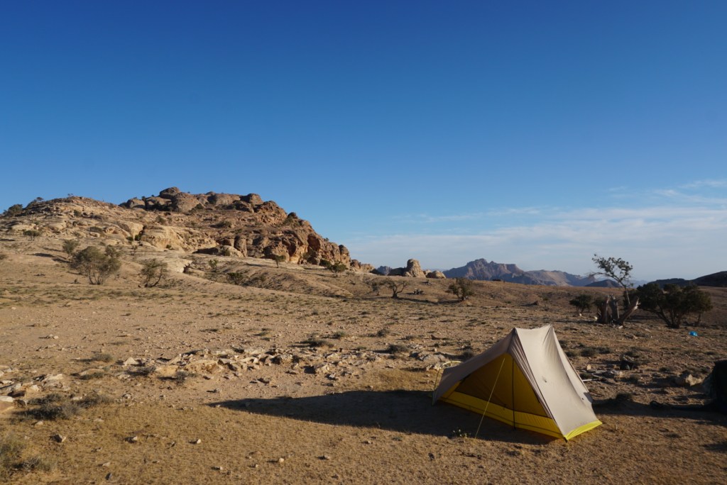


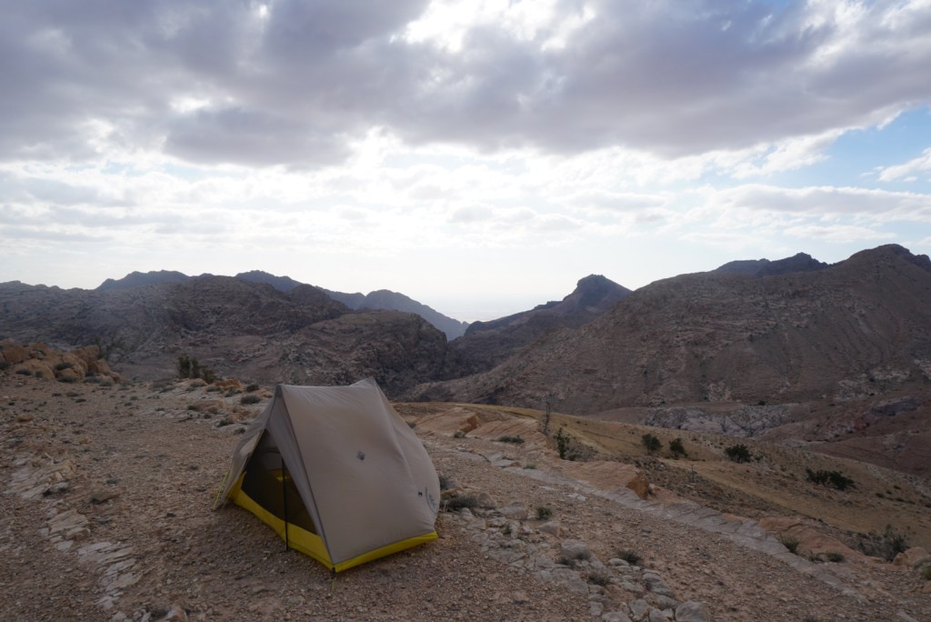


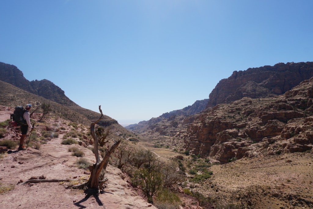


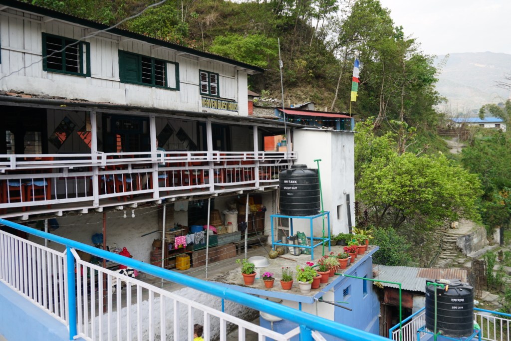
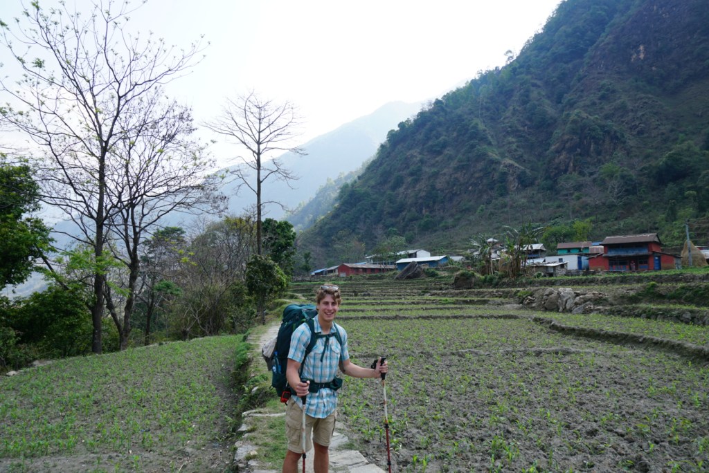
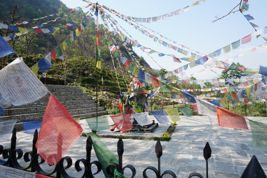

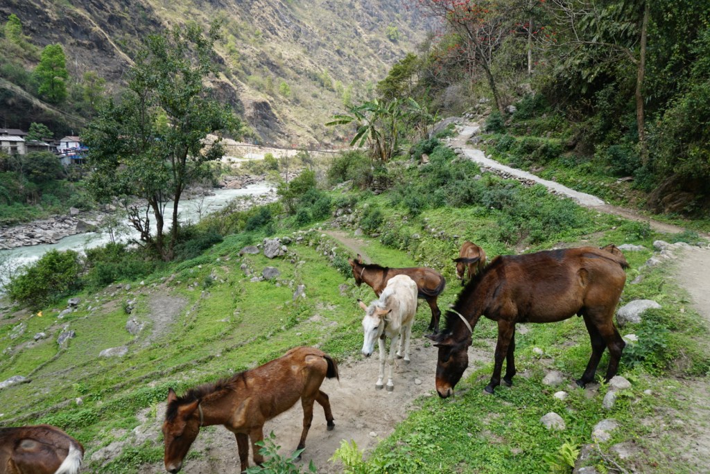


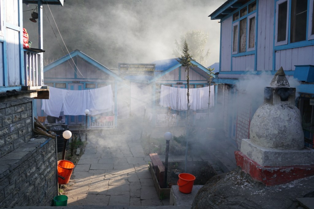
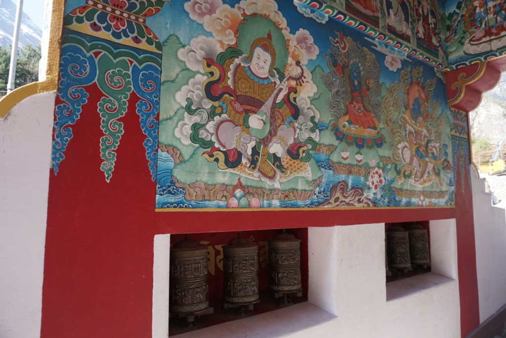


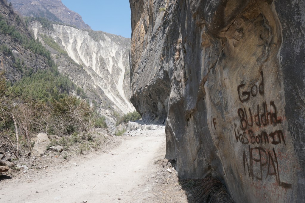

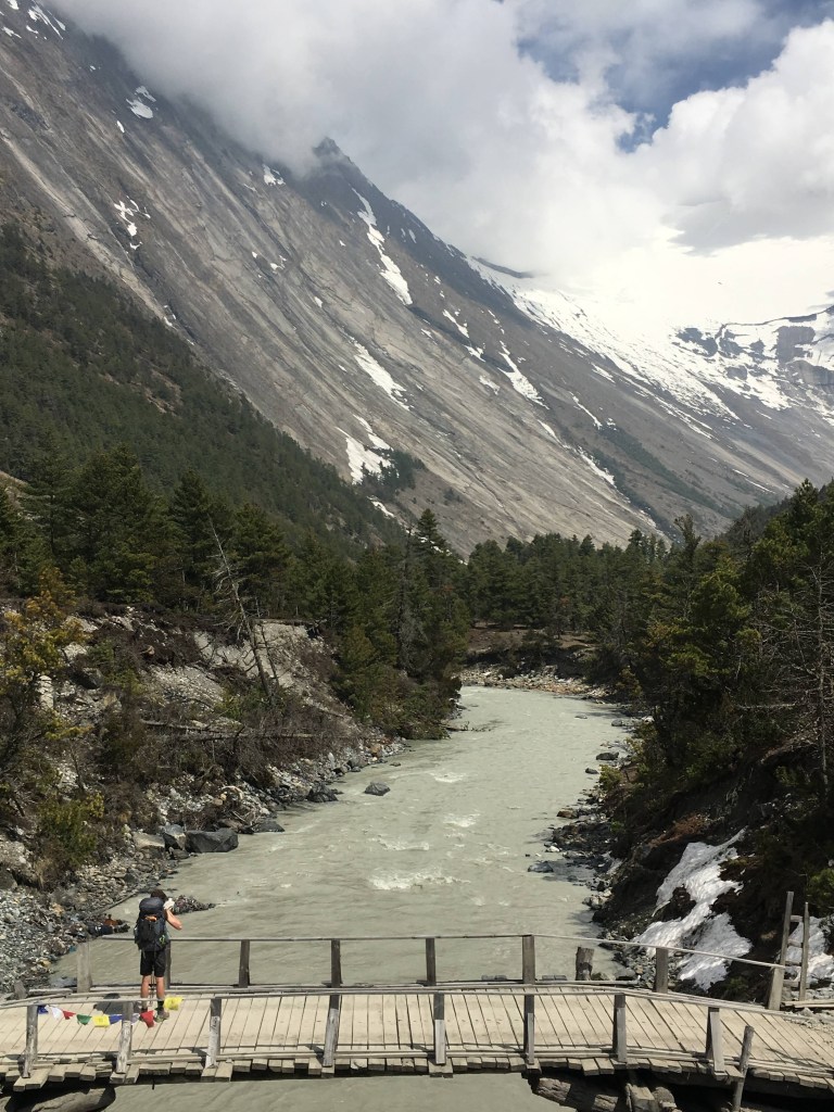

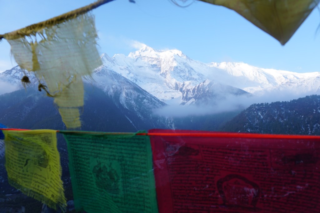
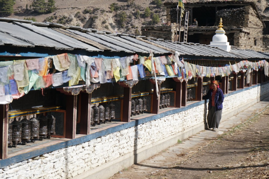

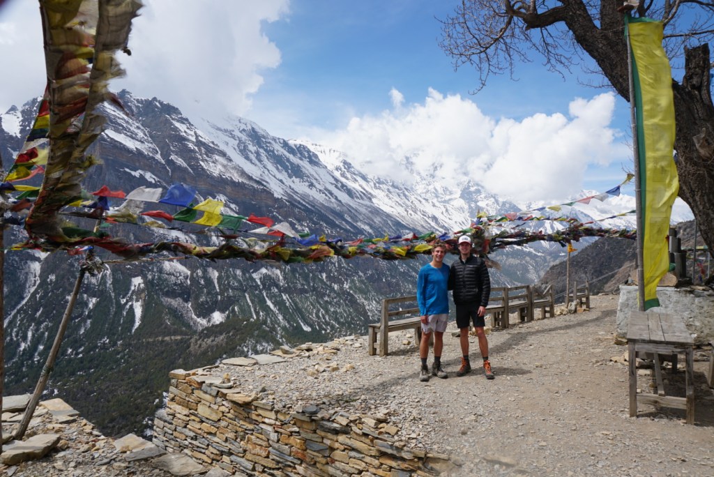

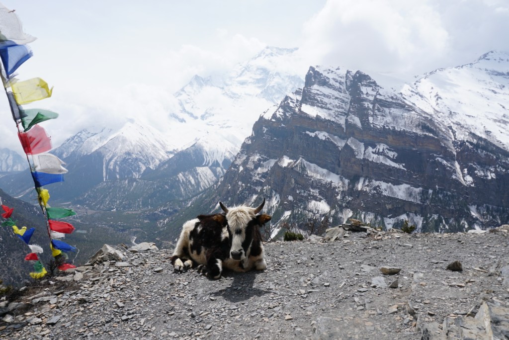


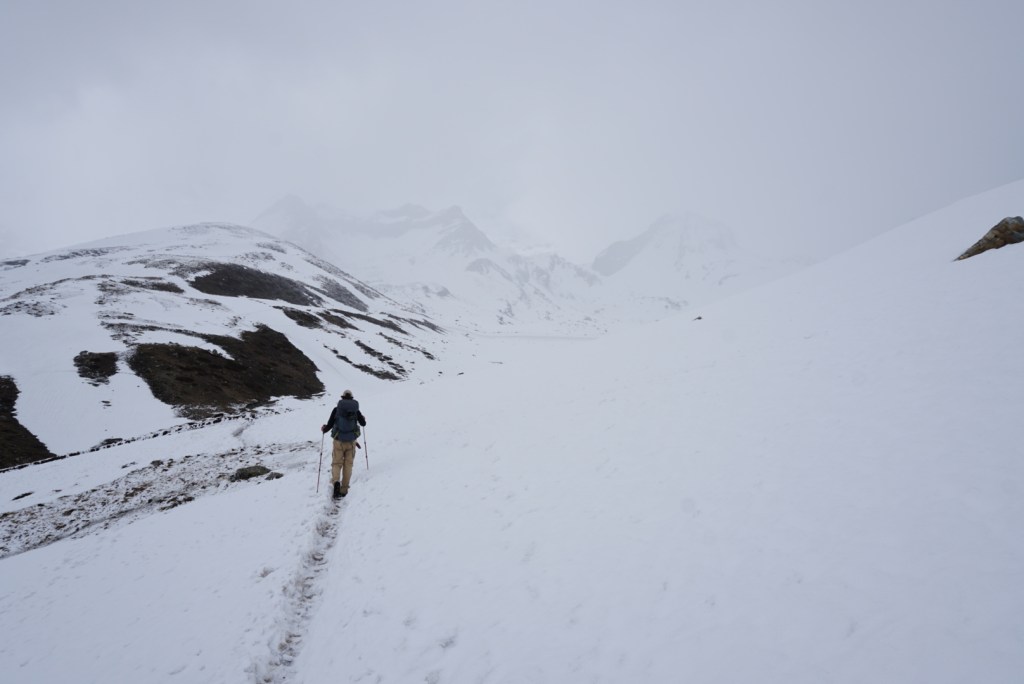


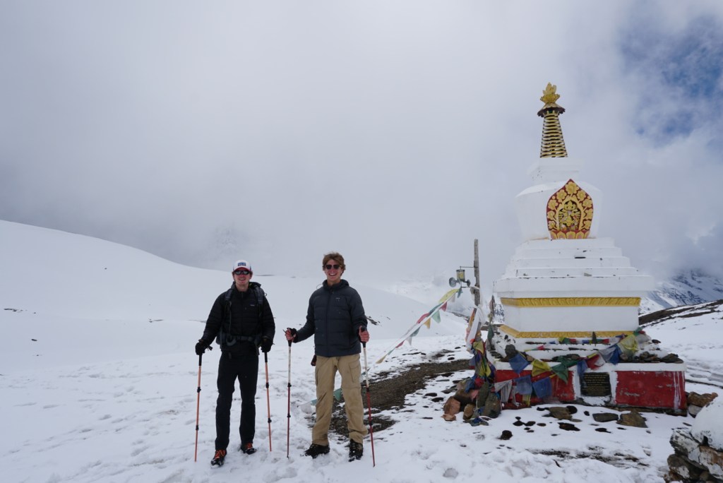
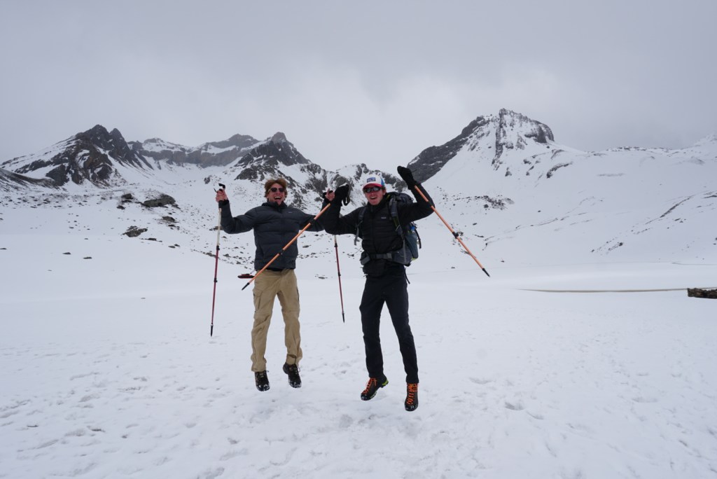
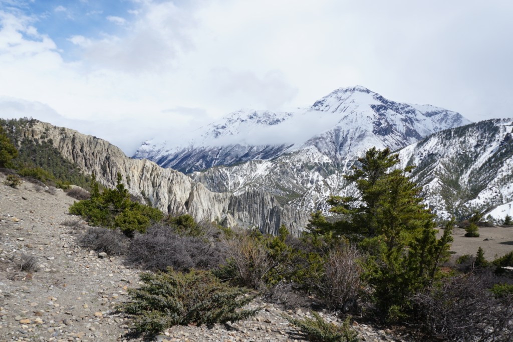
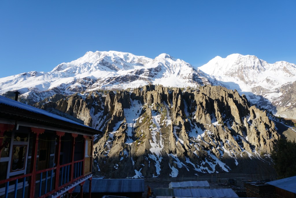
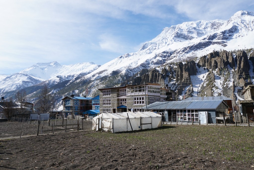

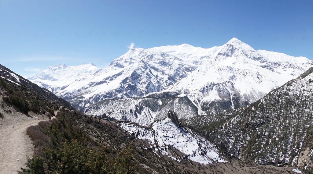
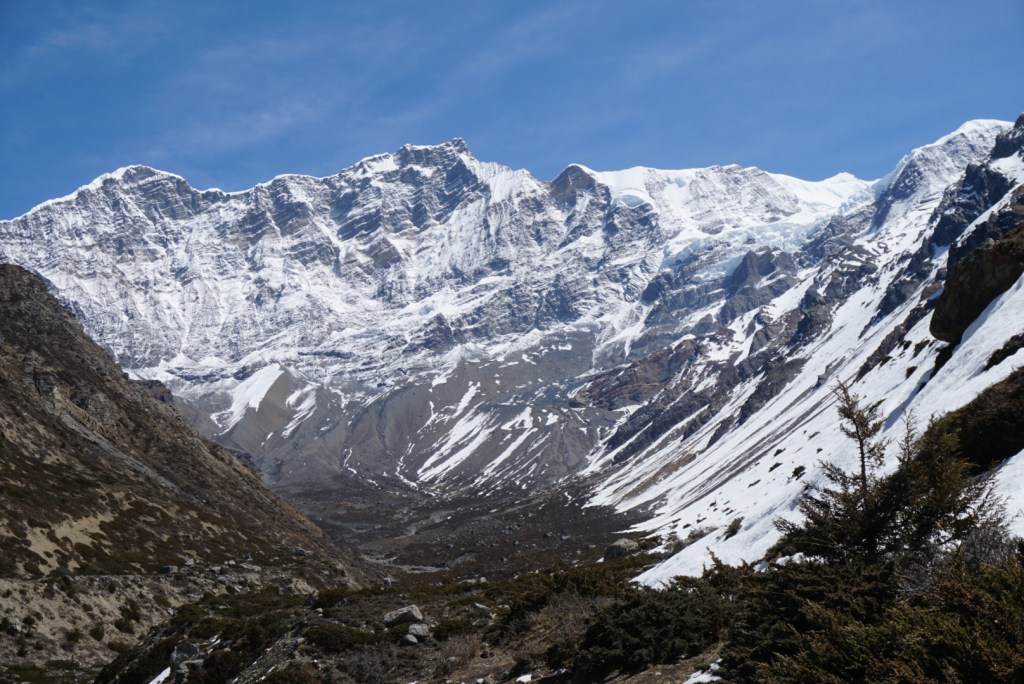

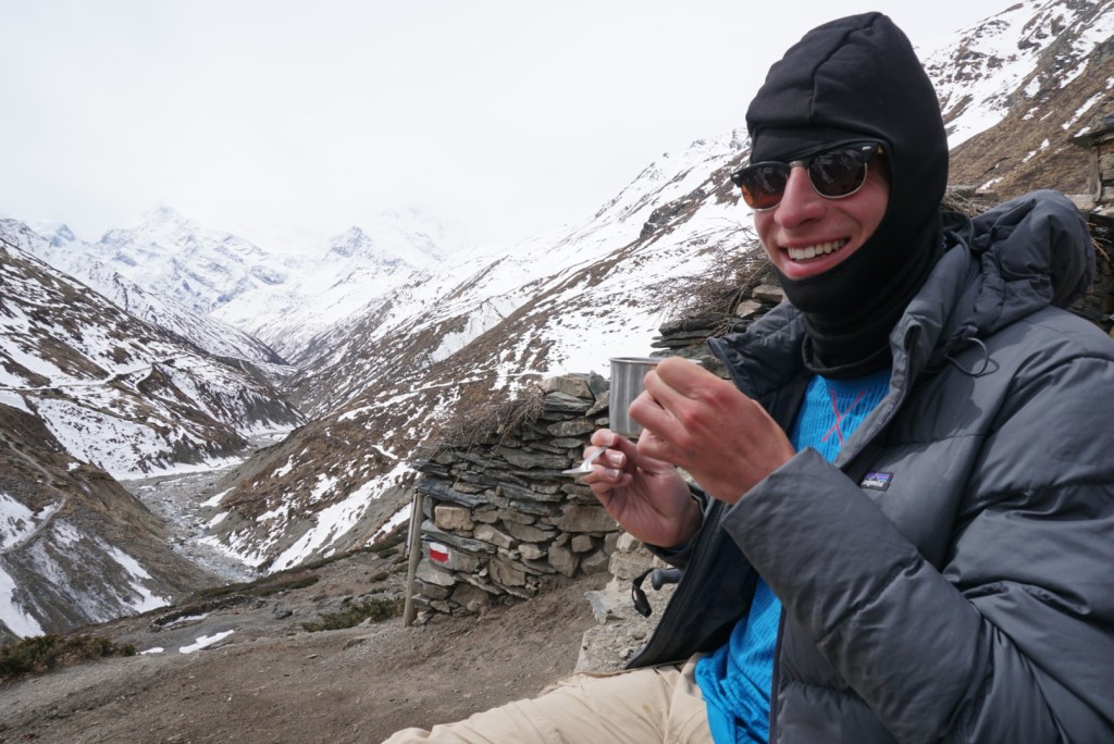
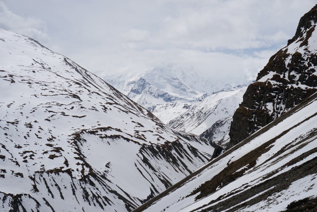


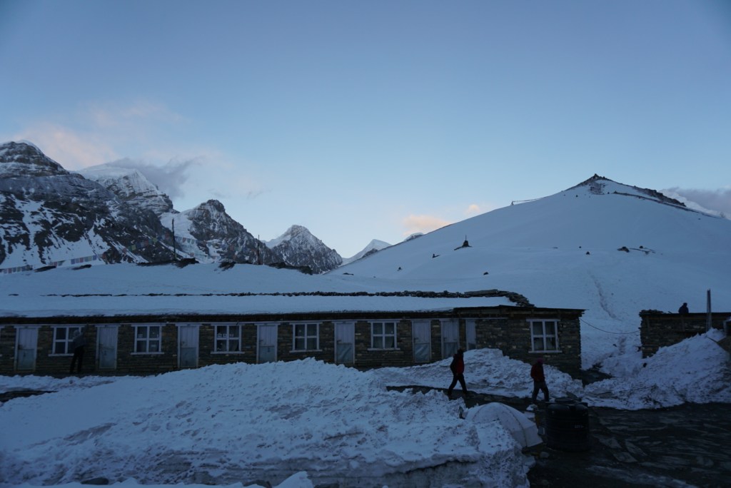
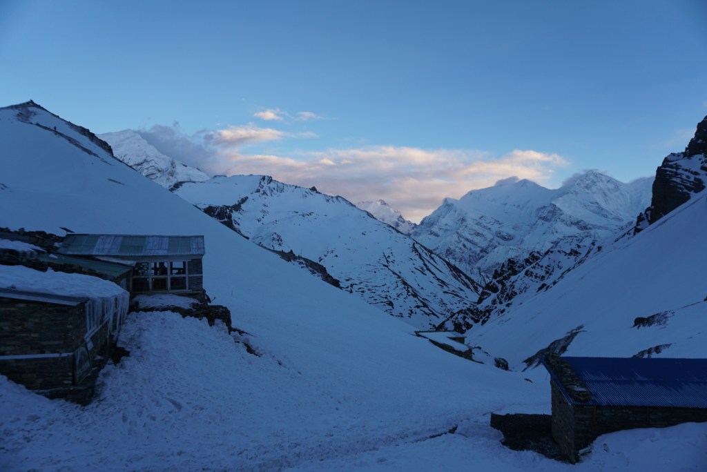


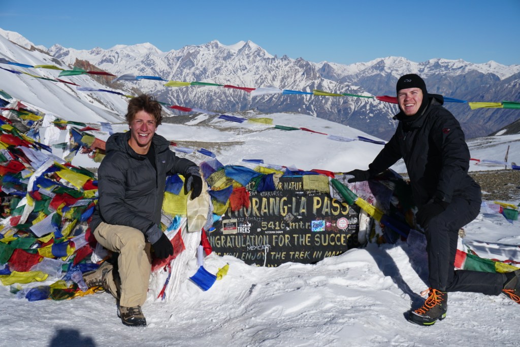


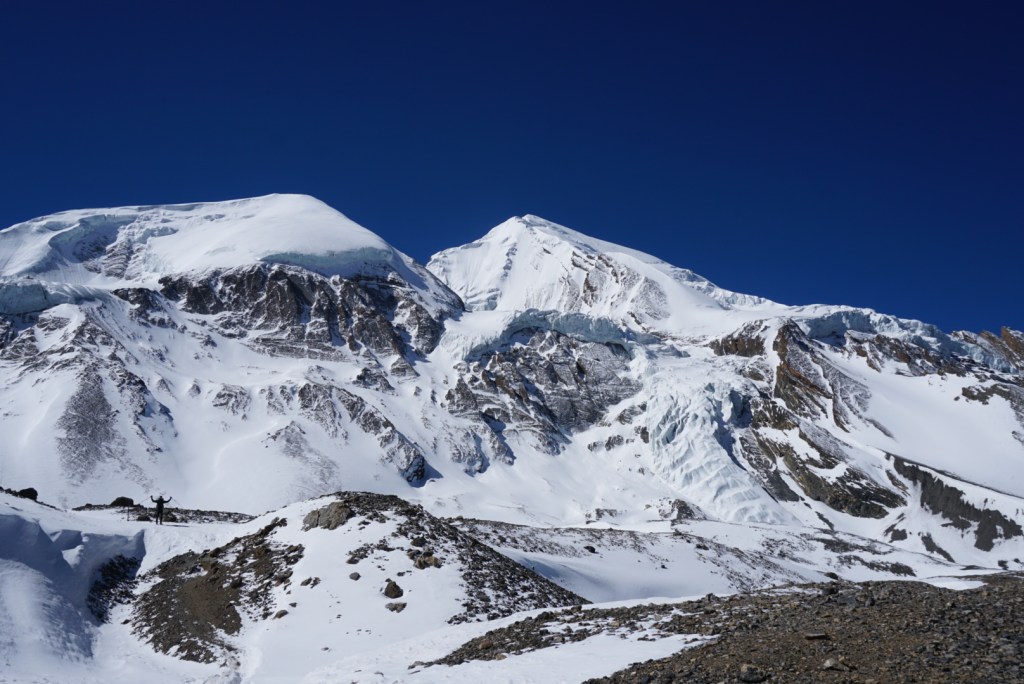


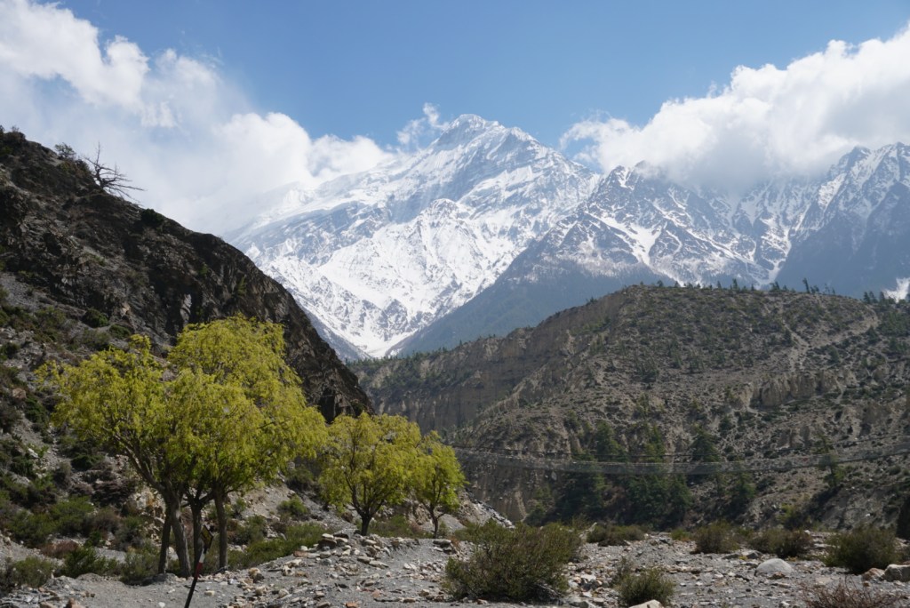


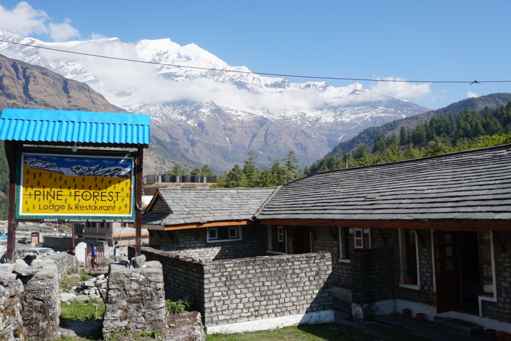
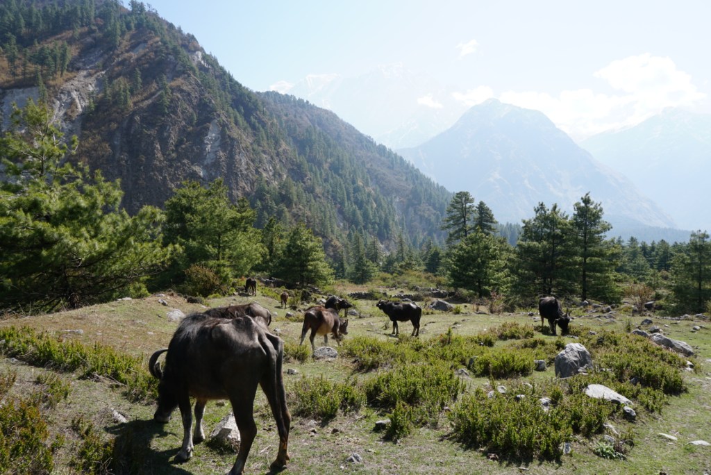
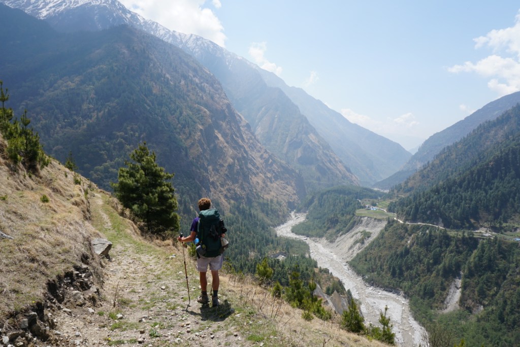
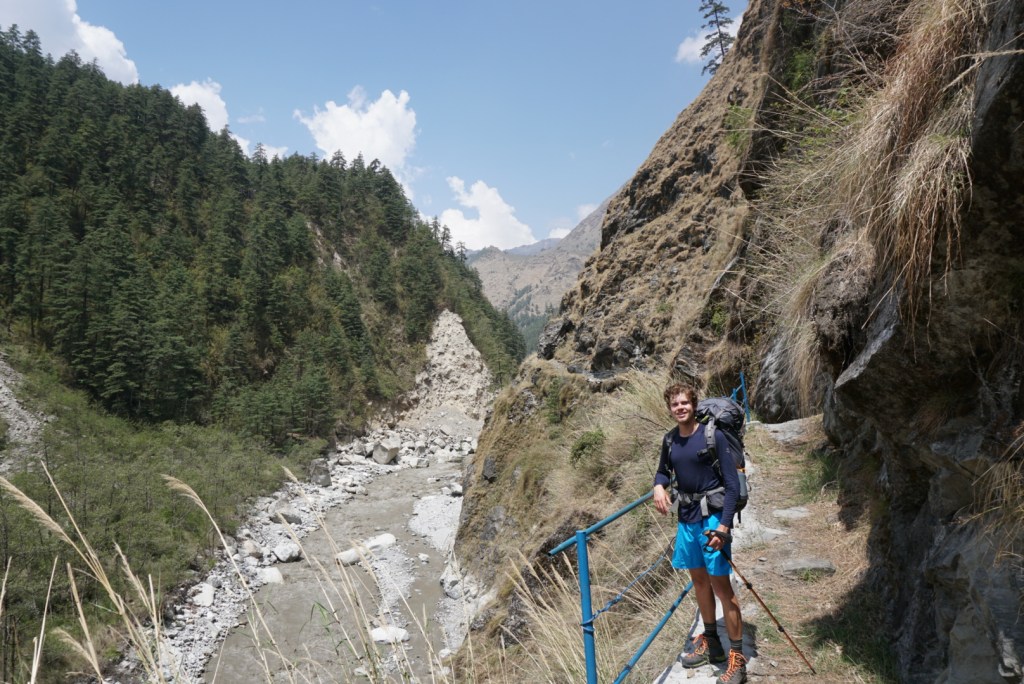
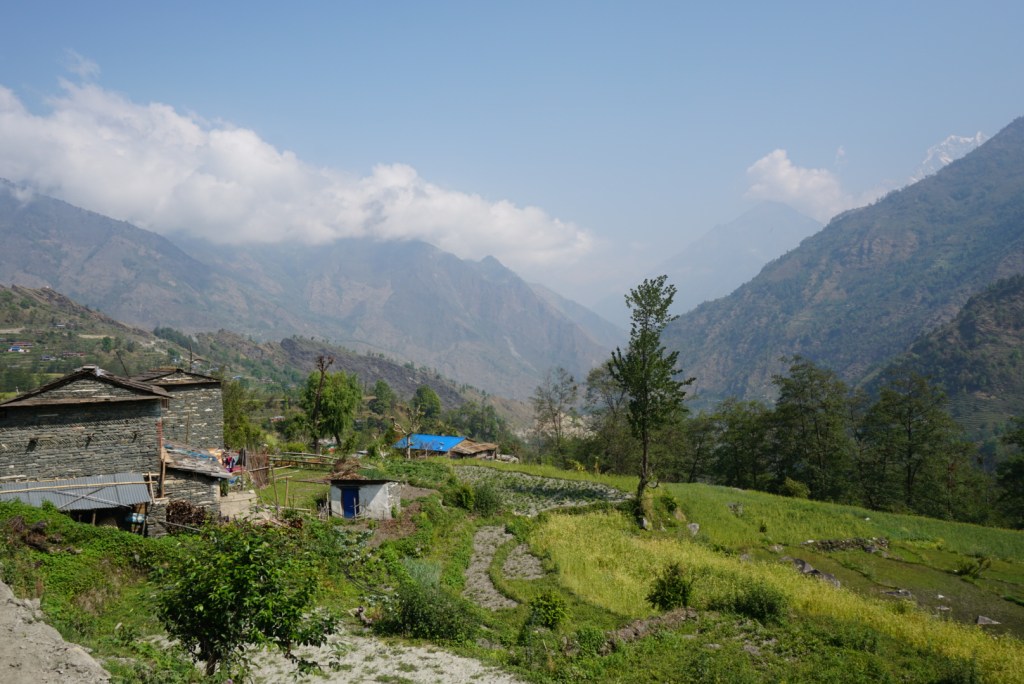


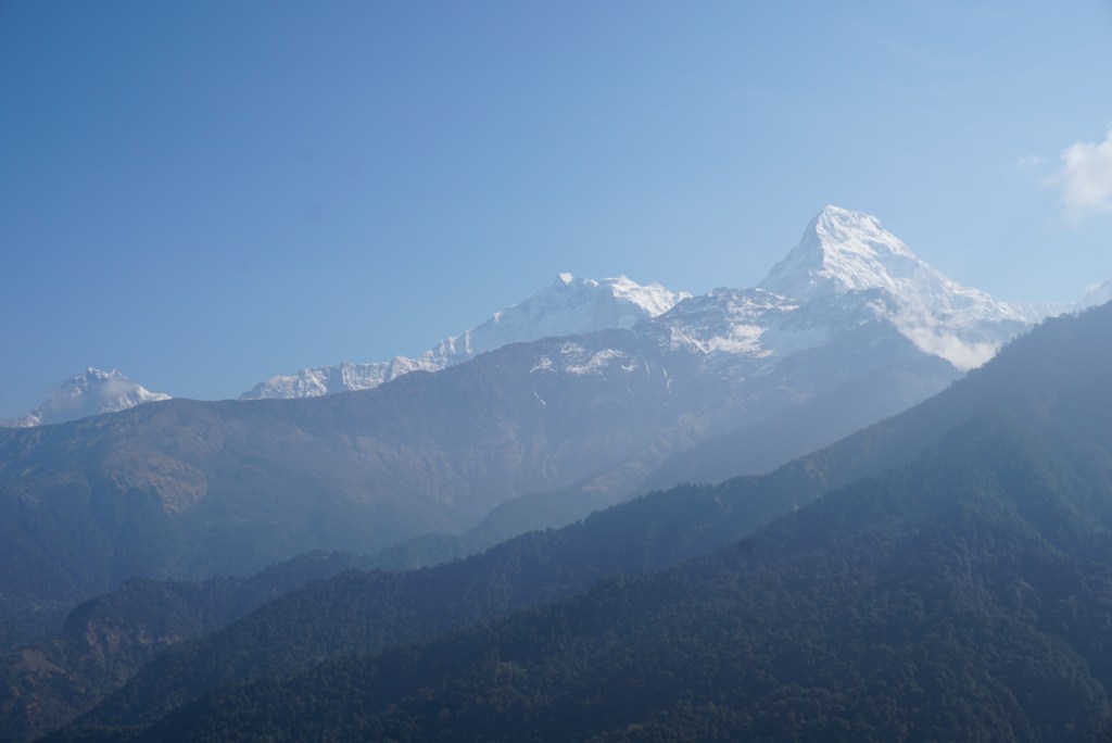
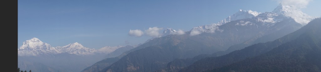
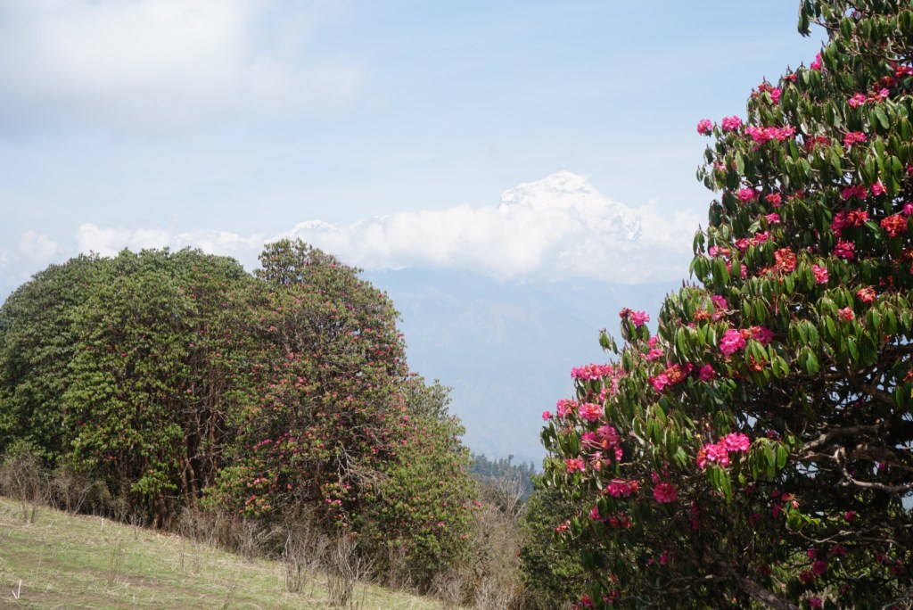

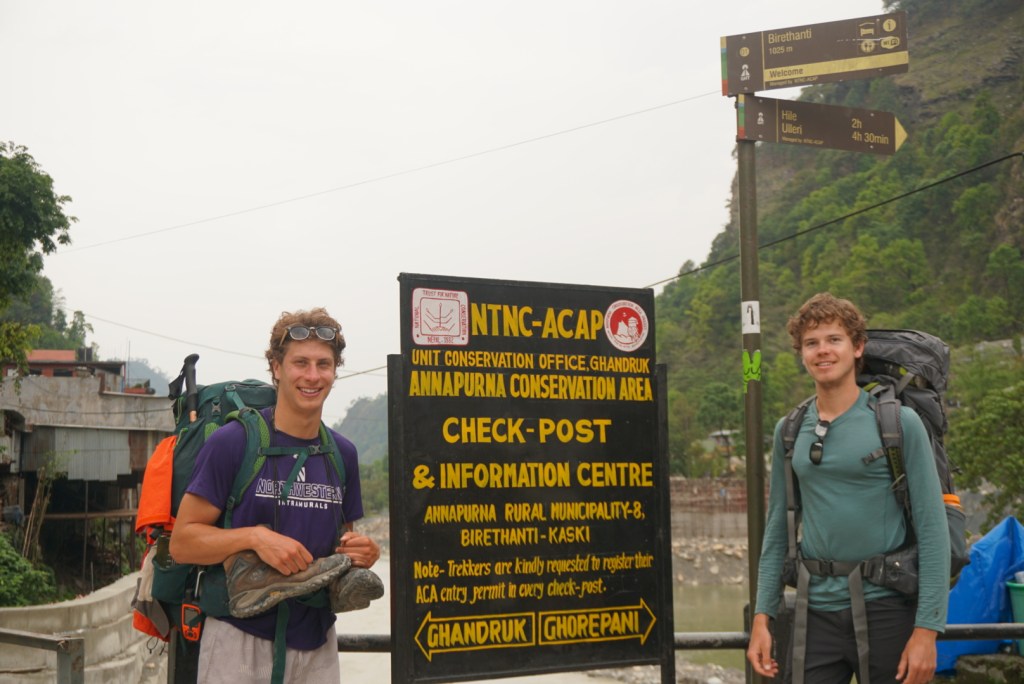
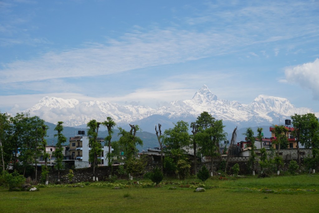

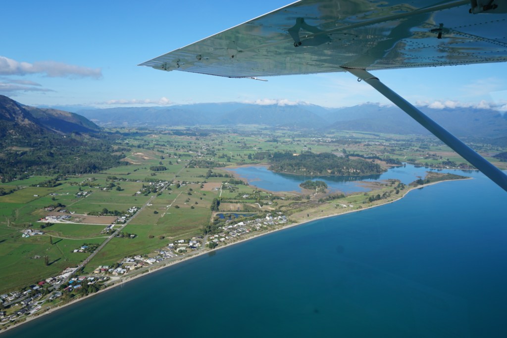
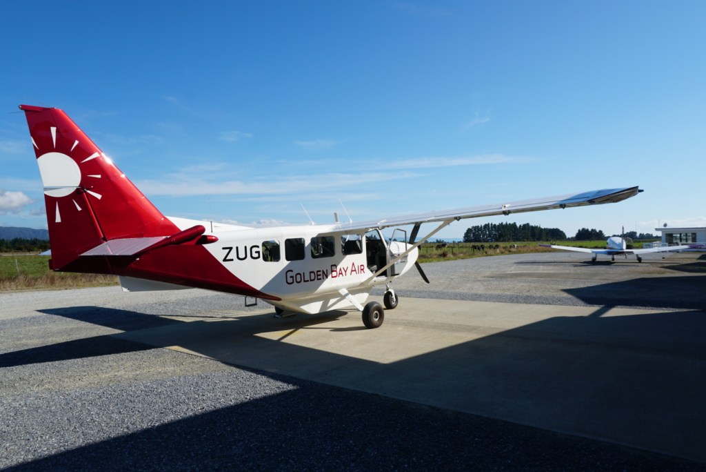
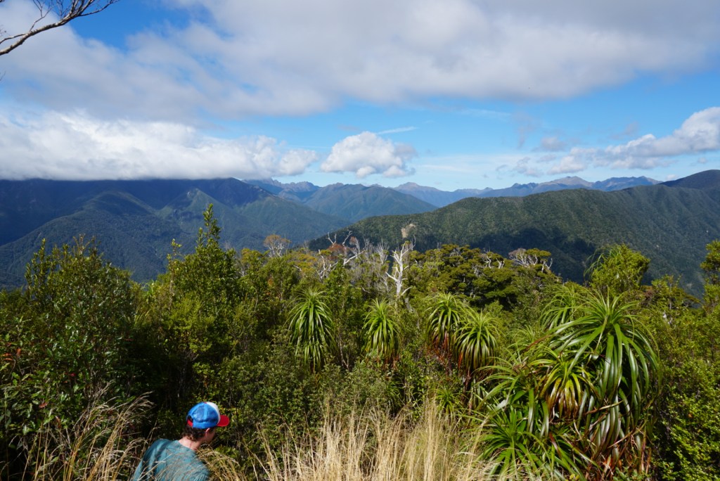
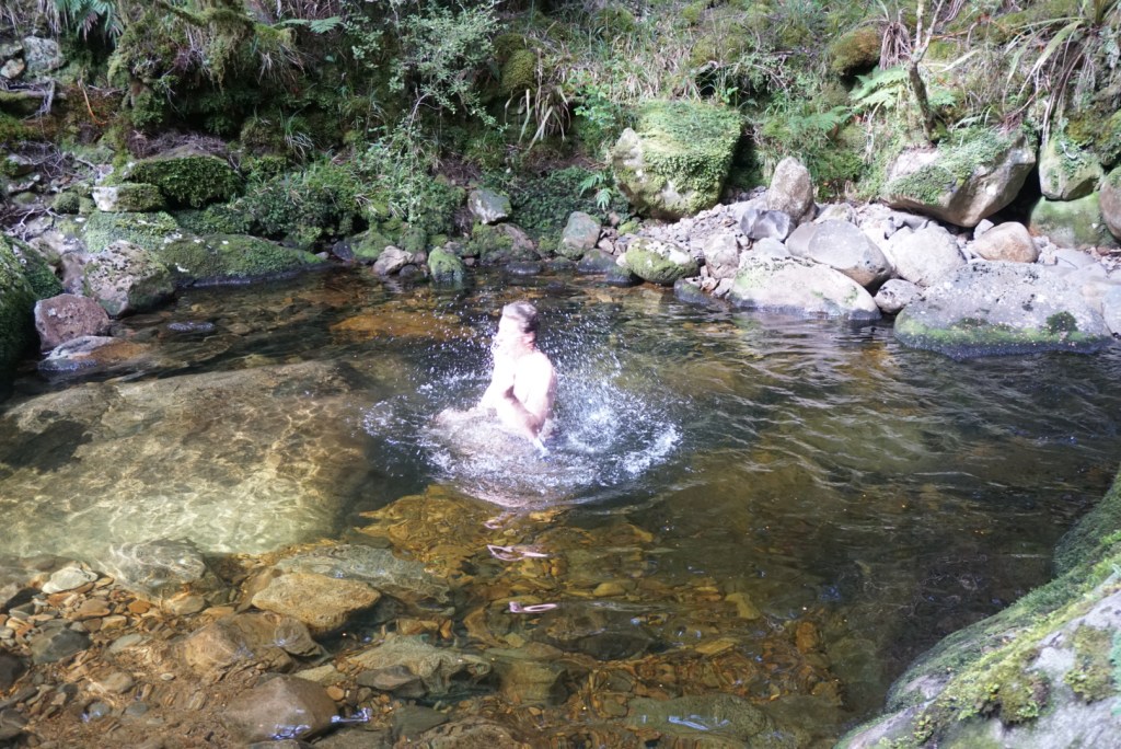
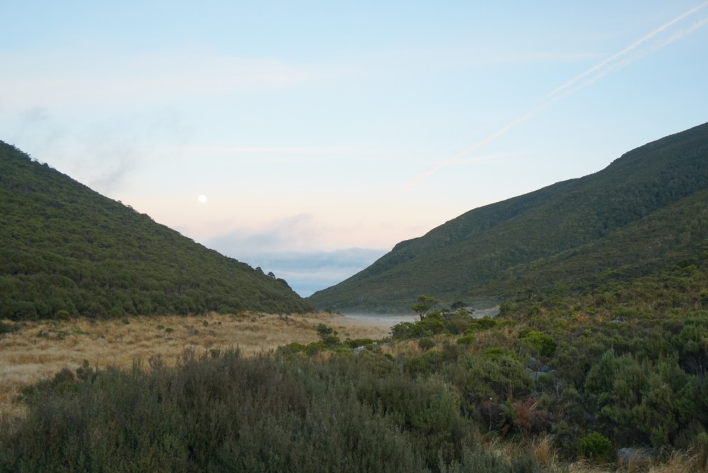
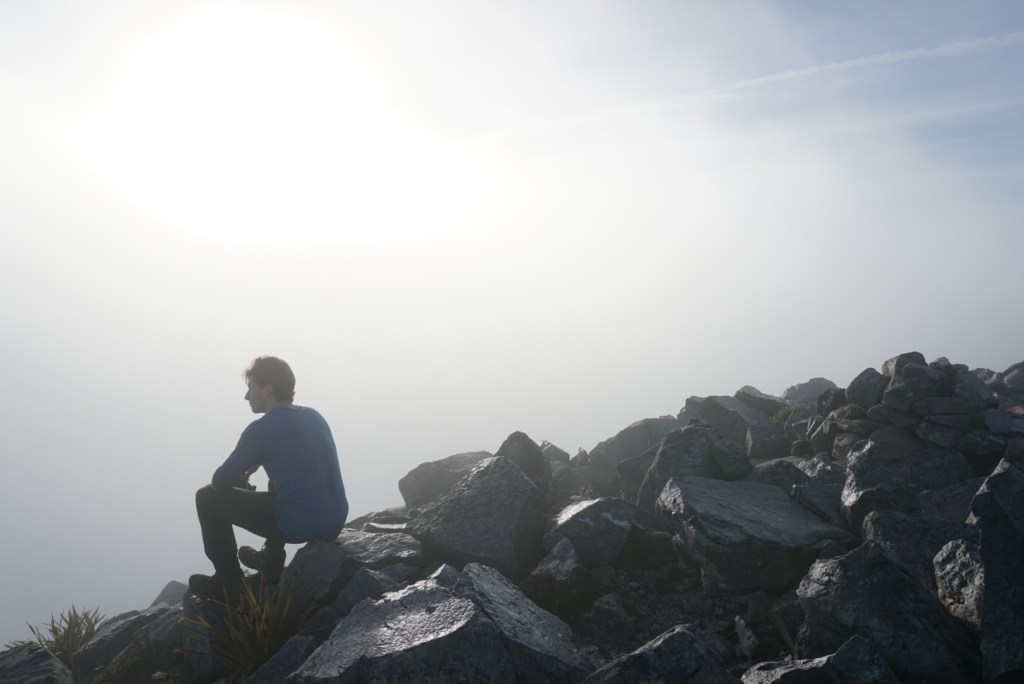


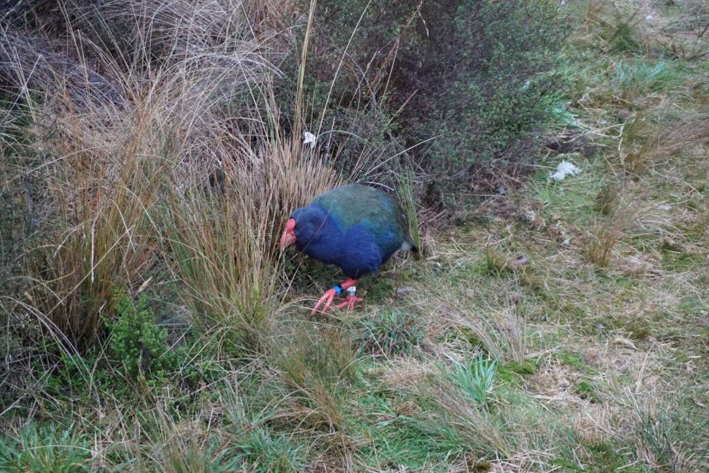


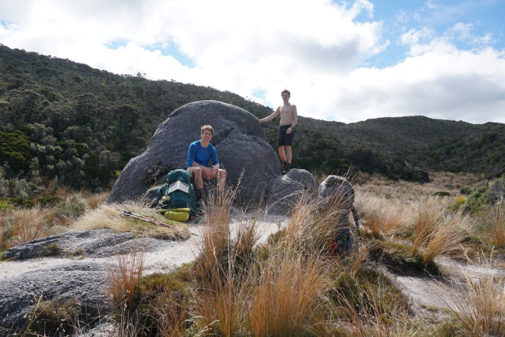
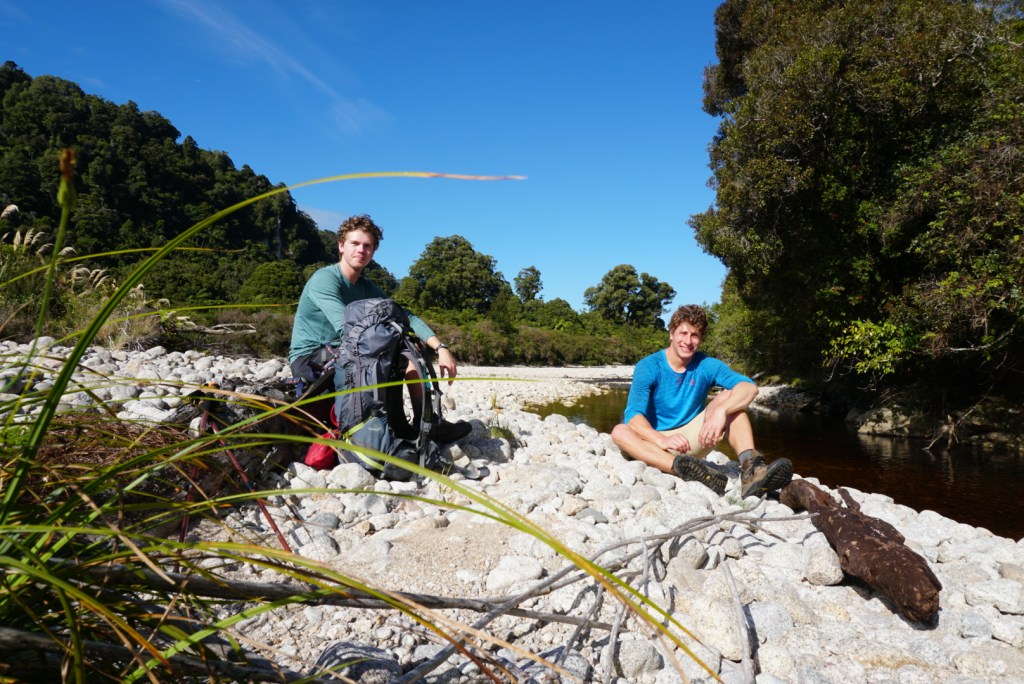


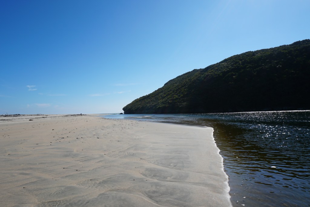

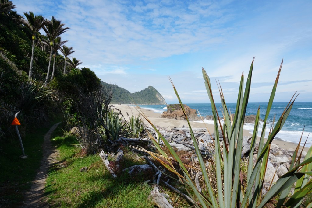
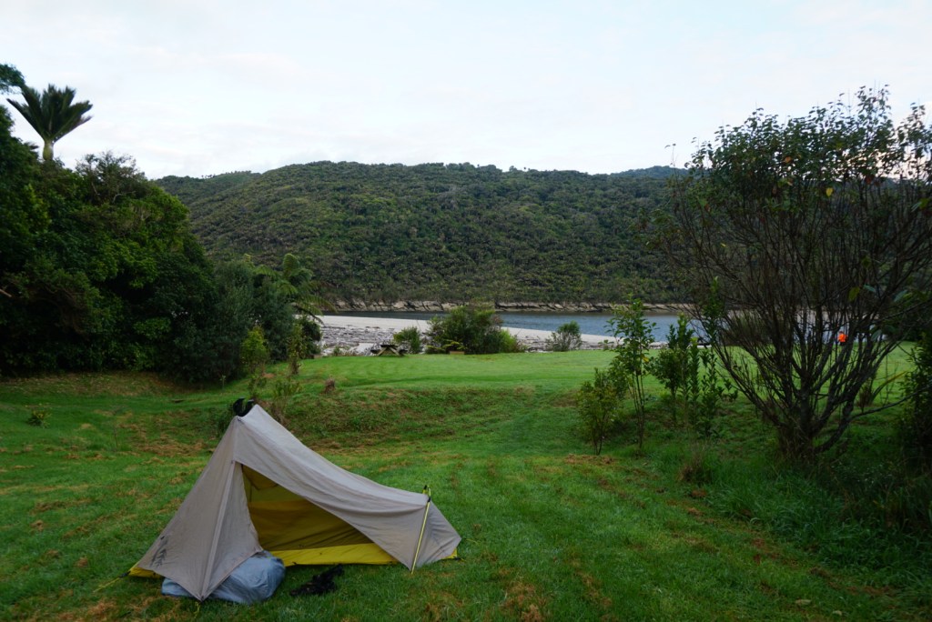
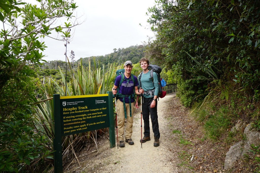
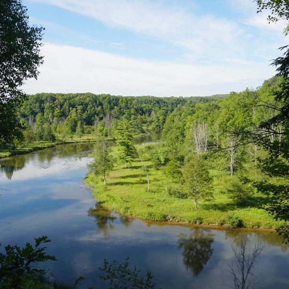


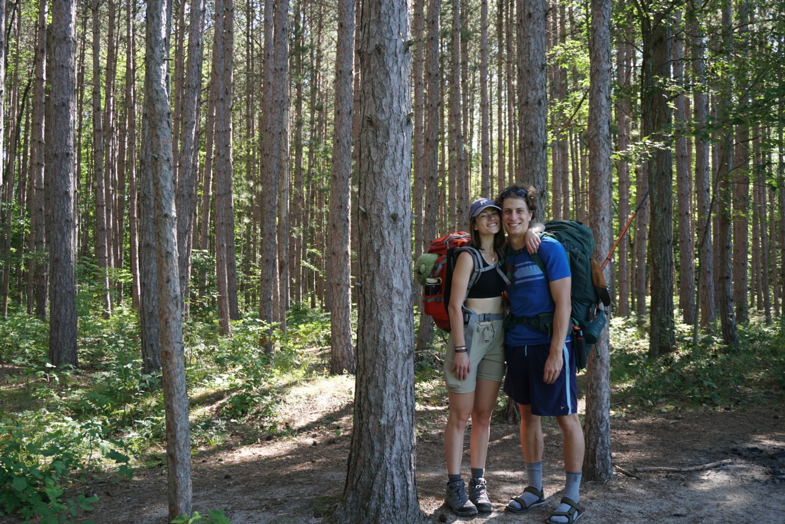
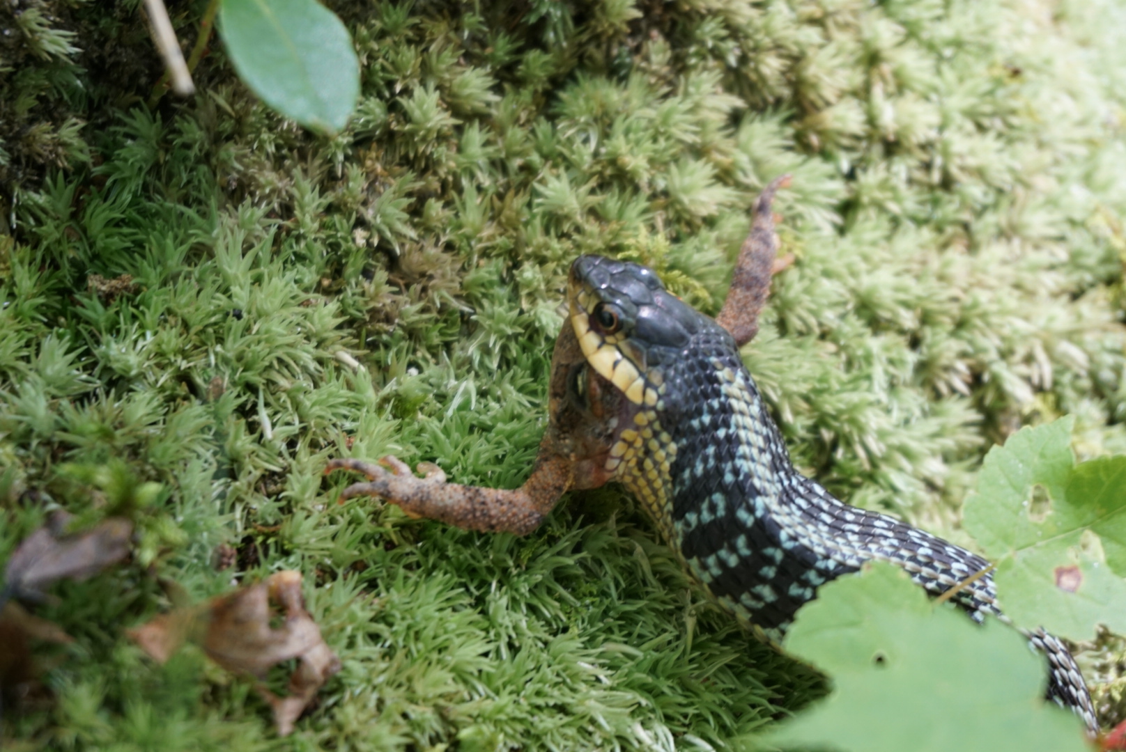


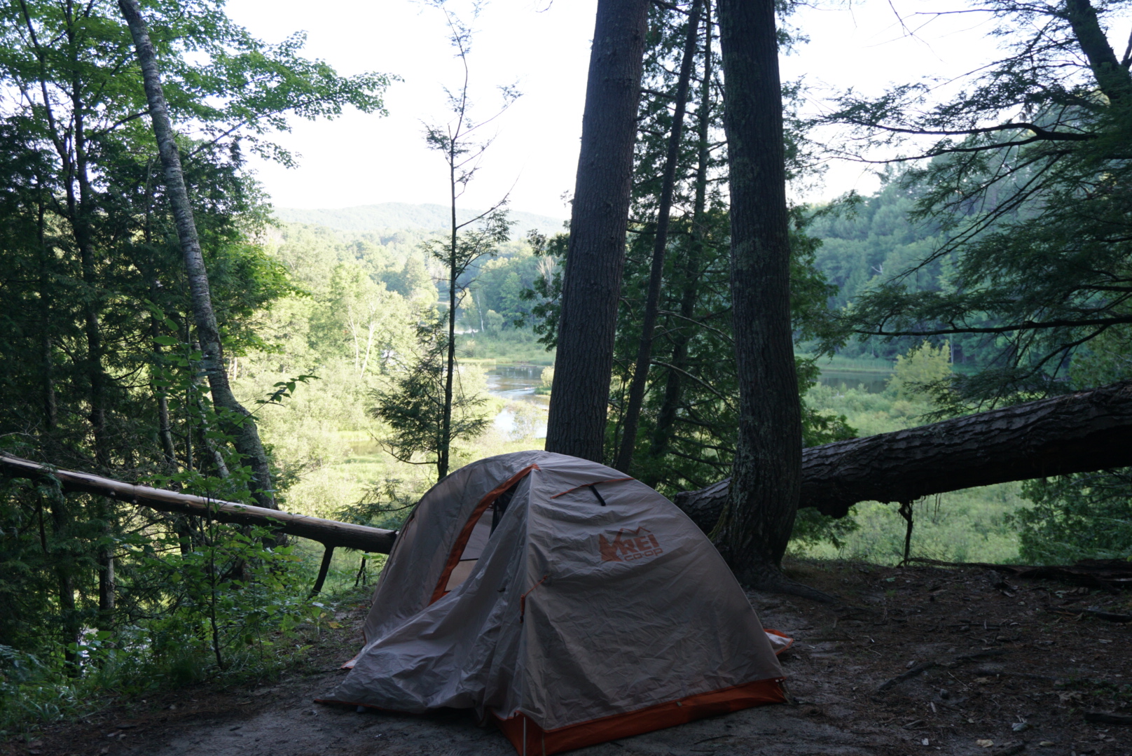


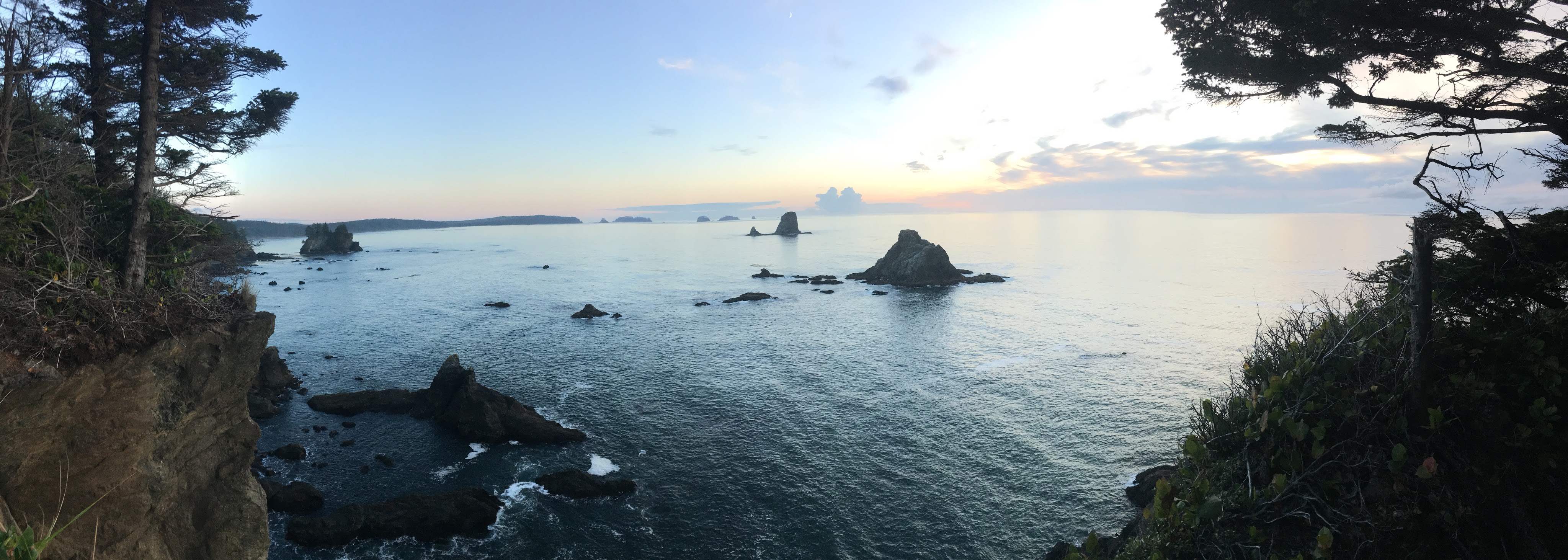
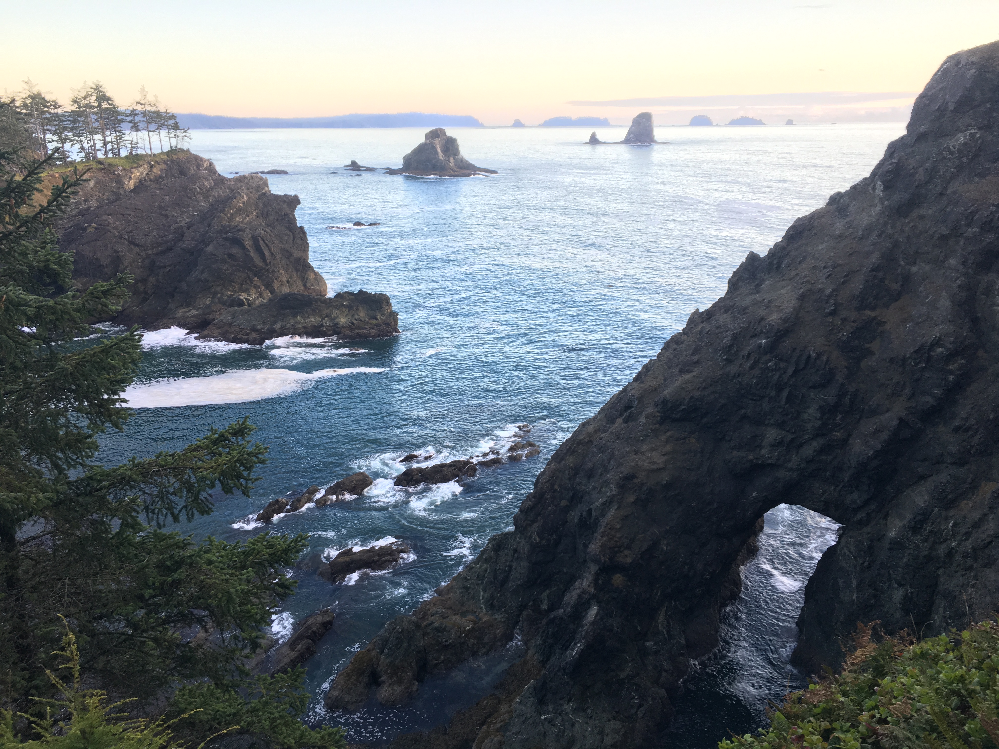


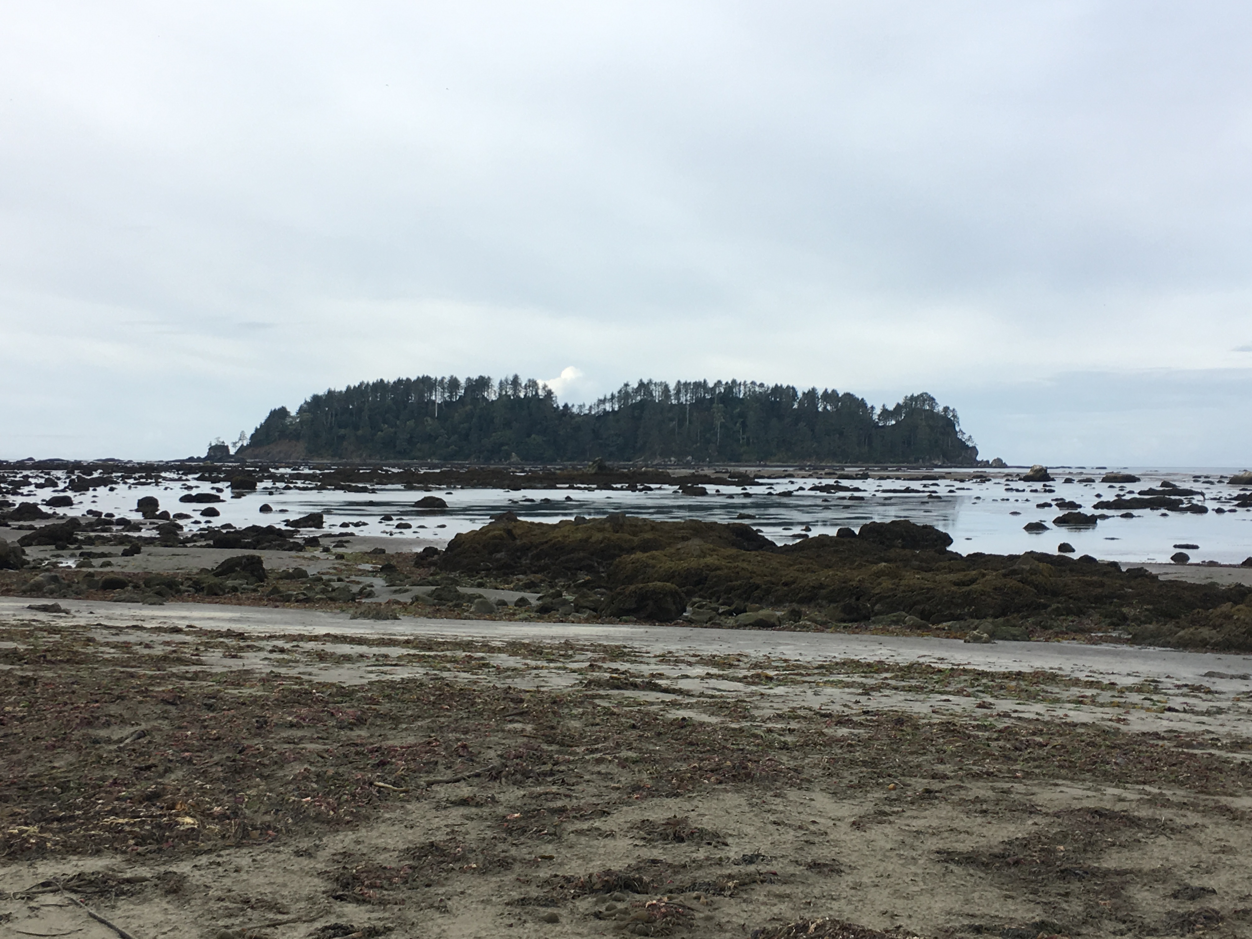
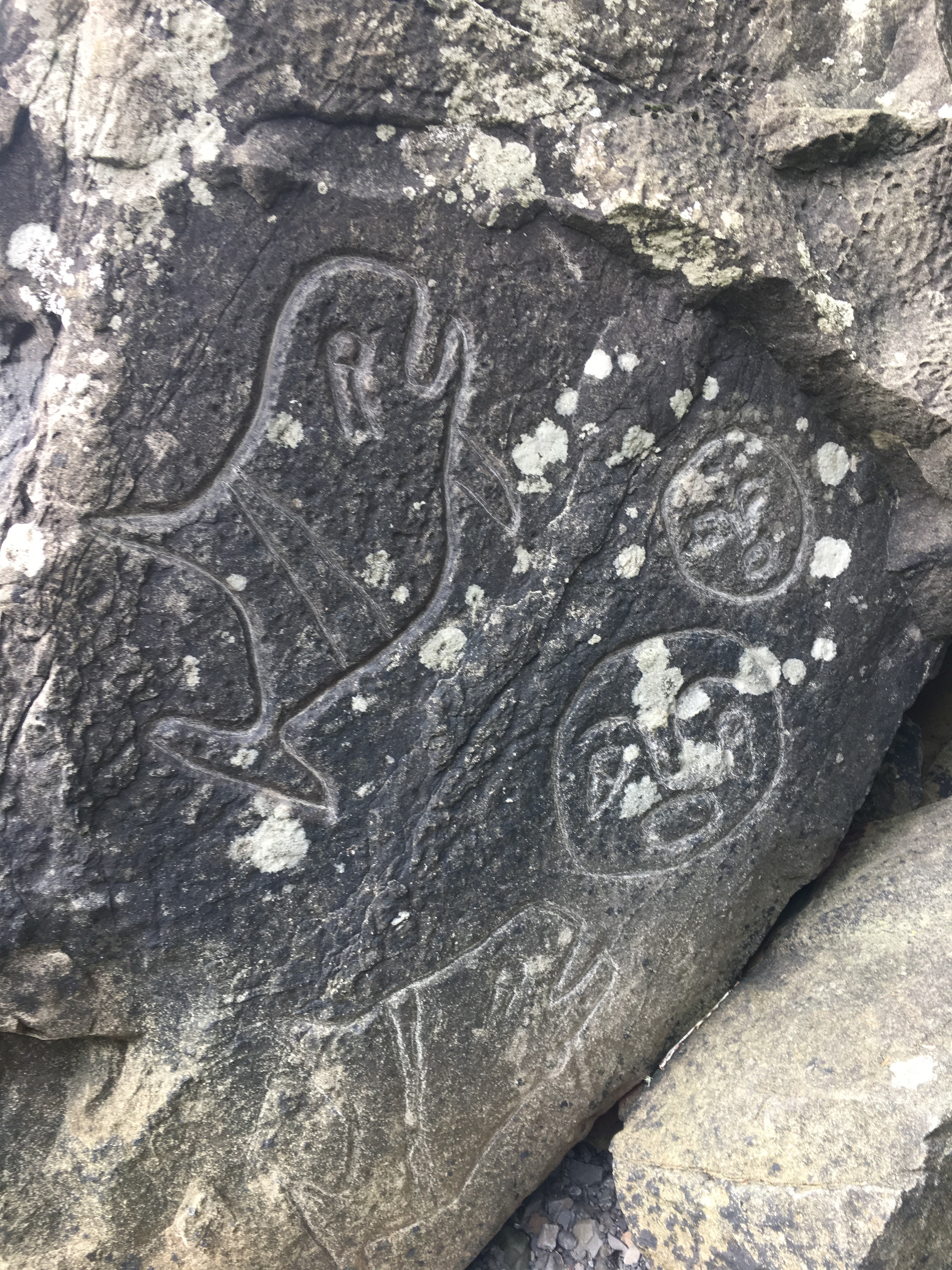

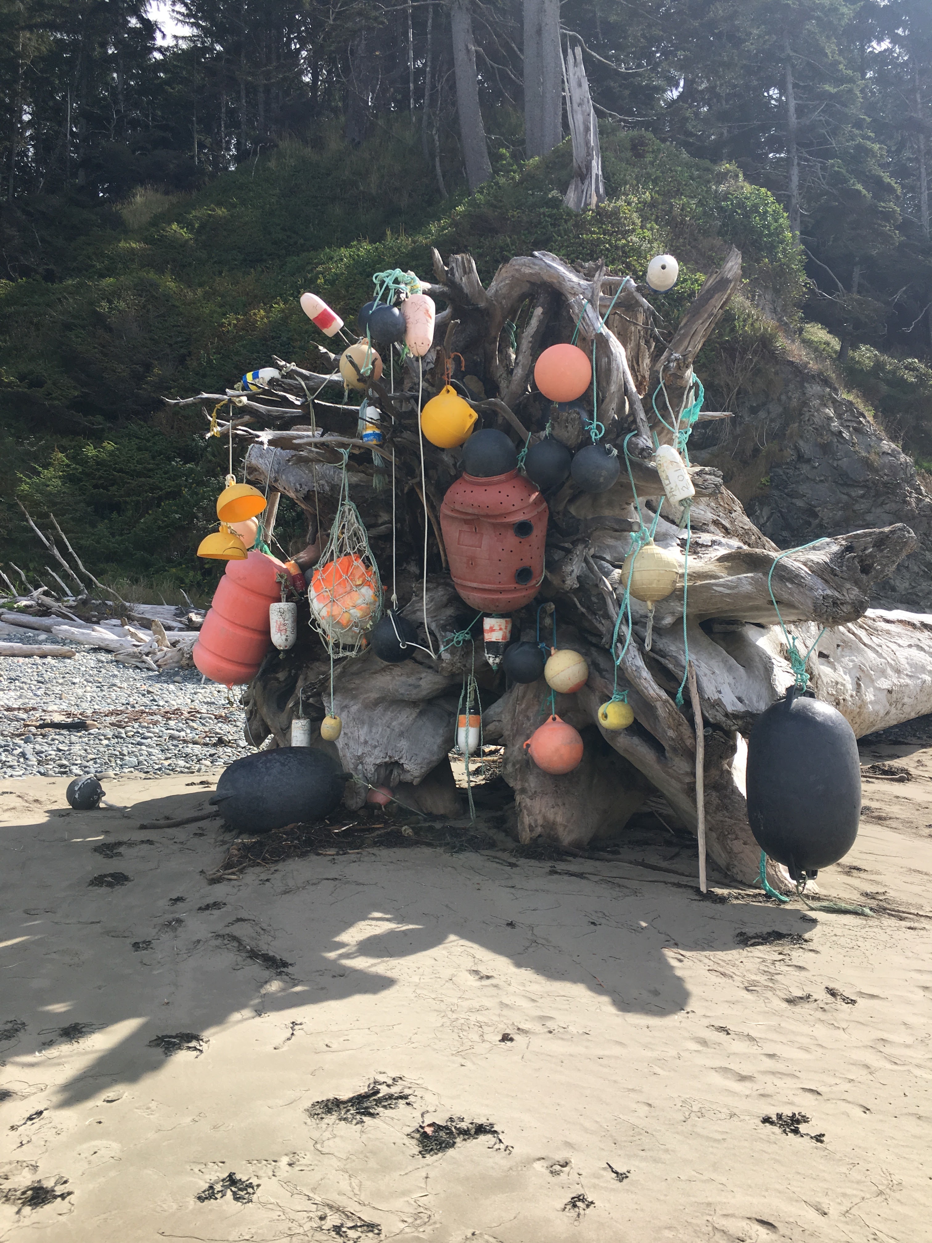


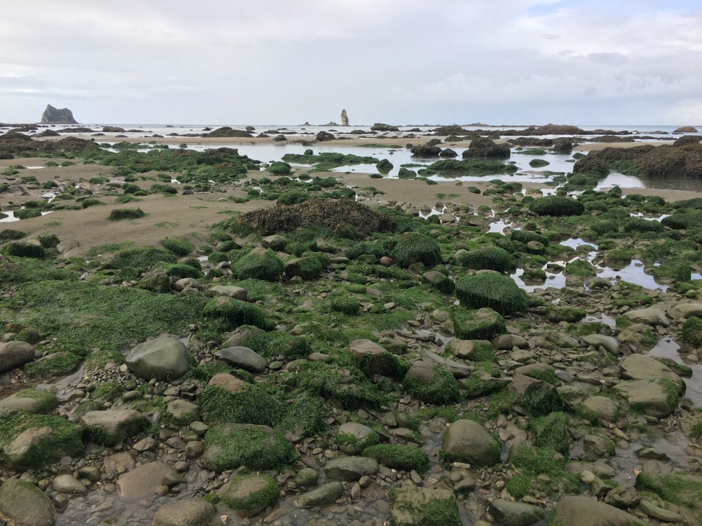


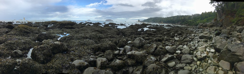
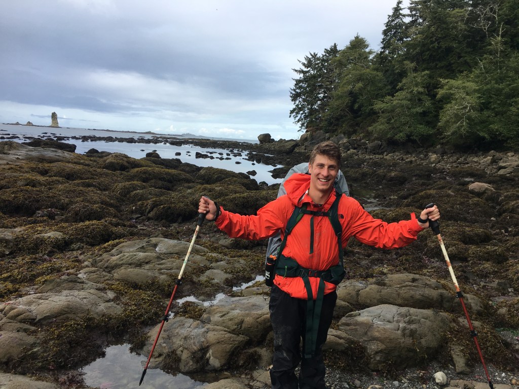


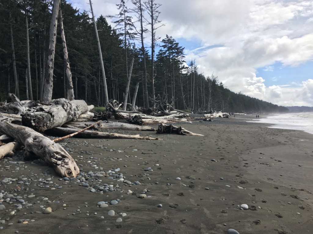
